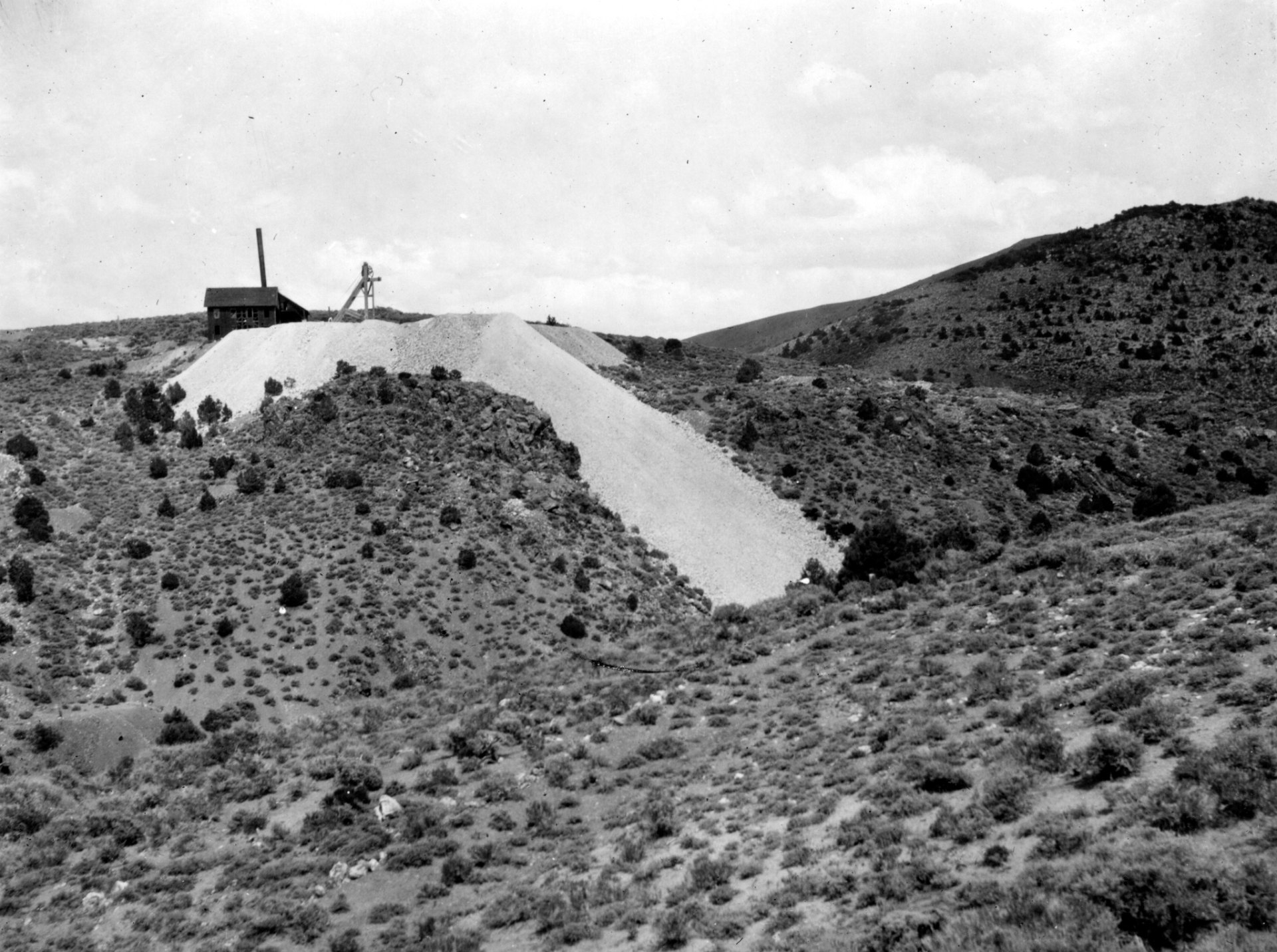
Black and white photo of a small wooden shaft house and headframe on top of a pale mine dump, on a sagebrush hillside with scattered pinyon trees

Aurora, Nevada: The Boomtown Two States Claimed
Quick facts
What it isGold and silver boomtown of the Esmeralda Mining District, on the Nevada side of the California line near Bodie
FoundedAugust 1860 (accounts differ on the exact day)
Peak populationAbout 5,000 in 1863 and 7,000 in 1864 by the National Register count; popular accounts say 10,000
County seatMono County, California (1861 to 1863) and Esmeralda County, Nevada (1861 to 1883)
Post officeEsmeralda 1861 to 1866, then Aurora to 1897; reopened 1906 to 1919
ElevationAbout 7,400 feet
Coordinates38.2871° N, 118.9007° W
DistanceAbout 8 miles northeast of Bodie and roughly 30 road miles southwest of Hawthorne
LandMostly private mining land, surrounded by Humboldt-Toiyabe National Forest
CountyMineral County (Esmeralda County until 1911)
StateNevada
⚠ Unpaved mountain roads · High clearance, 4WD when wet · Snow and mud in winter and spring · No services · Active mine and private land · Open shafts
Black and white photo of a small wooden shaft house and headframe on top of a pale mine dump, on a sagebrush hillside with scattered pinyon trees
A shaft house and waste dump on Last Chance Hill above Aurora in 1912. Photo: James M. Hill, U.S. Geological Survey, public domain.

Aurora is a gold and silver ghost town in the hills of Mineral County, Nevada, about 8 miles from Bodie. Prospectors found rich quartz veins here in August 1860, and by 1864 Aurora held thousands of people, brick business blocks, 17 stamp mills and four newspapers. For two years it was the county seat of both Mono County, California, and Esmeralda County, Nevada Territory, until a boundary survey in 1863 put it inside Nevada. Mark Twain tried his luck here in 1862, and in 1864 a citizens’ committee hanged four men of the Daly Gang. The ore gave out within a decade, the brick buildings were torn down for salvage after World War II, and today a cemetery, foundations and mine dumps remain beside a modern gold mine.

The Esmeralda discovery

In August 1860 three prospectors, E. R. Hicks, James M. Cory and James M. Braly, found gold- and silver-bearing quartz in the hills east of Mono Lake. They organized the Esmeralda Mining District, and their first camp, called Esmeralda, stood in a gulch south of the later town. Men poured in from Monoville and the other eastern Sierra camps, and 350 claims were filed within two months. The new town platted to the north was named Aurora, after the Roman goddess of the dawn.

On the discovery date and the names: Sources disagree on the day. A 1930s Bureau of Mines report gives August 16, 1860; an 1878 pamphlet describes the strike on August 21 and 22; and one history dates the formal organizing of the district to August 30. The prospectors’ names are also spelled several ways, including Corey for Cory and Braley or Brawley for Braly.

A boomtown of brick

Aurora grew fast. 593 votes were cast there in 1861, and rich strikes on the Wide West and other veins brought a second rush in 1862 and 1863. By 1863 the town had about 700 houses, 20 stores, 22 saloons and 16 quartz mills, and by 1864 there were 17 mills, the largest with 30 stamps. Its richest ore lay close to the surface.

Brick buildings went up along the business streets, and Aurora supported four newspapers, among them the Esmeralda Star, started in 1862, and the Aurora Daily Times. The town built a courthouse, hotels, churches and an armory hall. In May 1862 Company A of the 2nd California Volunteer Cavalry, under Captain Edward A. Rowe, set up Camp Aurora near town during conflicts with Native people in the region, and moved on to Adobe Meadows that summer.

On the population: The National Register nomination puts Aurora at about 5,000 people in 1863 and 7,000 in 1864. Many popular histories say 10,000. No census counted the town at its peak, so treat all of these as estimates.

One town, two county seats

Nobody knew in 1860 where the line between California and the new Nevada Territory ran through these hills, and both governments claimed Aurora. In the spring of 1861 California created Mono County and made Aurora its seat. That November, Nevada Territory created Esmeralda County and made Aurora its seat too. For two years the town housed two sets of county officers, two courts and two sets of tax collectors.

The best-known story from those years comes from the election of September 1863. According to many histories, Aurorans voted for California and Mono County offices at the police station and for Nevada Territory and Esmeralda County offices at Armory Hall, on the same day. That same month a joint California and Nevada boundary survey reached the district and placed Aurora about three miles inside Nevada. Mono County’s officials packed up their records and left, and in 1864 Bridgeport became Mono County’s seat.

On the double election: The two polling places appear in many later histories, but we did not find the original election records, and one account dates the joint voting to 1862. Accounts also differ on the boundary: most say Aurora ended up three miles inside Nevada, a few say four.

Mark Twain in Aurora

Aurora’s most famous resident was a failed miner. Samuel Clemens, whose brother Orion was secretary of Nevada Territory, visited briefly in 1861 and came back in April 1862 to try his hand at quartz mining. He shared cabins with partners, bought interests in claims and, by his own account in Roughing It, worked about a week in a quartz mill for $10 a week and board before quitting. Roughing It also tells how he and his partner Calvin Higbie found a rich blind lead near the Wide West mine and lost it by failing to do the required work on the claim.

Clemens had been sending humorous letters signed “Josh” to the Territorial Enterprise in Virginia City, and that summer the paper offered him a job. In September 1862 he left Aurora for Virginia City, where a few months later he first signed his work “Mark Twain.”
On the Twain stories and the cabin: Roughing It is a comic memoir, and scholars at the Mark Twain Project note that its blind-lead story mixes up the real claims involved. A cabin long shown as Mark Twain’s was moved to Idlewild Park in Reno in 1924 and was gone by the early 1950s. A 2003 study in the Nevada Historical Society Quarterly found that Clemens owned no property in Aurora and that the famous cabin was probably the mining district recorder’s office, so treat it as legend.
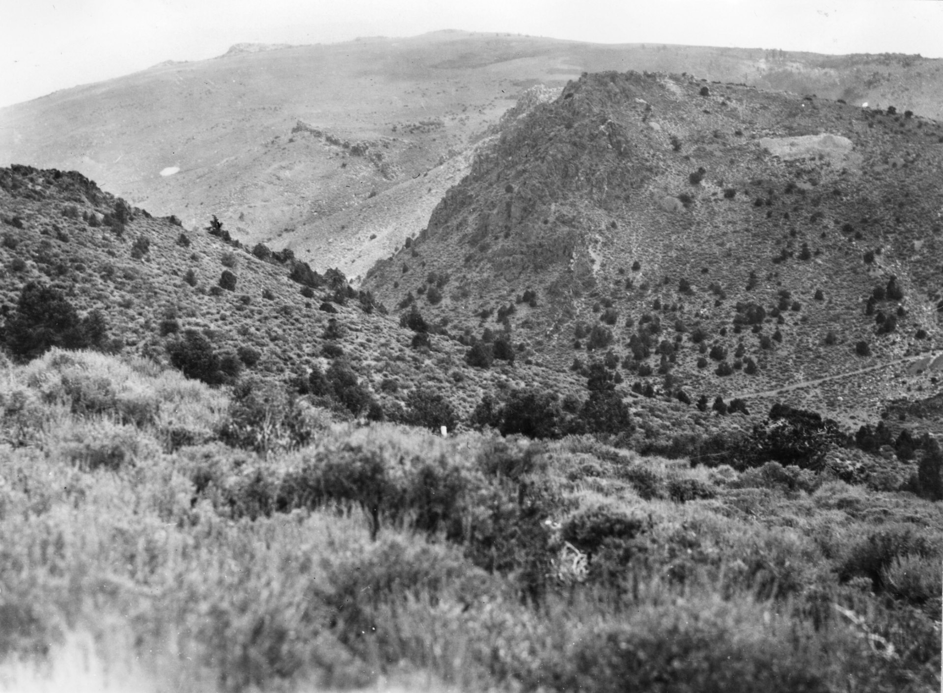
Black and white photo of steep rocky hills covered with sagebrush and pinyon, with pale rock outcrops and a mine dump on the slope
The south end of Silver Hill, where the Old Esmeralda vein crops out, in 1912.Photo: James M. Hill, U.S. Geological Survey, public domain

The Daly Gang and the vigilantes

Like most early mining camps, Aurora had its share of violence. A gang led by John Daly ran with the town’s toughs and was blamed for robberies and killings on the roads. In 1863 a gang associate stole a horse and was later killed by William R. Johnson. On February 1, 1864, the gang ambushed and murdered Johnson in revenge.

This time the town struck back. Several hundred citizens formed a Citizens’ Safety Committee and arrested the suspects. On February 9, 1864, they hanged four men, John Daly, William Buckley, James Masterson and John “Three-Fingered Jack” McDowell, from a gallows built outside Armory Hall. Territorial Governor James Nye came to Aurora with the U.S. marshal, but no troops were sent and the committee soon disbanded. Historian Roger D. McGrath studied the case in his book on frontier violence in Aurora and Bodie.

On the details: Accounts differ on whether Johnson was killed on February 1 or February 2, 1864, and on whether the committee numbered about 400 or about 600 men. Where the four men were buried is not documented, and modern searches for their graves in the Aurora cemetery rest on local tradition.

The bust

Aurora’s bonanza did not last. The rich ore lay close to the surface, and as the shafts went deeper the gold thinned and the costs rose. Several mills shut down in 1864, and more closed in 1865. On January 6, 1866, a fire on Antelope Street destroyed 21 buildings. By 1870 half the houses stood empty, and by 1880 about 500 people were left, many miners having moved on to Bodie when it boomed in the late 1870s.

Estimates of what the Aurora mines produced in the 1860s run from at least $27 million to about $30 million in gold and silver. Some mining went on, especially on Last Chance Hill in the 1880s, but in 1883 the Esmeralda County seat moved to Hawthorne, and in 1897 the post office closed.

On production: Geologist James M. Hill estimated at least $27 million for 1861 to 1869, and a 1937 Bureau of Mines report put it at about $30 million. The National Register nomination gives over $30 million for the district’s whole history, with only about $2 million of it after 1869. The figures are for gold and silver together.

A second life, 1906 to 1919

The gold strikes at Tonopah and Goldfield brought prospectors back. The post office reopened in 1906, and in 1912 Utah mining men Jesse Knight and W. Lester Mangum formed the Aurora Consolidated Mines Company and began work on a large mill. In 1914 George Wingfield’s Goldfield Consolidated Mines Company bought control. Its 500-ton cyanide mill, with 40 stamps, stood at the company town of Mangum next to Aurora. The mill closed in 1918, after producing a little over $1.8 million, and was moved to Goldfield. The post office closed for good on May 31, 1919.
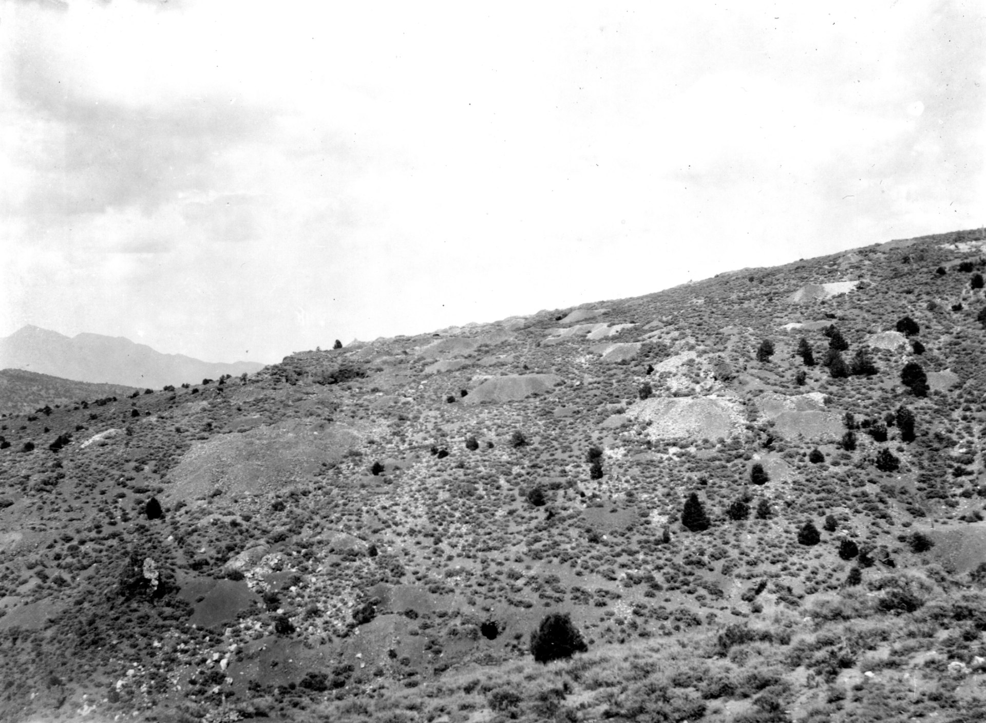
Black and white photo of a long sagebrush slope dotted with pale mine dumps and dark pinyon trees under a cloudy sky
Old mine dumps scattered across Last Chance Hill in 1912.Photo: James M. Hill, U.S. Geological Survey, public domain

How the brick town disappeared

Unlike Bodie, Aurora was not saved. A handful of people stayed on through the 1920s and 1930s, and many of the brick buildings were still standing. Then, in August 1946, a Southern California contractor began tearing them down and trucking the used brick away; according to one account, much of it ended up in chimneys in San Pedro and Wilmington. By about 1960 the last brick building was gone. The townsite was listed on the National Register of Historic Places on July 30, 1974, but by then only rubble, foundations and the cemetery were left.

On the last residents: One history says George Mills was the only resident by 1930, and another says Sigfried “Fried” Walker, who died in 1955, was the last to live there. The two may simply reflect different years.

Modern mining

Mining at Aurora never fully stopped. Nevada Goldfields opened a modern mine in the district in 1987, and a mine and mill now sit just east of the old townsite. Hecla Mining Company owns the operation through its subsidiary Klondex Aurora Mine. On March 31, 2026, federal permitting was completed for its Polaris Exploration Project on Humboldt-Toiyabe National Forest land, allowing up to 250 drill sites on up to 150 acres of the district.

What remains

The cemetery. Aurora’s hillside cemetery, a short way north of the townsite, is the best-preserved part of the town, and Travel Nevada calls it one of the best historic cemeteries in the state. Among the graves is that of gunman William E. Carder, killed outside the Exchange Saloon on December 10, 1864, whose headstone was later broken by vandals. In 2014 Mineral County regraded the road to the cemetery for a Nevada 150 ceremony that dedicated a monument to ten veterans buried there, and in 2016 the Forest Service and volunteers added an interpretive sign at the entrance. An E Clampus Vitus plaque from 1986 stands nearby.

The townsite. Brick rubble, stone and concrete foundations, and faint street lines mark the old town.

The mills and mines. Concrete foundations of the Mangum mill, old shafts, and mine dumps on Last Chance Hill and Silver Hill.

What is gone. The courthouse, the brick business blocks, the hotels and nearly every house.

Timeline

1860
Hicks, Cory and Braly find gold and silver in August and organize the Esmeralda Mining District.
1861
California makes Aurora the seat of Mono County; Nevada Territory makes it the seat of Esmeralda County; the Esmeralda post office opens in September.
1862
Samuel Clemens mines here from April to September; cavalry set up Camp Aurora in May.
1863
About 5,000 people; the September boundary survey puts Aurora in Nevada.
1864
Vigilantes hang four Daly Gang men on February 9; Bridgeport becomes Mono County’s seat; Aurora peaks near 7,000 people.
1866
Fire on Antelope Street destroys 21 buildings; the post office takes the name Aurora.
1870
Half the town’s houses stand empty.
1883
The Esmeralda County seat moves to Hawthorne.
1897
The post office closes.
1906
The post office reopens during a new rush.
1911
Aurora becomes part of the new Mineral County.
1914
Goldfield Consolidated takes control and runs a 500-ton mill at Mangum.
1918
The mill closes and is moved to Goldfield.
1919
The post office closes for good on May 31.
1946
A contractor begins tearing down the brick buildings for salvage.
c. 1960
The last brick building is gone.
1974
Aurora is listed on the National Register of Historic Places on July 30.
1987
Nevada Goldfields opens a modern mine in the district.
2026
Federal permitting is completed for Hecla’s Polaris exploration project on March 31.
Visit guide — Aurora
Can you visit?Yes. The cemetery is open to visitors and the townsite can be seen from the roads. Much of the old town is private mining land, and the modern mine is fenced and posted.
Getting there from HawthorneTake NV-359 south about 6 miles, turn right on Lucky Boy Pass Road and follow it about 18 miles to the Aurora turnoff, then about 5 more miles south to the townsite, roughly 30 miles in all. Travel Nevada calls it about an hour.
From BridgeportTake CA-182 north from US-395, turn right on Aurora Canyon Road past the Bridgeport cemetery and follow the dirt road east into Nevada, about 20 miles and an hour in good conditions.
From BodieA dirt road runs about 12 miles north from Bodie State Historic Park down Bodie Creek. You must pay the park entrance fee to pass through ($8 for adults as of 2026), and the creek road is prone to washouts.
Coordinates38.2871, -118.9007
Road conditionsAll routes are unpaved mountain roads with ruts, rocks and washouts. High clearance is the minimum, and 4WD is wise and often needed when wet. California State Parks has warned that storm damage left Lucky Boy Pass road unmaintained and impassable at times, so check before you go.
SeasonLate spring through fall. Snow and mud make the roads unsafe in winter and spring, and the paved road to Bodie (CA-270) is not plowed in winter. For conditions, call Visit Mineral County at 775-945-5854 or the Forest Service’s Bridgeport Ranger District.
ServicesNone. Get fuel, food and water in Hawthorne or Bridgeport, and expect little or no cell signal.
Land statusThe townsite is mostly private mining land; the surrounding hills are Humboldt-Toiyabe National Forest, where vehicles must stay on designated roads. Hecla’s active mine and exploration areas sit next to the townsite.
Backcountry hazards: Aurora sits above 7,400 feet, and storms can turn the roads to mud quickly. The hills are full of old shafts and caved stopes, often hidden in the sagebrush. Stay out of all mine openings and away from the edges of dumps and pits. Carry water, a spare tire and an offline map, and tell someone your route.
Respect the ground: Do not dig, metal detect or collect anything; bricks, bottles and metal are part of a National Register site. Treat the cemetery with care and do not touch or move headstones. Obey all gates, fences and signs around the active mine and private claims.
Approximate location of Aurora, about 8 miles northeast of Bodie in Mineral County, Nevada.

Historic sites nearby

Bodie, CA
~8 miles southwest, straight line · also on this site
State historic park · where many Aurora miners went next
Masonic, CA
~12.5 miles northwest, straight line
Gold camp ruins in the Bodie Hills
Monoville, CA
~16 miles southwest, straight line
Placer camp that sent the first prospectors to Aurora
Lucky Boy, NV
~17 miles northeast, straight line
Early 1900s gold camp on the Lucky Boy Pass road
Bridgeport, CA
~18 miles west, straight line
Mono County seat since 1864 · services
Hawthorne, NV
~22 miles northeast, straight line
Took the county seat from Aurora in 1883 · services
Belleville, NV
~39 miles east, straight line
1870s mill town ruins
Candelaria, NV
~45 miles east, straight line
Silver camp ruins and cemetery

Further reading

Books and records about Aurora
Gunfighters, Highwaymen, and Vigilantes: Violence on the Frontier
Roger D. McGrath · University of California Press, 1984
Roughing It
Mark Twain · American Publishing Company, 1872
Some Mining Districts in Northeastern California and Northwestern Nevada
James M. Hill · U.S. Geological Survey Bulletin 594, 1915
Reconnaissance of Mining Districts in Mineral County, Nevada
William O. Vanderburg · U.S. Bureau of Mines Information Circular 6941, 1937
The Early Settlement of Aurora, Nevada, and Nearby Mining Camps
Earl W. Kersten Jr. · Annals of the Association of American Geographers, 1964
Aurora, National Register of Historic Places Nomination
Nevada State Park System · 1972, listed 1974
Aurora NevadaNevada Ghost TownsGhost TownMineral County NevadaEsmeralda CountyMono CountyBodieMark TwainVigilantesGold MiningSilver Mining

Sources

National Park Service — Aurora National Register nomination; U.S. Federal Permitting Council — Polaris Exploration Project completes federal permitting

Forgotten Nevada — Aurora; Nevada Expeditions — Aurora and Mangum; Western Mining History — Aurora; Mindat — Aurora Mine Area

Mineral County Museum — The Daly Gang; Twain’s Geography — Aurora, Nevada; Mark Twain Project — Roughing It, chapter 40; Fort Wiki — Camp Aurora; Nevadagram — Aurora

Travel Nevada — Aurora Ghost Town; California State Parks — Bodie: How to Get Here; Atlas Obscura — Aurora; HMdb — Aurora marker; Mineral County Independent-News — 2014 cemetery ceremony and 2016 interpretive sign; Wikipedia — Aurora, Nevada and Daly Gang

Photos: James M. Hill, U.S. Geological Survey, 1912, public domain, via the USGS Denver Library collection on ScienceBase: Last Chance Hill shaft house, south end of Silver Hill and Last Chance Hill mine dumps
Similar Posts

Leave a Reply

Your email address will not be published. Required fields are marked *