Thistle Ghost Town, Utah: The Railroad Town Erased by America’s Costliest Landslide
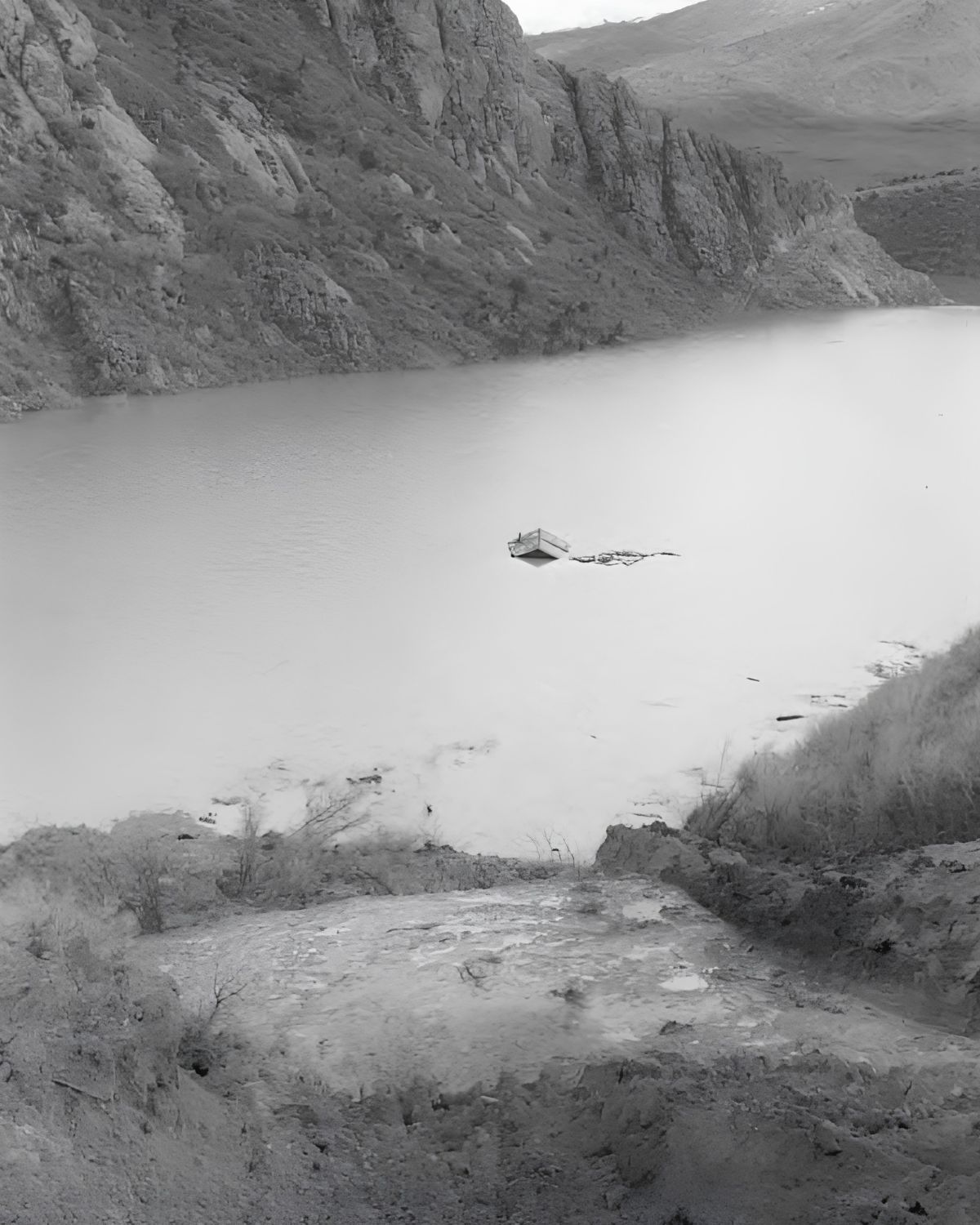
Most ghost towns die slowly — a mine plays out, a rail line reroutes, the last families drift away over a decade or two. Thistle, Utah died in six days. In April 1983, a slope of unstable clay above Spanish Fork Canyon let go, and what had been a working Denver & Rio Grande Western railroad junction for nearly a century was buried under a lake of the railroad’s own making. It remains the most expensive landslide in United States history, and one of the strangest ghost towns in the West: a town not abandoned, but drowned.
Today the valley floor is private property, mostly silt and marsh, but the wreckage is visible from a Utah Department of Transportation pullout on US-89 — interpretive signs, a slide scar on the mountainside, and, when the light is right, the ghostly outline of a house still standing in the mud.
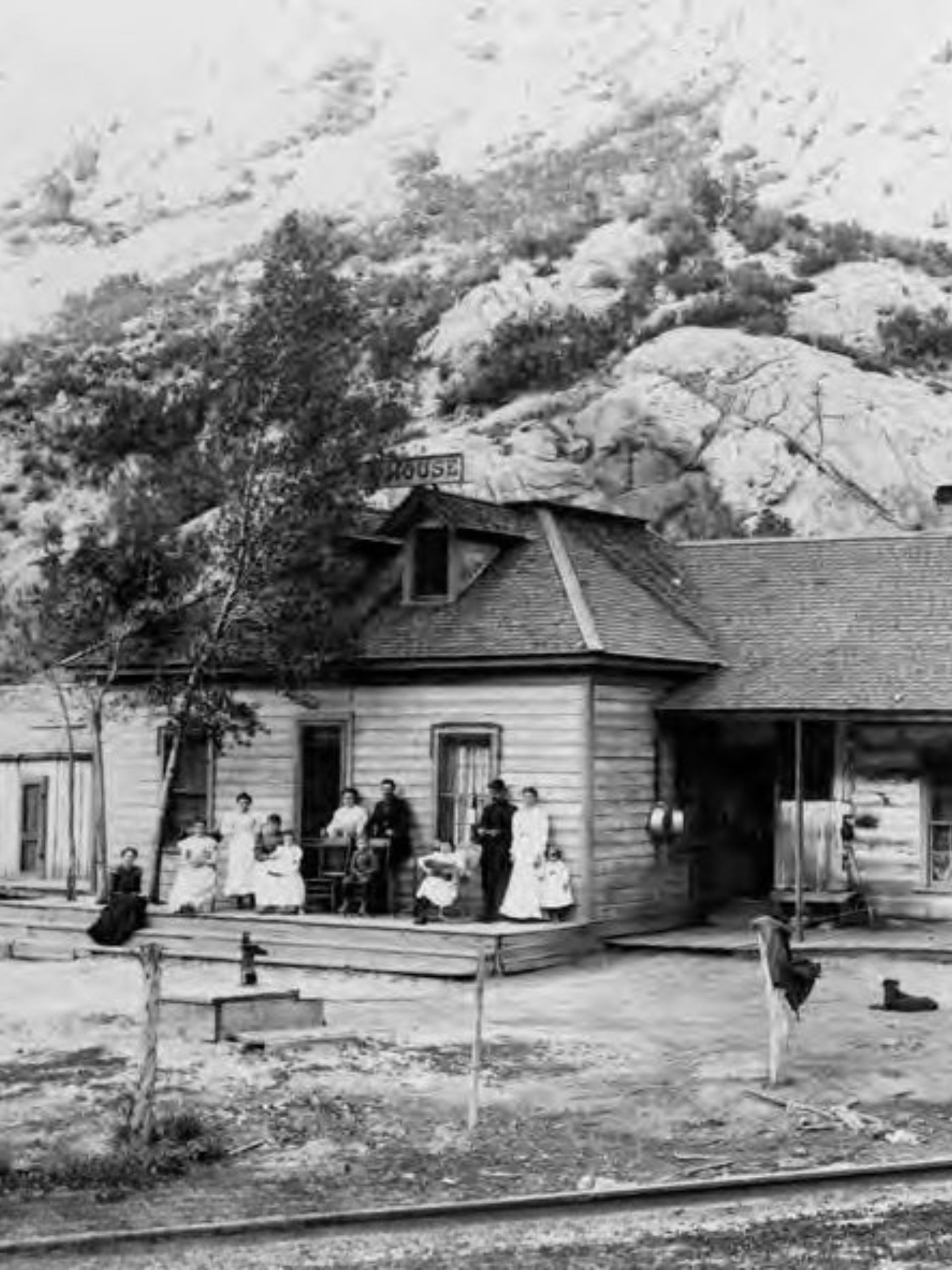
A Canyon Crossroads: Founding and Early Settlement
Spanish Fork Canyon had been a travel corridor long before anyone built a permanent settlement in it. In 1776, Franciscan friars Silvestre Vélez de Escalante and Francisco Atanasio Domínguez were guided through the drainage by local Native Americans while searching for an overland route from Santa Fe to California — the expedition that gave Spanish Fork its name. Trappers and army units passed through in the decades after, leaving behind place-names like Soldier Creek.
Permanent settlement came with the Latter-day Saint migration west. The Pace family arrived from Nauvoo, Illinois in 1848 and established a cattle ranching operation in the valley that their descendants would maintain for more than 135 years. The community itself wasn’t formally platted as a townsite until 1883, starting life as a modest farming and stock-raising outpost at the mouth of the canyon.
Becoming a Railroad Town (1890–1912)
Thistle’s fate changed when the railroads discovered it sat at a natural three-way junction — routes converging from the Wasatch Front, the Sanpete Valley to the south, and the coalfields of Carbon and Emery counties to the east. In 1890 the Denver & Rio Grande Western (D&RGW) completed a branch line south through the Sanpete Valley toward Marysvale, and Thistle became its operational hub. By 1912 the Utah Railway Company had built a parallel line up the same canyon to reach the Helper coalfields, and the two companies signed an agreement to jointly maintain track through the corridor.
Steam-era railroading required a small army of infrastructure to push freight up the canyon’s brutal four-percent grade toward Soldier Summit: coaling towers, water tanks, an engine repair shop, a roundhouse, and staging tracks for helper locomotives. Around that infrastructure grew a working town — worker housing, a saloon, a schoolhouse, storehouses, and a U.S. Post Office.
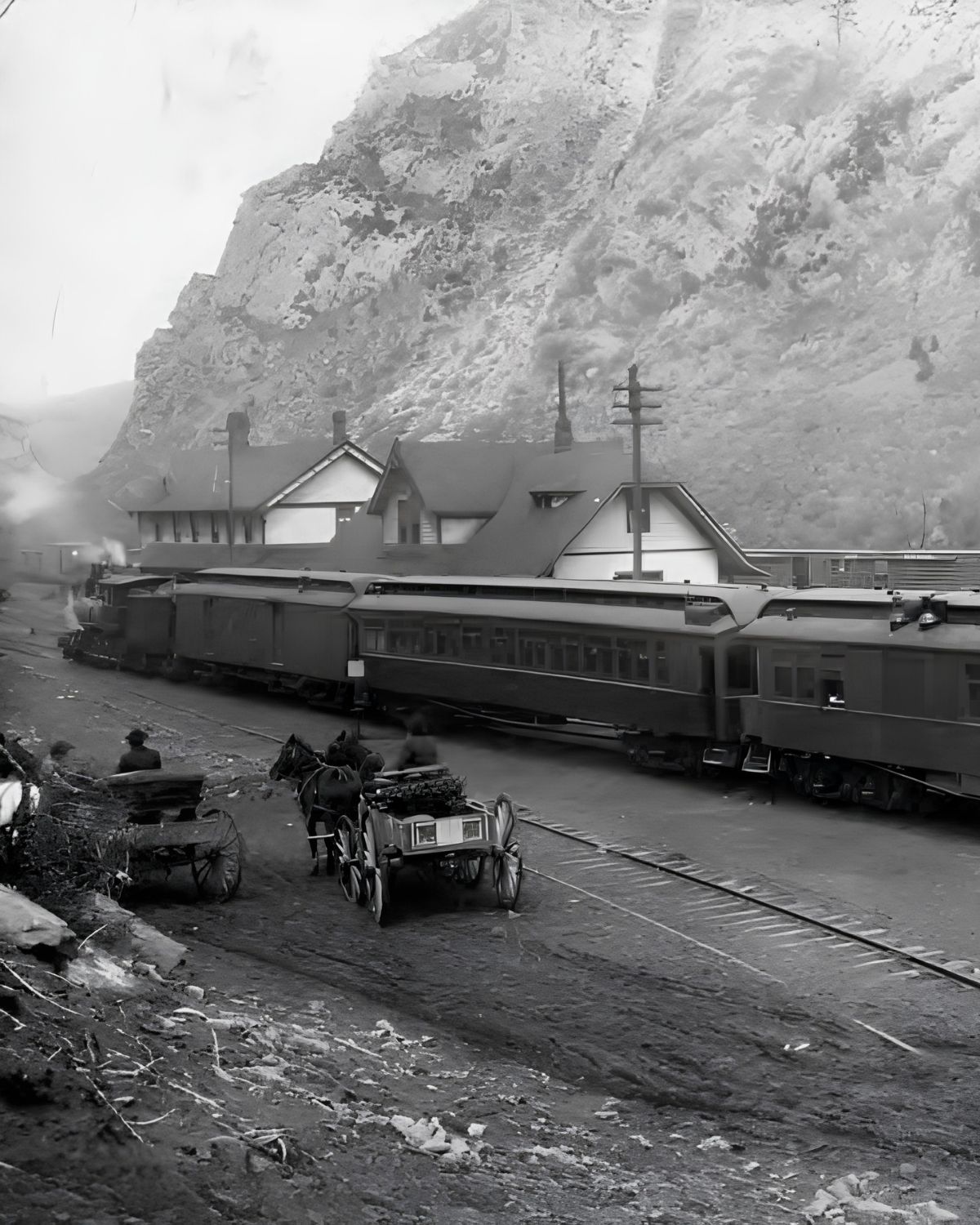
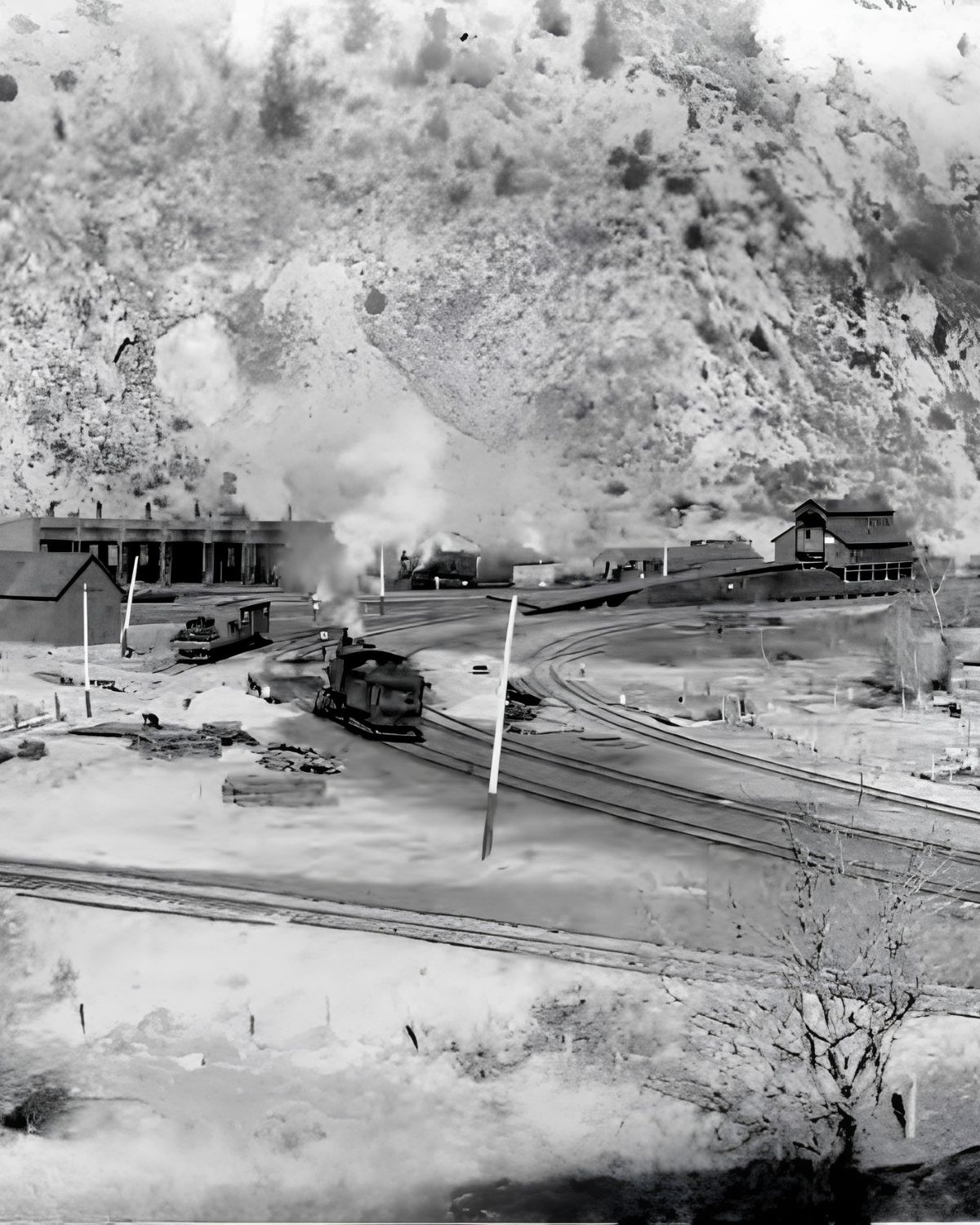
Peak Years on the Line (1917)
Thistle reached its demographic high point in 1917, with roughly 600 residents — railroad engineers, shop mechanics, maintenance crews, and the ranching families who had been there from the start. It was never a large town, but it was a genuinely essential one: for decades, almost nothing moved through central Utah’s rail network without passing through the Thistle junction.
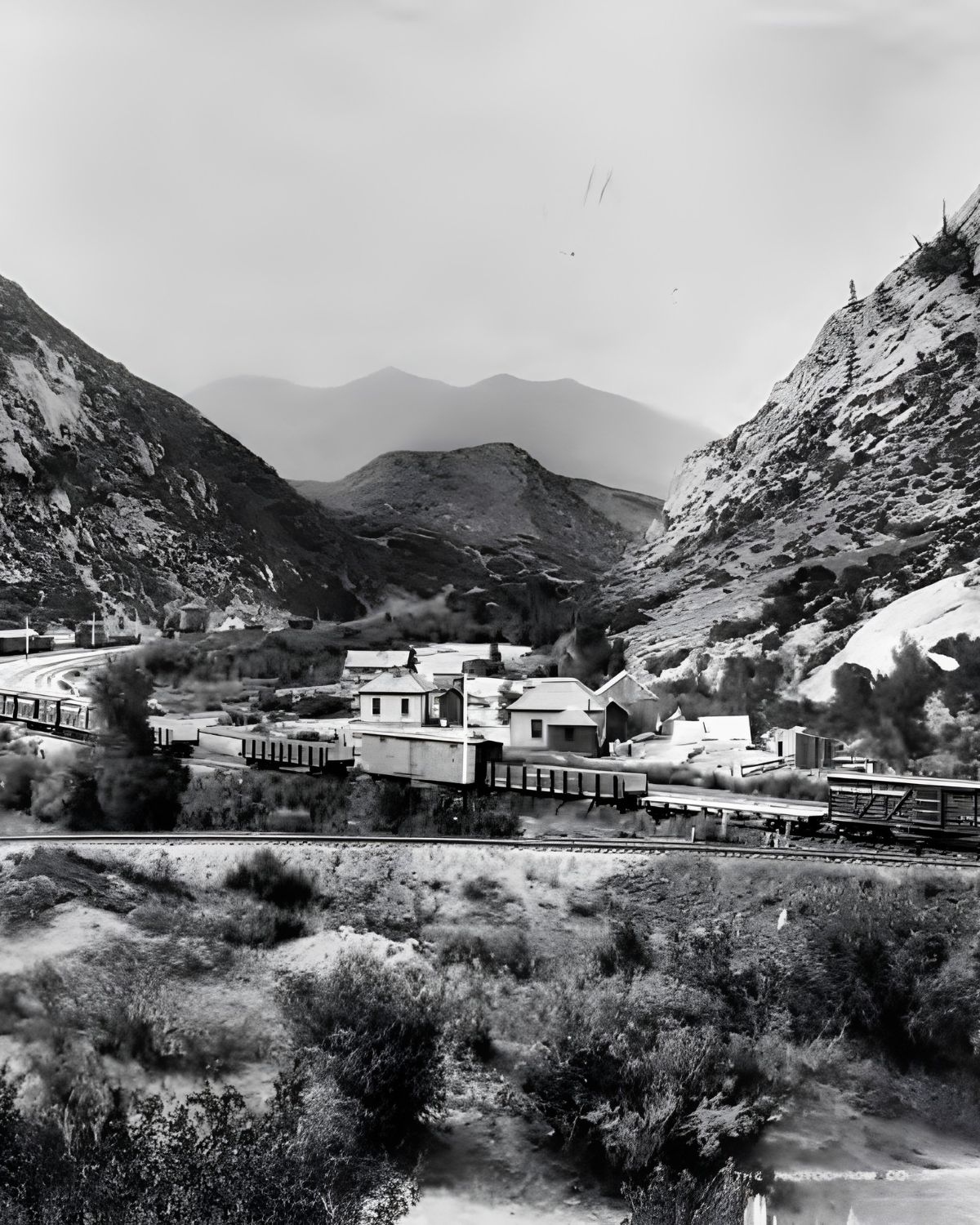
Dieselization and Decline (1950s–1970s)
Thistle’s decline had a precise mechanical cause: the diesel-electric locomotive. Diesel engines needed far less servicing and far fewer stops than steam power, and as D&RGW modernized its fleet through the mid-twentieth century, the coaling towers, water tanks, roundhouse, and helper crews at Thistle became obsolete almost overnight. The railroad steadily cut its local workforce, and the town shrank with it. The passenger depot was demolished in 1972; the post office, the last piece of formal civic infrastructure, closed in 1974. By early 1983 only around 50 people remained, living in a dozen to twenty-five houses.
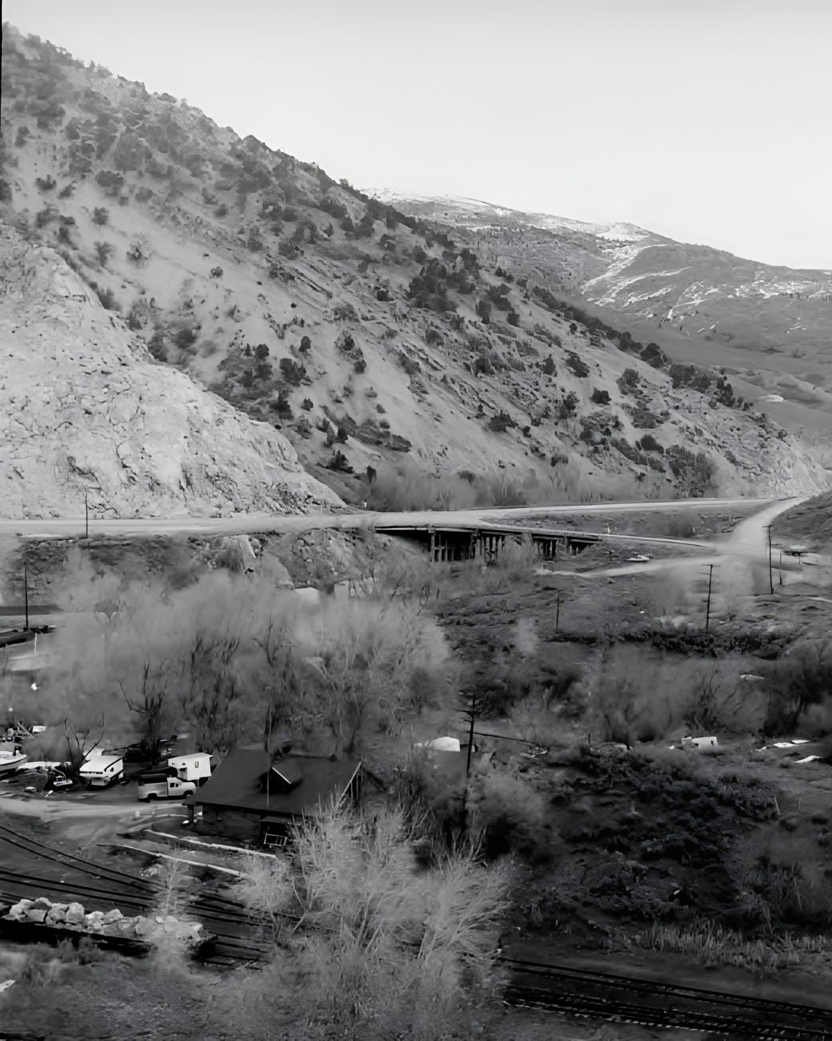
April 1983: The Landslide That Swallowed a Town
What destroyed Thistle wasn’t economic exhaustion — it was geology, and weather. The winter of 1982–83 had been the wettest on record across northern Utah, beginning with moisture from the remnants of Hurricane Olivia and continuing through a snowpack that measured two to three times normal levels. When a sudden warm spell hit in mid-April, that snowpack melted fast, saturating the weak, clay-rich rock of the Wasatch Plateau above the canyon — ground that had a documented history of instability going back to at least 1939.
Movement was first detected on April 12–13. By Friday the 15th, the earthflow was advancing up to five inches an hour, lifting the roadbed of U.S. Highway 6 by fifteen feet. At its peak the slide reached speeds of 3.5 feet per hour and eventually measured roughly 1,000 feet wide, 200 feet thick, and more than a mile long. When its leading edge hit the sandstone bedrock of Billies Mountain across the canyon floor, it built a natural earthen dam 220 feet high — and the Spanish Fork River, with nowhere left to go, began backing up into the valley.
Efforts to cut a drainage channel through the toe of the slide failed on April 17; the ground was moving faster than excavators could dig. Evacuation orders went from voluntary to mandatory on April 16, and residents left with as little as two hours’ notice, grabbing what they could carry. By April 18 the rising water had reached the rooflines of 22 occupied homes. Utah Governor Scott M. Matheson requested federal assistance, and President Reagan issued Utah’s first-ever presidential disaster area declaration. The resulting reservoir — Lake Thistle — grew to three miles long and up to 200 feet deep, holding back nearly 65,000 acre-feet of water directly over the townsite.
The Last Train Through: The Rio Grande Zephyr’s Final Run
Thistle’s destruction happened to coincide with the end of an era in American passenger rail. The Rio Grande Zephyr was the last privately operated, long-distance passenger train in the country — D&RGW had declined to join Amtrak when it formed in 1971 and kept running its own service instead. On the night of April 14, 1983, the westbound Zephyr crept through Thistle at just 10 miles an hour, its track already warped by the advancing slide. It was the last train to clear the junction before the line was severed for good that night. Ten days later, on April 24, 1983, D&RGW retired the Zephyr and finally joined Amtrak.
Aftermath: Rebuilding Around a New Lake
The destruction of Thistle didn’t just erase a small town — it severed one of the most important rail corridors in the Mountain West. With the D&RGW mainline between Denver and Salt Lake City cut, transcontinental traffic had to detour north through Wyoming on Union Pacific track, and $10-per-ton rerouting surcharges helped drive a nearly 30 percent drop in central Utah coal production that year. The D&RGW’s Marysvale branch line, the one that had made Thistle a junction in the first place, was never rebuilt. Both U.S. Highway 6 and U.S. Highway 89 were buried under as much as 50 feet of earth and water.
Crews eventually stabilized the landslide dam with roughly 500,000 cubic yards of additional fill and bored a permanent drainage tunnel through Billies Mountain to control the lake level. D&RGW drilled a new twin rail tunnel higher on the mountainside to restore mainline service, while state crews realigned both highways along new cuts well above the old canyon floor. Direct damages were estimated at $48 million; total direct and indirect losses, once lost trade and rerouting costs were included, topped $400 million — making Thistle the single costliest landslide in U.S. history.
What Remains Today
Once the drainage tunnel let engineers draw the lake back down, it left behind a mud-scarred basin dotted with the town’s ruins. The most striking survivor is the two-story wood-frame house visible from the highway, its ground floor permanently filled with silt while its upper floor and roofline still tilt above the waterline. Nearby, the collapsed masonry of the old schoolhouse’s red sandstone entry arch has slowly crumbled into rubble. Scattered across the valley floor are concrete foundations, open basement vaults, rusted utility pipe, and brick debris from homes and railroad buildings alike, along with silted cuts marking the abandoned D&RGW right-of-way. The 220-foot landslide dam and the bare slide scar on the mountain above remain the clearest evidence of what happened here.
All of it sits on private land. The valley floor is not open for exploration, and the marsh itself — deep mud, standing water, decaying timber — is genuinely hazardous even if you could get to it legally.
Folklore and the Haunted Valley
Thistle has picked up its share of regional folklore since 1983, most of it centered on the half-submerged house and the sealed rail tunnels — visitors and amateur ghost hunters often describe an unusually eerie atmosphere around the flooded valley. None of it is verified history, but it’s become part of how the site is talked about locally, alongside the very real human stories: longtime resident Evelyn Nelson, 73, reportedly refused to evacuate at first, unable to accept that a mountain could simply slide into a river, and had to be escorted out by emergency crews. Families like the Dunns, who had bought a home in Thistle just nine months before the slide, lost their investment entirely — standard property insurance rarely covered damage caused by a combination of earth movement and floodwater.