Woodstock, Colorado: The Railroad Camp an Avalanche Erased
ColoradoRailroadSite only · Gravel road access·~9 min read
Quick facts
What it isRailroad camp and water stop on the Denver, South Park & Pacific's Alpine Tunnel line
Founded1881, as the railroad was being built
DestroyedMarch 10, 1884, by an avalanche
Deaths13, including all six children of Marcella Doyle
PopulationReportedly up to about 200; 17 or 18 people were caught in the slide
RailroadDenver, South Park & Pacific, narrow gauge
ElevationRoughly 10,900 to 11,000 feet (estimated)
CoordinatesAbout 38.614° N, 106.391° W (approximate)
CountyGunnison County
StateColorado
⚠ Site only: a sign and stone footings · Narrow gravel shelf road, high clearance advised · Snow closes the road most of the year · Avalanche country
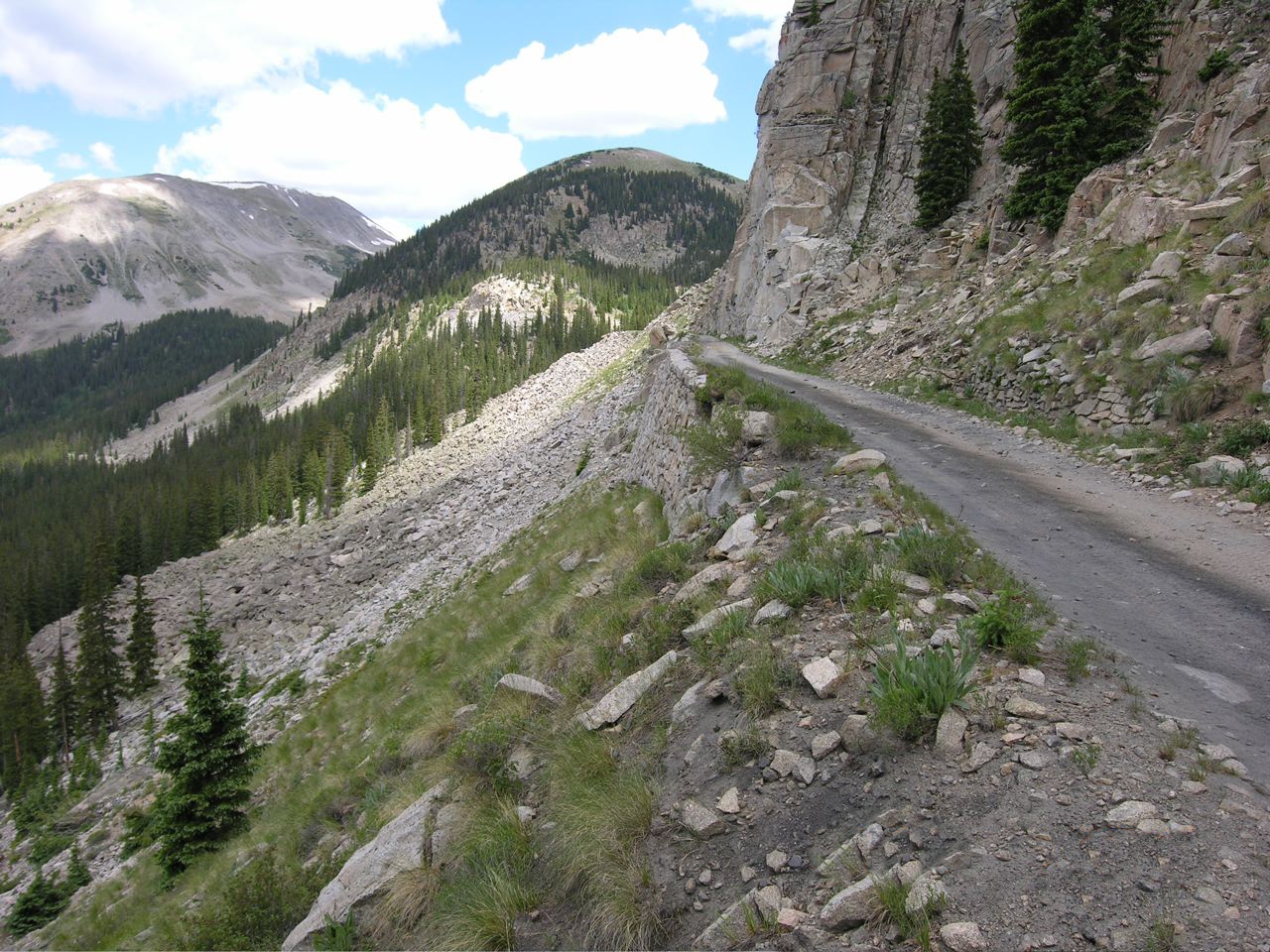
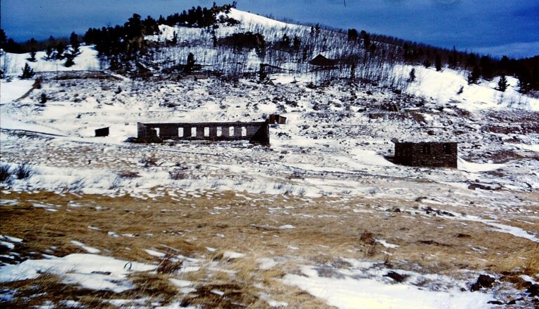
The Palisades, the stone-walled railroad ledge above the Woodstock site, 2006. Photo: A. L. Szalanski, CC BY-SA 3.0, via Wikimedia Commons.
Woodstock was a small railroad camp high on the west side of the Continental Divide, on the narrow-gauge Denver, South Park & Pacific line that climbed from Pitkin to the Alpine Tunnel. It grew up around 1881 while the railroad was being built, and by 1883 it had a section house, a water tank, a telegraph office and a passing track. On March 10, 1884, an avalanche broke loose on the slope directly above the camp and buried it. Thirteen people died, among them all six children of Marcella Doyle, the widow who ran the boarding house. Woodstock was never rebuilt, and today a Forest Service sign and the stone footings of its water tank mark the spot beside the Alpine Tunnel road above Pitkin.
A water stop below the Divide
In the early 1880s the Denver, South Park & Pacific was racing the Denver & Rio Grande to the new mining camps of the Gunnison country. Instead of climbing over a pass, the South Park went under one. Work on the Alpine Tunnel, beneath Altman Pass, began in January 1880, and the crews broke through on July 26, 1881. The bore was 1,772 feet long and about 11,523 feet above sea level, and the rock was so crumbly that the whole tunnel had to be lined with California redwood. Trains were running through it in 1882, and the line reached Gunnison that September.
West of the tunnel the track dropped toward Pitkin down the valley of Middle Quartz Creek, on a steep grade cut into the mountainsides. Just below the tunnel it crossed the Palisades, a ledge held up by a dry-laid stone wall about 452 feet long and 33 feet high. Below that the line swung around a broad horseshoe curve, then known as the Woodstock Loop. Woodstock sat there, a little more than three miles by rail below the tunnel.
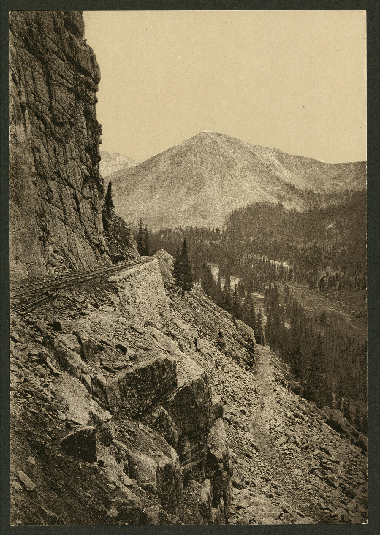
"Alpine Pass," a Detroit Publishing Co. photochrom from about 1898 to 1905, showing the railroad on its stone wall below the cliffs.Library of Congress, public domain
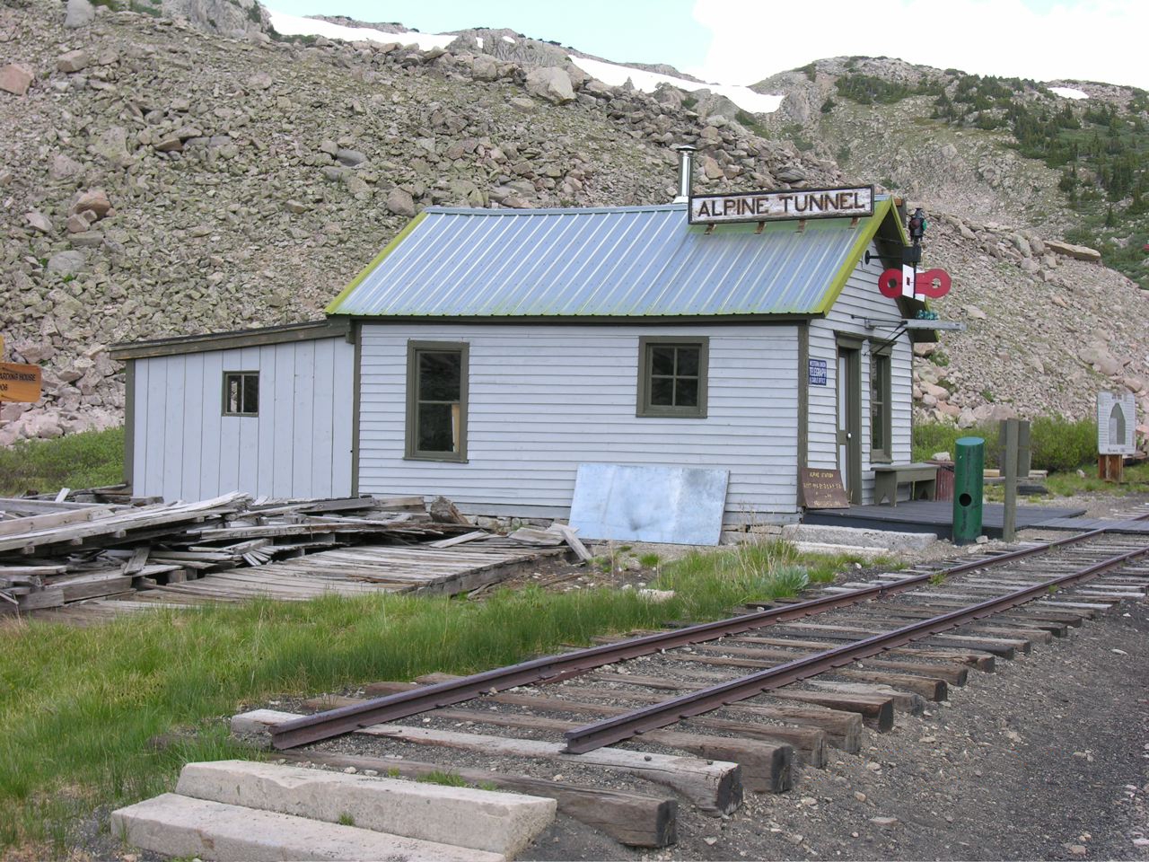
The restored telegraph office at Alpine Station, near the top of the climb past Woodstock, 2006.Photo: A. L. Szalanski, CC BY-SA 3.0, via Wikimedia Commons
A camp of section men
Woodstock was a working stop, not a town in the usual sense. According to the Forest Service sign at the site, the railroad kept a passing track, a water tank, a coaling platform and a station telegraph office there. Section men, the crews who kept the track clear and in repair, lived in the railroad's section house. Later accounts add a saloon or restaurant and a few cabins, and some say the camp began as a silver prospectors' camp before the railroad arrived.
On November 5, 1883, Marcella Doyle, a widow, took over the section house and began running it as a boarding house for the section hands. Her six children lived with her: Martin, Andrew, Christopher, Catharine, Marcella and Maggie. Andrew worked on the section crew.
On the population: The sign at the site says Woodstock had been home to 200 people, a figure repeated in later articles. Accounts of the avalanche itself count only 17 or 18 people in the camp that day. No census count exists, so how many lived there at its busiest is uncertain.
March 10, 1884
On March 10, 1884, a snow slide released on the small, steep slope directly above the camp and swept down over it. According to several accounts, an eastbound train had just pulled out. The avalanche buried the buildings and destroyed the water tank. Rescuers dug through the snow and debris, and two women were pulled out alive. Marcella Doyle survived, injured, but all six of her children died.
A wire report published in April 1884 listed among the missing the telegraph operator, J. Brown; George and Horace Alexander; Mike Shea; and Jasper M. Carwell of Tomichi. The rest, it said, were section men. Forest Service avalanche records note that debris was still being cleared that April.
On the death toll: The sign at the site says 18 people were buried and 13 died, and most sources agree on 13. One road guide gives 14 dead out of 17. Colorado avalanche studies list Woodstock's 13 as the highest toll from a single avalanche in the state's records, although a series of slides at the Liberty Bell mine near Telluride in 1902 killed more people in total.
On the recovery: Some retellings say the last bodies were not found until the summer thaw. We found no record to support that; the documented account has the debris being dug out in the weeks after the slide.
Doyle against the railroad
Marcella Doyle sued the railroad, by then part of the Union Pacific system, over the deaths of her children, arguing that the company had put the section house in a place it knew was dangerous. The case went all the way to the U.S. Supreme Court. In Doyle v. Union Pacific Railway, decided in 1893, the court ruled for the railroad: Doyle had been running the boarding house as a tenant, the justices said, and the danger of snow slides was a risk of the country that she knew as well as the company did.
Never rebuilt
The railroad did not rebuild Woodstock. It put up a new water tank about half a mile down the grade at Tunnel Gulch, in 1885 according to one account, away from the slide path. That tank still stands. A drawing by the Historic American Buildings Survey places it at 10,920 feet, 9.2 track miles from Pitkin, and members of the Mile-Hi Jeep Club restored it in 1969.
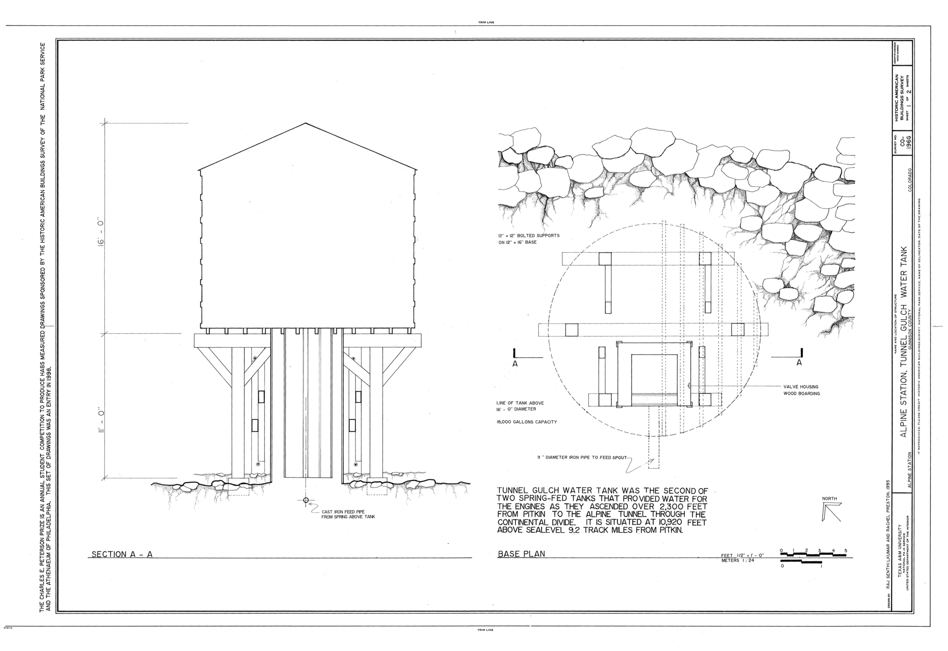
Historic American Buildings Survey drawing of the Tunnel Gulch water tank, built to replace the tank lost at Woodstock.Library of Congress, public domain
The line itself had a hard life. A cave-in closed the Alpine Tunnel in 1888, and it stayed shut until 1895. The bankrupt South Park was reorganized in 1889 as the Denver, Leadville & Gunnison, which became part of the Colorado & Southern in 1898. Fire swept the buildings at Alpine Station in 1906, and after another cave-in in 1910 the railroad gave up on the tunnel for good. The rails were later pulled up, and the grade became a road.
The slopes above the old camp had one more boom. Around 1903 a silver strike brought a short-lived camp called Sherrod to the area just upgrade, and the horseshoe curve took its name as the Sherrod Loop. By about 1906 Sherrod was empty too.
On Sherrod: Some retellings say Woodstock's survivors moved up to Sherrod. That cannot be right: Sherrod began almost twenty years after the avalanche.
Legends
A disaster this sudden gathered stories. One says the whistle of a passing train set off the slide. Another says a ghost train can be heard on the anniversary. Both are local tradition with nothing in the record behind them.
What remains
Very little. Beside the road stand a Forest Service interpretive sign about the avalanche and the stone footings of the lost water tank, with a few foundation stones and scattered old timbers nearby. Half a mile below is the restored Tunnel Gulch tank. Above, the road follows the old grade around the Sherrod Loop and over the rebuilt Palisades to Alpine Station, where the 1883 telegraph office has been restored and the ruins of the stone engine house and the buried west portal of the tunnel can be seen.
Timeline
January 1880
Work begins on the Alpine Tunnel under Altman Pass.
1881
A camp grows up at Woodstock on the west side of the line. The tunnel crews break through on July 26.
1882
Trains run through the tunnel and past Woodstock, reaching Gunnison in September.
November 1883
Marcella Doyle begins running the section house as a boarding house.
March 10, 1884
An avalanche buries Woodstock and kills 13 people, including Doyle's six children.
1885
By one account, the Tunnel Gulch water tank replaces Woodstock's tank half a mile downgrade.
1888 to 1895
A cave-in closes the Alpine Tunnel.
1893
The U.S. Supreme Court rules against Doyle in her suit against the railroad.
1903 to 1906
The silver camp of Sherrod booms and fades just upgrade of the old Woodstock site.
1910
Another cave-in ends service through the tunnel.
1969
The Mile-Hi Jeep Club restores the Tunnel Gulch water tank.
1996
The Alpine Tunnel Historic District is listed on the National Register of Historic Places.
2024
The Alpine Tunnel road reopens after repairs to the Palisades.
Visiting Woodstock
Can you visit?Yes. The site is on Gunnison National Forest land along the Alpine Tunnel road, part of the Alpine Tunnel Historic District.
Getting thereFrom Gunnison, drive east on US 50 about 11.5 miles to Parlin, then north on County Road 76 through Ohio City to Pitkin, about 15 to 16 miles. From Pitkin, follow Forest Road 765 toward Cumberland Pass about 3 miles and turn right on Forest Road 839, the Alpine Tunnel road. The Woodstock sign is roughly 7 miles up, about half a mile past the Tunnel Gulch tank.
CoordinatesAbout 38.614, -106.391, at the old Woodstock (now Sherrod) Loop. Approximate.
Road conditionsGraded gravel on the old railroad grade, narrow, with drop-offs. High clearance is recommended; 4WD is usually not needed in dry weather. A gate stops cars about 1,000 feet short of Alpine Station, and rockfall can close the upper road.
What to seeThe avalanche sign and tank footings, the Tunnel Gulch tank, the Palisades, and Alpine Station with its restored telegraph office, engine house ruins and the buried tunnel portal.
ServicesNone on the road. Pitkin has a seasonal general store and lodging; full services are in Gunnison. Expect little or no cell signal.
Land statusGunnison National Forest (GMUG). Alpine Station is day use only, sunrise to sunset, with no fee and no water.
Best timeUsually July through September, sometimes into early October. Snow closes the road the rest of the year. Check with the Gunnison Ranger District, 970-641-0471, before you go.
Avalanche and road hazards: Woodstock is a reminder that these slopes slide. Do not travel here in winter or spring unless you are trained and equipped for avalanche terrain. In summer, watch for rockfall below the cliffs, meet oncoming vehicles with care on the narrow ledge, and expect thin air and afternoon lightning near 11,000 feet. Stay out of any old mine openings.
Respect the ground: This was a place where children died; treat it quietly. Do not dig, metal detect or take anything, not even a spike or a bit of rusted metal. Removing artifacts from national forest land is against federal law. Leave the tank footings and foundation stones exactly as you found them.
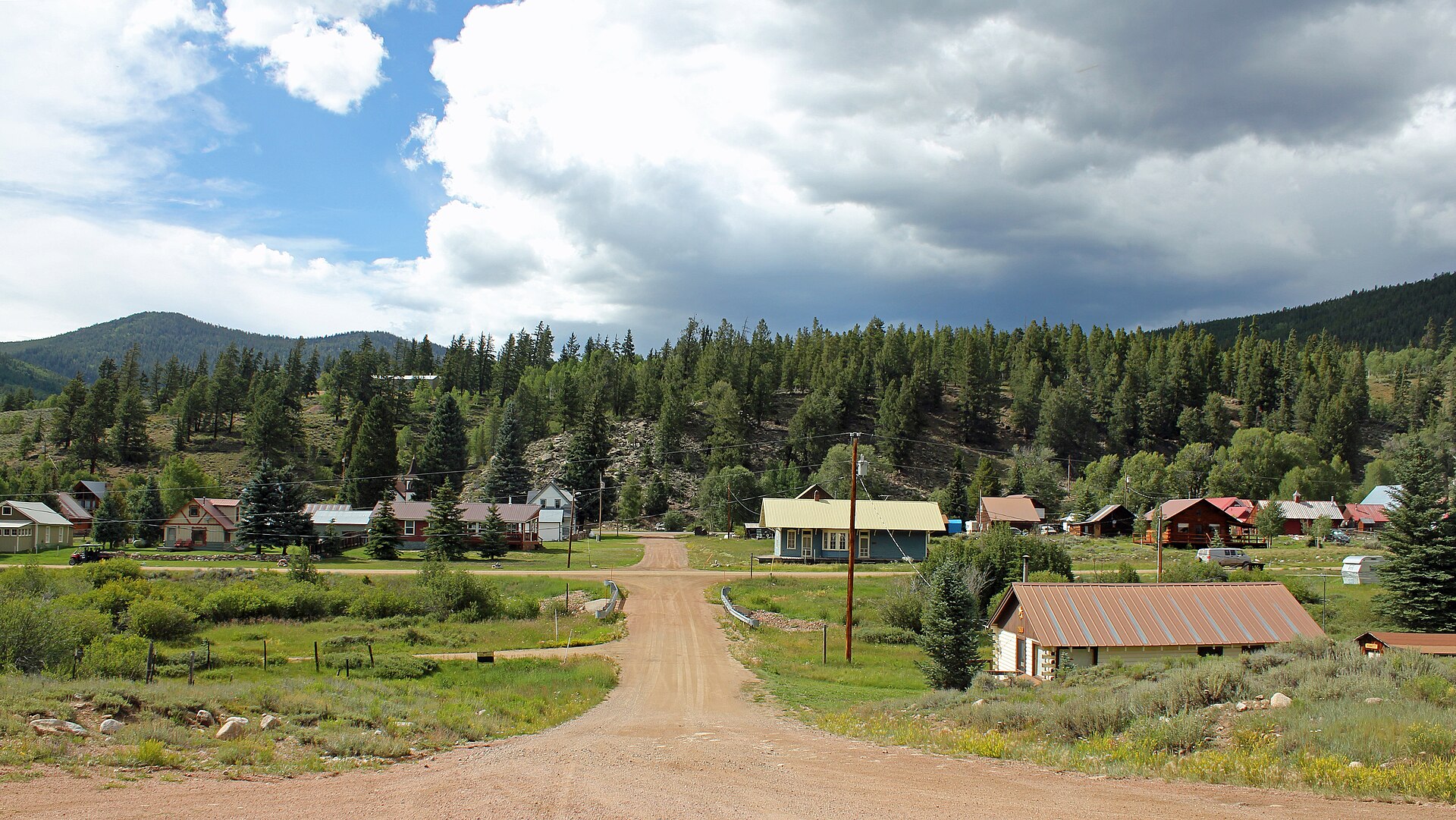
Pitkin, the last town on the drive up to Woodstock and the Alpine Tunnel, 2014.Photo: Jeffrey Beall, CC BY 3.0, via Wikimedia Commons
Approximate location of the Woodstock site on the Alpine Tunnel road, about 10 miles by road above Pitkin in Gunnison County.
Historic sites nearby
Alpine Tunnel and Alpine Station
~3 miles up the road
1881 tunnel at 11,523 feet · restored telegraph office
Hancock, CO
~2.5 miles east in a straight line, across the Divide, also on this site
Railroad camp below the tunnel's east portal
St. Elmo, CO
~7 miles east in a straight line, also on this site
The South Park line's supply town on Chalk Creek
Pitkin, CO
~10 miles down the road
1879 mining town · store and lodging in summer
Tin Cup, CO
~11 miles north in a straight line, also on this site
Silver camp over Cumberland Pass from Pitkin
Ohio City, CO
~16 miles down the road
Gold and silver camp on Quartz Creek
Further reading
Books and records about Woodstock and the Alpine Tunnel
Historic Alpine Tunnel
Dow Helmers · Sage Books, Denver, 1963 — the standard history of the tunnel and its camps
The South Park Line: A Concise History
Gordon Chappell, Robert W. Richardson and Cornelius W. Hauck · Colorado Rail Annual No. 12, Colorado Railroad Museum, 1974
Historic Avalanches in the Northern Front Range and the Central and Northern Mountains of Colorado
M. Martinelli Jr. and C. F. Leaf · U.S. Forest Service, Rocky Mountain Research Station, General Technical Report RMRS-GTR-38, 1999
Doyle v. Union Pacific Railway Co., 147 U.S. 413
U.S. Supreme Court, 1893 — the court record of Marcella Doyle's lawsuit
Stampede to Timberline: The Ghost Towns and Mining Camps of Colorado
Muriel Sibell Wolle · Boulder, 1949
Woodstock ColoradoColoradoColorado Ghost TownsGhost TownRailroad TownNarrow Gauge RailroadDenver South Park & PacificAlpine TunnelAvalancheGunnison CountyPitkinContinental Divide
Sources
U.S. Supreme Court — Doyle v. Union Pacific Railway Co., 147 U.S. 413 (1893)
U.S. Forest Service — Alpine Tunnel Historic District and Historic Avalanches (RMRS-GTR-38)
Papers Past — Feilding Star, April 17, 1884 (wire report of the avalanche)
Denver7 — This Colorado town was wiped off the map by an avalanche; Ghosttowns.com — Woodstock (text of the site sign)
Wikipedia — Alpine Tunnel; Legends of America — Alpine Tunnel, Colorado
4x4explore — Alpine Tunnel road; Colorado Public Radio — Alpine Tunnel road reopens; CoGenWeb — Gunnison County towns
Photos: A. L. Szalanski, CC BY-SA 3.0 and CC BY-SA 3.0; Detroit Publishing Co., Library of Congress, public domain; Historic American Buildings Survey, Library of Congress, public domain; Jeffrey Beall, CC BY 3.0