Leadfield, California
Part of Death Valley ghost towns, with drive times and road notes for every town near the park.
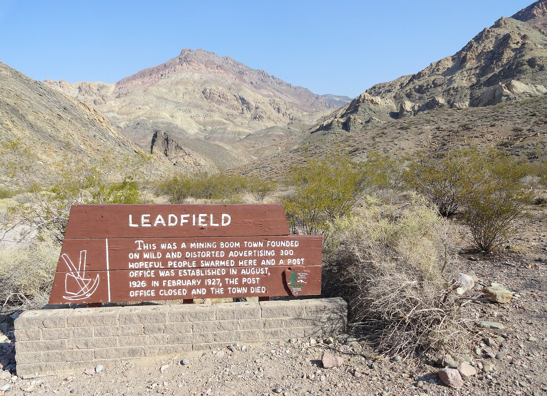
Leadfield is a short-lived 1920s mining camp in the middle of Titus Canyon, high in the Grapevine Mountains of Death Valley National Park. Prospectors staked lead claims here in 1924, and the camp boomed in late 1925 and 1926 after the Los Angeles oil promoter C. C. Julian took over its leading company and sold its stock with lavish advertising and a famous one-day excursion. About 300 people lived in the canyon, a townsite of 1,749 lots was surveyed, and a post office opened in August 1926. Within months the main tunnel hit poor ore, California regulators stopped Julian’s stock sales, and the camp emptied; the post office closed in early 1927. Leadfield is remembered as a swindle, but the Park Service’s own history argues the story is more complicated, and what Julian left behind, the Titus Canyon Road, is still one of the best backroad drives in the park.
Lead in Titus Canyon
Miners were working ore in Titus Canyon as early as 1905, during the gold rush at nearby Rhyolite and Bullfrog, but nothing came of it for almost twenty years. In March 1924, three prospectors, Ben Chambers, L. Christensen and Frank Metts, staked claims on lead outcrops in the canyon. They worked them for more than a year before selling twelve claims to John Salsberry, a promoter with long experience in Death Valley mining.
Salsberry formed the Western Lead Mines Company with 1,500,000 shares priced at 10 cents. By the end of 1925 the company held more than fifty claims. It installed a compressor plant for its air drills, and eighteen men with six trucks started building a steep auto road out of Titus Canyon toward the Beatty highway. In January 1926 the company put up a boarding house and began laying a pipeline from Klare Spring, about two miles down the canyon. By the end of that month the camp had a name: Leadfield.
C. C. Julian takes over
Courtney Chauncey Julian was a Canadian-born promoter, famous in Southern California for selling shares in his Julian Petroleum Corporation through blunt, folksy newspaper ads. By early February 1926 he had bought into Western Lead and become its president. Under Julian the company ordered heavy machinery, pushed its main tunnel into the canyon wall, and advertised Leadfield across the country.
The high point came in mid-March 1926. A specially chartered train brought 340 passengers, picked from about 1,500 who had applied, to Beatty, Nevada. Joined by another 840 visitors from Tonopah and Goldfield, they rode in 94 automobiles over the new road into Leadfield. There the owner of Ole’s Inn said he served 1,120 meals outdoors, to music from a six-piece band brought from Los Angeles. Nevada’s lieutenant governor gave the keynote speech ridiculing the California Corporation Commission’s treatment of Julian, Julian spoke in the same vein, and the visitors toured the Western Lead tunnels. According to the Park Service history, Western Lead stock rose 25 cents on the San Francisco market the next day.
A week after the excursion the camp had its own newspaper, the Leadfield Chronicle, and there was talk of a forty-room hotel. By the end of March, Western Lead shares had climbed to $3.30, and more than 300,000 had changed hands. The Leadfield Townsite was surveyed at the end of April with 1,749 lots in 93 blocks, and other companies crowded into the district with claims of their own.
A real town, briefly
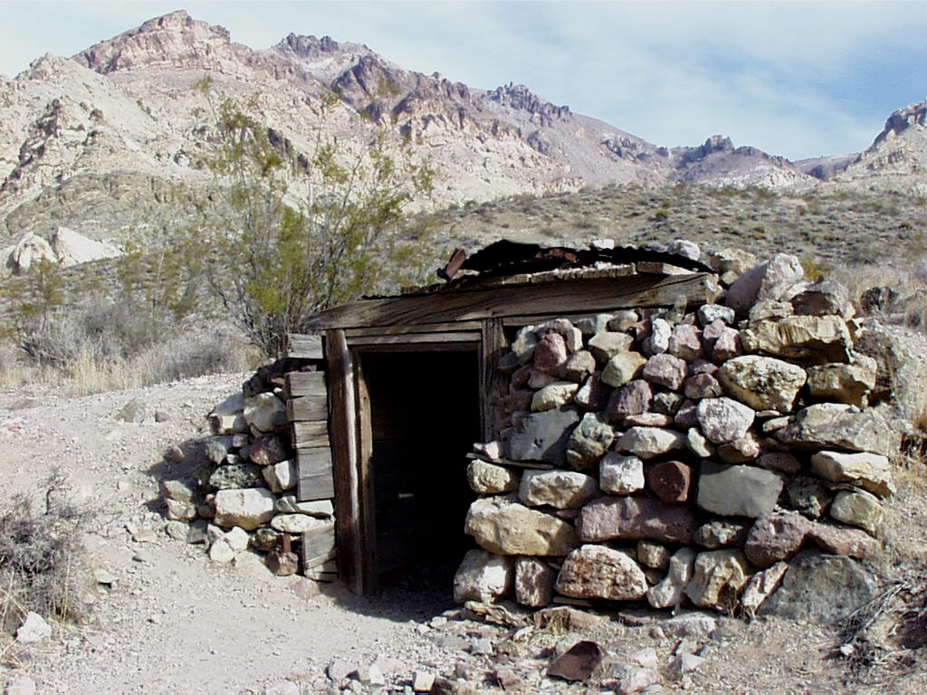
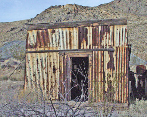
Through the spring and summer of 1926 Leadfield looked like a lasting camp. About 300 people lived in the canyon in wood-and-tin cabins, tents and dugouts cut into the hillsides. There was Ole’s Inn, a boarding house, and mine offices for several competing companies. On August 25, 1926, the federal government opened a post office, which the Park Service history takes as a sign the camp was seen as a permanent family town.
The bust
Trouble had already started. In late June 1926 the California Corporation Commission stopped sales of Julian’s personal Western Lead stock on the Los Angeles exchange, calling them unfair to buyers. Julian folded his interests into a holding company, Julian Merger Mines, Inc., as a backup.
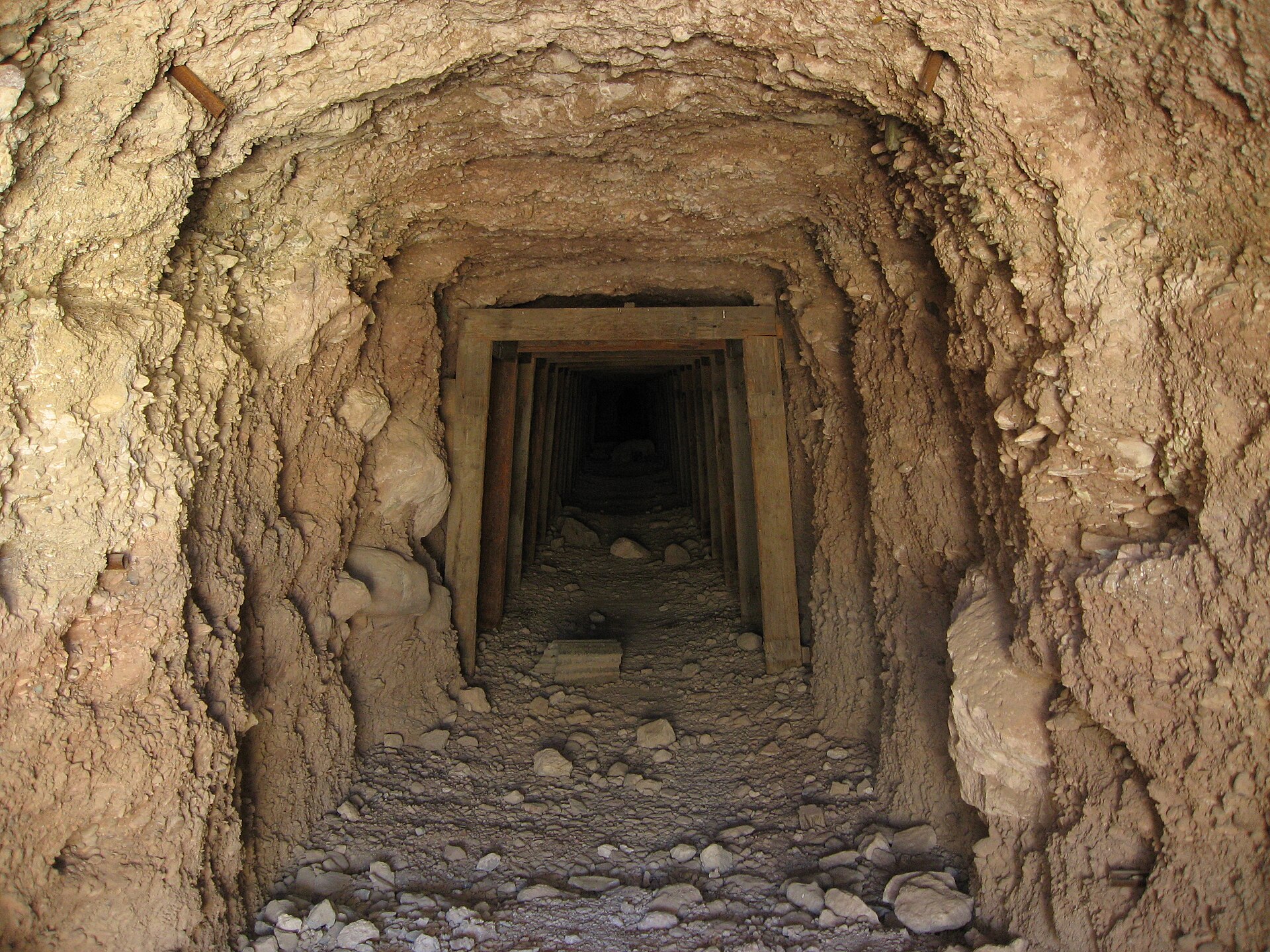
Then, in the autumn of 1926, Western Lead’s main tunnel finally reached the ledge its geologists had been aiming for. Instead of rich ore it found rock that assayed only about 2 percent lead, too poor to pay for hauling out of a desert canyon. At almost the same time the Corporation Commission halted sales of Julian Merger Mines stock. Julian’s companies collapsed, and the smaller Leadfield companies lost heart and closed one after another.
The camp emptied in a matter of months. The post office closed in early 1927, and workers sued for back wages. Julian took the Commission’s ban on Julian Merger stock to the state court of appeals and lost. By early summer Western Lead had pulled out its machinery and pipeline and shipped them to a mine it owned in Arizona. In July 1927 the Mining Journal reported just seven miners left in the district, working with hand tools.
What happened to Julian
Julian’s troubles followed him. He later moved to Oklahoma and promoted oil again through the Julian Oil and Royalties Company. Indicted there for using the mails to defraud investors, he jumped bail and fled to Shanghai, China, in 1933. He died there by suicide on March 25, 1934, at age 48.
Swindle or bad luck?
The popular version of Leadfield is a pure con. In this telling, Julian salted barren tunnels with lead ore hauled in from Tonopah, printed posters of steamboats sailing up the Amargosa River to the camp, and even tricked the government into opening a post office for a town that did not exist.
Some of that is legend. The Park Service’s 1981 history of Death Valley mining, by Linda Greene and John Latschar, argues the usual story “must be revised.” Lead ore really was in the canyon and had been known since 1905. Geologists, engineers and even the Corporation Commission accepted that, and the Commission let companies other than Julian’s keep selling stock. The boom began before Julian arrived, and Western Lead spent real money on tunnels, compressors and a road. In 1938 the state’s mining bureau reported that Leadfield’s main ledges carried 5 to 7 percent lead and about five ounces of silver a ton, enough to support a modest mine. Greene and Latschar side with desert writer Harold O. Weight, who concluded that no one will ever know whether the camp, honestly financed and developed, could have made a real mine.
What remains
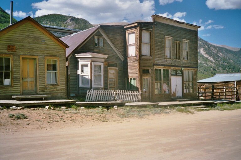
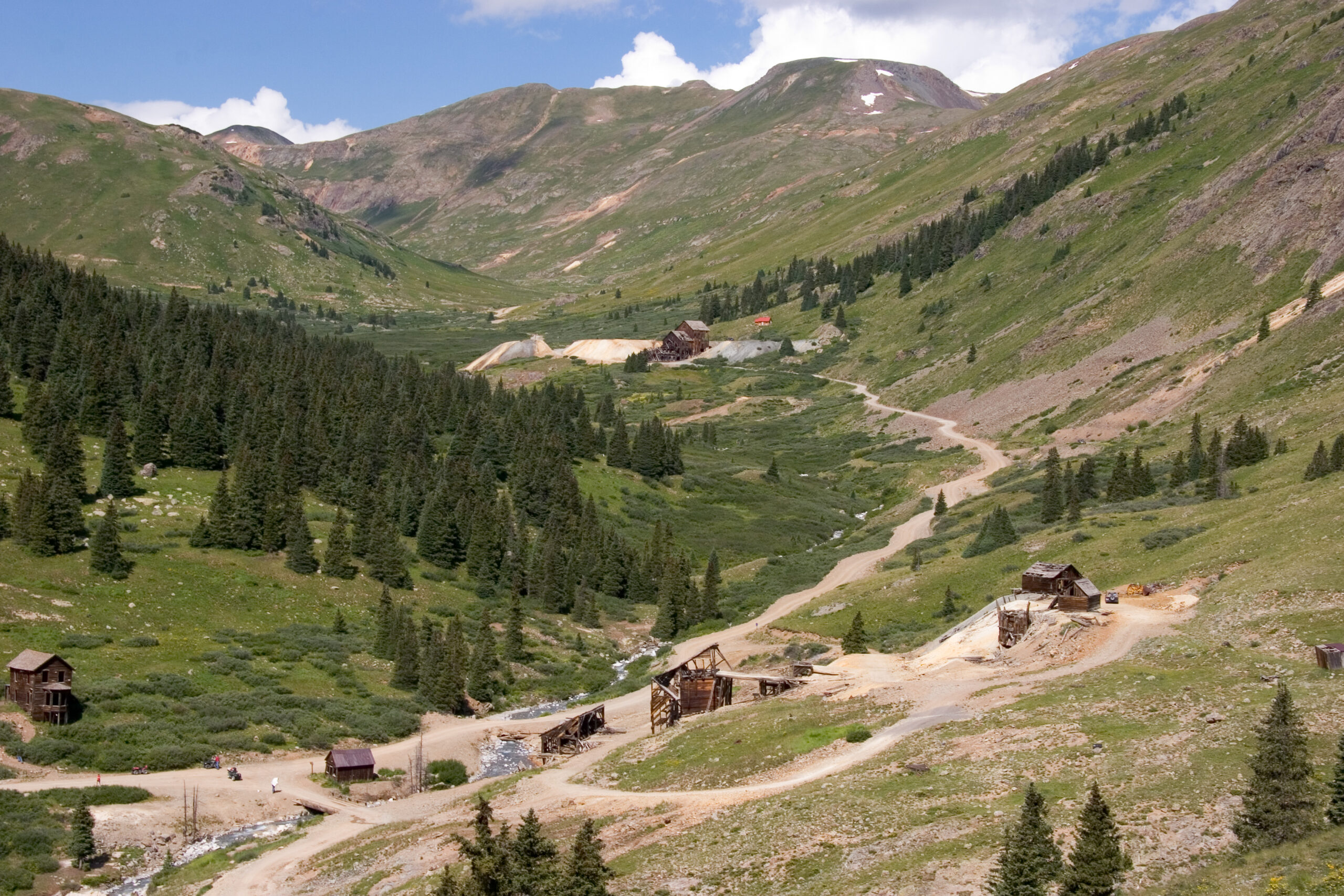
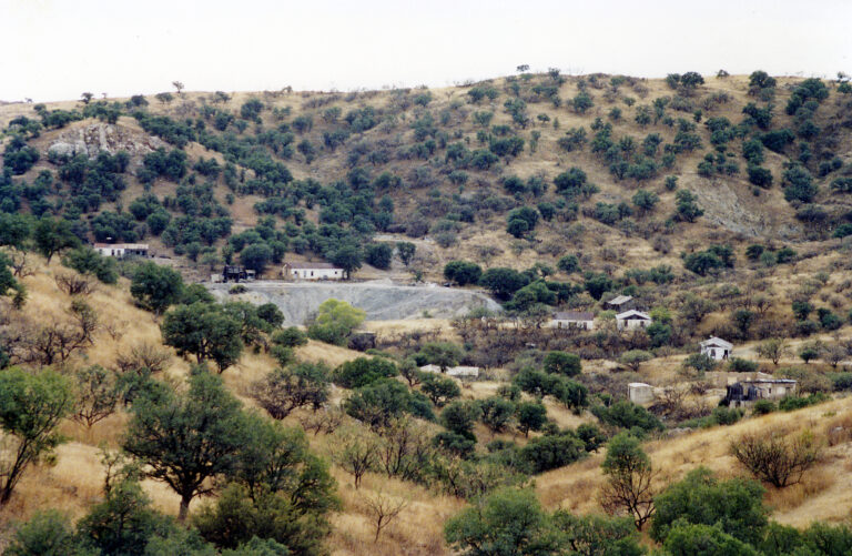
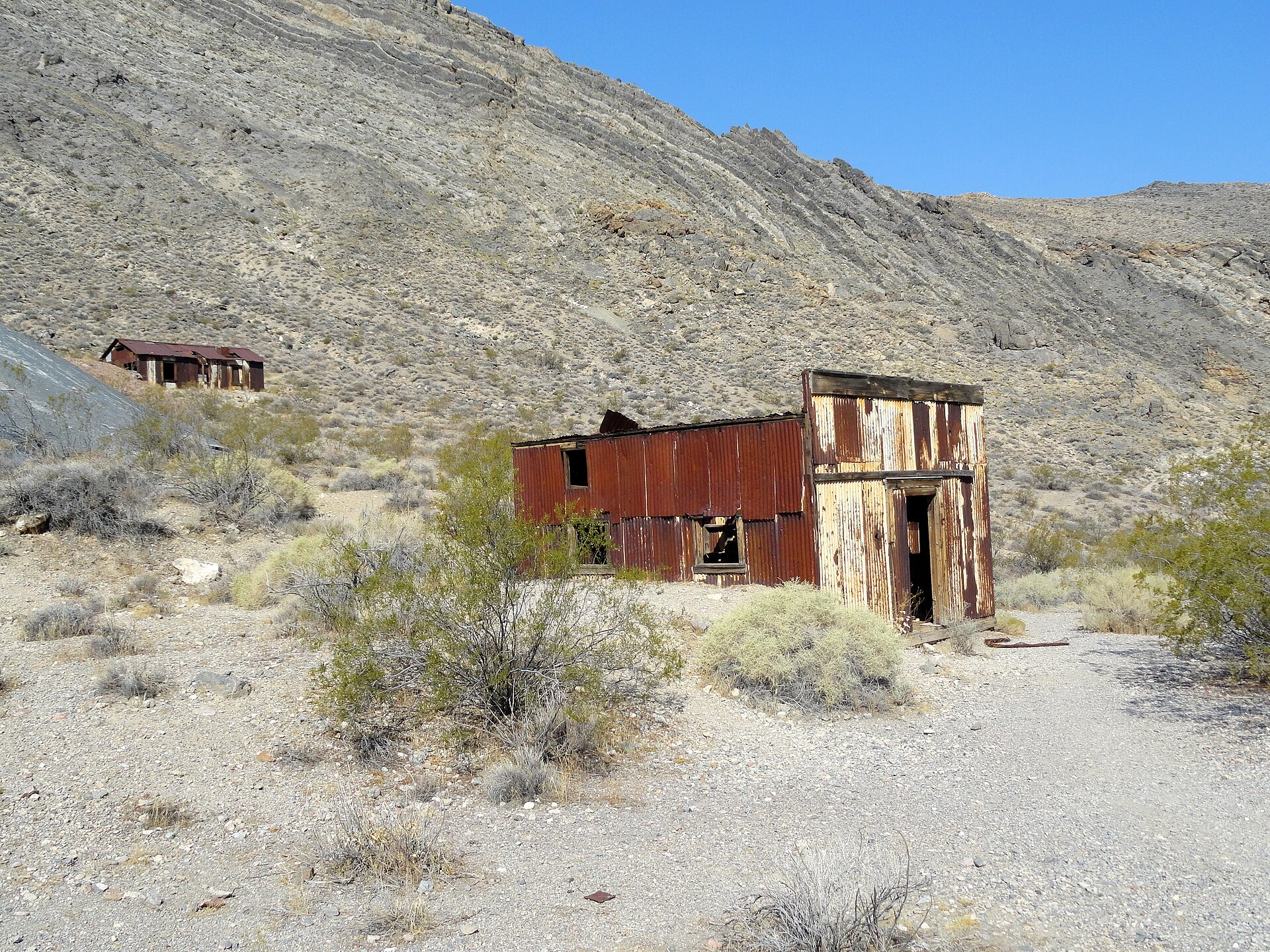
Because the big machinery went to Arizona in 1927, Leadfield has no mill or headframe. What survives is the shape of a small camp: several wood-and-corrugated-tin buildings, well-preserved dugouts built into the slopes, concrete foundations, and tunnels, prospect holes and waste-rock dumps on the hillsides. The main shaft has partly caved in. One building is on the Park Service’s List of Classified Structures as Leadfield Building No. 1, and the site was added to the National Register of Historic Places on June 10, 1975.
The Titus Canyon Road
Even the Park Service history, critical as it is of the legends, credits Julian with one lasting thing: the road. It cost an estimated $60,000 and climbs more than fifteen miles from the Beatty highway, at about 3,400 feet, over passes above 5,000 feet before dropping to Leadfield at about 4,000 feet. Today it is the 27-mile Titus Canyon Road, one-way from east to west. Below Leadfield it passes Klare Spring, with its petroglyphs and bighorn sheep, and squeezes through narrows where the canyon walls are less than 20 feet apart. In 1933 a fossil skull of a titanothere, a large rhinoceros-like mammal, was found in the rocks along the upper road.
Timeline
Historic sites nearby
Distances are approximate straight-line miles from Leadfield. Driving distances are much longer.
Further reading
Sources
National Park Service — Historic Resource Study, Section IV (Leadfield); National Register nomination, Leadfield; Perils of Opportunity: The Mining Towns
National Park Service, Death Valley — Titus Canyon Road; Alerts and conditions; Titus Canyon Road closing for repairs October 2; Titus Canyon Road open for limited time; Entrance fees
Wikipedia — Leadfield, California; C. C. Julian
Mojave Desert — History of Leadfield; Historical Marker Database — Leadfield; Western Mining History — Leadfield
Photos: Fabio Achilli, via Wikimedia Commons (CC BY 2.0); eflon, via Wikimedia Commons (CC BY 2.0); National Park Service, including a photo held by the National Archives (public domain).