Winfield, Colorado: The Silver Camp at the Head of Clear Creek Canyon
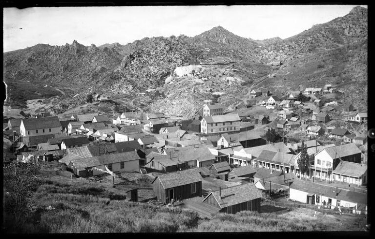
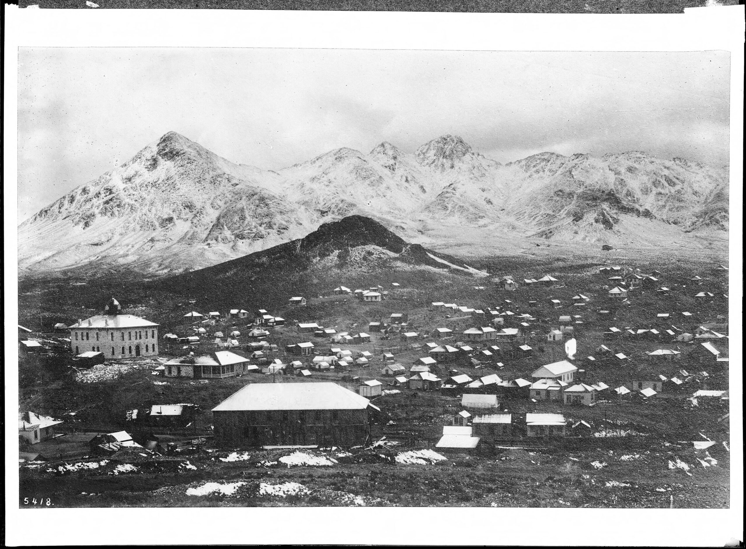
Winfield is the last and highest of the old mining camps in Clear Creek Canyon, a ghost town near Buena Vista that sits about 10,240 feet up where the North and South Forks of Clear Creek meet. Prospectors worked the canyon in the 1860s, but Winfield itself grew out of a silver rush in 1879 and 1880, and its townsite was laid out in 1881. By about 1890 it had some 1,500 people, three saloons, two hotels, a church, a school, a mill and a smelter, and it was the supply town for the whole upper canyon. The silver crash of 1893 ended the boom, the post office closed in 1912, and the last ore left by stage in 1918. Today a restored schoolhouse museum, a handful of log cabins and a small cemetery remain, about 26 miles from Buena Vista on a gravel road that most cars can drive in summer.
Gold seekers on Clear Creek
Clear Creek drains the high Sawatch Range and runs east to the Arkansas River near Granite. Placer gold was found at Cache Creek near Granite in 1859, and in the 1860s miners worked the gravels of Clear Creek west of town. According to the Forest Service’s National Register nomination for Winfield, the first log cabin on the townsite went up in 1861.
In 1867 Colorado’s territorial governor, John Evans, and William N. Byers, founder of the Rocky Mountain News, organized the La Plata Mining District along Clear Creek. Not much came of it, and the district was abandoned. Through most of the 1870s the canyon was quiet, and the people living in it were mostly ranchers and homesteaders down near the mouth.
The 1880 silver rush
Prospecting picked up again in 1879, and by the winter of 1880 prospectors were pouring up the canyon after silver. Five camps took shape along Clear Creek that winter: Beaver City, Vicksburg, Silverdale, Rockdale and Winfield. Silverdale was soon abandoned. Vicksburg, about four miles down the creek, and Winfield, at the top, became the two real towns.
In 1881 six men, P. H. Symons, G. L. Brown, J. S. Sharpe, Dr. J. J. Smith, L. W. Clark and Thomas Leasure, laid out a 120-acre townsite at the forks. They divided it into lots 50 by 100 feet and gave a lot free to anyone who would build on it.
The camp went by more than one name at first. A note in the Buena Vista newspaper, the Chaffee County Times, on August 12, 1881, explained that “Lucknow is the name given to the old town of Florence” and that Winfield was the name of the post office, calling it “a much named town.” The post office name won out.
Supply town of the canyon
Winfield got its post office in 1881, the same year as Vicksburg, and it grew into the commercial center of the upper canyon. Miners in the gulches above town came down to it for supplies, mail and company. At its peak, around 1890, the National Register nomination puts the population at about 1,500 and lists three saloons, three stores, two hotels, a boarding house, a church, a school, a mill, a concentrator and a smelter.
Silver was the main prize, mostly in lead-silver ore, with some copper and a little gold. Two mines above town are the best remembered. The Tasmania, high on the slopes to the west, was worked by a company that held a group of claims there. The Banker, up the South Fork south of town, was a silver and lead mine whose ore also carried molybdenite and bismuthinite.
The crash and the long fade
The Silver Panic of 1893 wrecked the price of silver and stopped mining all through Clear Creek Canyon. Winfield never recovered its boom. Some mining picked up again in the early 1900s, enough to keep the post office open until 1912. According to the National Register nomination, the last ore shipped from the camp went out on a two-horse stage in 1918.
The Banker kept going a little longer. Its claims were patented in 1906, and silver-lead ore was reportedly shipped from it between 1910 and 1927. Interest in its molybdenum came later: in a 1918 state geological bulletin on Colorado’s molybdenum deposits, P. G. Worcester described the Winfield district and called Winfield itself “an old, almost deserted mining camp.”
In the 1930s summer residents built five new log cabins among the old ones, and families kept coming back to the canyon. Winfield was listed on the National Register of Historic Places on March 10, 1980, as the Winfield Mining Camp. The Forest Service had prepared the nomination in 1976, and it counted four original log buildings from the 1880s, the schoolhouse among them, plus the five cabins from the 1930s.
The Winfield cemetery
A short walk up the North Fork road from town, the Winfield cemetery holds about 26 graves, but only two markers remain, and both belong to children of the Aude family. Local histories say those buried there died of fires, snowslides, shootings, mining accidents and disease. According to the Clear Creek Canyon Historical Society, Frederick Carl Aude Jr. was the first person buried there, on June 28, 1885. Local histories also record a Payne child killed in a snowslide among the unmarked graves. The Aude name turns up in the mining records too: a Fred Aude was one of the men credited with locating the Banker claims.
What remains
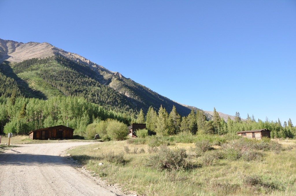
Winfield is one of the better-kept small camps in the Sawatch. The cabins line the road at the forks, set in a meadow with aspen, pine and big peaks all around.
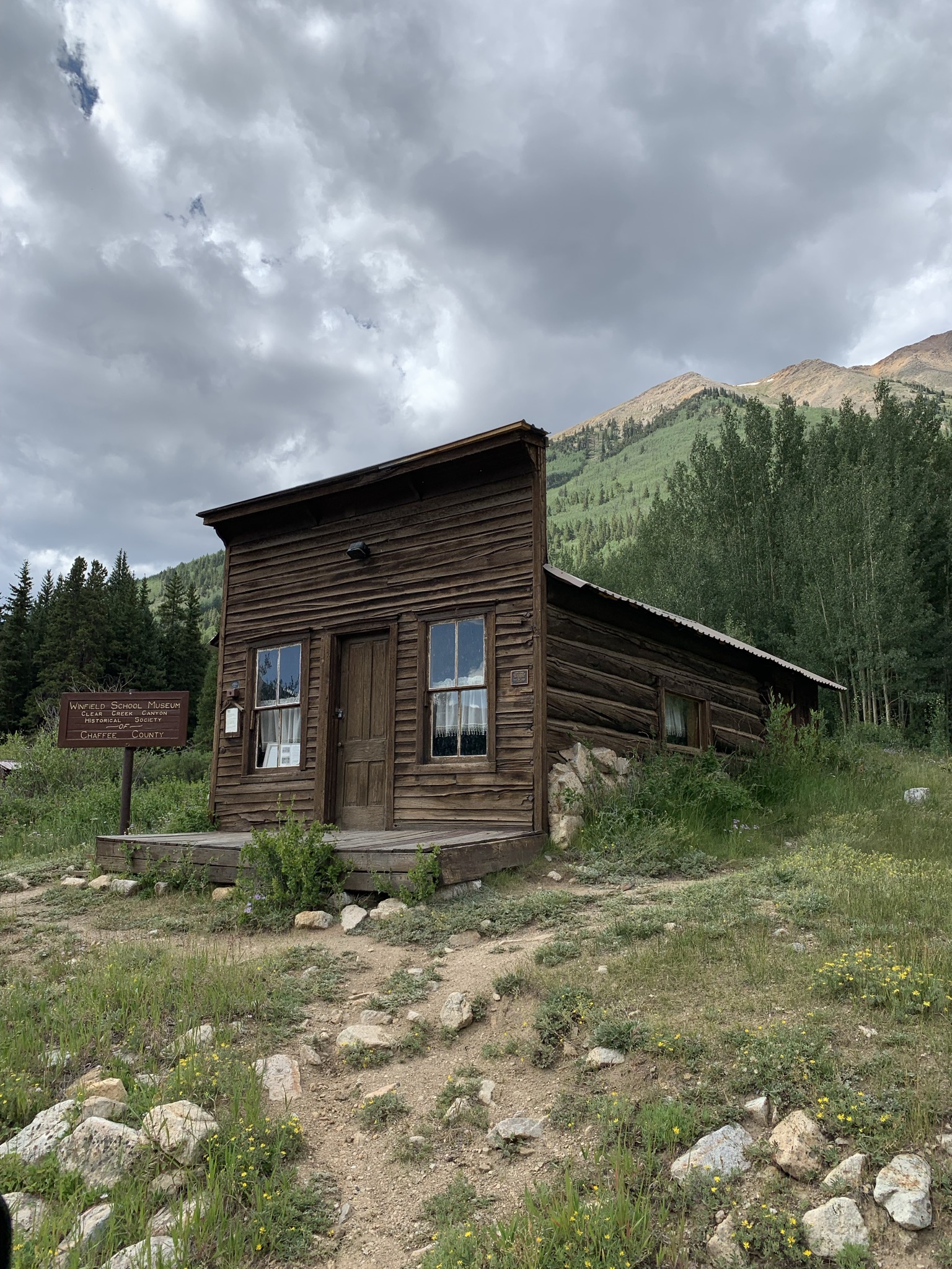
The schoolhouse. An original log building with a board false front, owned by the federal government and restored by the Clear Creek Canyon Historical Society of Chaffee County. It is open as a museum on some summer weekends.
The Ball Cabin. Another 1880s cabin, also run by the historical society as a summer museum.
The cabins. Several old and newer log cabins are private summer homes held under Forest Service permits, some by families with roots in the canyon. Look from the road and leave them alone.
The cemetery. Up the North Fork road, with its two Aude markers among about two dozen unmarked graves.
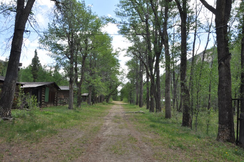
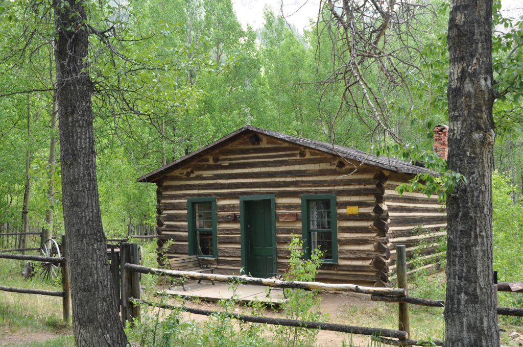
Four miles down the creek, Vicksburg is worth a stop on the way in. It was listed on the National Register in 1977 and has a row of log cabins under tall cottonwoods, plus a small museum the same historical society opens in summer.
Gateway to Huron Peak
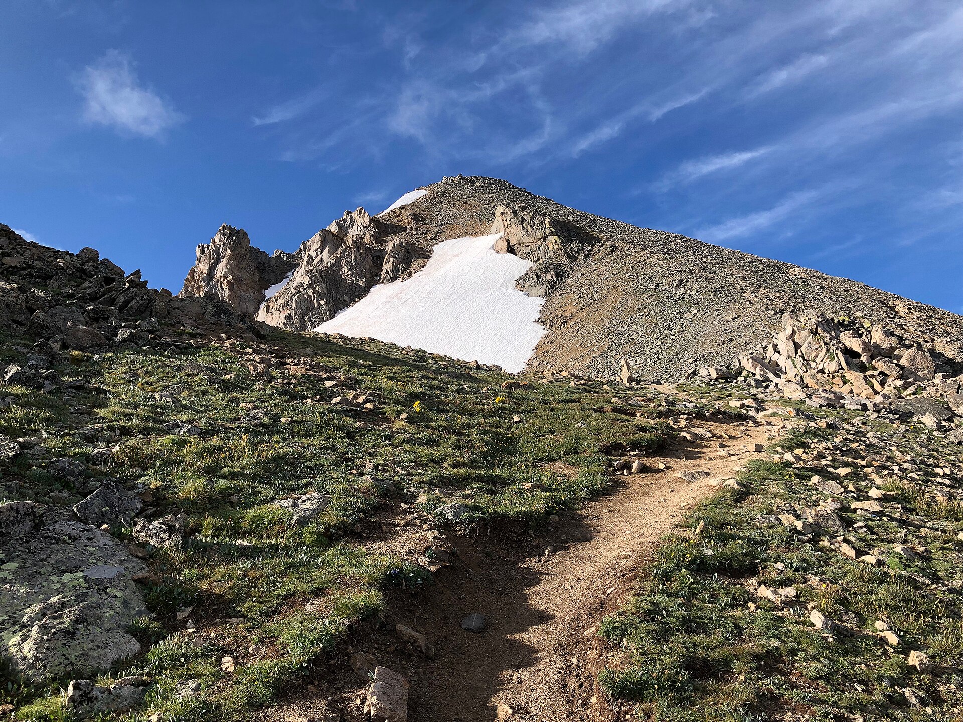
Many people reach Winfield today on the way to somewhere higher. The roads that leave town end at trailheads for the Collegiate Peaks Wilderness and Huron Peak, a 14,000-foot summit just south of town. The South Fork road leads to the South Winfield trailhead, the start of the North Huron trail and the trail to Lake Ann. The North Fork road passes the cemetery and ends at the North Fork Clear Creek trailhead. Back down the canyon near Rockdale, the Sheep Gulch trailhead starts the climb over Hope Pass to Twin Lakes on the Colorado Trail.
Timeline
Historic sites nearby
Further reading
Sources
National Park Service — National Register nomination, Winfield Mining Camp; Wikipedia — National Register listings in Chaffee County
History Colorado — Winfield Mining Camp
U.S. Forest Service — Winfield Mining Camp Interpretive Site, Winfield Dispersed Camping Area, Huron Peak and designated dispersed camping project
Colorado Geological Survey — Molybdenum Deposits of Colorado, Bulletin 14; Western Mining History — Banker Mine
Ghosttowns.com — Banker Mine; Rocky Mountain Profiles — Winfield, Colorado
Legends of America — Ghosts of Clear Creek Canyon; Uncover Colorado — Ghost towns near Leadville
4x4explore — Winfield road guide; Wikipedia — Winfield, Colorado and Vicksburg, Colorado
Photos: Magicpiano, Winfield, Vicksburg street and Vicksburg cabin, and Mainheat, Winfield schoolhouse, all CC BY-SA 4.0; Craig Talbert, Huron Peak, CC BY 2.0; via Wikimedia Commons