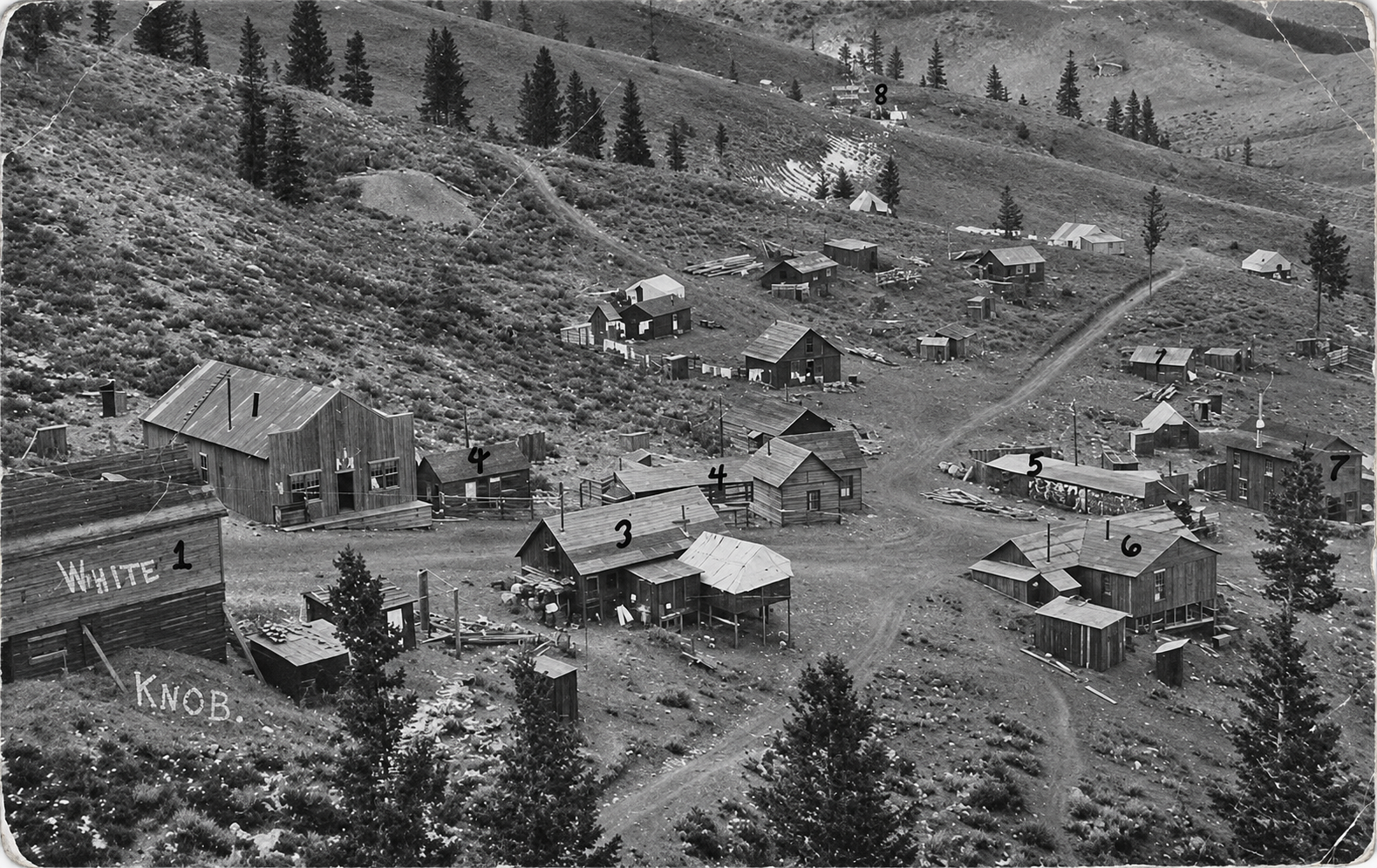
Historic black-and-white photo of White Knob, a mining camp of wooden buildings and cabins spread across a sagebrush and pine hillside, with WHITE KNOB painted on a building in the foreground and numbers marked on several buildings

White Knob, Idaho: The Copper Camp on Mackay’s Mine Hill
Quick facts
What it isCopper company camp on the Mackay Mine Hill, now ruins on a historic tour route
FoundedAbout 1901, with the White Knob Copper Company
Peak populationAbout 500 (1915); local histories say nearly 1,000
Post office1916 to 1934
Main mineThe Empire copper mine
ElevationAbout 7,400 feet
Coordinates43.8924° N, 113.6703° W
LandBLM, national forest and private mining claims
CountyCuster County
StateIdaho
⚠ Steep one-lane mine roads · Summer and fall only · No services on the hill · Active mining company ground · Old tunnels and loose rock
Historic black-and-white photo of White Knob, a mining camp of wooden buildings and cabins spread across a sagebrush and pine hillside, with WHITE KNOB painted on a building in the foreground and numbers marked on several buildings
White Knob in its working years, with numbers marked on several buildings by an early hand. Photo: South Custer Historical Society. Sharpened with AI.

White Knob was the company camp on the Mackay Mine Hill, a steep limestone ridge about three miles west of Mackay, Idaho, where the Empire copper mine was dug into the White Knob Mountains. It grew up around 1901, when Comstock millionaire John W. Mackay put his money into the White Knob Copper Company, and it lived and died with the mine. The company built an electric railway, then a Shay steam line, then a three-mile aerial tramway to get ore down the mountain to its smelter, and lost about $3 million before its best years arrived under lease miners after 1910. The camp had stores, a school, a movie house and about 500 people in 1915, but the mines shut in 1930 and the post office closed in 1934. Today White Knob is a scatter of cabins and foundations on the Mackay Mine Hill tour, a loop of rough roads past tram towers, a rebuilt Shay trestle and an aerial tram headhouse.

Copper on Alder Creek

Prospectors found copper along Alder Creek, on the east side of the White Knob Mountains, in 1879. Little happened for five years. The Big Lost River valley had no railroad, the ore was locked in hard limestone, and the men who staked the claims had no money to develop them.

A rush in 1884 changed that for a while. Small camps sprang up in the gulches below the Mine Hill, among them Houston, Alder City, Carbonate and Cliff City. Houston, down in the valley, got a post office in January 1884 and soon had boardinghouses, saloons, a meat market and a school of sixty pupils.

Everything depended on smelting the ore close to home. In late 1884 Relf J. Bledsoe built a 20-ton smelter at Cliff City, on the south side of the Mine Hill. It fired up on November 23, 1884, turned out good-looking copper, and shut down a little more than a week later. Coke, flux and freight cost more than the copper was worth. A second run began in July 1885 and was over by January 1886, and by June of that year only eight people were left in Houston.

On the early smelter: Some accounts call Bledsoe’s furnace a 50-ton smelter. The Idaho State Historical Society describes it as a twenty-ton smelter, which we use here. Some retellings also add a camp called Republic and call Houston “Old Mackay”; we found no source for either.

John W. Mackay’s company

New York investors paid for another smelter run from late 1890 into February 1891, but the district needed far more money than that. Wayne Darlington, a mining engineer, worked to tie the best claims together, and by 1899 he had bonded the leading prospects. In April 1900 the White Knob Copper Company was reorganized with John W. Mackay, who had made a fortune on Nevada’s Comstock Lode, as president and Darlington as general manager.

The money moved fast. The Oregon Short Line built a branch up the Big Lost River in 1901, and a new town was laid out at the foot of the Mine Hill and named Mackay. Houston’s buildings were hauled to the new townsite, and Mackay grew to about 1,200 people. Darlington led its first village board. Across the river the company built a smelter rated at 600 tons a day, with two blast furnaces and a stack about 120 feet tall.

On Mackay and the town’s name: Most sources say the town was named for John W. Mackay; one local history says Darlington named it for Mackay’s son Clarence and his family. Local historians think it unlikely that either man ever saw the town. John W. Mackay died in London on July 20, 1902.

Up on the hill, a camp grew beside the Empire workings to house the miners. That camp was White Knob.

Seven managers and $3 million

The White Knob Copper Company never made money. The ore came in irregular lenses rather than tidy veins, the smelter struggled with it, and copper prices fell. In April 1902 a miners’ strike and a fight with company president Henry J. Luce over spending ended with Darlington and his staff resigning. Seven general managers tried to run the property over the next two years, and all of them failed.

In October 1904 the company went into receivership. A U.S. Geological Survey report later put its spending at about $3 million without a cent of profit. On March 18, 1905, George W. Young of New York bought the property for $1 million.

On Samuel Newhouse: Some modern retellings say the Utah copper promoter Samuel Newhouse briefly ran the White Knob company. We found his name in none of the company records, the state historical society’s history or the federal geology reports, so we have left him out.

Getting the ore down the mountain

The Mine Hill rises about 2,000 feet above the smelter, and moving ore down it shaped the camp’s whole history. The company tried three answers in fifteen years.

The electric railway (1903 to 1905). In 1903 the company opened a 7.1-mile electric line that wound up the hill on a grade of about 6 percent. Two Baldwin-Westinghouse locomotives pulled trains of 8-ton ore cars, about 80 tons a load, three or four trips a day, and a steam power plant at the smelter supplied the current. It kept running through ten-foot snowdrifts in the winter of 1903 and 1904, but it was costly to run.
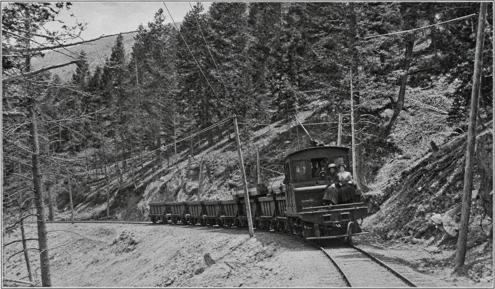
Black-and-white photo of a small boxy electric locomotive pulling a line of ore cars along a curving track through a pine forest, with trolley wire overhead and two women riding on the front of the locomotive
An ore train on the White Knob Copper Company’s electric railway, published in 1904.Photo: The Street Railway Review, 1904, public domain, via Wikimedia Commons; sharpened with AI

The Shay line (1905 to 1918). After Young took over, manager Frank M. Leland replaced the electric locomotives with a Shay, a geared steam engine built for steep, twisting logging track. The first Shay went into service in December 1905 and a second followed in 1907. A wooden trestle carried the line across a ravine on the hill; it was rebuilt in 2002 and is one of the highlights of the tour today.

The aerial tramway (1917 and 1918). In 1917 the company spent about $125,000 on a gravity tram that ran about three miles in a straight line from a headhouse on the hill down to the mill. Thirty-six wooden towers carried the cable, and the weight of the loaded buckets coming down pulled the empty ones back up. It ended the railroad on the hill.

On the railway and tram figures: Sources give the electric line’s length as anywhere from six to twelve miles and disagree on its gauge; we use the 7.1 miles reported in a 1904 trade journal. The tram’s cable ran a loop of about six miles, which is why some accounts call it a six-mile tram. Some retellings name the tram’s builder and call the Shay route the “High Line”; we found no source for either.

The lease years and the best year

After 1905 the property passed through more hands. The Empire Copper Company, organized in 1907, shut down that October and sat idle through 1908 and 1909. From 1910 it leased blocks of the mine to small groups of miners, who paid for their own digging and sold their ore to the company. That arrangement finally made the mine pay.

In June 1915 L. R. Eccles of Ogden and his associates bought the Empire Copper Company, and that year was the district’s best. Lease miners employed about two hundred men and set a production record. By the federal government’s count, the Empire produced more than 55 million pounds of copper between 1901 and 1942, nearly all of it before 1931, along with silver and gold.
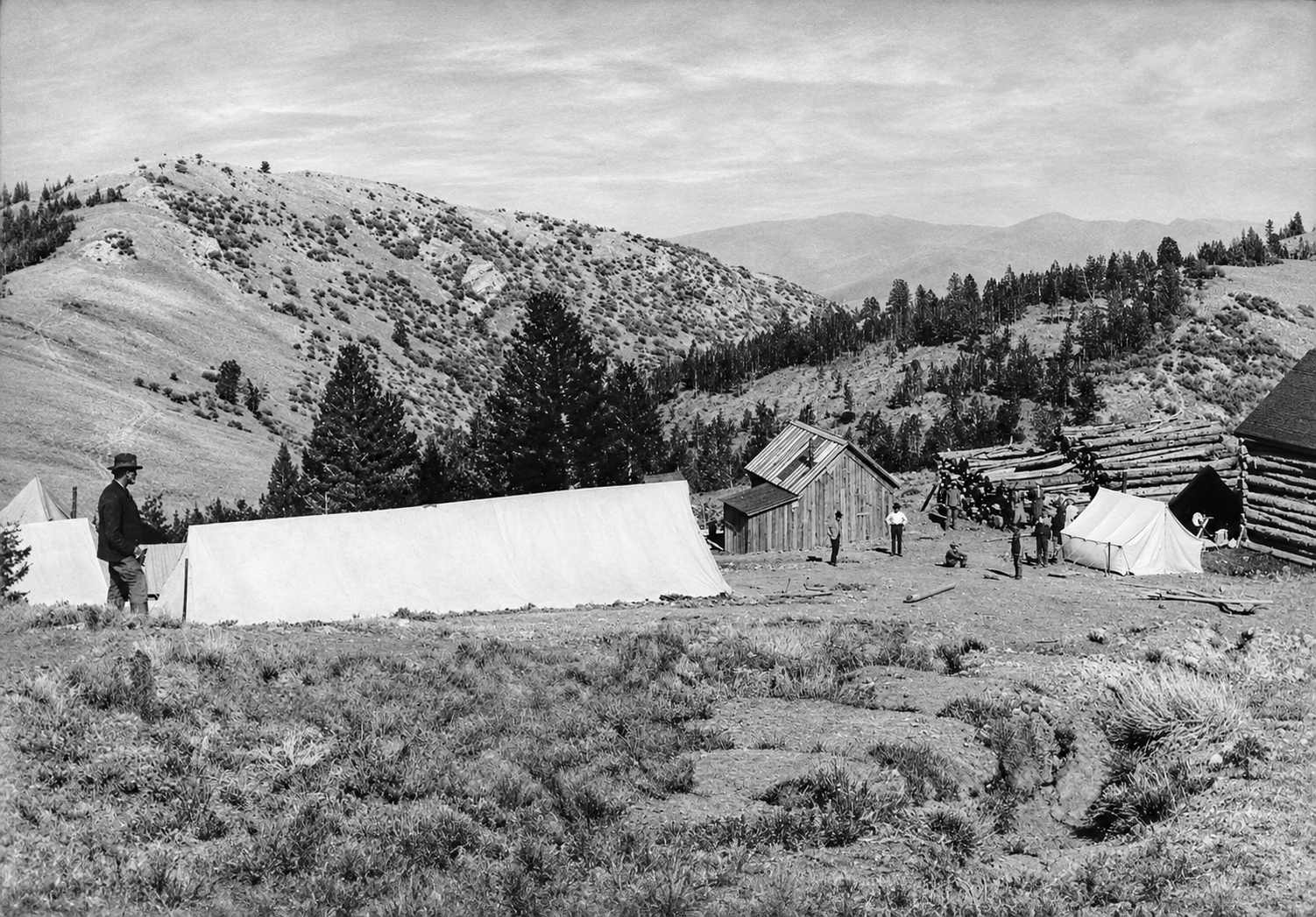
Historic black-and-white photo of a mountain clearing with white canvas tents, a small wooden shed, log cabins and a large pile of logs, with a man in a hat standing at left and bare hills behind
Tents, log cabins and a woodpile at White Knob. The date of the photo is not recorded.Photo: South Custer Historical Society; sharpened with AI

Life on the hill

White Knob was a company camp, built around the mine boardinghouse and the shaft houses. In August 1915 the Mackay newspaper counted about 300 men and 75 women in the camp, plus children. Local histories describe a mercantile, Fishel’s Cash Store, a pool hall, a barbershop, a restaurant, saloons, a movie house and an amusement hall. A school taught about thirty children, and a telephone line ran down to Mackay. A post office opened in 1916, with Frances Fishel as postmaster.

On the population: Local historians say White Knob held nearly 1,000 people at its peak. The best contemporary count we found is the 1915 figure of about 500. Earlier, from 1901 to 1905, the camp housed somewhere between 100 and 400 men. Some modern accounts also describe a “Great White Knob Fire of 1905”; we found no record of it.

Many of the miners were Basque. According to the Basque Museum in Boise, Basques came to Mackay mainly for the mines, from all four Spanish Basque provinces and some from France, and many lived up on the hill in huts and dugouts. Basque boardinghouses in Mackay, such as Jose Elquezabal’s, opened by 1914. Basque laborers also worked for the Utah Construction Company, which built the Mackay Dam on the Big Lost River between about 1908 and 1918.

Decline

As roads and cars improved, more miners kept their families in Mackay and drove up for their shifts. The Empire company went into receivership in 1921 and was reorganized as Idaho Metals; another receivership followed in 1928. Work stopped in August 1930, and in 1931 the property was sold to Custer County for taxes. The White Knob school closed around 1932, and the post office closed in 1934. Leasers and small companies worked the mine on and off for decades after, but the camp was finished.

What remains

In 1999 local volunteers formed the White Knob Historical Preservation Committee and, with the South Custer Historical Society, the Idaho Heritage Trust, the BLM and the Forest Service, began stabilizing what was left. They shored up the tram towers and cabins and rebuilt the Shay trestle, which had been condemned in 1998. The Mackay Mine Hill tour opened in 2004.
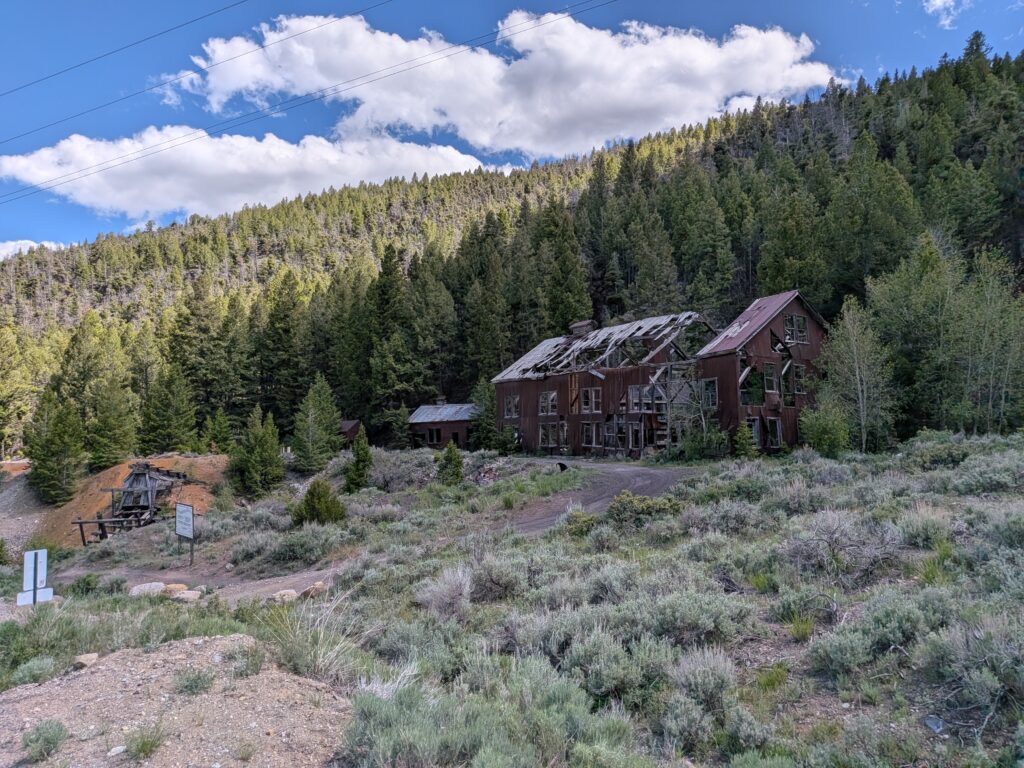
Color photo of a large abandoned multi-story building with a collapsed roof below a pine-covered mountain, with a small wooden headframe on a mine dump at left and sagebrush in front
A big abandoned building with its roof caved in, and a small wooden headframe at left, in the Mackay mining district in June 2026.Photo: Darrel Bishop

The tour has up to 19 numbered stops. Among them:

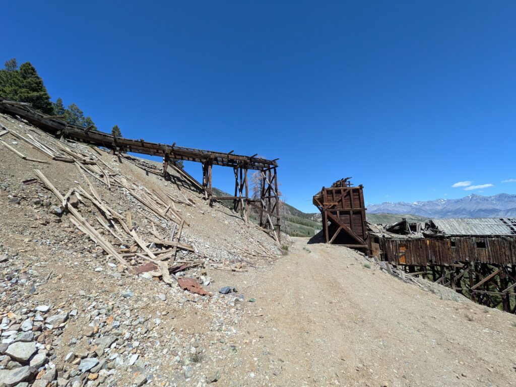
Smelter site and Hardrock Mining Exhibit at the start, near the river. The smelter quit smelting around 1908 and served as a mill for years after. Tram towers and tensioners along the lower slope. The Cossack Tunnel and compressor building; the Cossack was started in 1903 and driven about 6,000 feet into the hill. The Horseshoe Mine, worked from 1916 to 1978, with a forge, bunkhouse, office and cook shack. The White Knob townsite, now foundations, cellar holes and a few cabins, picked over by souvenir hunters for decades. The aerial tram headhouse, a big timber structure perched on a steep slope. Cliff City, with smelter ruins, kilns and an old cabin. The Shay trestle, about 25 feet high, on the ATV route.
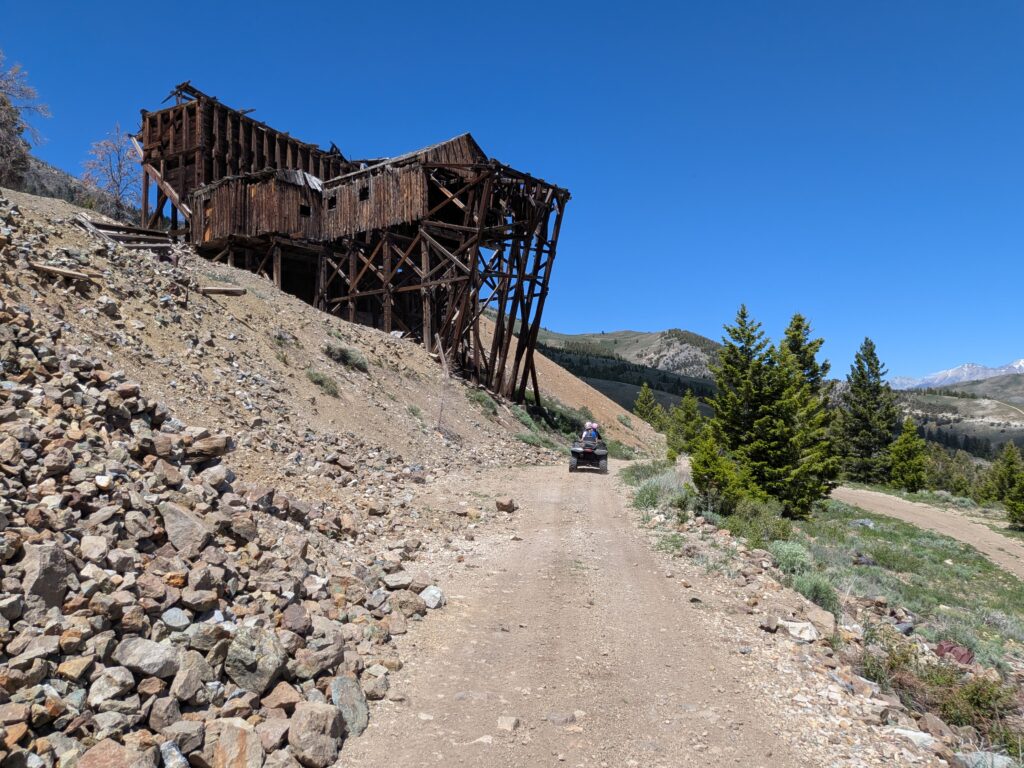
Color photo of a large weathered timber structure on stilts perched on a rocky slope above a dirt road, with an ATV on the road and pines and snowy peaks behind
A tall timber structure perched on the slope above the tour road, June 2026.Photo: Darrel Bishop
Color photo of weathered wooden ore bins and a long broken wooden chute on a gravel mine dump, with snowy mountains in the distance
Ore bins and a broken wooden chute on a mine dump, June 2026.Photo: Darrel Bishop
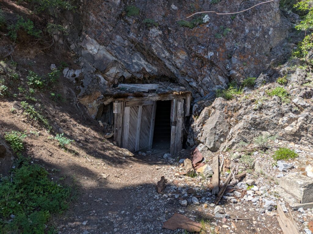
Color photo of a timbered mine tunnel entrance cut into a rock face, with a dirt path and scattered boards and rusted metal in front
A timbered mine portal in the rock, June 2026. Like every tunnel on the hill, it is unsafe to enter.Photo: Darrel Bishop
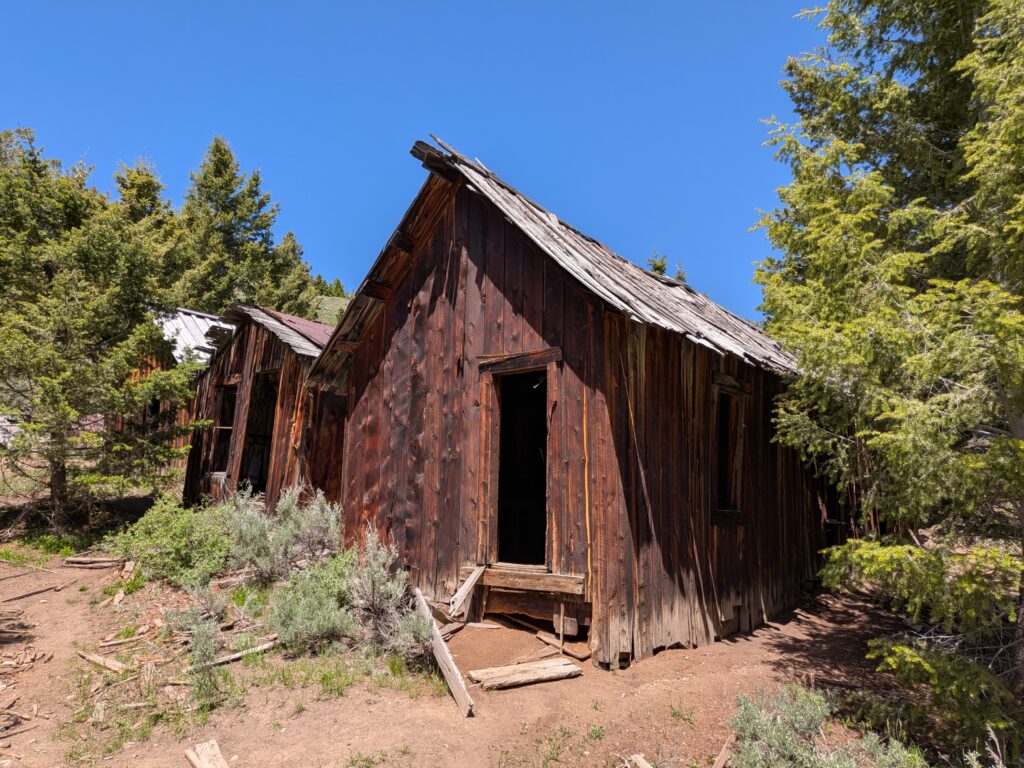
Color photo of a weathered board cabin with an open doorway and a sagging roof, with more old buildings and pine trees behind
A weathered board cabin and outbuildings in the pines, June 2026.Photo: Darrel Bishop
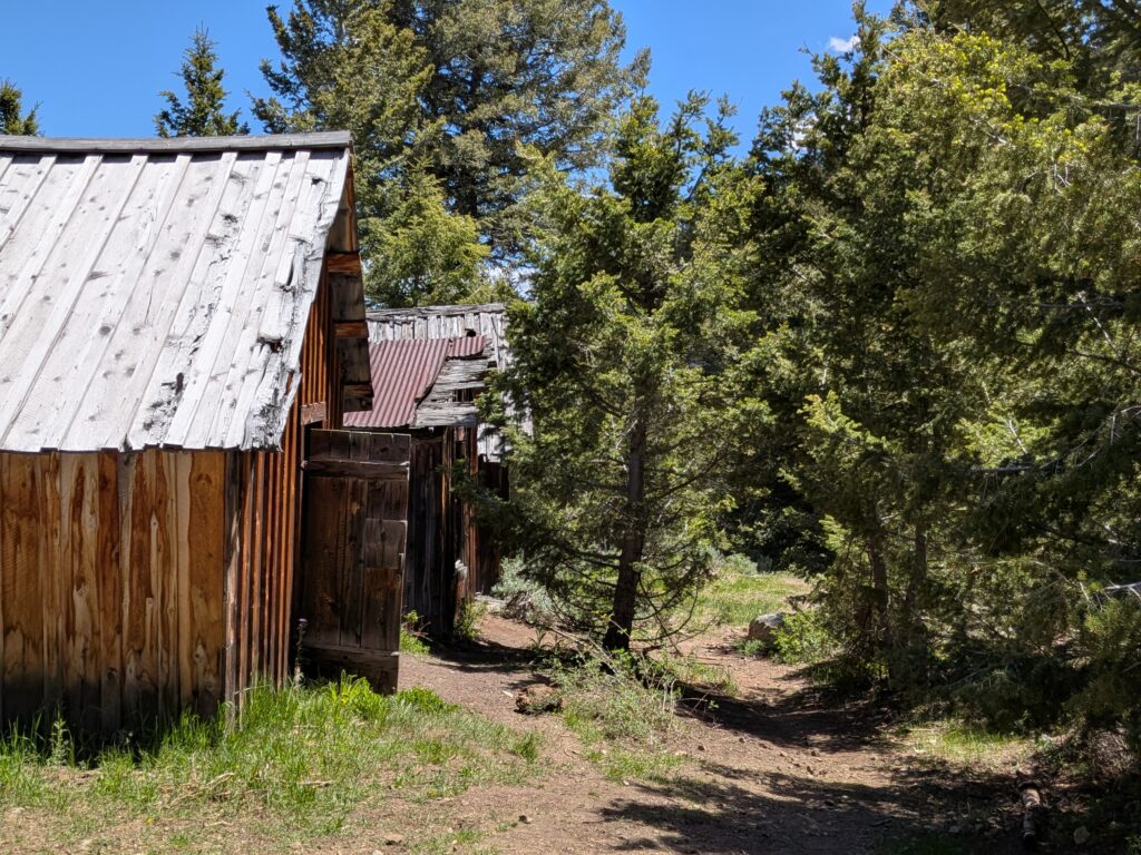
Color photo of old board buildings with metal roofs along a dirt footpath through pine and juniper trees
Old board buildings along a footpath through the trees, June 2026.Photo: Darrel Bishop

The Empire Mine itself is private, active ground. Phoenix Copper, which holds most of the project, published a reserve statement in November 2026 for a planned open pit of about 13 million tonnes. As of late 2026 the company was still in planning and permitting, and the mine was not producing. Expect fences, signs and changes to the tour where the company is working.

On the underground workings: Some accounts give a total of about 30,000 meters of tunnels. A 1944 federal report counted “well over 60,000 feet” of horizontal workings, down to the Cossack Tunnel at the mine’s 1,600-foot level. All of it is closed and dangerous.

Timeline

1879
Copper is found along Alder Creek in the White Knob Mountains.
1884
A rush brings Houston, Cliff City and other camps. Bledsoe’s 20-ton smelter at Cliff City runs for about a week.
1885–1886
The smelter runs again from July to January. By June 1886 Houston is down to eight people.
1890–1891
New York money pays for another smelter run.
1900
The White Knob Copper Company is reorganized with John W. Mackay as president and Wayne Darlington as manager.
1901
The railroad reaches the Big Lost River and the town of Mackay is laid out. White Knob grows up on the hill.
1902
John W. Mackay dies; Darlington resigns after a strike and a dispute with the company’s president.
1903
The 7.1-mile electric railway opens.
1904–1905
The company goes into receivership after spending about $3 million. George W. Young buys it for $1 million; a Shay locomotive replaces the electric line.
1907–1910
The Empire Copper Company is formed, shuts down, then turns to leasing in 1910.
1915
The Eccles family buys the company; the district has its best year, and White Knob counts about 500 people.
1916
White Knob’s post office opens.
1917–1918
The three-mile aerial tramway replaces the Shay line.
1930–1931
Work stops; the property is sold to Custer County for taxes.
1934
The White Knob post office closes.
1999–2004
Volunteers stabilize the site, rebuild the Shay trestle in 2002 and open the Mine Hill tour in 2004.
2026
Phoenix Copper publishes new reserves for a planned open pit at the Empire Mine.
Visit guide — White Knob and the Mackay Mine Hill
Can you visit?Usually, on the self-guided Mackay Mine Hill tour. Parts may be closed for mining work, so check in Mackay before you go.
Getting thereIn Mackay, turn southwest off US-93 onto Main Street, which becomes Smelter Avenue. Cross the Big Lost River to the tour sign at the old smelter, about a mile and a half from town. The tour road climbs from there; White Knob is about three miles west of Mackay in a straight line.
Coordinates43.8924, -113.6703
Road conditionsColor-coded routes. Green: rough gravel, fine for most vehicles. Blue: steep and narrow, high clearance recommended. Red: ATVs and UTVs under 50 inches, dirt bikes, bicycles, horses and hikers only, single lane with no turnouts. No motorhomes or trailers on any route.
SeasonRoughly late spring to fall; summer is surest. Snow closes the upper hill in winter.
What to seeSmelter site, tram towers and headhouse, Cossack Tunnel, Horseshoe Mine buildings, White Knob townsite, Cliff City and the Shay trestle.
MapsThe BLM’s free tour map, also available in Mackay at City Hall, the Forest Service office and the Lost River Museum.
ServicesNone on the hill: no water, toilets or food, and spotty cell service. Mackay has basic services, an RV park and a city campground; the BLM’s Mackay Reservoir campground is a few miles north.
Land statusA mix of BLM, Salmon-Challis National Forest and private patented claims, including active Phoenix Copper ground around the Empire Mine.
OHV rulesNo tour fee that we know of. Non-residents need an Idaho OHV sticker, and riders under 18 must wear a helmet.
Mine Hill hazards: The roads are steep, narrow and one lane, with sharp drop-offs and old nails and scrap that puncture tires. Old tunnels such as the Cossack are prone to rockfall; stay out of every portal and shaft, and stay off old structures. Recent visitors have reported gates and route changes, so get a current map and ask locally before you set out.
Respect the ground: Do not dig, metal detect or collect anything, including bottles, nails and ore. The cabins, towers, trestle and townsite are protected historic features. Stay out of posted mining areas and private claims, and leave everything where you found it.
Approximate location of the White Knob townsite on the Mackay Mine Hill, about three miles west of Mackay.

Historic sites nearby

Mackay, ID
~3 miles east
The town White Knob built · tour start, museum, services
Cliff City, ID
On the Mine Hill tour
1884 smelter camp · smelter ruins and kilns
Houston, ID
A few miles east, in the valley
1884 supply camp · buildings moved to Mackay
Arco, ID
~25 miles southeast of Mackay
First town lit by atomic power, July 17, 1955
Copper Basin, ID
~45 to 50 miles by road
High mountain basin of 1880s silver and copper mines
Bayhorse, ID
~65 miles by road via Challis, also on this site
Silver camp with charcoal kilns · state park

Further reading

Books and records about White Knob and the Mackay Mine Hill
Mackay and Copper Basin
Idaho State Historical Society · Reference Series No. 208, Boise, 1980
Geology and Ore Deposits of the Mackay Region, Idaho
Joseph B. Umpleby · U.S. Geological Survey Professional Paper 97, 1917
Geology of the Empire Copper Mine near Mackay, Idaho
F. W. Farwell and R. P. Full · U.S. Geological Survey open-file report, 1944
Mackay’s Yesterdays
G. Olsen · Mackay, Idaho, 1978
Just One More Round and I’ll Strike It Rich: The Anderson Story of Life on White Knob, Idaho
D. A. Anderson · 1994
Empire Copper Company Records, MG 143
University of Idaho Library Special Collections · company records, 1900 to 1946
White KnobIdaho Ghost TownsGhost TownCuster CountyMackayMackay Mine HillCopper MiningEmpire MineAerial TramwayShay Locomotive

Sources

Idaho State Historical Society — Mackay and Copper Basin, Reference Series No. 208

Archives West — Empire Copper Company Records, University of Idaho

U.S. Geological Survey — Professional Paper 97 (Umpleby, 1917) and Geology of the Empire Copper Mine (1944)

Bureau of Land Management — Mackay Mine Hill Tour Map; Visit Idaho — The Mackay Mine Hill Tour

Custer County IDGenWeb — White Knob and the aerial tramway; Idaho Heritage Trust — Mackay Mine Hill

Basque Museum & Cultural Center — Mackay community history

Wikipedia — White Knob, Idaho and Electric railway of the White Knob Copper Co.; Historical Marker Database — Idaho marker 509

Argonne National Laboratory — BORAX-III and Arco; Yahoo Finance — Phoenix Copper increases Empire Mine reserves (2026)

Photos: South Custer Historical Society (White Knob camp views); The Street Railway Review, 1904, public domain, via Wikimedia Commons. All of the historic photos in this post were sharpened with AI. Color photos of the Mackay mines: Darrel Bishop, June 2026.
Similar Posts

Leave a Reply

Your email address will not be published. Required fields are marked *