Ophir Ghost Town, Utah: The Silver Camp in the Oquirrh Mountains That Never Quite Emptied
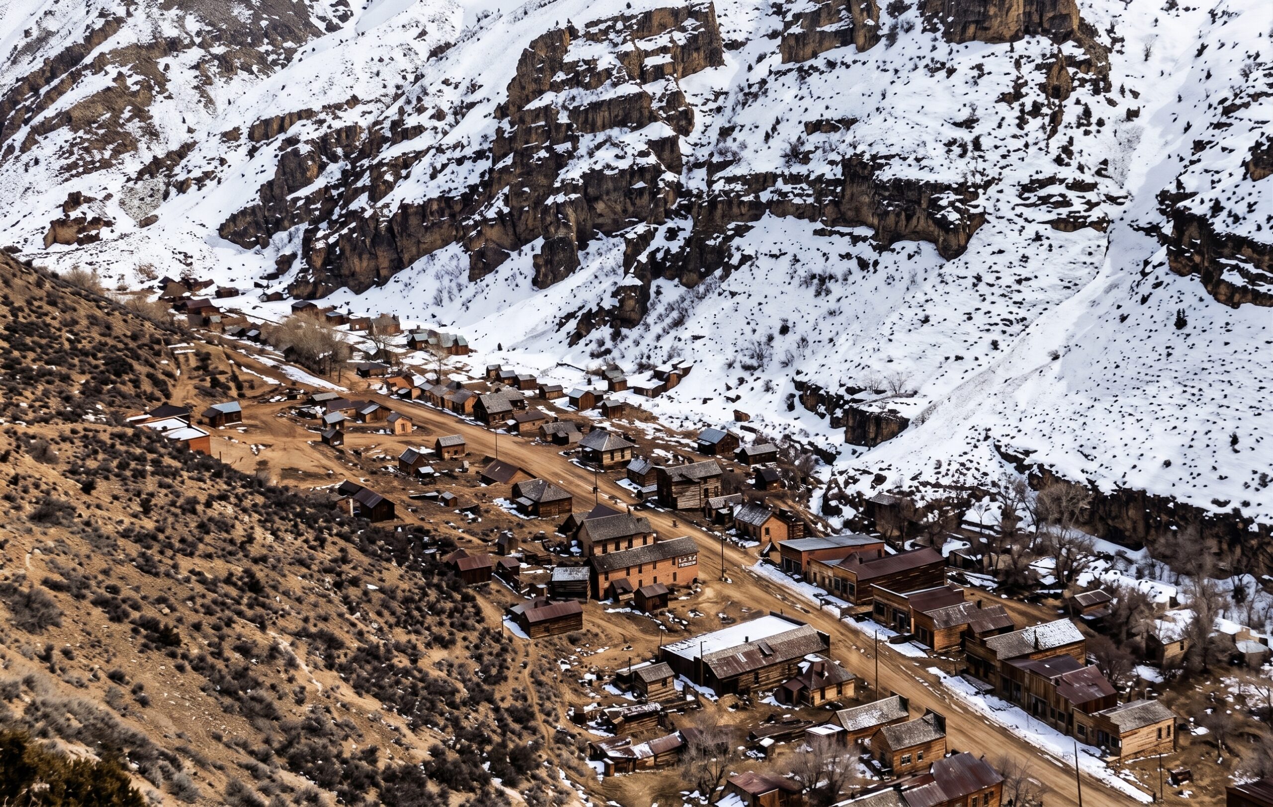
In August 1870, a group of soldier-prospectors gathered in a steep canyon on the western slope of the Oquirrh Mountains and organized a mining district. They named it Ophir, after the biblical land from which King Solomon was said to have brought back gold. Within a year the canyon held a town of more than a hundred buildings, a school, a post office, and the first silver stamp mill in Utah. The richest surface ore played out in a handful of years. The town stayed anyway.
That is what makes Ophir unusual among the places on this site. Mining here revived again and again, through new capital, deeper shafts, a railroad, and a long twentieth-century run of lead and zinc, until the last big underground operation shut down in 1971–72. People never fully left. Ophir remained an incorporated town until 2016, one of the smallest in Utah, and a few dozen residents still live among its preserved buildings. It is best described as a living ghost town: a real mining camp whose history is mostly intact, in a place you visit as a guest in someone’s neighborhood.
“…its Town Hall is the oldest remaining of its type in Utah.”
Phil Notarianni, Ophir Town Hall National Register of Historic Places nomination, Utah State Historical Society, 1982Connor’s soldiers and the Oquirrh silver
Ophir exists because of a Civil War decision. Colonel Patrick Edward Connor arrived in the Salt Lake Valley in 1862 with the Third California Infantry Volunteers and established Camp Douglas above Salt Lake City. He believed a non-Mormon mining economy would diversify Utah Territory, and he encouraged his soldiers to prospect. They organized the large Rush Valley Mining District in June 1864, covering much of the western Oquirrhs, and some accounts place the first ore finds in the future Ophir district as early as 1865.
Little came of those early claims at first. Hauling ore across the desert by wagon was too expensive to make most of them pay. That changed when the transcontinental railroad was completed in 1869 and the cost of getting ore to smelters dropped sharply. The following year, the Ophir Mining District was carved out of the southern part of the older Rush Valley district, and a rush began.
The name is the standard biblical explanation: Ophir, the land of Solomon’s gold. A Kennecott heritage history cites Utah place-name sources for it.
1870–1874: the first rush
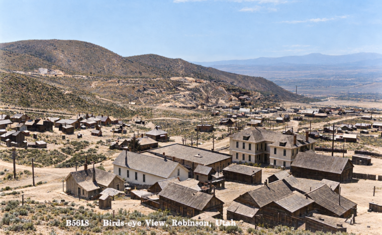
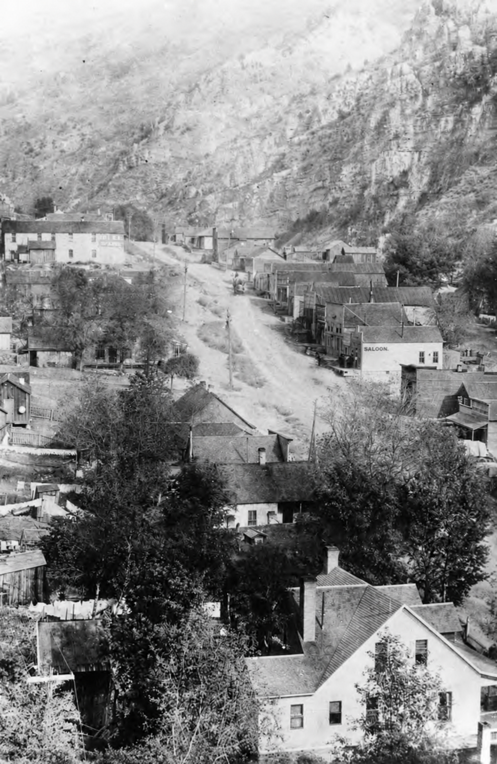
The 1870 discoveries centered on rich silver and “horn silver” (chlorargyrite) on Silverado Hill, with more ore on neighboring Lion Hill. A. N. Moore laid out the townsite that summer. By April 1871 Utah newspapers were calling it “Ophir City,” and in May 1871 the plat and legal papers were filed with the Tooele County recorder. By the end of 1871 the camp had about 125 houses and businesses, a school, and a post office.
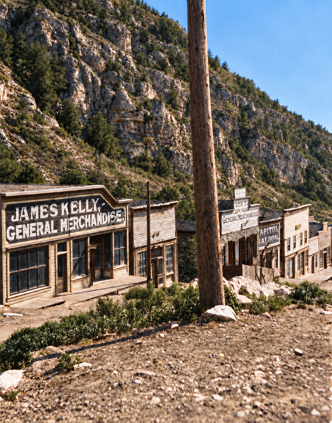
The Salt Lake banking and mercantile firm of the Walker Brothers built the Pioneer Mill in 1871 to treat ore from the Zella claims and other Lion Hill mines. It is generally described as the first stamp mill to operate in Utah. Local historian and longtime miner John Skinner, interviewed in 2014, remembered four hotels, saloons, breweries, lawyers, general stores and a daily stage to Salt Lake City, but that detail is recollection rather than a counted inventory.
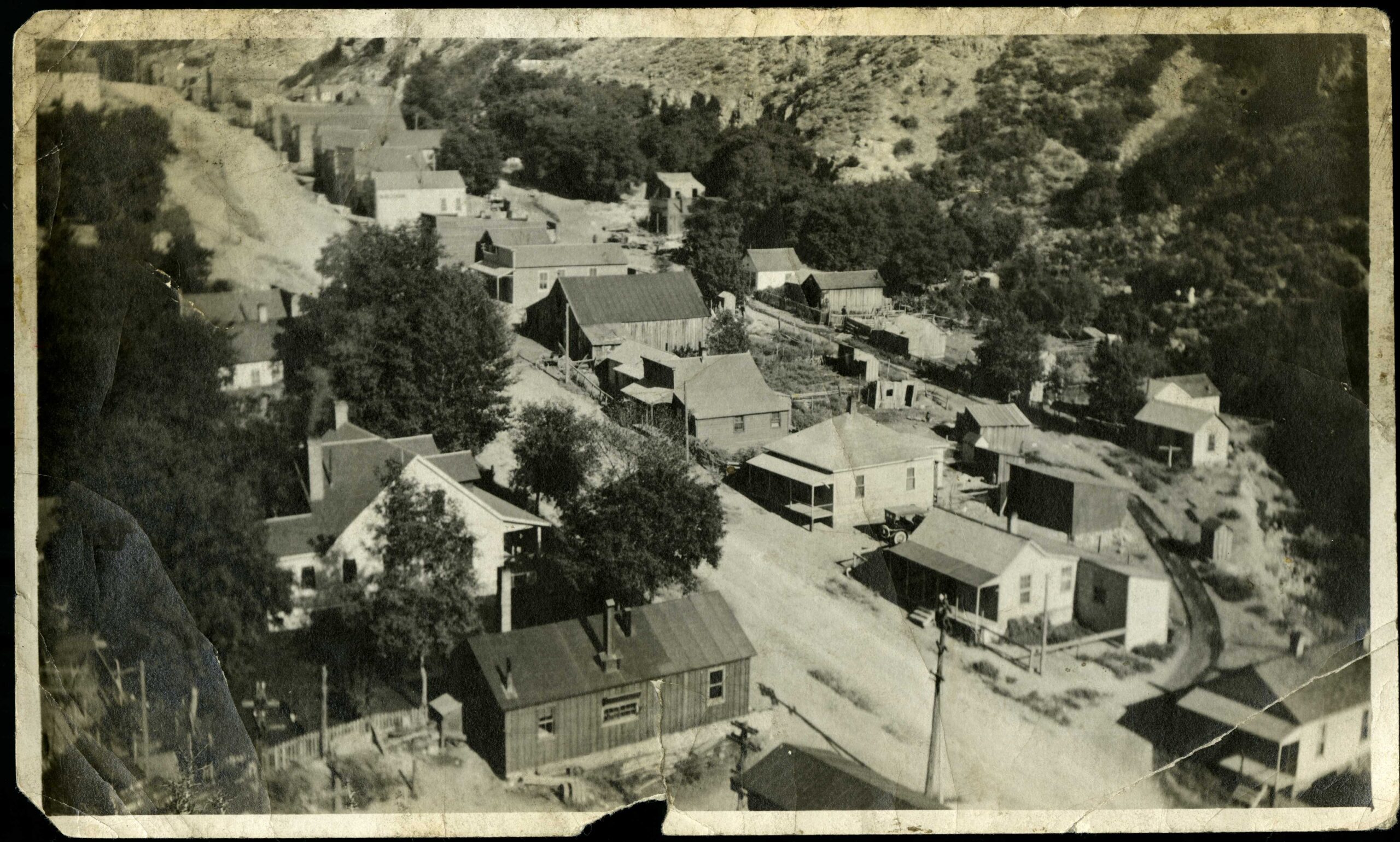
The National Register research identifies 1872, 1873 and 1874 as the years of peak mining activity. After that the easy surface ores began to thin, and the town never grew into the permanent regional center its promoters had expected.
Marcus Daly before Anaconda
Ophir’s best-known alumnus is Marcus Daly, the Irish immigrant who later became one of Montana’s “Copper Kings.” The American National Biography places him at Utah properties including the Emma and Ophir mines before his Montana career, and the Daly Mansion’s history says that by 1871 he was at Ophir as a foreman for the Walker Brothers. While inspecting a mine near Ophir in 1872 he met Margaret Evans; they married that year and their first two children were born at Ophir. In 1876 Daly left for Montana on Walker Brothers business, carrying the experience and contacts that led to Butte and Anaconda. Ophir is a small but genuine chapter in the pre-Anaconda biography of one of the West’s major mining figures.
Decline and revival, 1880s–1927
The first boom faded through the late 1870s and 1880s. Skinner specifically tied the 1880s decline to the exhaustion of high-grade surface ore on Lion Hill. What kept Ophir alive was a different kind of mining: deeper workings in the limestone, better mills, and outside capital.
Enos Andrew Wall, a mining man who would later help launch the Bingham Canyon copper operation, was an early player. Wall was a party to claims in the Ophir district in the mid-1870s, and by 1890 was organizer and majority shareholder of the Ophir Hill Mining and Reduction Company. (His later low-grade copper work is the story told in our Bingham Canyon post.) By 1901 the Ophir Hill property was owned by William A. Clark, the Montana copper capitalist and Daly’s great rival, who also owned the railroad built to serve it.
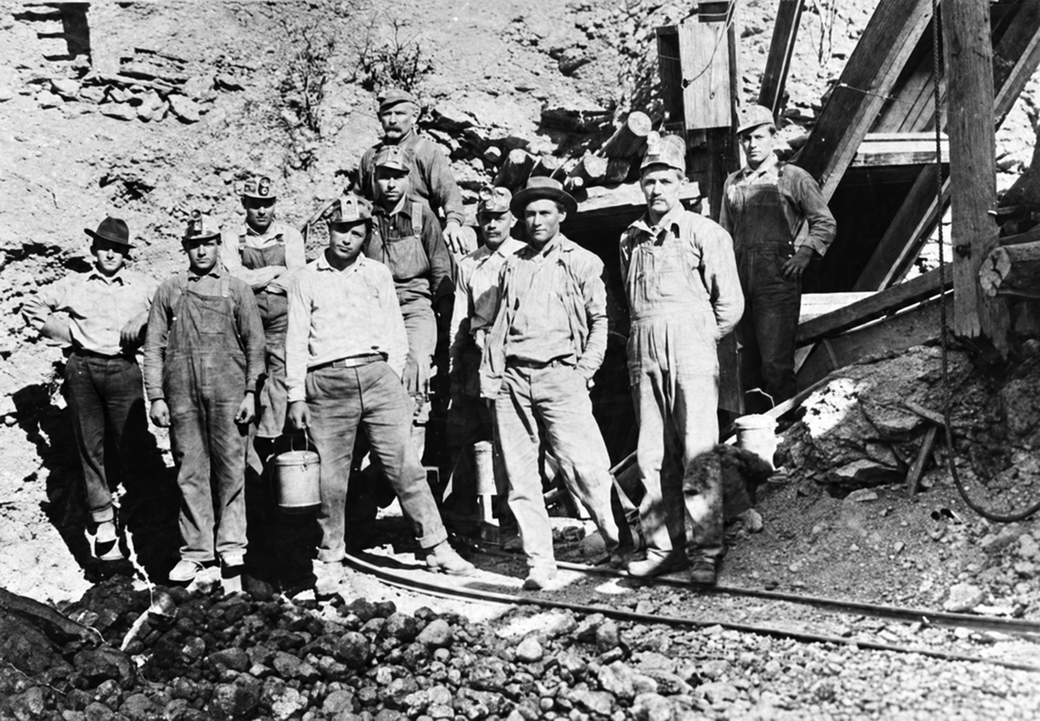
The technical record suggests the scale. A 1995 report preserved by the Utah Geological Survey describes the Ophir Hill mine as having more than 46,000 feet of drifts and crosscuts, five incline shafts, and a drain tunnel of roughly 3,800 feet, and credits Ophir Hill and Hidden Treasure together with more than 2.2 million tons of historic production. (That report was commercially produced, so treat the totals as industry figures rather than audited ones.) Major production periods ran from 1901 to 1927 and again from 1936 to 1971.
The St. John & Ophir Railroad
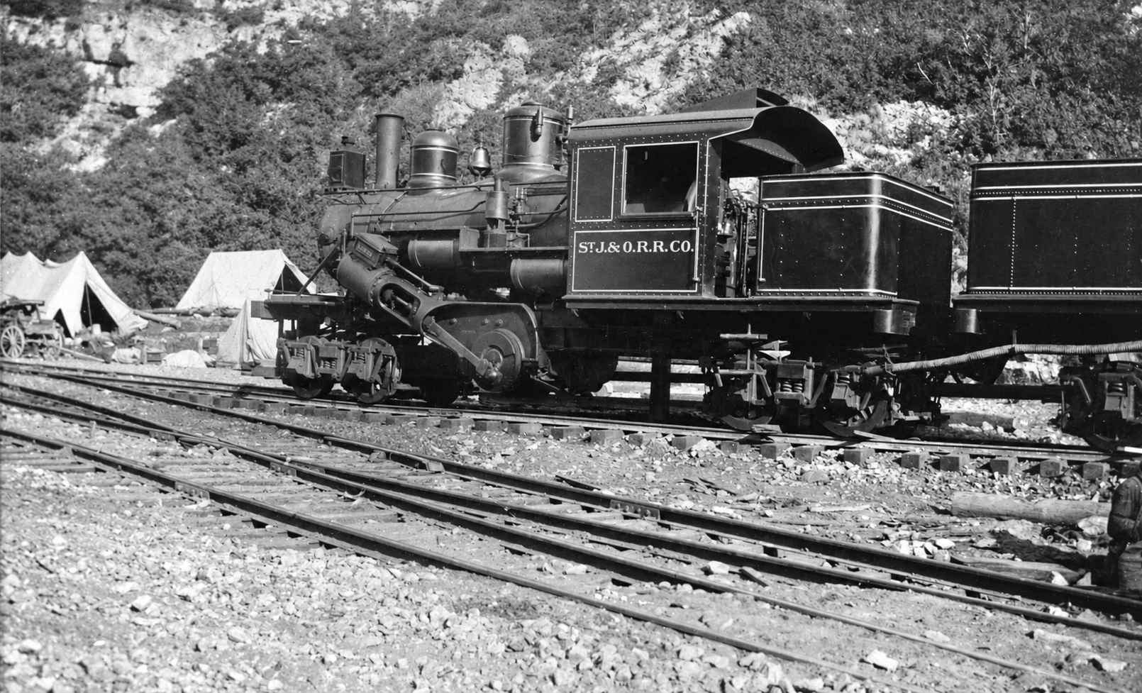
For decades, ore left the canyon by freight wagon. In 1912 that changed. The St. John & Ophir Railroad was incorporated on March 5, 1912, and built a standard-gauge line of about 8.5 miles from St. John, on the Los Angeles & Salt Lake main line, up to the Ophir Hill mine. It owned a single locomotive and a combination baggage coach. Skinner identified August 1, 1912, as the date the railroad arrived, and that day was remembered locally as “Ophir Day.”
The railroad did not outlast the Clark-era mine by long. A 1926 Interstate Commerce Commission valuation found the Ophir Consolidated company was the line’s principal shipper, and that the company had stopped operating in December 1925. Utah regulators approved abandonment of the railroad on December 10, 1928.
Fire, flood and the long twentieth century
The district kept working after the railroad ended, and kept being hit by the canyon itself. Skinner recalled that the Ophir Hill mill burned in 1928 while idle and under a watchman’s care. That account is oral history, and no stronger contemporary source turned up in the research for this post. Nothing found there supports a single town-destroying fire at Ophir, either. In August 1930 a cloudburst sent a flood of mud and water down Ophir Canyon that, according to the U.S. Monthly Weather Review, considerably damaged the highway and a powerhouse pipeline. It was serious infrastructure damage in a narrow canyon, not the end of the settlement. A large flotation mill was built at the canyon mouth in 1930 to process tailings.
U.S. Smelting acquired the Ophir Hill mine in 1949, and McFarland & Hullinger operated it from 1953 until production stopped in late 1971. Census numbers show how the town rode these cycles.
1971–72: the last underground mining
The end was less a collapse of the ore than of the system around it. On October 25, 1971, a cave-in at Ophir Hill killed one miner and partly buried another, who freed himself and had to travel roughly 1.5 miles through the workings to get help, according to Kennecott’s historical account. Skinner, who worked at Ophir Hill from 1964 to 1971, remembered it as the most frightening event of his mining career. It came only weeks before production stopped.
The mine’s own technical history says the Midvale mill and Tooele smelting outlets stopped being a practical way to process Ophir concentrates. Skinner remembered that shipping concentrates all the way to Anaconda, Montana, was considered but was too expensive, and described the loss of processing capacity as a “domino” that forced the mines to close.
Lost for five days in the Hidden Treasure
The most famous event in the district’s modern history happened just over the ridge. On Friday, September 22, 1989, ten-year-old Joshua Dennis went into the abandoned Hidden Treasure Mine in Dry Canyon with his father and a Boy Scout troop from Kearns. He became separated from the group in the dark and was soon alone in a maze of old workings. The mine’s tunnels were later described as totaling some 21 miles.
Searchers from sheriff’s deputies to volunteers combed the mine for days. As the search stretched on and hope faded, John Skinner, a longtime miner who knew the old Ophir-area workings and how they connected, kept pushing to be allowed to search. He eventually got in, and Joshua was found alive, in a small, pitch-black cavity roughly 2,000 feet inside, after five days without food or water. The rescue made national news and was dramatized in the 2024 film Faith of Angels.
After the rescue the mine’s owners sealed the Hidden Treasure with boulders and dirt with help from the state’s Abandoned Mine Reclamation Program. The Hidden Treasure is private property, and unauthorized entry is trespassing.
Disincorporation, 2016
Ophir remained an incorporated town until 2016, and in its last years it was one of the three smallest incorporated municipalities in Utah. By the 2010s it had only a couple of dozen year-round residents and could not fill its municipal offices. On September 20, 2016, the town held a referendum on whether to disincorporate, and the Tooele Transcript Bulletin reported two days later that residents had voted to drop incorporation. Utah’s municipal records list the dissolution as effective in October 2016, and the state mapping office noted that Ophir was “officially dissolved” that fall. County claims against the dissolved town were later the subject of a settlement in 2017.
Under the arrangement, the town’s public property, including the historic district, passed to the Tooele County School District. The district has since turned the old mining town into an outdoor learning site: a lodge now hosts STEM workshops and leadership retreats for district students.
What survives today
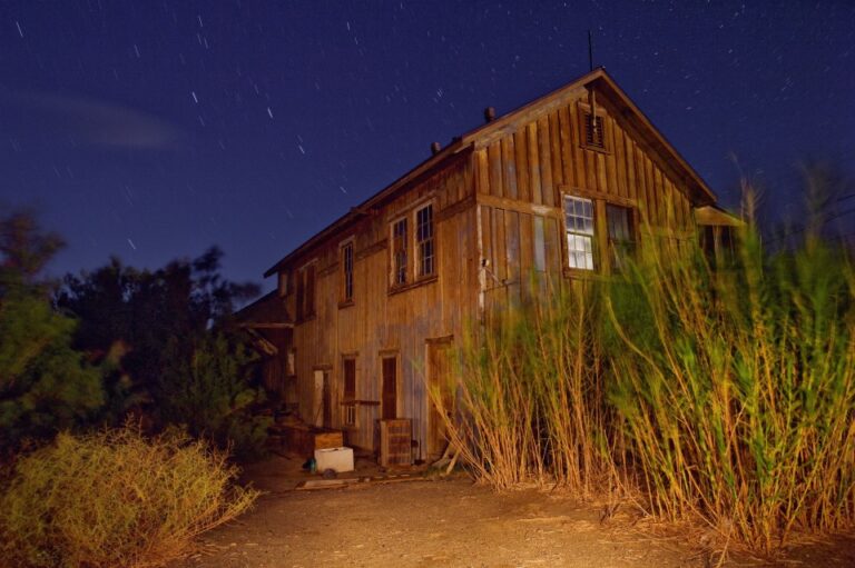
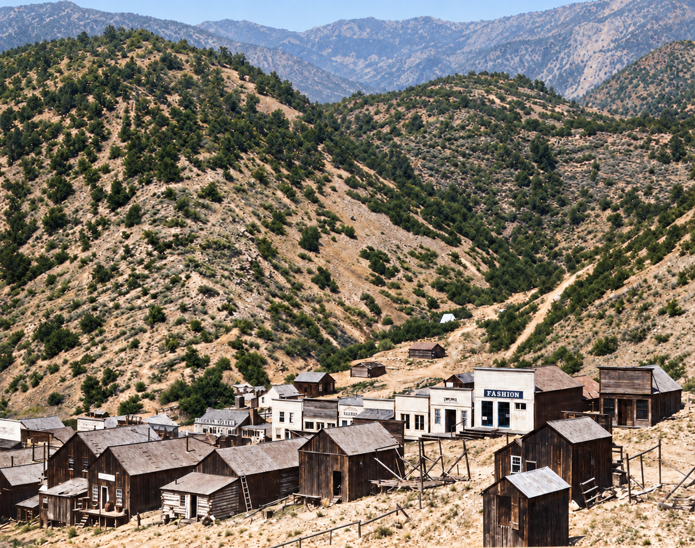
Ophir is not a field of empty foundations. It keeps a mix of genuine nineteenth- and early twentieth-century buildings, inhabited houses, relocated preservation buildings, mining artifacts and mine-scarred terrain.
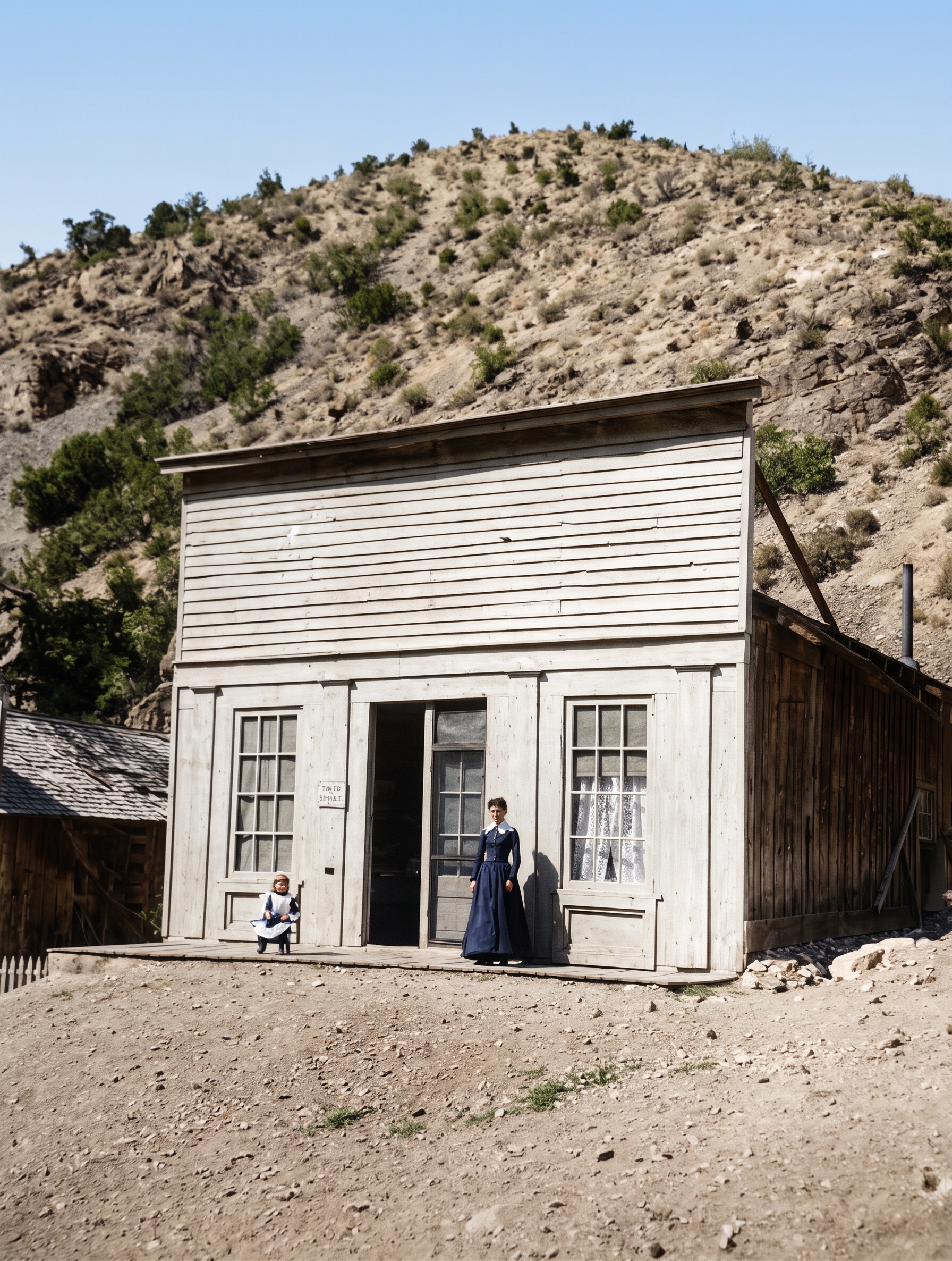
The best-documented survivor is the Ophir Town Hall at 43 Main Street, a small false-front frame building built in the early 1870s, probably between 1870 and 1872, and associated with both municipal and fire functions. When it was nominated to the National Register it was described as one of only three surviving nineteenth-century mining-town city halls in Utah, and the oldest. It was recorded by the Historic American Buildings Survey in 1967 (HABS UT-38) and listed on the National Register of Historic Places on June 9, 1983 (#83003193). A second Ophir building, the Reddick Hotel / Ophir LDS Meetinghouse, was listed on the National Register on September 27, 2016.
Tooele County’s tourism site promotes an Ophir Historic District with a schoolhouse, church, hotel, original homes and businesses, and an Ophir Museum holding mining-era artifacts. There is a preservation nuance worth knowing. Skinner explained that the “historic section” combines buildings preserved in place with buildings moved there, and that residents began moving older houses into the Moore Avenue historic area in the mid-1980s. After a 1914 school building was demolished, his grandparents’ house was moved into the display area and adapted to stand in for the schoolhouse.
The mining landscape above town is a different matter. A 2004 Deseret News report described abandoned clapboard houses, hundreds of shafts or mine openings, stone retaining walls and ore cars as visible remnants, but that description predates major cleanup and should not be read as a list of what is accessible today. That same year, an EPA-directed project addressed lead- and arsenic-bearing mine material and included covering the exposed Ophir Hill mine face to reduce movement of contaminated waste.
Timeline
Historic sites nearby
Further reading
Sources
National Park Service — Ophir Town Hall, NRHP nomination #83003193 (Phil Notarianni, 1982) — founding, district organization, 1872–74 peak, Town Hall history
Utah Division of Oil, Gas and Mining — John Skinner oral history (2014) — local life, decline, 1971–72 closure, preservation of the historic section; oral-history claims are labeled as such
Explore Tooele County — Ophir Historic District — current visitor description and county contact
Library of Congress — Town Hall, 43 Main Street, Ophir (HABS) — Historic American Buildings Survey record
Utah Rails — St. John & Ophir Railroad — incorporation, length, ownership, 1926 ICC valuation, 1928 abandonment
Utah Rails — Enos A. Wall — claims in the Ophir district and the Ophir Hill Mining and Reduction Company
Daly Mansion — History and Preservation — Marcus Daly at Ophir, marriage, departure for Montana
Rio Tinto Kennecott — Ophir, Tooele County, Utah — 1971 cave-in, name origin, 1930 flotation mill, 1970 population
Wikipedia — Ophir, Utah — U.S. Census figures, 2016 disincorporation
Utah Geospatial Resource Center — 2016 municipal boundary updates — Ophir dissolved in fall 2016
Tooele County Elections — September 20, 2016 ballot question — “Shall the Town of Ophir Dis-Incorporate?”
Ensign (1991) — Hidden Treasure: Ten-Year-Old Josh Dennis Lost in Mine — September 22, 1989 date, mine description
Church News — 1989 rescue coverage — location where Joshua was found
Deseret News — Old mine is sealed (1989) and Ophir residents object to cleanup (2004)
NOAA / American Meteorological Society — Monthly Weather Review, August 1930 — Ophir Canyon flood
USGS — Geology and Ore Deposits of the Stockton and Fairfield Quadrangles (Gilluly, 1932)
Utah Division of State History — Reddick Hotel / Ophir LDS Meetinghouse, NRHP listing (2016)
Historic photographs courtesy of the Utah State Historical Society. Images marked “colorized” were colorized with AI and are interpretations, not original color.