Iosepa, Utah: The Hawaiian Colony in Skull Valley That Still Gathers Every Memorial Day
Most Utah ghost towns were built around something in the ground. Iosepa was built around a belief. In 1889 a group of Native Hawaiian Latter-day Saints, many of them tired of low-wage work and prejudice in Salt Lake City, settled on a ranch in the empty, windswept Skull Valley of Tooele County. They laid out a town on the Latter-day Saint grid plan, named it for Joseph, and spent twenty-eight years turning sagebrush into irrigated fields, shade trees and a piped water system.
Then, in 1915, the Church announced a temple in Laā‘ie, Hawai‘i. Within two years almost everyone was gone. What remains is a cemetery, a memorial, a lone fire hydrant in the brush, and a gathering of descendants every Memorial Day weekend. That is why Iosepa is not quite a ghost town, and why the old “leper colony” story attached to it is wrong.
“…our trail of tears.”
How scholar Hokulani K. Aikau records community memory of the 1917 departureFrom Hawai‘i to Salt Lake City
Latter-day Saint missionaries began preaching in the Hawaiian Kingdom in 1850, and a young Joseph F. Smith served there and formed close ties with Hawaiian members. Many converts embraced the idea of “gathering” to Utah, but Hawaiian law first restricted emigration, and Church leaders themselves warned that Utah’s climate and economy would be hard on islanders. By the late 1880s, after the weakening of the monarchy in 1887, small groups had made the move. By mid-1889 historian Dennis H. Atkin counts about 75 Hawaiian Latter-day Saints in Salt Lake City, many near the Warm Springs area.
Life there was hard. The islanders shared the faith of the white majority but met language barriers, racial prejudice and irregular, low-paid manual work. Some newspapers stereotyped them as diseased or backward. Historian Benjamin Pykles, writing for the Utah Historical Society, lists language, racial prejudice and fear of leprosy among the reasons for creating a separate community. Church leaders proposed a company town where residents could have year-round work, build their own homes and keep more of their culture.
Choosing Skull Valley, 1889
Islanders helped choose the site. The May 1889 land committee paired returned missionaries Harvey H. Cluff, William W. Cluff and Fred A. Mitchell with Hawaiian converts J. W. Kauleinamoku, George Kamakaniau and Napeha. After looking at ranches in several counties they recommended John T. Rich’s ranch in Skull Valley for its water, soil, crops, livestock and price. The Church bought it for $35,000, and the Iosepa Agricultural and Stock Company was incorporated on August 7, 1889, with the Church holding controlling stock. Cluff became company president and manager, and Kauleinamoku gave the community religious and civic leadership.
The founding party arrived on August 28, 1889, the date best treated as Iosepa’s first-settlement day. Cluff proclaimed it “Hawaiian Pioneer Day,” and the town celebrated it every year. The settlers called their home Iosepa, the Hawaiian form of Joseph, after Joseph F. Smith.
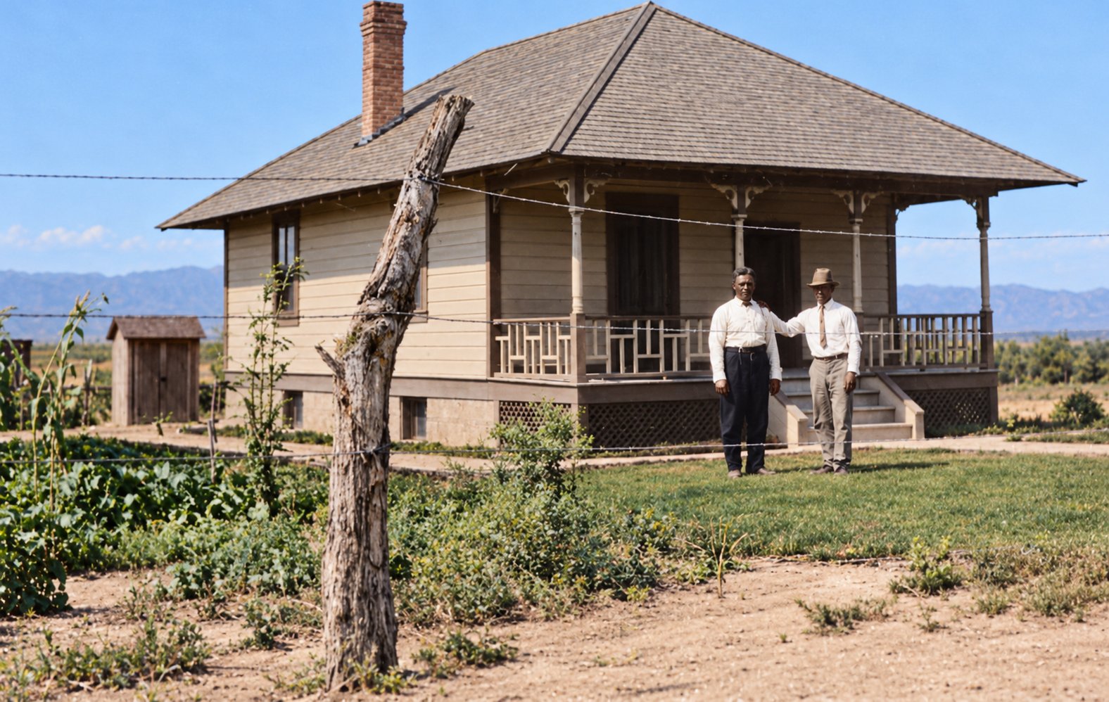
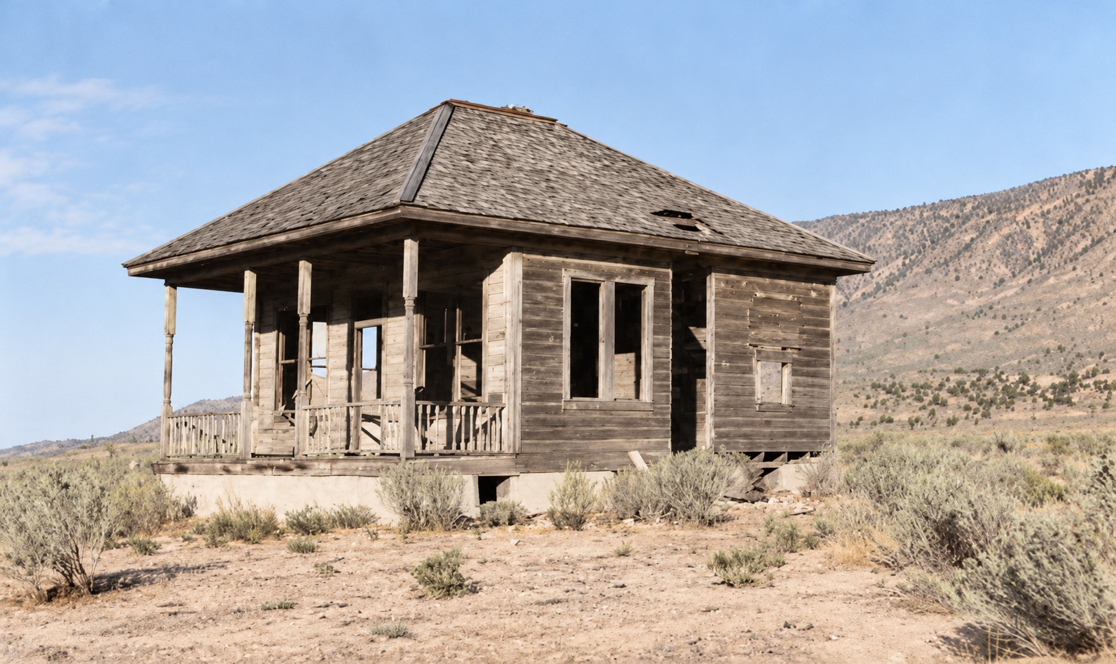
A Hawaiian town on the Zion plan
Iosepa followed the Latter-day Saint grid but wore its Pacific identity openly. The central square was called Imilani, roughly “to seek God” or “to seek the heavens.” East–west avenues carried Hawaiian place names, and north–south streets honored Hawaiian people and families. Standard residential blocks were divided into corner lots of about three-quarters of an acre, each with room for a house, garden and animals. The company bought a sawmill, opened a store and school, and built a combined church and social hall at the center.
The first winter, 1889–1890, was exceptionally cold. Pykles notes that the leeward Hawaiian Islands can be hot and dry, so the desert itself was not the greatest shock. The prolonged freezing weather and snow were. Drafty, wood-heated houses worsened colds, and whooping cough moved through the children.
Water, fields and Kanaka Lake
Water was the settlement’s great accomplishment and its main hazard. For the first years, household water came from open irrigation ditches and was dipped into barrels. After a typhoid scare, remembered by manager Thomas Waddoups as around 1903, the community gathered water from mountain streams and springs into cement-bottomed canals and then piped it through town. The system, finished by 1908, supplied irrigation and drinking water and fire hydrants.
The company raised grain, alfalfa, barley, field corn, squash, potatoes and, later, sugar beets, along with cattle, sheep and hogs. Residents dug small spring-fed ponds, the best known being Kanaka Lake, used for swimming, picnics and carp and trout. On Arbor Day in 1899 residents and guests planted more than 700 trees and shrubs. Visitors in the 1910s described a green, cultivated settlement where they had expected only sagebrush. By 1915 a company officer reported more than 1,000 irrigated acres and about 800 head of Shorthorn Durham cattle.
Culture in the desert
Iosepa was never just Utah farming performed by Hawaiians. Residents held luaus and dances, kept Hawaiian widely spoken, and became popular performers around the region. They substituted flour-and-starch paste for poi, harvested algae from the reservoir in place of edible seaweed, and used corn husks where Hawai‘i cooks used ti leaves. The Iosepa Troubadors, a musical group formed in 1910, played, and the town staged hula, choral recitals and feasts for visiting Church leaders. The population was largely Hawaiian but also included Samoan, Māori, Portuguese, English and Scottish families.
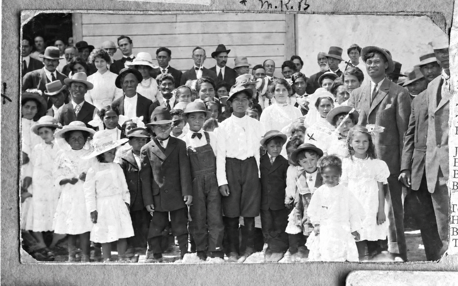
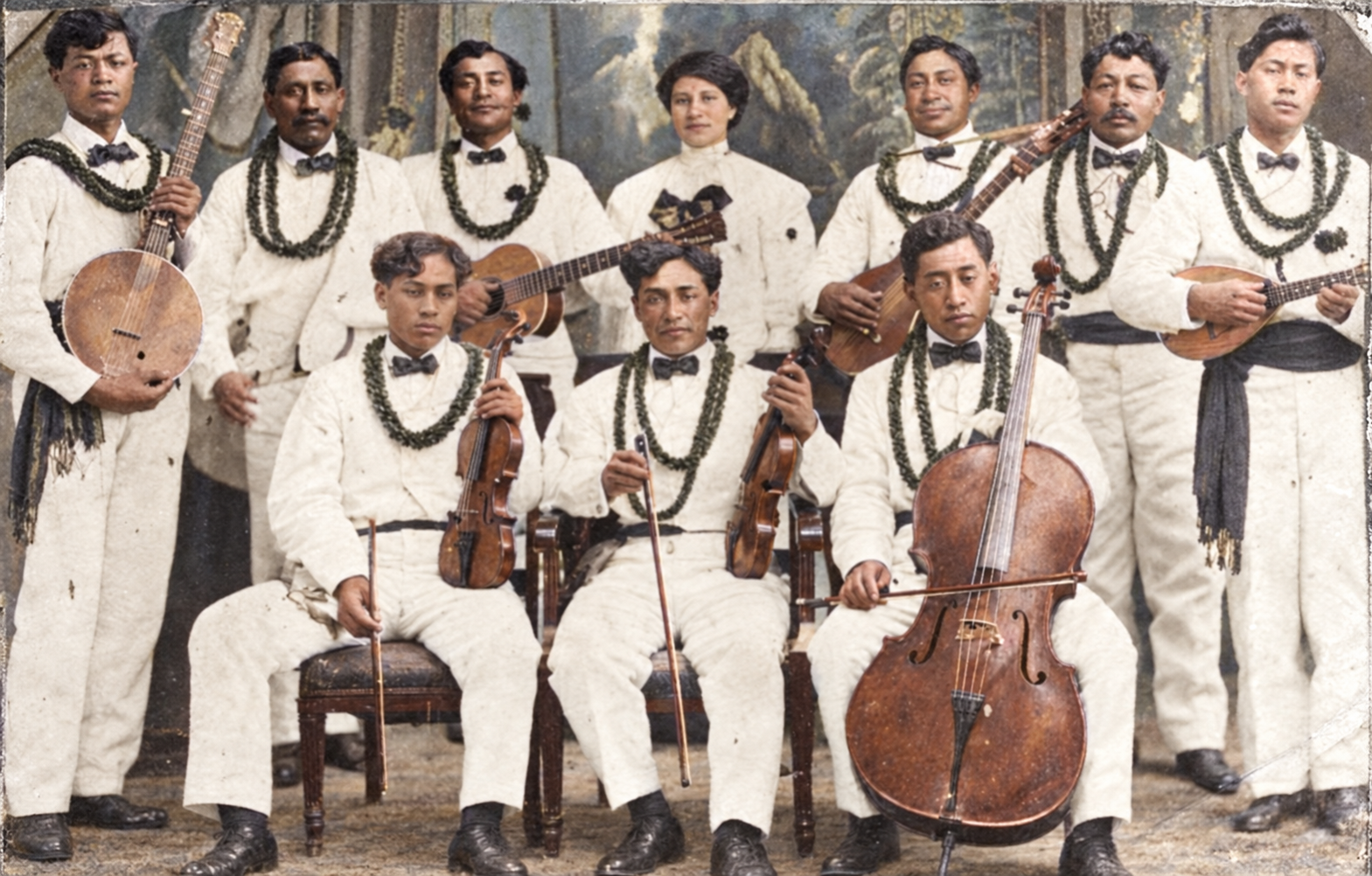
Daily life was disciplined. Residents were paid wages, and at first purchases were simply entered in company account books. After Thomas A. Waddoups took charge in 1901, workers were paid in locally printed scrip from five cents to a dollar, with cash gradually replacing it. Saturday morning was for pay, Saturday afternoon for recreation, Sunday for worship and rest. By the early twentieth century the enterprise was breaking even and then making money.
The Hansen’s disease story
Iosepa is often called a leper colony. The documented history is narrower. An elderly woman named Makaopiopio reached Skull Valley already ill and died on September 15, 1889, becoming the first person buried in the cemetery. In the mid-1890s, three residents were diagnosed with Hansen’s disease. They were isolated in a small frame house about a mile outside town, and other residents brought food and care. All three were dead by about 1900, and there were no further cases.
That is a real episode, but it did not define the town. The settlement had been founded years before the cases, and hundreds of people lived there without ever being sick. The popular myth grew largely from sensational newspaper coverage that treated Pacific Islanders as a public-health threat.
Clean town, and what the record says
Iosepa’s reputation for cleanliness is largely documented. A 1915 newspaper report preserved by Atkin quotes state sanitation inspector James H. Wallis ranking Iosepa highest overall for clean streets, yards and interiors among the places he inspected. Some sources say the town won a state prize as the “best kept and most progressive city” in 1911.
Peak, then departure, 1915–1917
By the 1910s Iosepa was at or near its economic high point. The population grew from about 80 in 1901 to 228 around 1915–1916, with the State of Utah giving 1916 and the National Register nomination also recording 228. The Church dedicated a temple site at Laā‘ie on Oahu on June 1, 1915, and formally announced the temple on October 1, 1915. It was dedicated on November 27, 1919.
For Hawaiian Saints who had moved to Utah partly to be near temple worship, a temple at home changed the logic of migration. Many residents quickly decided to return. Church funds helped families who could not afford passage, and the company bought back town lots and shares. By summer 1917 so few Hawaiians remained that outside labor had to be hired for the harvest, and that fall the ranch and townsite were sold to the Deseret Live Stock Company for $150,000. Only two families, those of Benjamin Kaloni Hoopiiaina and J. Palikapee Nawahine, stayed permanently in Utah.
Descendants preserve a painful memory of the last day. Oral accounts describe women who walked the roughly 14–15 miles north to the railroad at Timpie, looking back at their homes and the cemetery. Those accounts are repeated in state histories and oral histories, but the most dramatic details come from later retellings, not verified contemporary quotations.
What archaeology found
The most evocative surviving object is Story Rock, a limestone boulder on the brushy western slope of Salt Mountain above the townsite. Its face carries carved sea turtles, sharks, whales, sailing vessels, jellyfish, palm trees and human stick figures joining hands in a circle. Descendant tradition says parents carved it so children who had never seen the ocean could learn about it.
Archaeologist Benjamin Pykles and students excavated lots associated with John and Lucy Mahoe’s family in 2008 and 2010. They found stone and mortar foundations and a privy full of objects discarded around 1917, including pharmaceutical glass for cold remedies and menthol, imported ceramics, hand-painted porcelain, and carved marine abalone and polished shell. The finds show a community balancing frontier survival with Victorian-era household taste and ties to island origins.
The cemetery and memory, 1917 to now
After the ranch was sold, buildings were moved, dismantled or reused, and the townsite went back to grazing land. The cemetery survived. It was listed on the National Register of Historic Places on August 12, 1971. In 1980 Vermin Hawes, a descendant of early settlers, organized a clean-up of weeds, fences and graves over Memorial Day weekend. The Iosepa Historical Association was formed in the mid-1980s.
On August 28, 1989, the centennial of the founding, LDS Church President Gordon B. Hinckley dedicated a monument at the cemetery before a crowd of several thousand. It features a cast-bronze bust of a Polynesian warrior on a pink granite base, flanked by plaques listing known settlers and the 79 people buried there.
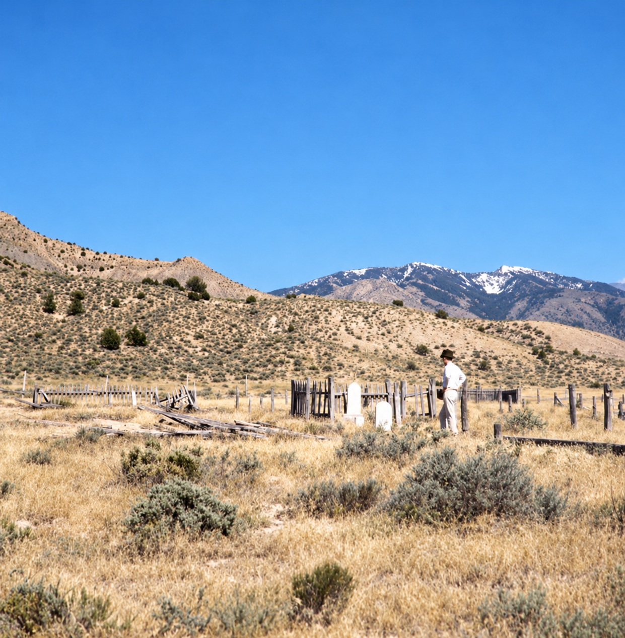
The Memorial Day weekend gathering is the strongest proof that Iosepa is not simply dead. Descendants and Pacific Islanders clean the cemetery, whitewash borders, decorate graves with leis, and share prayer, music, performances, food and oral history. In 2025 the Utah Historical Society held a free Native Hawaiian and Pacific Islander oral-history presentation at the Iosepa pavilion during the memorial weekend. Each year’s schedule changes, so check it separately.
The place is also still being argued over. In late April or early May 2025 two newly installed carved tiki figures at the cemetery were cut down with a saw, and the Tooele County Sheriff’s Office investigated. Iosepa Historical Association president Ron Manuela described the figures as gifts meant to recall Hawaiian roots, and the incident exposed disagreement among descendants about their religious meaning.
Timeline
Historic sites nearby
Further reading
Sources
Utah Historical Society — Iosepa: Utah’s Pacific Islander Pioneers (Pykles) — founding, settlement and 2025 oral-history context
Utah History to Go — A Bit of Polynesia Remains in the Salt Desert — Hansen’s disease, peak population, 1989 monument
BYU Studies — Iosepa: A Utah Home for Polynesians (Atkin) — site selection, company administration, water system, the departure
Utah Historical Quarterly — Vol. 76, No. 4 (2008) — Jackson and Jackson on land, water and the clean-town awards
National Park Service — Iosepa Settlement Cemetery National Register documentation (NRHP #71000856) — 1971 listing, town plan and cemetery
Visit Utah — Road Trip: Utah’s West Desert & The Pony Express — visitor access and the private-property limit
KSL — Tikis at Iosepa cemetery cut down, destroyed — the 2025 incident
JSTOR — The Case of Native Hawaiians at Iosepa, Utah (Aikau) — the critical view of the 1917 departure
Road Trip Ryan — Iosepa — Skull Valley — route details and facilities
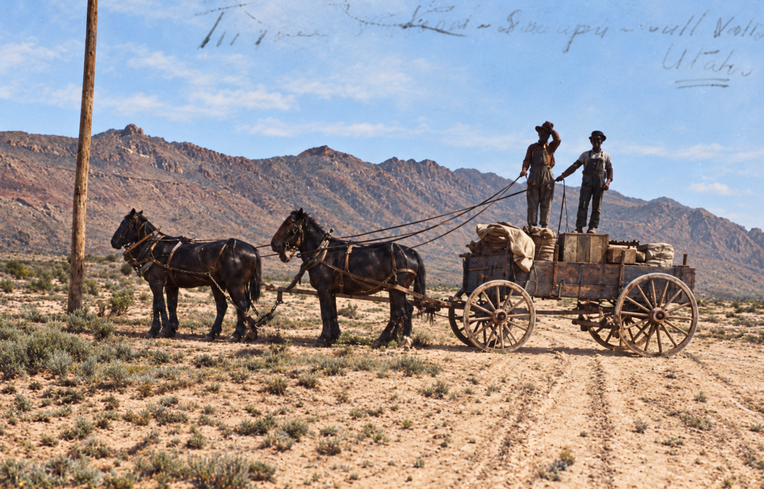
Additional detail draws on the research compilations assembled for this post, which cite Utah Historical Markers, BYU ScholarsArchive (Atkin’s thesis), Utah Humanities and other sources. Distances to Ophir and Mercur were recalculated from coordinates. Historic photographs courtesy of the Utah State Historical Society. Images marked “colorized” were colorized with AI and are interpretations, not original color.