Drawbridge, California
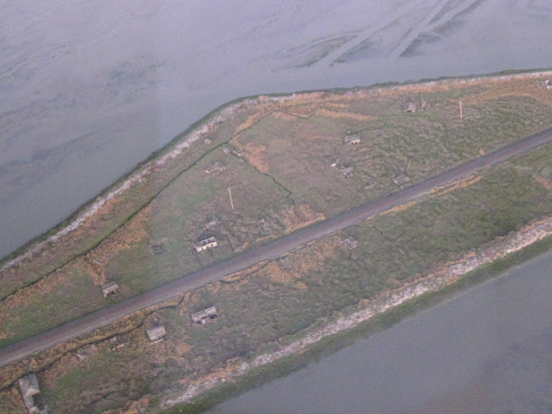
In the tidal marshes of the southern San Francisco Bay, roughly midway between Fremont and the drowned edge of Alviso, a scatter of collapsing cabins leans into the pickleweed and cordgrass. This is Drawbridge — the only ghost town on San Francisco Bay, and one of the strangest settlements California ever produced. It was never a mining camp, never a farm town, and never had a road. It grew up entirely around a railroad and the two swing bridges that gave it its name, and for half a century it was a boisterous duck-hunting and weekend resort built on a sinking island of mud.
Today Station Island belongs to the ducks again. The town sits inside the Don Edwards San Francisco Bay National Wildlife Refuge, off-limits to visitors, its buildings gradually surrendering to the tides that its residents once fought with pilings and boardwalks. Where Bodie in the eastern Sierra is preserved in a state of deliberate “arrested decay”, Drawbridge has been left to the opposite fate: a slow, complete surrender to dissolution, watched over only by egrets and the occasional passing commuter train.
A town that began with a bridge
Drawbridge owes its existence to the South Pacific Coast Railroad, a narrow-gauge line pushed across the bay marshes in 1876 to connect Alameda and Newark with Santa Cruz. To cross the two tidal sloughs that braided through the marsh — Coyote Creek and Mud Slough — engineers built a pair of swing bridges that could pivot open to let scows and small boats pass. A cabin was raised beside the northern span to house the bridge tender, and that solitary structure, more than any grand plan, was the seed of the town.
The first tender, a German immigrant remembered as George Mundershietz, quickly discovered that the marsh teemed with waterfowl and that the railroad delivered a steady stream of sportsmen from the growing cities around the bay. He began renting cots and rowboats to hunters and, by most accounts, charged around fifty cents a night for the privilege of a dry place to sleep before dawn shooting. Word spread. Gun clubs leased marsh parcels, hunters built their own shacks along the tracks, and the settlement that coalesced around the swing bridges took the plain, descriptive name the railroad crews already used for the stop: Drawbridge.
The roaring weekends
By the first decades of the twentieth century Drawbridge had swelled into a full-blown recreation colony. At its height in the 1920s the town counted something like eighty to ninety buildings strung along both sides of the single rail line — hunting cabins, gun-club lodges, a couple of hotels, saloons, and a general store. There were no streets and no automobiles; the railroad was the only way in, and residents and visitors walked the tracks or picked their way along raised plank boardwalks that floated over the mud. Rowboats were tied at nearly every doorstep, because at high tide the “yards” were simply water.
On a good weekend the town might host six hundred to a thousand visitors. Trains disgorged hunters in autumn and, in summer, families who came simply to swim, fish, sail, and escape the fog and noise of the cities. The Sprung Hotel and its rivals did brisk business; dance music drifted over the marsh at night; and the crack of shotguns opened the mornings. For a place with no soil, no road, and no fresh water of its own, Drawbridge was improbably alive.
The town famously organized itself into two loose communities that mirrored the two bridges. The settlement clustered around the northern span leaned Protestant and drew heavily from Alameda and Oakland, while the southern cluster, nearer San Jose, skewed Catholic and Portuguese. The two ends kept their own hotels, their own gun clubs, and a friendly-to-prickly rivalry, but they shared the same tracks, the same tides, and the same fundamental problem: they were living on a slowly sinking scrap of marsh.
Guns, ducks, and the market hunters
Waterfowl were the town’s first industry and its longest-lived one. The marshes of the south bay lay squarely on the Pacific Flyway, and in the era before bag limits and federal migratory-bird law, the shooting was almost unimaginable by modern standards. Sport hunters filled their blinds every weekend, and for a time market hunters worked the sloughs with punt guns — oversized, boat-mounted shotguns capable of dropping dozens of birds with a single blast, their harvest shipped by rail to the restaurants and markets of San Francisco.
That kind of hunting could not last. The Migratory Bird Treaty Act of 1918 and the tightening of state game laws outlawed market gunning and reined in the daily slaughter, and the great flocks that had made Drawbridge famous began to thin. Sport hunting continued for decades through the private gun clubs, but the town’s founding purpose was already being written out of the law books, and the marsh itself was beginning to change in ways no game warden could reverse.
The marsh turns against the town
Drawbridge did not die from a single blow. It was slowly squeezed out of existence by a combination of forces that reshaped the entire south bay in the first half of the twentieth century. Around the town, industrial-scale salt production spread across the tidelands, diking off the open marsh into geometric evaporation ponds and cutting the free tidal flushing that had kept the sloughs relatively clean. As the cities of San Jose and Santa Clara grew, their sewage and industrial effluent poured into the same waters, and the once-swimmable channels around Drawbridge grew fouled and malodorous.
The most insidious problem lay underground. Decades of heavy groundwater pumping in the Santa Clara Valley caused the land to subside — in places the valley floor dropped by several feet — and Station Island sank with it. What had always been a marginal perch a few inches above high tide became a losing battle. Tides that residents had once held back with pilings and raised boardwalks now pushed under the floorboards and left cabins standing in brackish water. Each year the town sat a little lower, and the marsh reclaimed a little more.
The long emptying
The decline showed first in the summer crowds and then in the year-round population. As roads and cars gave Bay Area families the whole coast and Sierra to choose from, the isolation that had once been Drawbridge’s charm became its burden. Cabins were abandoned or, more often, simply stopped being maintained; salvagers stripped lumber and fixtures; and vandals worked over what was left. The Southern Pacific, which had absorbed the old narrow-gauge line, ended passenger service to the marsh stop in 1955, severing the town’s lifeline. After that only the most stubborn holdouts remained.
The last permanent resident, a man named Charlie Luce, held on alone into the late 1970s, finally leaving in 1979 after years as the town’s sole human inhabitant. With his departure Drawbridge became a true ghost town — every structure empty, the marsh closing in. In 1986 an arson fire destroyed one of the best-known surviving cabins, and periodic fires and collapse have thinned the remains ever since. What stands today is a fraction of what stood in the 1920s: a few dozen gray shells sinking at their own pace into the bay.
A refuge rises around the ruins
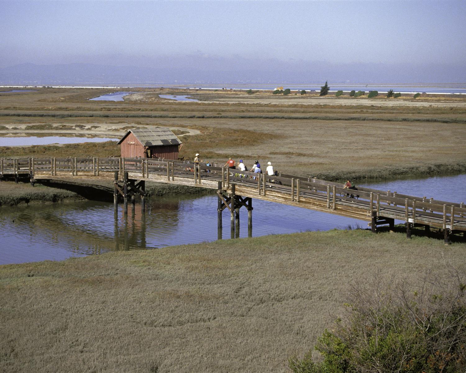
The same marsh that doomed the town ultimately saved its remains from the bulldozer. In 1972 Congress established the San Francisco Bay National Wildlife Refuge — later renamed for Representative Don Edwards, who championed it — to protect the shrinking tidal wetlands of the south bay from the fill and development that had already erased most of the bay’s historic marsh. Station Island and its ruins fell inside the refuge boundary, and Drawbridge passed from a dying resort into a protected, off-limits fragment of wetland.
The refuge’s managers have deliberately chosen not to restore or stabilize the buildings. Unlike a preserved park town, Drawbridge is being allowed to decompose naturally, both because stabilizing structures in an active, sinking tidal marsh is impractical and because the site is simply too fragile and too dangerous to open to visitors. It is a conscious policy of managed disappearance — a very different philosophy from the ranger-tended stabilization at Bodie or the full reconstruction and interpretation at the state historic park of Allensworth.
That contrast is part of what makes Drawbridge so compelling. California’s ghost towns run the full spectrum of afterlives. Some, like Keeler on the shore of dry Owens Lake, still shelter a handful of residents among the ruins. Others are meticulously frozen for tourists. Drawbridge alone has been handed back, whole, to the natural forces that will eventually finish it — a town being un-built by the tide in real time.
What remains
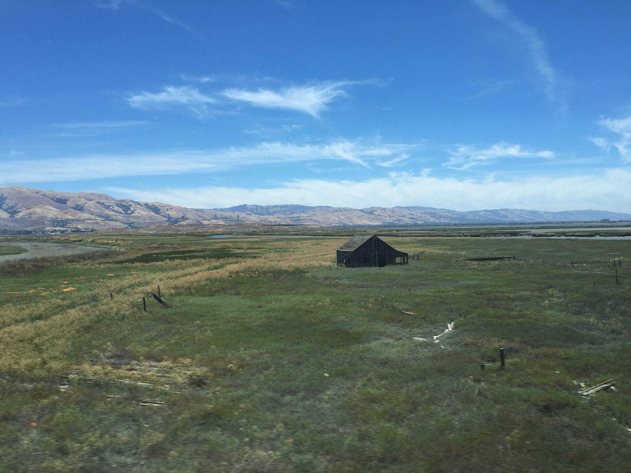
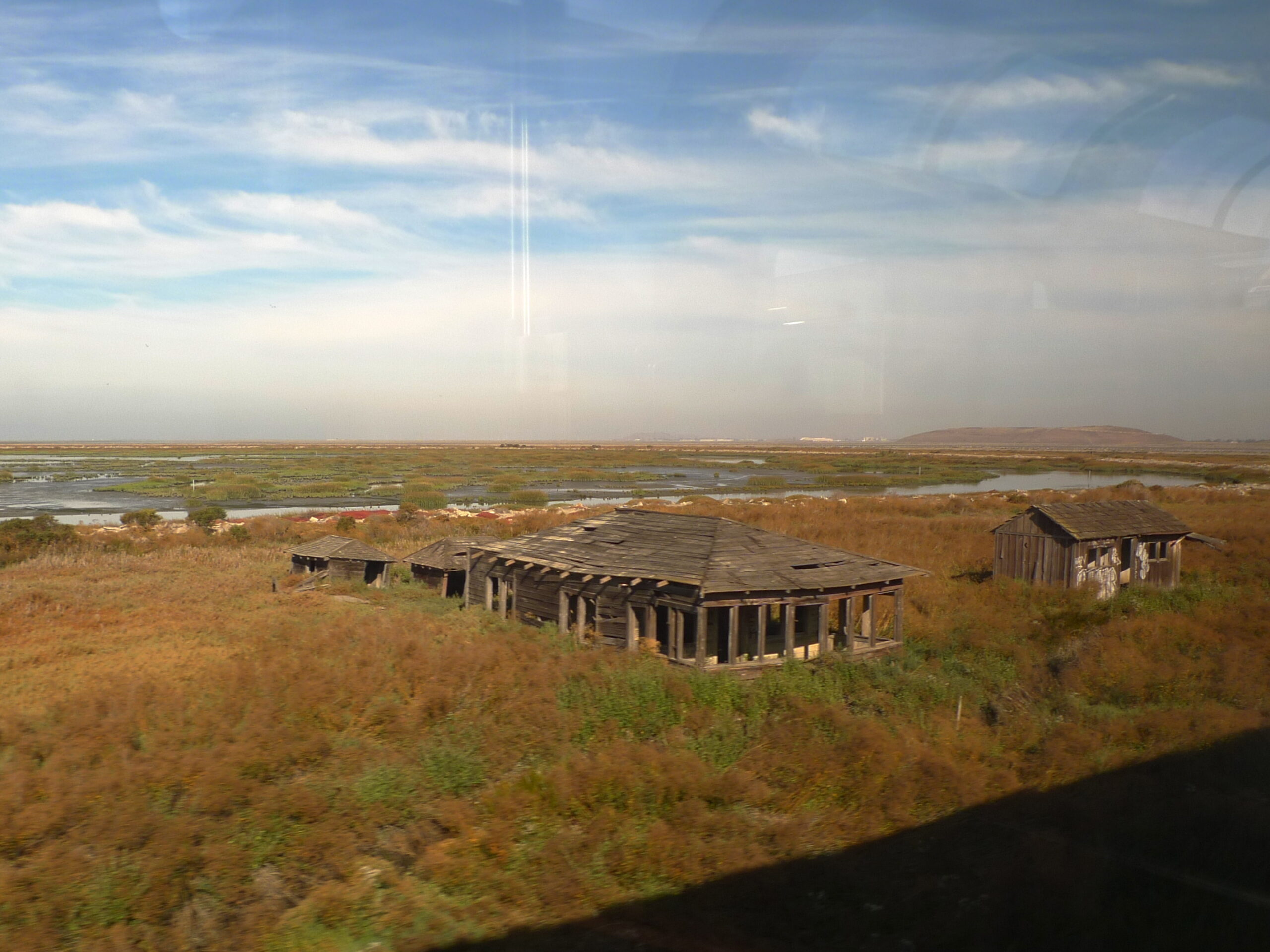
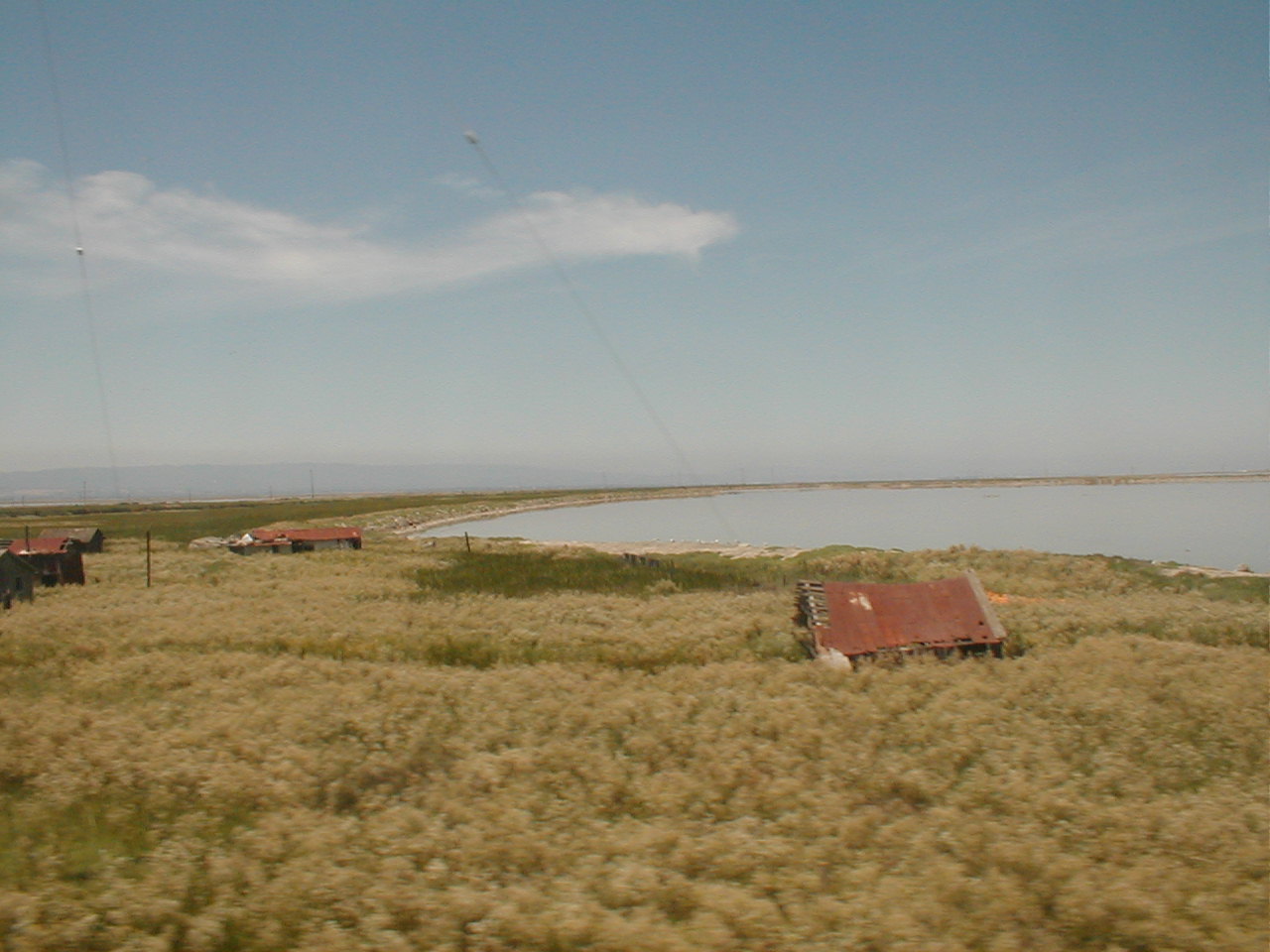
A visitor peering across the marsh today — from a passing train or a distant levee trail — sees perhaps two to three dozen weathered structures listing at drunken angles, their unpainted redwood turned silver-gray by a century of salt air. Boardwalks have rotted into the mud; pilings stand like broken teeth where cabins have collapsed entirely. At high tide the water laps at floorboards and, in the lowest spots, flows straight through. Egrets, avocets, and shorebirds pick through the same channels that once rang with shotgun fire, and the loudest sound is usually the wind or a freight train rattling down the still-active line that runs, incredibly, right through the middle of the dead town.
Timeline
How to see Drawbridge legally
- From the train: The Capitol Corridor and ACE passenger trains pass directly beside the ruins between Fremont and Santa Clara — the closest legal view most people will ever get.
- Mallard Slough Trail: Starts at the refuge’s Environmental Education Center, 1751 Grand Blvd, Alviso, and offers distant marsh-level views toward Station Island.
- Refuge programs: The USFWS and partners have occasionally run guided van excursions and history talks — check the Don Edwards refuge calendar for current offerings.
Getting There
There is no public access to the town itself. The nearest sanctioned point is the Don Edwards refuge Environmental Education Center in Alviso, from which the Mallard Slough Trail gives the best legal, marsh-level view across to Station Island. The map below marks the approximate location of the ruins in the southern bay.
Nearby ghost towns
Further Reading
- Drawbridge, California: A Hand-Me-Down History — Ceal Craig & Aric Crabb / the SF Bay Wildlife Society (2018).
- The Town That Wouldn’t Die and related local histories on the south-bay resort era.
- Don Edwards San Francisco Bay National Wildlife Refuge interpretive materials, U.S. Fish & Wildlife Service.
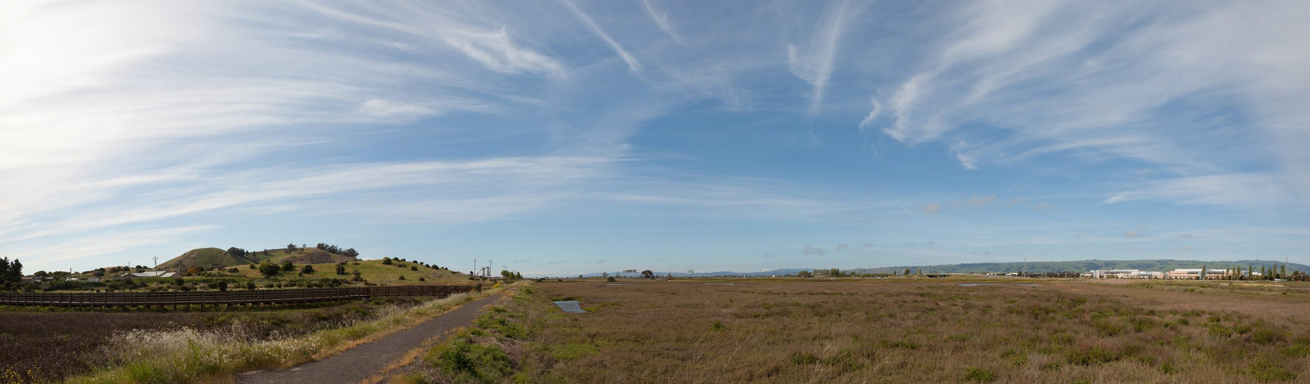
Historic photographs of Drawbridge in its prime are held by the San Francisco Bay Wildlife Society and are not freely licensed; the images on this page are contemporary, openly-licensed views of the ruins and surrounding refuge. Each caption links to its original file on Wikimedia Commons.
Sources
Craig, C. & Crabb, A., Drawbridge, California: A Hand-Me-Down History (2018) · U.S. Fish & Wildlife Service, Don Edwards San Francisco Bay National Wildlife Refuge site records · National Register and Bay Area historical-society accounts of the South Pacific Coast Railroad and south-bay resort towns · Contemporary reporting on land subsidence in the Santa Clara Valley.
Photo credits: Aerial view — Paguerra, 2009 (CC BY 3.0) · Abandoned buildings, 2012 — Britta Gustafson (CC BY-SA 2.0) · Ruins from train, 2016 — Dargasea (CC BY-SA 4.0) · Cabin in the marsh, 2005 — William Ward (CC BY 2.0) · Refuge marsh — John & Karen Hollingsworth, USFWS (public domain) · Refuge panorama — King of Hearts (CC BY-SA 3.0). All images via Wikimedia Commons.