Mercur Ghost Town, Utah: The Cyanide Gold Boomtown That Mining Later Erased
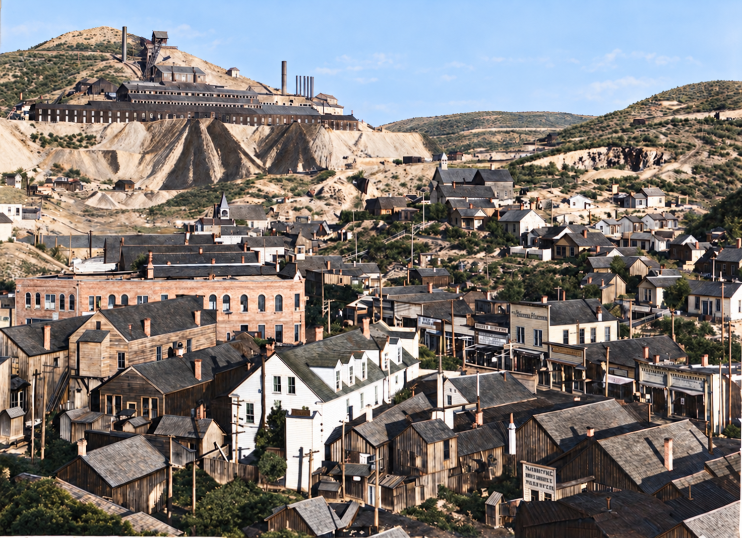
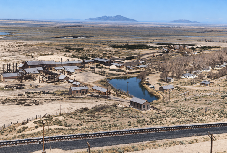
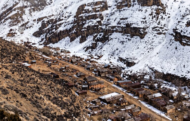
Most ghost towns fade. Mercur was dug up. In the 1890s this steep canyon on the southwest side of the Oquirrh Mountains held a bustling town of hotels, saloons, churches and a mill complex that overwhelmed the canyon itself. Then the ore ran out, the railroad was pulled up, the houses were hauled away, and a century later a modern open-pit mine was excavated through the old streets. Today there is no town to walk through. What remains is a cemetery on a hillside, a highway marker, and an unusually rich archive of photographs and maps.
What makes Mercur matter is the gold. The ore here was disseminated so finely that miners could see almost nothing in it and recover almost nothing from it, until a chemistry experiment in 1890–91 changed the economics. By the Utah Geological Survey’s accounting, this became Utah’s top gold camp. Its story runs from silver pockets and a failed quicksilver claim through the first successful commercial cyanide gold operation in the United States, to a Depression-era revival and a late twentieth-century open pit. This page covers all of it, then tells you plainly what you can and cannot visit.
“…the first successful commercial cyanide-gold operation in the United States.”
How the Utah Geological Survey and Utah State Archives describe Mercur’s 1891 millLewiston and the silver pockets, 1870–1880
Silver float found in the spring of 1870 started it. The Camp Floyd Mining District was organized that year in Lewiston Canyon, named for nearby Camp Floyd, and the first camp took the name Lewiston. Prospectors found rich silver-bearing quartz and jasperoid on the canyon walls and staked claims with names such as the Sparrow Hawk, Last Chance, Marion and Carrie Steele. The Carrie Steele, located in November 1871 by Leandro Steele and named for his daughter, became the classic early bonanza. By 1872 Lewiston was a tent-and-shack camp, and the Camp Floyd Silver Mining Company built a 20-stamp mill south of the townsite that November.
The silver did not last. The deposits were shallow, pocketed and discontinuous, and they pinched out as workings went deeper. Lewiston Canyon also had almost no dependable surface water, which crippled milling and forced expensive hauling. By about 1880 the best pockets were gone and the camp was nearly empty.
Pinedo’s cinnabar and the name Mercur
In 1879 a prospector named Arie Pinedo found a vein carrying cinnabar, the red mercury sulfide, in the canyon wall. He expected a quicksilver bonanza and filed a claim called “Mercur,” reportedly after the German word for mercury. It never produced commercially, and he gave up the property by about 1884. Assayers testing his claims and the surrounding rock noticed something more important: traces of gold, locked in silicified limestone so fine that panning and mercury amalgamation could not release it.
The name outlived the mine. When the camp reorganized around the new discoveries, the Lewiston name was already in use by another Utah town, and the community took the Mercur name instead.
1890–91: cyanide changes everything
In 1890 a syndicate of Nebraska businessmen bought Pinedo’s abandoned claim through intermediaries. The group included Gilbert S. “Gill” Peyton, a pharmacist from Fremont, and the merchant and investor John Dern. On December 26, 1890, they incorporated the Mercur Gold Mining and Milling Company with $5,000,000 in capital stock.
Their first attempt repeated the old failure. The company spent about $25,000 on an amalgamation mill at Manning, three miles south, where water could be piped in, and the plant did not work. The ore was talcy, clayey and carbonaceous, and it coated the mercury plates and neutralized recovery.
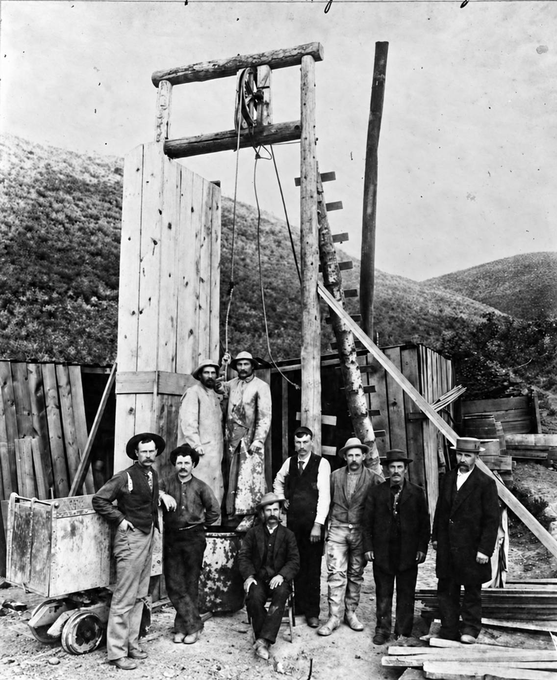
Peyton, drawing on his pharmaceutical training, turned to a process patented in Glasgow in 1887 by MacArthur and the Forrest brothers. A dilute cyanide solution dissolves fine gold from crushed ore, and the gold can then be precipitated from the solution onto zinc. After laboratory tests, Peyton and the company retrofitted the Manning mill in late 1890 and early 1891. It worked. Utah State Archives and the Utah Geological Survey both treat this as the first successful commercial cyanide gold operation in the United States, and as the event that made Mercur, because it turned ore once regarded as nearly worthless into a profitable one.
That success gave the district a famous nickname. Promoters called it “The Johannesburg of America,” after the South African gold district that used the same chemistry on disseminated ore. A railroad booklet published in 1896 carried that phrase in its title.
The railroad and the Golden Gate Mill
Water and distance still held the district back. The company first hauled ore by wagon down Manning Canyon to the Manning mill. In 1894, promoter Joseph G. Jacobs began the Salt Lake & Mercur Railroad, and it was completed in early 1895. Starting from a connection with the Union Pacific at Fairfield Switch, the standard-gauge line climbed roughly 1,986 feet over about 12 miles through Manning Canyon and crossed a 7,100-foot divide into Mercur by switchbacks and tight curves. Geared Shay locomotives did the work. The line cut freight costs for machinery, coal and timbers, and it ran open excursion cars for passengers.
The next jump came in 1895, when mining man Captain Joseph R. DeLamar bought the Golden Gate claims next to the Mercur company’s ground. Near the surface the Golden Gate ore leached readily, but the deeper ore bodies were refractory, carbonaceous and sulfide-rich, and they resisted plain cyanidation. DeLamar commissioned the Golden Gate Mill, designed and built in 1897–98 with metallurgical engineer Daniel C. Jackling as the key figure. It was built of structural steel on stepped concrete tiers to reduce fire risk, grew from about 500 tons a day to about 1,000 by 1900, and used a bank of long roasting furnaces to burn off sulfur and organic carbon before cyanidation. The plant also ran on electric power transmitted over a long high-voltage line from a hydroelectric plant in Provo Canyon, an early use of long-distance alternating-current transmission at an industrial site.
Jackling is the link to a bigger story. The experience he gained handling very large tonnages of very low-grade ore at Mercur helped lay the groundwork for the mass-production copper methods he later brought to Bingham Canyon. In 1900, on July 30, the Mercur company merged with DeLamar’s Mercur Mines Company to form the Consolidated Mercur Gold Mines Company, known as “Con Mercur,” which unified the underground mines, the Golden Gate Mill and the Manning facilities.
Con Mercur’s managers included a young man who went on to national office. George H. Dern followed his father John to Utah in 1894, started as a bookkeeper in the family’s Mercur company, and became general manager in 1900. He later served as governor of Utah and as President Franklin D. Roosevelt’s Secretary of War.
The town at its height
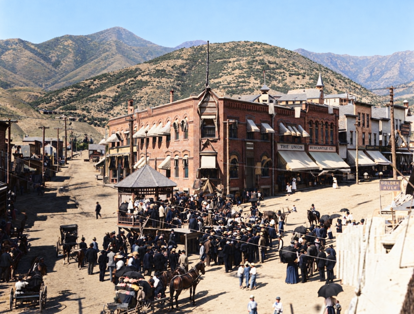
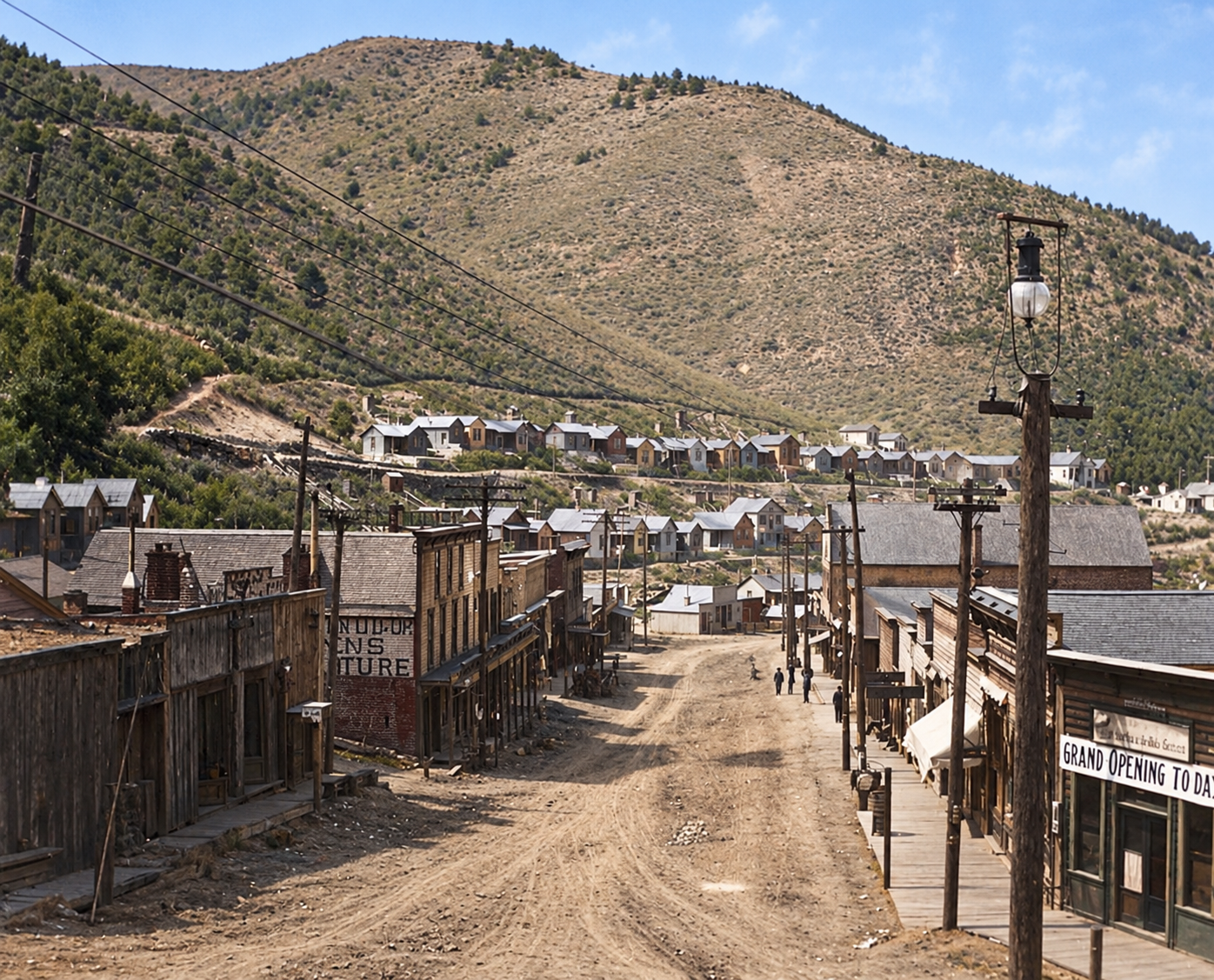
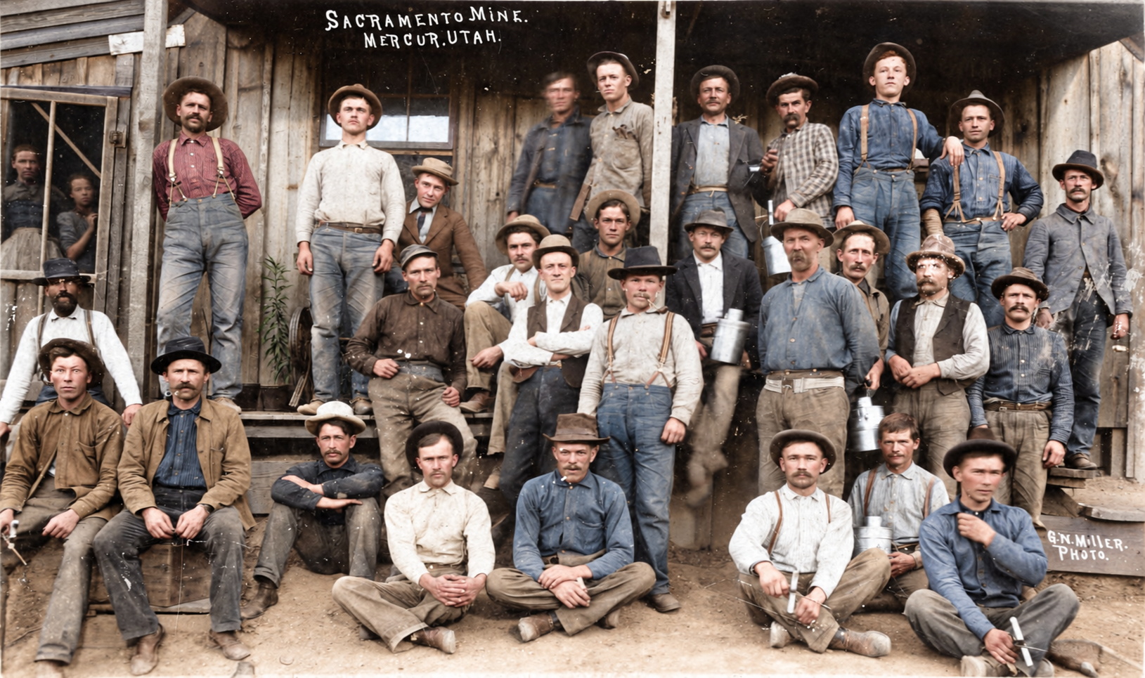
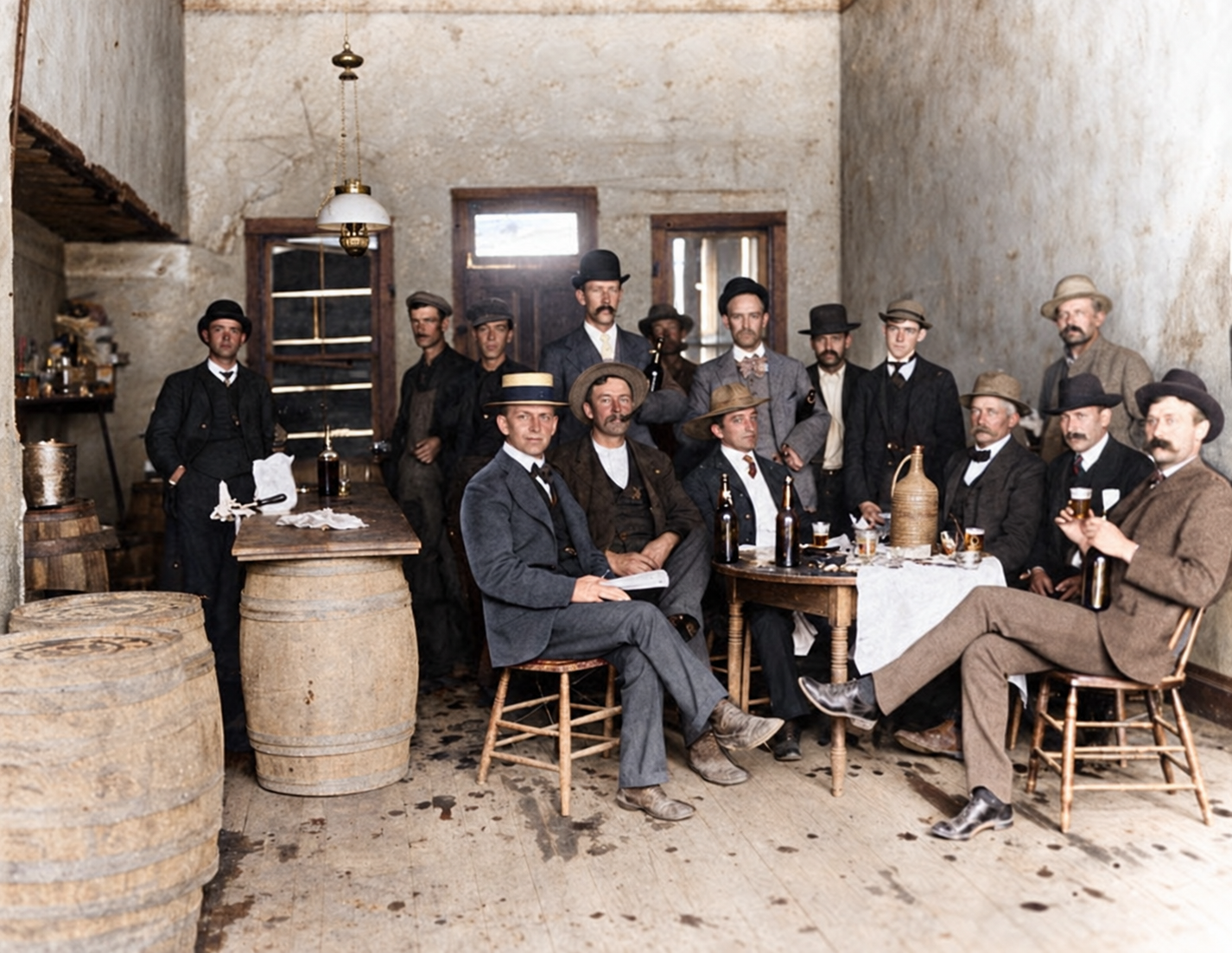
Mercur grew down the narrow bedrock trench of Lewiston Canyon, with frame buildings stacked up the unstable slopes. It was the largest commercial center in Tooele County in its day, with hotels, saloons, shops, boarding houses, a local mining exchange, fraternal organizations, churches and schools. A Catholic church went up in 1904, and Utah historical research identifies Mercur as the largest Italian settlement in Tooele County, with Austrian and Slavic miners as well.
How many people lived there is one of the places where ghost-town mythology inflates the numbers. A historical mining-industry source gives a 1900 population of about 2,351. Modern public-history accounts commonly describe a peak near 5,000, which may reasonably include transient miners and laborers that a census would miss.

Two fires, 1896 and 1902
Mercur’s wooden false fronts, dry climate and thin water supply made it a fire risk. The first big fire came in the first days of January 1896, almost exactly as Utah became a state on January 4. A Utah Historical Quarterly treatment of Tooele County history notes that the fire destroyed Mercur’s city hall and disrupted plans to incorporate. The town rebuilt quickly with fresh timber hauled in on the new railroad.
The fire of June 26, 1902 was far worse. It started in the lower part of the business district and, driven by wind funneling up the narrow canyon, swept through the commercial district in about two and a half hours. Almost every business building was destroyed, including the stone ones, and most of the residential areas and the mills were spared. One account estimates damage near $600,000. Utah collections preserve photographs of Mercur “before” and “after” the fire.
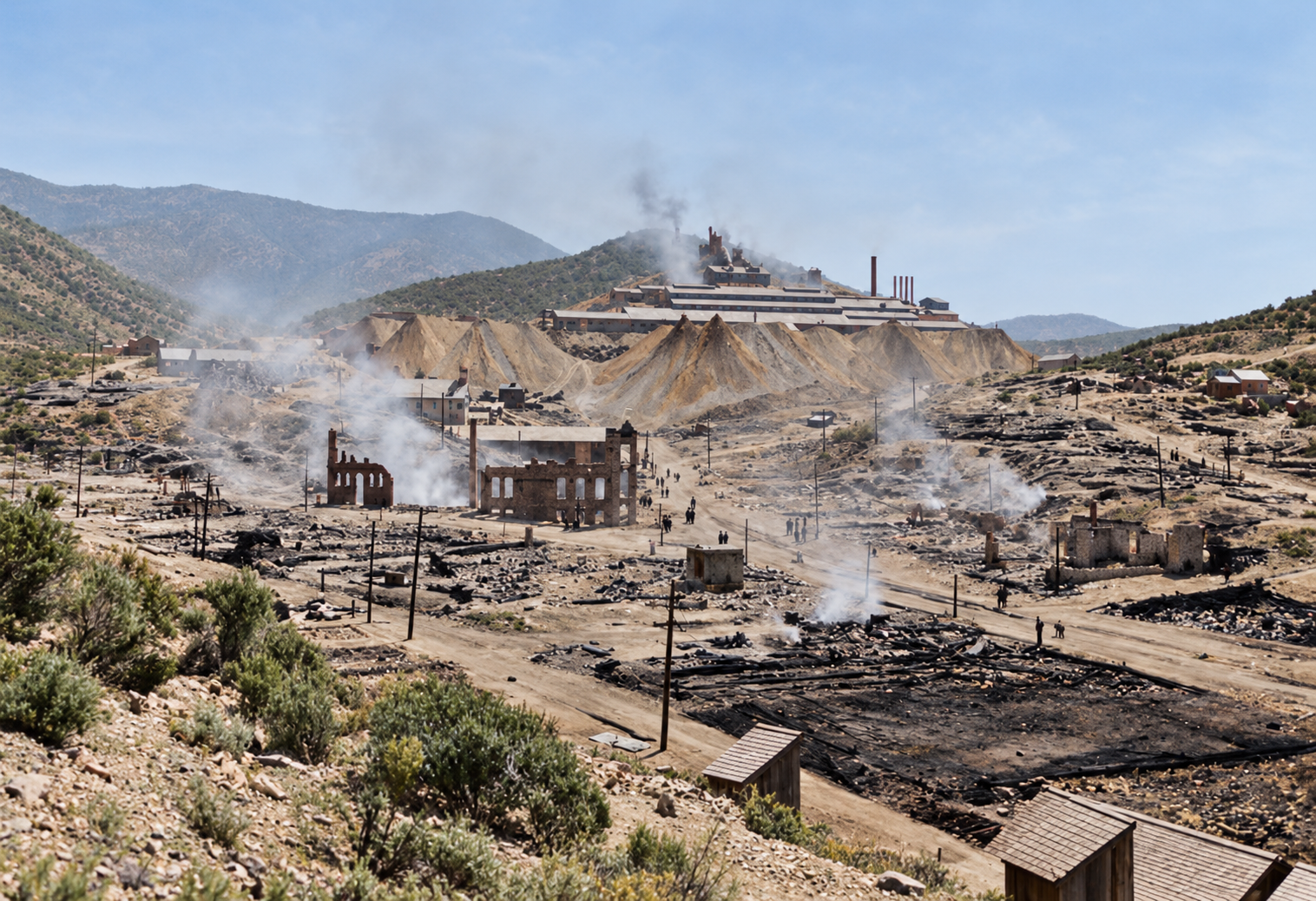
The fire did not kill Mercur. The town was rebuilt to a meaningful degree, and the surviving 1903 Sanborn fire-insurance map is direct evidence of a post-fire town that was still doing business, not an instant ruin.
1913: when the ore ran out
The economics did what the fires could not. By about 1910 the underground stopes had reached deeply seated refractory pyritic ore whose extraction cost exceeded its value, and average values that once ran $10 to $30 a ton had fallen to under $2.50. Rising water inflows and labor costs made it worse. Consolidated Mercur ceased operations in 1913, with one account giving the date as March 30. Over its lifetime it reportedly paid $3,445,312 in dividends, and a 1972 ghost-town guide credits the district with roughly $16.5 million in gold by the closing.
The town emptied fast. The Salt Lake & Mercur Railroad hauled out the Golden Gate Mill’s salvageable machinery, boilers and steel, and the rails came up in 1914. The local ward of The Church of Jesus Christ of Latter-day Saints was discontinued in 1913. Frame houses were dismantled or rolled on logs down the mountain to Cedar Fort, Fairfield and Lehi. One account says only a single derelict building stood by 1916 and that it had collapsed by 1930, while another describes the town as deserted by 1917. When a ghost-town author surveyed the site around 1972, he found massive mill foundations, tailings piles, four cyanide tanks, one rock store and a few rusting shacks.
The Depression revival, 1932–1945
The federal government raised the gold price from $20.67 to $35 an ounce in 1933–34, and low-grade dumps and mill tailings became worth reworking. The Geyser Marion Gold Mining Company was reincorporated in Salt Lake City on August 18, 1932. Under company president Glenn R. Bothwell it built a new 300-ton cyanide mill in 1935, cast largely underground from about 1,500 cubic yards of reinforced concrete to cut costs and fire exposure, and it pumped slurry from the old dumps to be reprocessed.
World War II ended it. On December 8, 1942, the War Production Board issued Limitation Order L-208, closing nonessential gold mines so labor and equipment could go to copper, lead and zinc. The Geyser-Marion mill ran briefly into 1944–45 crushing silica-rich rock for flux at a copper smelter and then shut for good. Mercur thus had at least three distinct lives before 1950: the Lewiston silver camp, the cyanide boomtown, and a much smaller tailings-and-dump revival.
Getty, Barrick and the open pit, 1968–1997
The fourth life erased what was left of the third. Geologists realized that Mercur’s disseminated, micron-scale gold in silty, carbonaceous limestone resembled the Carlin-type deposits then being developed in Nevada. Newmont explored the district in 1968, the central property was consolidated and sold to Getty Oil in 1973, and Getty developed a modern open-pit mine and recovery plant that poured its first gold in 1983. The American Barrick Resources Corporation, later Barrick Gold, acquired the operation in 1985 and developed the Mercur, Sacramento and Marion pits. A pressurized autoclave installed in 1989 oxidized the difficult carbonaceous ore before carbon-in-leach recovery.
Mining ran out of economic reserves in the 1990s. The last ore was mined in 1997, and processing continued into late 1998. Revival Gold, the current owner, says Barrick produced about 1.4 million ounces at Mercur. The Utah Geological Survey places the district’s cumulative historical production at roughly 2.5 million ounces.
The pits and waste dumps spread directly across the nineteenth-century townsite. The commercial core, residential lots, narrow main road and the stepped concrete foundations of the Golden Gate Mill were excavated, hauled away or buried. Barrick then ran a reclamation program through about 2010 that backfilled or re-sloped the pits, removed process ponds and mill infrastructure, capped the drainage with topsoil and reseeded it with native grasses, bitterbrush and sagebrush. Lewiston Canyon now looks like a quiet, recontoured mountain slope, with little visible trace of what happened there.
Mercur today: a mining project again
Mercur is not just an abandoned reclaimed mine. In 2024 Revival Gold acquired Ensign Minerals and its Mercur interests, then exercised its option on Barrick’s remaining interest in late 2025 and completed the consolidation in 2026. The company describes a project of about 7,200 hectares, mostly on private patented claims. A Preliminary Economic Assessment dated May 2, 2025 evaluates an open-pit, heap-leach operation. As of late October 2026 the company reports engineering and infill drilling underway, a prefeasibility study targeted for the first quarter of 2027, and mine permitting in progress that it expects to take about two years. Any description of Mercur as a “closed Barrick mine” is now out of date.
The Mercur Cemetery
The cemetery is the one significant nineteenth-century site that has survived, and the only one visitors are commonly directed to. It sits on a steep limestone knoll overlooking the mouth of Lewiston Canyon. One field account puts the number of burials at roughly 100, dating from 1894 to 1913, with between 20 and 40 plots marked by rustic wooden picket fencing, dry-laid limestone borders and hand-carved stone tablets. Many headstones mark infants and small children who died of illnesses such as diphtheria and typhoid, alongside miners killed in industrial accidents. A bronze Daughters of Utah Pioneers marker near the foot of the cemetery path reportedly summarizes the town’s history, from the 1870 silver strike through the cyanide breakthrough.
The cemetery has also become a destination for ghost hunters, and stories circulate of cold spots, photographic distortions and unexplained voices. Those accounts belong to modern folklore and visitor culture. No high-quality historical evidence turns them into documented events. The graves are of real people, most of them young, and they deserve the same respect as any other cemetery.
Timeline
Historic sites nearby
Further reading
Sources
Utah Geological Survey — The Mercur District: A History of Utah’s Top Gold Camp (Krahulec) — district overview, roughly 2.5 million ounces of cumulative production
Revival Gold — Mercur Project — current ownership, project size, PEA date (May 2, 2025), prefeasibility timeline and permitting status
Utah Rails — Mercur (Carr, Historical Guide to Utah Ghost Towns) — 1896 and 1902 fires, Golden Gate Mill, 1913 closure, state of the site in 1972
Utah Rails — Mercur Mining District and Salt Lake & Mercur Railroad — railroad construction, route and dismantling
Utah Division of State History — George Henry Dern — Dern’s role at Mercur
Utah Digital Newspapers — “Fire at Mercur,” Provo Daily Enquirer, January 7, 1896 — contemporary report of the first fire
Utah Historical Quarterly — “The Ghost of Mercur” (Alder, 1961) — the standard scholarly history
Utah State Parks — Camp Floyd State Park Museum — museum, Stagecoach Inn and published hours
Wikipedia — Mercur, Utah — elevation, name origin, general overview
Atlas Obscura — Mercur Cemetery — approximate cemetery coordinates
Additional detail on the cyanide breakthrough, the Golden Gate Mill, the Depression revival, modern mining and reclamation draws on the research compilations assembled for this post, which in turn cite Utah State Archives, Utah History to Go, the U.S. Geological Survey and the Society of Economic Geologists literature. Items that rest on a single account are worded as such.
Historic photographs courtesy of the Utah State Historical Society. Images marked “colorized” were colorized with AI and are interpretations, not original color.