Tin Cup, Colorado: The Wild Silver Camp Above Taylor Park
ColoradoGold & Silver MiningSummer town · Gravel road access·~12 min read
Quick facts
What it is1879 silver and gold camp, now a summer cabin town
First gold1859, placer gold on Willow Creek, by tradition found by Jim Taylor
Town foundedMarch 1879, laid out as Virginia City; renamed Tin Cup in 1882
Population1,495 in the 1880 census; 264 by 1900
Post officeJuly 1879 to January 1918 (as Virginia, Tin Cup, then Tincup)
Mining districtTincup district (silver, lead, gold)
ElevationAbout 10,160 feet
Coordinates38.7544° N, 106.4783° W
CountyGunnison County
StateColorado
⚠ Private cabins, look from the road · Roads closed by snow about November to May · No camping near town · Open mine workings in the hills
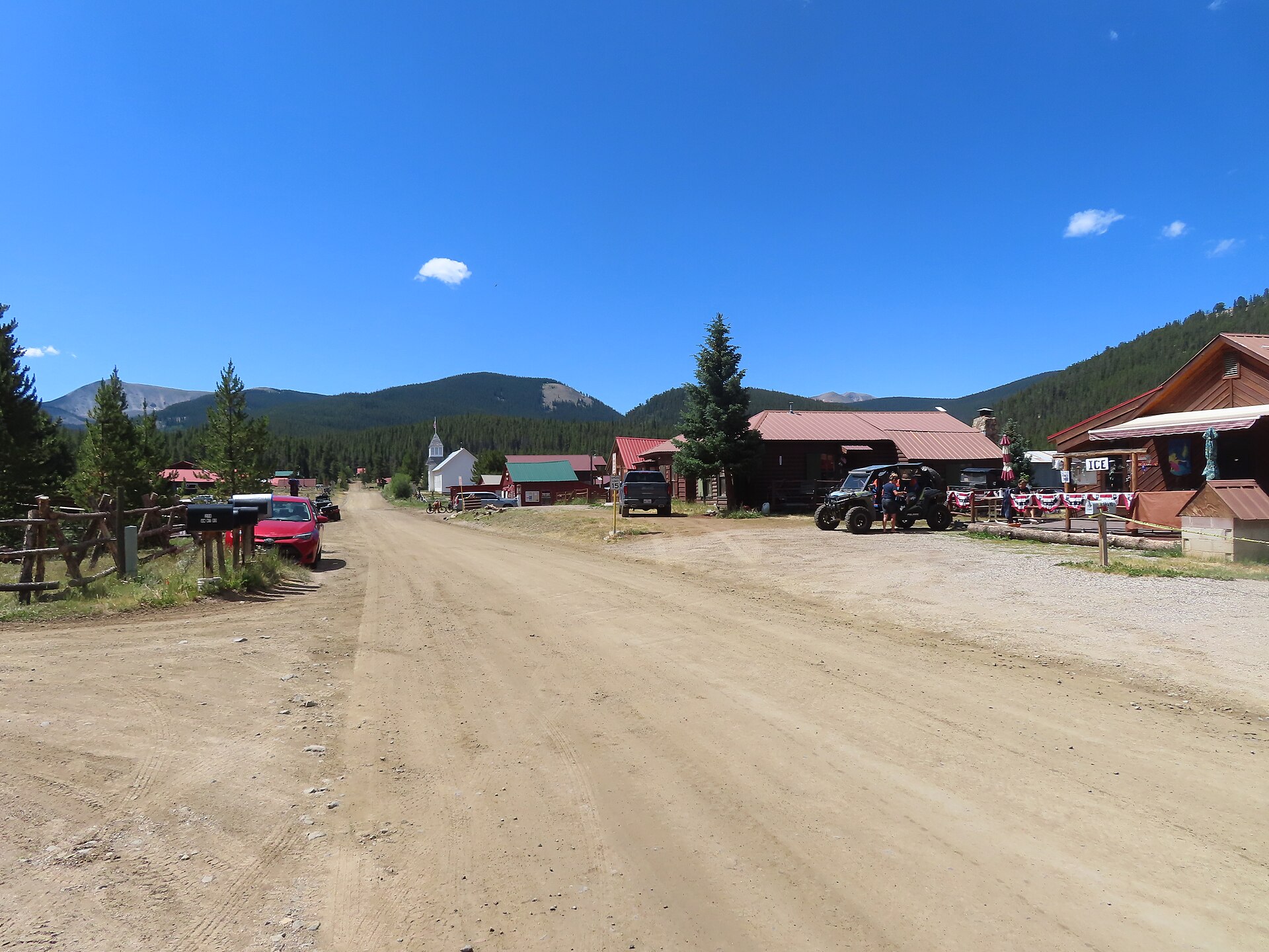
Tin Cup’s main street in summer, 2025. Photo: David Wilson, CC BY 4.0, via Wikimedia Commons.
Tin Cup sits at more than 10,000 feet in a mountain valley south of Taylor Park, in the Sawatch Range of Gunnison County. Prospectors panned gold here as early as 1859, but the town was born in 1879, when silver and lead lodes in the hills to the south brought a rush and a townsite called Virginia City. By the 1880 census nearly 1,500 people lived there, and the camp soon had a name for saloons, gamblers and dead lawmen: at least two town marshals were shot dead in little more than a year. The rich ore gave out within a few years, and by 1918 the post office had closed and the town held its last election. Today Tin Cup is a summer town of old log cabins, a store, a cafe and a cemetery spread over four knolls, reached by gravel roads that snow closes for half the year.
A tin cup of gold
The name comes from a story. In October 1859, during the first Colorado gold rush, a prospector named Jim Taylor is said to have panned gold from a stream in this valley, now Willow Creek, and carried it back to camp in a tin cup. The gulch became Tin Cup Gulch, and Taylor’s name stuck to Taylor Park and the Taylor River to the north.
Nothing much came of it for almost twenty years. The valley was high, cold and far from any supply town, and it lay in country the Ute people still held. Placer miners came and went in the short summers, and nobody stayed through the winter.
On the tin cup: The story is local tradition, and it comes in more than one version. Most accounts credit Jim Taylor in 1859; another says his partner Ben Gray named the gulch by dipping his tin cup in the creek, and some versions move the date to 1861. No record from the time settles it.
Virginia City, then Tin Cup
The real boom began in 1878, when prospectors found lode deposits, the veins and ore bodies that the placer gold had washed out of. The richest lay on Gold Hill and West Gold Hill, two to five miles south of town. In March 1879 a townsite was laid out on the valley floor and named Virginia City, and a post office called Virginia opened that July.
Growth was fast. The 1880 census counted 1,495 people in the town, and smaller camps grew up nearby, among them Hillerton and Abbeyville a mile or two to the north. Virginia City incorporated in August 1880.
The name caused trouble from the start. Mail and freight meant for the Gunnison County camp kept going to Virginia City, Nevada, and Virginia City, Montana, both far better known. The post office switched to the name Tin Cup in February 1880, and in July 1882 the town reincorporated under the same name. In 1895 the post office ran the two words together as Tincup, the spelling many maps still use.
On the population: The 1880 census figure of 1,495 is the only solid count from the boom. Some accounts claim 4,000, 6,000 or even 7,000 people in the district, and one says Hillerton alone had 1,500. None of those numbers can be traced to a record, so we use the census.
Saloons and dead marshals
Tin Cup earned a rough name fast. Writers have called it the wickedest town in Gunnison County and one of the three wildest mining camps in Colorado. Saloons and gambling halls did a steady trade with miners paid in cash, and keeping order was a dangerous job.
Cemetery records and newspaper accounts document three killings of men who wore the marshal’s badge:
Harry Rivers, the town marshal, was shot dead on March 7, 1882, by Charles LaTourette, who ran the Bullion Exchange Saloon. A hearing cleared LaTourette on grounds of self-defense.
Frank Emerson, another marshal, was killed on July 7, 1882, by Tom Leahy, who was sent to the penitentiary for twelve years.
Andrew Jameson, a 27-year-old marshal, was shot on May 5, 1883, by William Taylor, who served four years for it.
On the marshal legends: Popular histories add more colorful stories: a first marshal named Willis told to “see nothing, hear nothing, do nothing,” a marshal called Micky who went insane under threats, one who quit to become a preacher, and an “Uncle Dave” Corsaut who finally tamed the town and later found gold bullion in his lime kiln. These come from later retellings, not from records of the time, so treat them as local tradition. One story sometimes told about Tin Cup, of a sheriff who killed himself after a shootout, belongs elsewhere: that sheriff served Grand County, and the shootout was at Grand Lake in 1883.
The mines
Tin Cup’s ore lay mostly in replacement deposits, bodies of silver-rich lead ore, with some gold, that formed where hot mineral water dissolved limestone and dolomite and left metal in its place. Lead carbonate, lead sulfide and free gold came out of the same workings.
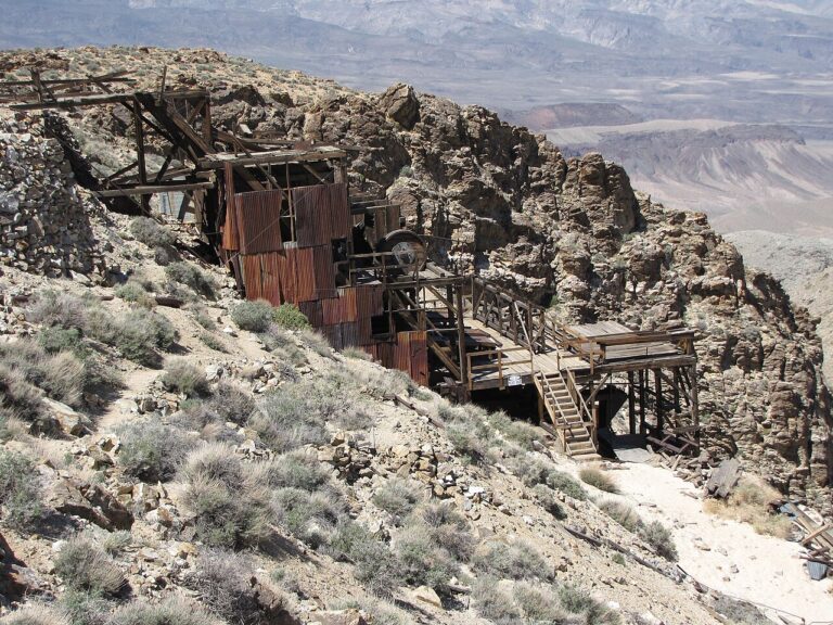
The biggest producer was the Gold Cup Mine on Gold Hill, about two and a half miles south of town, which kept working, on and off, until 1917. Federal mine records call its output very large without giving a total. The neighboring Jimmie Mack produced about $700,000 worth of ore, and the Silver Cup shipped high-grade ore. A mill on West Willow Creek, the Blistered Horn, also called the Brunswick Mill, crushed ore south of town.
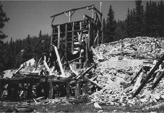
Ruins of the Blistered Horn (Brunswick) Mill on West Willow Creek, about four miles south of Tin Cup, around 1998.Photo: J. Thomas Nash, U.S. Geological Survey, public domain
Getting ore out was the hard part. In 1881 the Chalk Creek and Elk Mountain Toll Road Company built a wagon road east over Tincup Pass, 12,154 feet high on the Continental Divide, to St. Elmo, and by 1882 stage lines were running over it. In 1882 a second road was built south over Cumberland Pass toward Pitkin.
On production: Some accounts credit the Gold Cup with $7 million, half the district’s output, and describe a 20-stamp mill built in 1890. We could not confirm either from geological surveys or mine records, so we leave the figures out.
Bust and a long fade
The best surface ore was gone within a few years, and the crash of silver prices in 1893 hit Tin Cup like every other silver camp in Colorado. By 1900 the census found 264 people. Fires burned parts of town in 1906 and 1913. The Gold Cup closed in 1917, the post office shut on January 31, 1918, and the town held its last election the same year.
On a second boom: Some histories describe a revival in the early 1900s that brought as many as 2,000 miners back. With only 264 people counted in 1900 and no later count to match, the size of any revival is uncertain.
Tin Cup never quite emptied. In 1937 the Bureau of Reclamation finished Taylor Park Dam about ten miles to the north, and the reservoir became a summer draw for anglers and campers. Tin Cup’s old cabins became summer homes, and today it is a seasonal village with a handful of year-round residents.
Boot Hill and the four knolls
Tin Cup’s cemetery is its most famous sight. Instead of one burial ground, it is spread over four small hills, each with its own people: a Protestant knoll, a Catholic knoll, a Jewish knoll and Boot Hill, traditionally for outlaws, strangers and those who died by violence. Mourners walk down into the hollows and up again to move from one section to the next. The first recorded burial was T. L. Stormes, on April 30, 1879.
Boot Hill holds the best-known markers. A wooden board for a gambler called Black Jack Cameron says he “drew 5 aces.” Another marks a dance-hall girl remembered only as Pass Out. Several of the marshals killed in the 1880s are buried in the cemetery too.
On the markers: Several old wooden markers have been replaced over the years. Black Jack Cameron’s original board is reportedly missing, and accounts disagree on whether it read “drew five aces” or “held five aces.” Sources also disagree on which knoll lies in which direction.
What remains
Most of the town still stands. Log and frame cabins from the mining years line the grid of dirt streets, nearly all of them private summer homes. The Tin Cup Town Hall, a small Queen Anne-style building from 1903, is still the community’s meeting place. The old store, a red log building dating to around 1905, has long served summer visitors; according to one local history it was the first headquarters of the Gunnison National Forest. Frenchy’s Cafe, on a small pond at the edge of town, serves meals from about June to September.
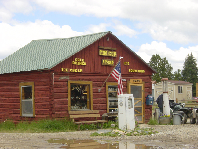
The Tin Cup store, 2008.Photo: Plazak, CC BY-SA 3.0, via Wikimedia Commons
The mine dumps, adits and mill ruins of Gold Hill and West Willow Creek lie a few miles south. About three miles east, on the road toward Tincup Pass, is Mirror Lake, a popular fishing spot with a Forest Service campground.
Timeline
1859
By tradition, Jim Taylor pans gold on Willow Creek and carries it out in a tin cup.
1878
Prospectors find silver and lead lodes in the hills south of the valley.
March 1879
The townsite is laid out as Virginia City; the first burial in the cemetery follows in April.
July 1879
A post office opens under the name Virginia.
1880
The census counts 1,495 people. The post office becomes Tin Cup in February; the town incorporates in August.
1881
A toll road opens over Tincup Pass to St. Elmo.
1882
Marshals Harry Rivers (March) and Frank Emerson (July) are killed. The town reincorporates as Tin Cup in July.
1883
Marshal Andrew Jameson is shot dead on May 5.
1893
The silver crash hits Colorado’s silver camps.
1895
The post office changes its spelling to Tincup.
1900
The census counts 264 people.
1903
The Town Hall is built.
1906, 1913
Fires damage parts of town.
1917
The Gold Cup Mine closes.
1918
The post office closes on January 31, and Tin Cup holds its last town election.
1937
Taylor Park Dam is completed ten miles north, and summer visitors start to arrive.
Visit guide — Tin Cup, Colorado
Can you visit?Yes, in summer and early fall. The streets, store, cafe and cemetery are open to visitors; the cabins are private homes.
Getting thereEasiest from Taylor Park Reservoir: about 10 miles south on Forest Road 765. From Pitkin, about 16 to 18 miles north over Cumberland Pass on the same road. From St. Elmo, about 12 miles west over Tincup Pass, 4WD only.
Coordinates38.7544, -106.4783
Road conditionsTaylor Park route: paved, then good gravel, fine for most cars. Cumberland Pass (about 12,000 feet): gravel, rough and steep on the Tin Cup side, high clearance advised. Tincup Pass: rocky 4WD road with ledges, high clearance and 4WD required.
What to seeThe cabins and Town Hall, the old store, the four-knoll cemetery with Boot Hill, and Mirror Lake about three miles east.
ServicesA seasonal store and Frenchy’s Cafe, roughly June to September. No fuel in town, so fill up before you come.
Land statusPrivate lots in town, surrounded by the Gunnison National Forest. Many old mines nearby are on private claims.
Best timeJuly through September. Snow closes the roads from about November to May, when the town is reached only by snowmobile.
CampingA Forest Service order bans camping near town and the cemetery. Use Mirror Lake or the campgrounds around Taylor Park.
Pairs well withSt. Elmo over Tincup Pass, or Pitkin and the Alpine Tunnel over Cumberland Pass.
Altitude and mine hazards: Tin Cup sits above 10,000 feet and both passes top 12,000, so expect thin air, cold nights and afternoon lightning. Never enter an old mine or adit; timbers rot, shafts drop away without warning and the air inside can kill. The pass roads are narrow and busy with off-road vehicles in summer.
Respect the ground: Stay on the roads and off private property, and do not go into cabins or yards. Do not dig, metal detect or collect anything around the mines. In the cemetery, walk around graves, not over them, and leave every marker exactly as you found it.
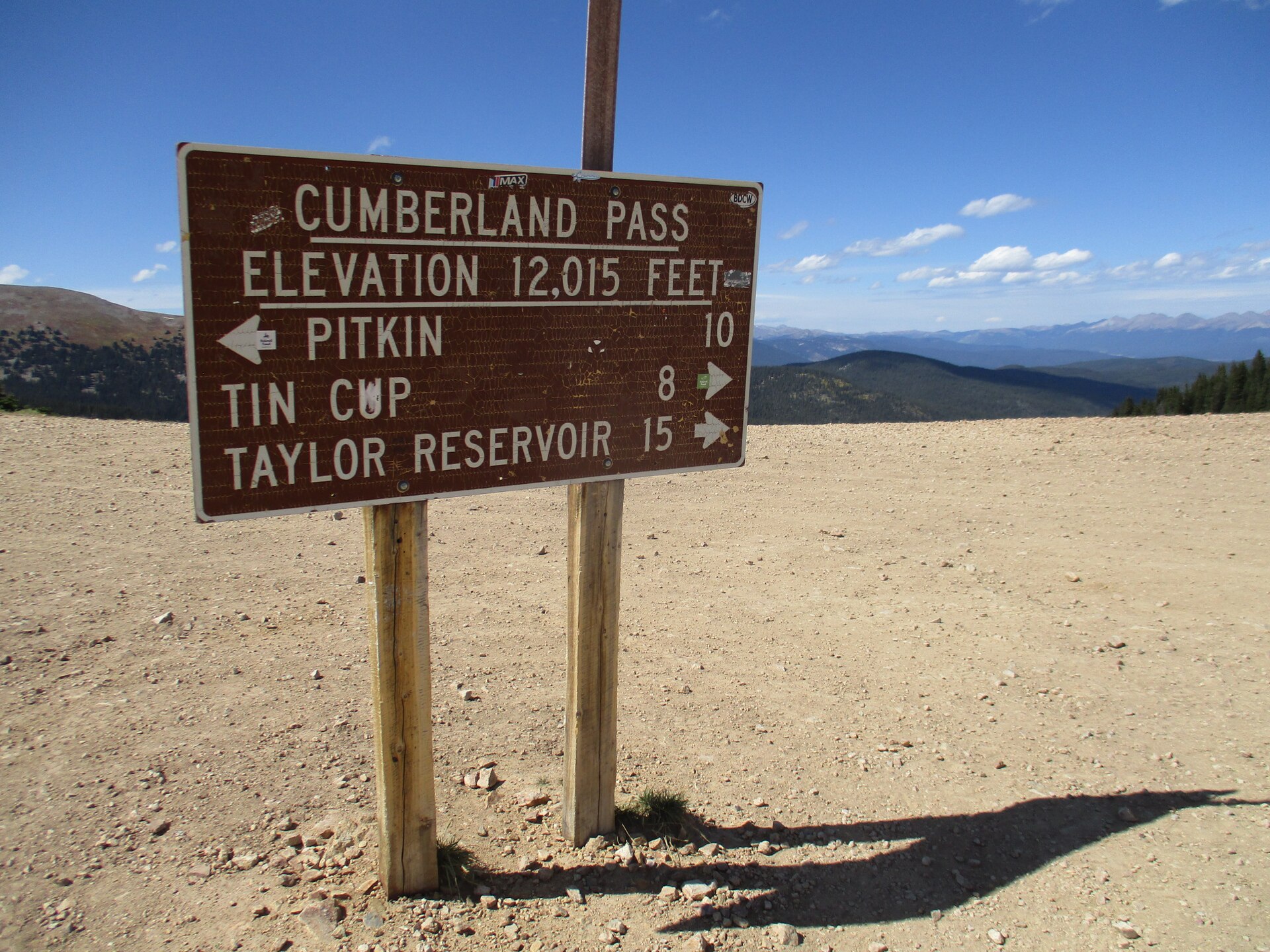
The sign on Cumberland Pass, 8 miles south of Tin Cup, 2019.Photo: John Sowell, CC BY-SA 4.0, via Wikimedia Commons
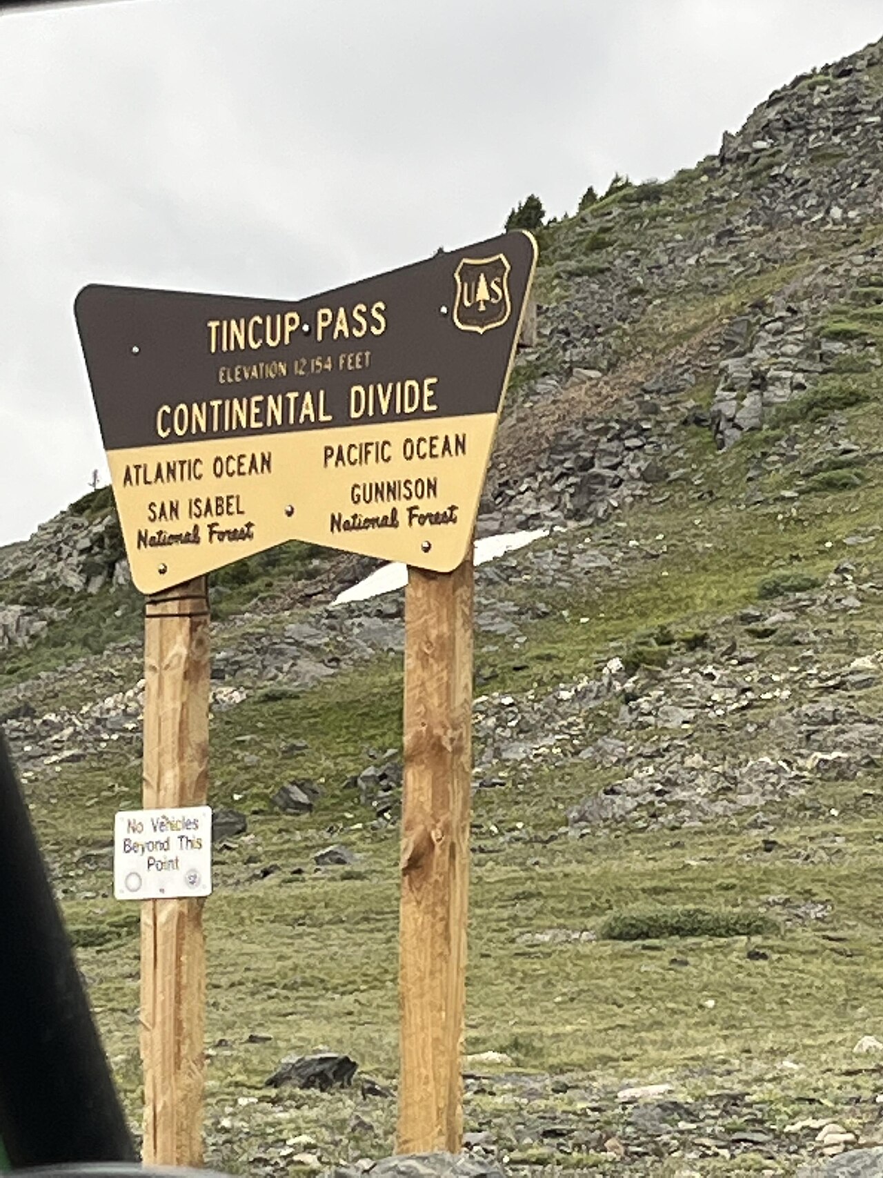
The Continental Divide at Tincup Pass, on the old road to St. Elmo, 2022.Photo: Yves Retailleau, CC BY-SA 4.0, via Wikimedia Commons
Approximate location of Tin Cup, about 10 miles south of Taylor Park Reservoir in Gunnison County.
Historic sites nearby
St. Elmo, CO
~12 miles east over Tincup Pass (4WD), also on this site
Tin Cup’s old supply route · well-preserved main street
Pitkin, CO
~16 to 18 miles south over Cumberland Pass
1879 mining town · still lived in, summer services
Alpine Tunnel
~8 miles southeast in a straight line, farther by road
1881 railroad tunnel at 11,523 feet · stone Palisades wall
Hancock, CO
~10 miles southeast in a straight line, also on this site
Railroad camp below the Alpine Tunnel · foundations
Woodstock, CO
~11 miles south in a straight line, also on this site
Section camp below the Palisades · 1884 avalanche
Winfield, CO
~16 miles straight line, across the Sawatch, also on this site
1880s silver camp at the head of Clear Creek · schoolhouse museum
Ohio City, CO
~23 miles south by road
Gold and silver camp of the 1880s on Quartz Creek
Mirror Lake
~3 miles east
Alpine lake and campground on the Tincup Pass road
Further reading
Books and records about Tin Cup and its district
Colorado’s Alluring Tin Cup: The District, Its Settlements, People, Mines
Conrad F. Schader · Regio Alta Publications, 1992 — the fullest history of the town and district
The Geology and Ore Deposits of the Tincup Mining District, Gunnison County, Colorado
E. N. Goddard · Proceedings of the Colorado Scientific Society, vol. 13, no. 10, 1936
Geology and Ore Deposits of the Garfield Quadrangle, Colorado
M. G. Dings and C. S. Robinson · U.S. Geological Survey Professional Paper 289, 1957
Stampede to Timberline: The Ghost Towns and Mining Camps of Colorado
Muriel Sibell Wolle · Boulder, 1949
Gunnison Country
Betty Wallace · Sage Books, 1960
Tin Cup ColoradoColoradoColorado Ghost TownsGhost TownLiving Ghost TownSilver MiningGold MiningGunnison CountyTaylor ParkTincup PassCumberland PassSt. ElmoContinental Divide