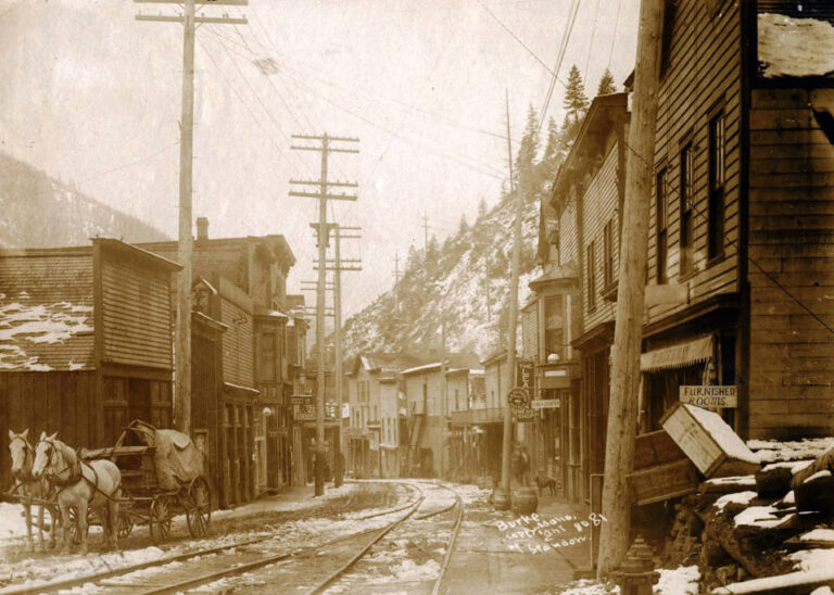
Black-and-white panorama of the Stateline mining camp in snow, with buildings spread across a flat below a wooded mountain slope

Stateline, Utah: A Gold Camp on the Nevada Line
Quick facts
What it isA gold and silver camp whose stone cabin walls, mine dumps and cemetery remain
First discoveries1894; the rush began in 1896
Main minesOphir (also spelled Ofer), Johnny and Creole
Peak populationAbout 200 to 300 around 1903
NewspaperThe Stateline Oracle
Post office1896 to 1938
Population in 1918About 18
Last mill closed1984, by the EPA
LocationAbout 38.00°N, 114.01°W, in far western Iron County, Utah
State / CountyUtah / Iron County
⚠ High-clearance vehicle needed · No services or cell signal · Open mine workings and unstable walls · Active mining claims nearby · Remove nothing
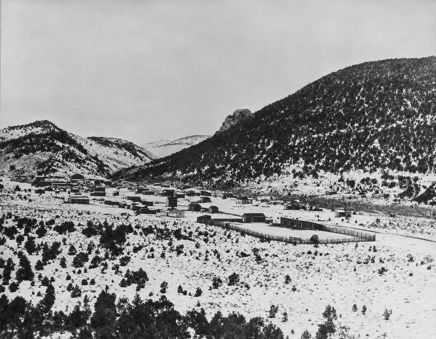
Black-and-white panorama of the Stateline mining camp in snow, with buildings spread across a flat below a wooded mountain slope
Stateline, Utah, in snow, about 1900 to 1905. Photo: Utah State Historical Society. Sharpened with AI.

Stateline sits in a canyon at the far western edge of Iron County, Utah, a short distance from the Nevada border. For about a decade after 1896 it was a real mining town, with stores, saloons, a school, a doctor, a hotel, mills and a newspaper that liked a fight. Then the rich surface ore ran out and the managers fell out with each other, and the camp emptied. By 1918 only about 18 people were left. Today the ruins are low stone walls, mine dumps, rusted machinery and a cemetery that people still look after.

Gold in the canyon

Prospectors turned up gold and silver outcrops in Stateline Canyon in the early to mid-1890s, and small-scale work began in 1894. The real rush came in 1896, when rich, shallow, oxidized veins were struck at the Ophir mine. The Stateline Mining District was organized that year, and word of the strike spread quickly through mining journals and Utah newspapers. According to one account, a townsite called Line City was laid out in July 1896, with empty lots selling for $100 each. By late September more than 180 men were working in the mines and 17 houses stood, with dozens more going up. The post office was authorized the same year.

The district lies in volcanic country. The veins run through welded tuff, rhyolite and andesite, and the gold and silver occur finely mixed in quartz, calcite and a mineral called adularia, or bound up in telluride minerals. Near the surface, weathering had enriched the ore, which made the early mining very profitable. Deeper down, the ore changed to harder-to-process sulfides with much lower values, and that change helped end the boom.

On the camp’s start: Sources give the first discoveries as 1894 or the early 1890s, and 1896 for the Ophir strike and the formal organization of the district. The name “Line City” and the $100 lot price come from a single account citing a mining journal of the time, so treat them as likely but not confirmed.

The camp at its height

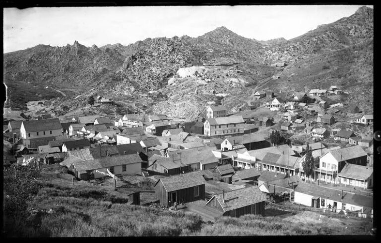
The census of 1900 counted 118 people, enough families with children to justify a schoolhouse. Around 1903 the population is estimated at 200 to 300. The camp stretched about a mile along the canyon and by then had moved from tents to false-front wooden stores and neatly laid stone cabins. Accounts list two or three general stores, two saloons, a blacksmith, a shoemaker, a restaurant, a doctor and a hotel.

The Stateline Oracle was edited by H. Stevenson, who had a reputation for combative editorials. He traded public jabs with the editor of the Iron County Record in Cedar City and defended the moral standing of the mining camp against the more settled Mormon farming towns to the east. Social life was lively. One account describes a Thanksgiving masquerade ball in 1903 that drew people from the neighboring camp of Fay, Nevada, with music and dancing late into the night.

On the population: The 1900 figure of 118 comes from the census. The 200 to 300 estimate for about 1903 is from later accounts and varies by source. Figures for 1910 (35 people in the Stateline precinct) and 1918 (about 18) are also from later accounts, so all of the numbers here are approximate.

Mines, mills and the long haul from Modena

Three mines carried the camp. The Johnny, at about 7,200 feet, was the best of them and a steady dividend payer. The Ophir (spelled Ofer on later maps) started the rush. The Creole, in the northeast part of the district, was said to be so rich that in 1899 its owners panned the waste dump for gold. Other veins, including the Big 14, were worked too.

Much of the gold was too fine, or too tied up in telluride minerals, for simple gravity separation. Investors built a 10-stamp mill with a cyanide plant at the Johnny. A stamp mill used heavy iron stamps driven by a camshaft to pound the ore to powder, and the cyanide solution then dissolved the gold out of it. A photograph of the camp from about 1900 to 1905 records three mills, the Big 14, the Johnnie and the Ophir, with a stagecoach corral in the foreground. An 1898 newspaper report mentions a mill called the Popkees running Creole ore.

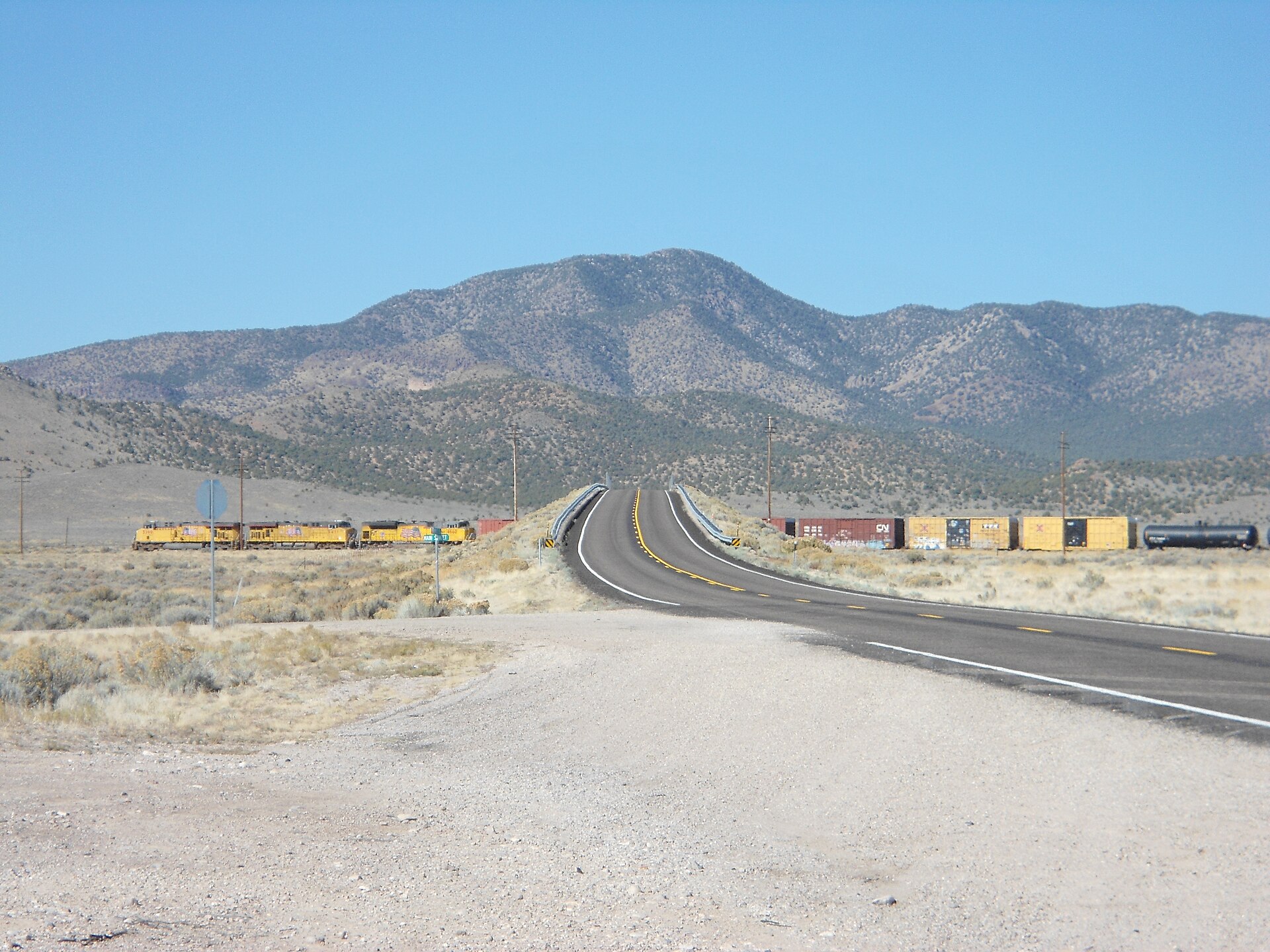
Everything had to come in by wagon. The nearest railroad was the Union Pacific at Modena, roughly 15 miles south, and teams of horses and mules hauled boilers, stamps and cyanide vats up the washouts of Modena Canyon. Water was just as hard to find. Mills use a great deal of it, springs were scarce, and whoever held the springs held the town. That led to claim jumping and lawsuits, and it forced mills to stop when creeks ran dry.
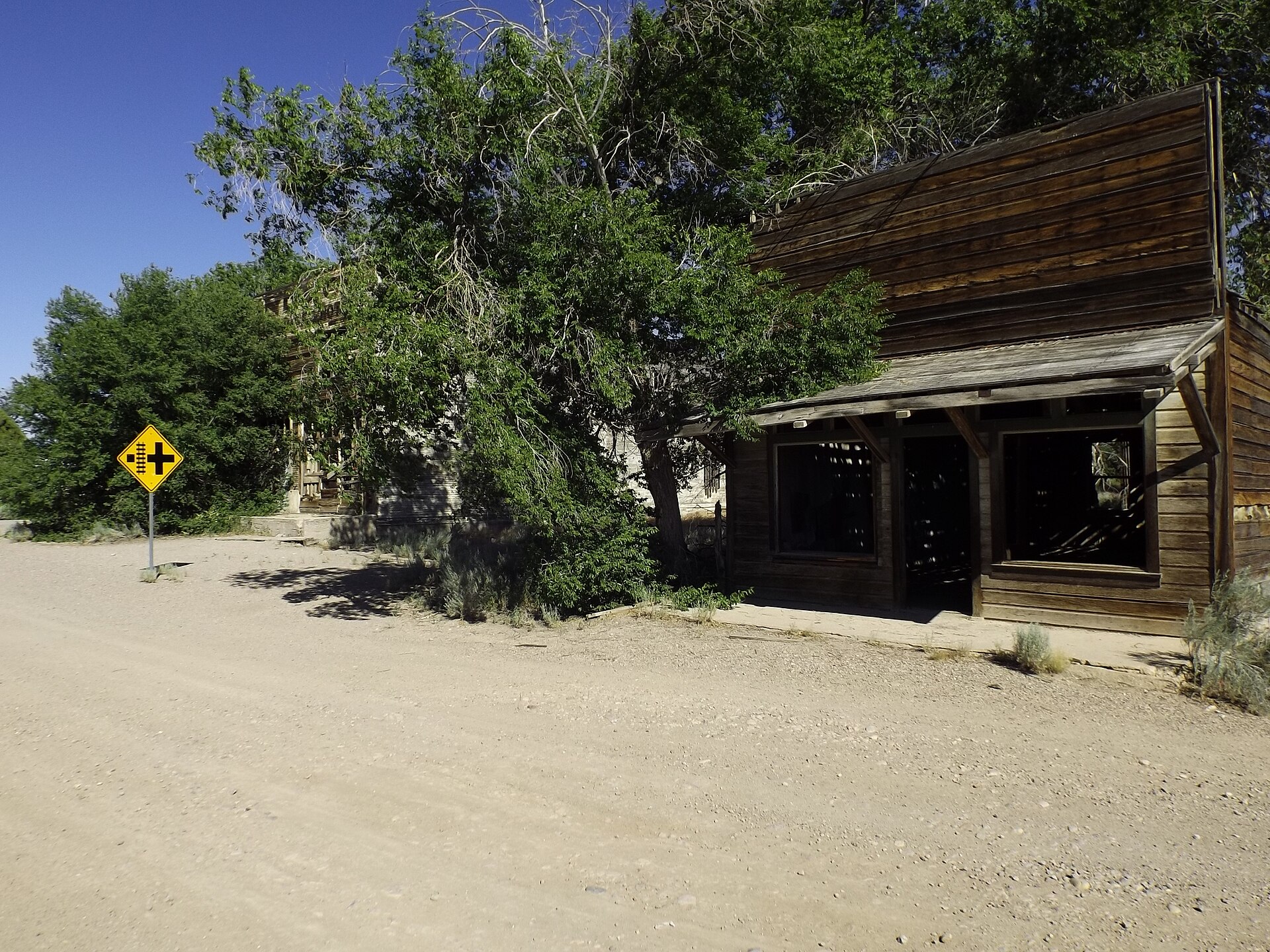
Weathered wooden false-front building on a dirt street in Modena, Utah, with a cottonwood tree and a road sign
Abandoned buildings on Center Street in Modena, the railhead for Stateline freight.Photo: The Utahraptor, via Wikimedia Commons, CC BY-SA 4.0
Union Pacific freight trains on the main line at Modena, Utah, beside a highway with a mountain behind
Union Pacific trains at Modena, still on the main line that served the camp.Photo: Hänsel und Gretel, via Wikimedia Commons, CC BY-SA 3.0
On the mills: Accounts name the mills differently. The photograph caption lists Big 14, Johnnie and Ophir mills. A trade account describes a 10-stamp mill and cyanide plant at the Johnny, and the Popkees mill appears in an 1898 report. They may be different names for the same plants or separate ones, so the exact number and ownership of the mills is uncertain.

Why it failed

By 1905 the easily milled oxidized ore was largely gone. As the mines followed the veins deeper they met sulfide ore that cost more to treat and paid less per ton. Management made things worse. In March 1908 the Salt Lake Mining Review reported that both the Ophir and Johnny mills were idle. It blamed “bad management or lack of harmony” and said the Johnny mine was not exhausted but tied up by internal disputes.

Without payrolls, the town drained away. The 1910 census found 35 people in the whole Stateline precinct, and by 1918 about 18 were left, scraping along on small leases and lesser claims. Iron County tax ledgers filled up with delinquent names. In May 1924 the county clerk told the State Board of Health that no one was living at Stateline at that time.

After the boom

The post office kept serving a handful of ranchers until 1938. In June 1936, with gold prices up, 65 miners and stockmen asked Iron County to grade the rutted road to Modena. Nothing like the old boom came of it. In the 21st century an exploration company has mapped and drilled the district’s veins, describing it as a gold and silver vein district of more than 40 square kilometers, on BLM land where drilling permits are straightforward. The last industrial activity at the townsite came in 1984, when a small modern mill on the hill above the old camp, trying to recover gold from old tailings with cyanide vats, was shut down by the Environmental Protection Agency over how it handled cyanide solutions. The surrounding country went back to open-range cattle grazing.

Rustlers on the line

The canyons around Stateline were good cover for cattle thieves. According to local tradition, rustlers drove stolen Utah stock west through the canyon to feed the mining camps of Nevada, where officials had little interest in stopping them. The best-known story is of Nate Hansen, an alleged cattle thief and stagecoach robber, who is said to have been caught by a posse of Utah cattlemen and a deputy marshal as he drove forty or fifty stolen cattle up the canyon. In the telling, he was shot dead a few hundred yards from the Nevada line.

On the Nate Hansen story: The account of Hansen’s death appears in a single local history and has not been confirmed in the records we looked at. Treat it, and the idea that officials looked the other way, as local tradition rather than documented history. Other claimed robberies and shootouts at Stateline are not documented at all.

Fire on the canyon

In July 2020 the Big Summit Fire, started by lightning in Lincoln County, Nevada, spread east across the line and forced evacuations in Iron County. Recent visitor accounts say the fire burned through the Stateline townsite and that you can still see where it passed, and the stone walls survived. Afterward, the Bureau of Land Management reseeded burned slopes in the area and fenced streams to protect new growth.

On the fire and the mill: Accounts disagree about what burned. One says the fire destroyed the last wooden mill structure on the hill above the camp, which was later removed for safety. Others describe only burned woods and stone ruins, and the mill closed in 1984 is a separate, small modern one. We could not confirm which buildings were lost, so check with the BLM before visiting for what remains.

Timeline

1894
Gold and silver are found in Stateline Canyon.
1896
The Ophir strike starts the rush; the mining district is organized and the post office opens.
1898–1899
The Creole mine is producing; mills are running Creole ore.
1900
The census counts 118 residents.
About 1903
Peak population, about 200 to 300; the Stateline Oracle is publishing.
1905
The rich oxidized ore is largely used up.
1908
The Ophir and Johnny mills sit idle amid management disputes.
1910
Only 35 people are counted in the precinct.
1918
About 18 people remain.
1924
The county clerk reports that no one is living at Stateline.
1938
The post office closes.
1984
The EPA shuts down a small cyanide mill above the townsite.
July 2020
The Big Summit Fire burns through the area.
Visit guide — Stateline, Utah
Can you visit?Yes. There is no fee and no seasonal closure beyond snow and mud. The townsite is mostly on BLM public land, but active private mining claims are mixed in.
Getting thereFrom Modena on Utah Highway 56, take Modena Canyon Road north, about 13 miles on the main gravel road, then northwest on unimproved tracks for another 4 to 5 miles into Stateline Canyon. Another route runs from Highway 56 north on Hamlin Valley Road and west on a gravel branch. Distances vary by source, so use a current map.
CoordinatesAbout 38.00°N, 114.01°W. Approximate.
VehicleHigh clearance is a must, and four-wheel drive if it is wet. The roads are littered with sharp volcanic rock, so carry a full-size spare and a plug kit.
Road conditionsThe road crosses deep gravel washes that blow out in spring runoff or after summer storms. Call the BLM Cedar City Field Office for current conditions before you go.
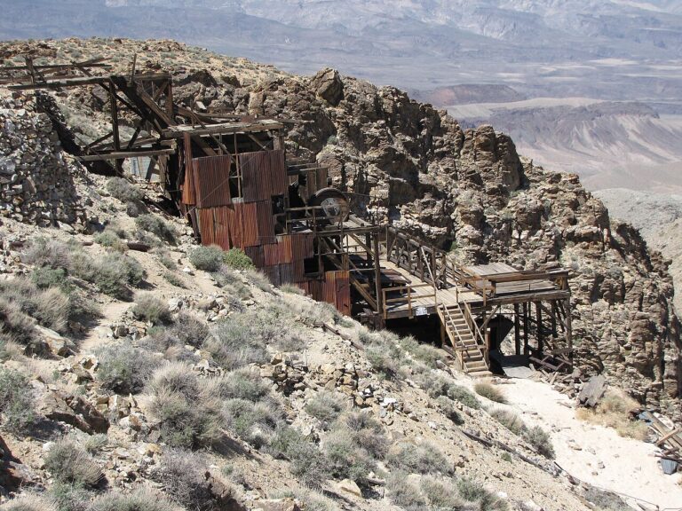
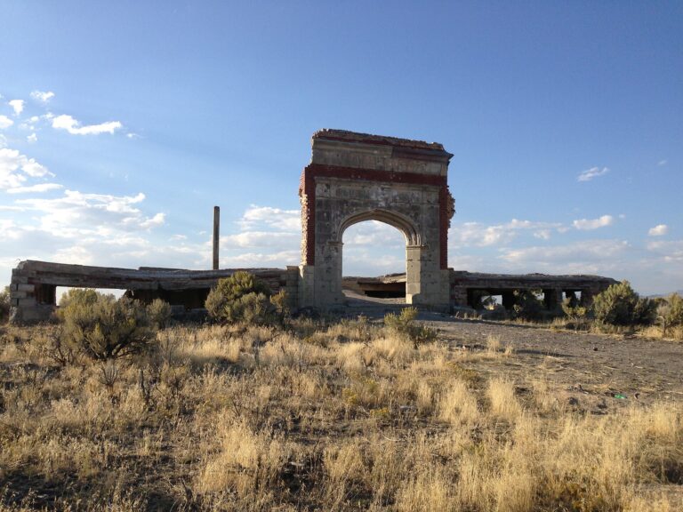
What to seeStone cabin walls and foundations, mine dumps, rusted machinery, old mill sites, grated shafts, and a well-kept cemetery just outside the main townsite. Some graves have carved stones; others are marked by plain fieldstones.
ServicesNone. There is no cell service in the canyon and no visitor facilities or signs. Bring water, fuel, offline maps and a satellite messenger.
Land statusBLM land with patented private claims. Obey all No Trespassing signs, and note that modern exploration drilling may be under way nearby.
Mine hazards: Some shafts have been covered with metal grates, but unmarked open stopes, collapsing adits and brush-hidden shafts remain on the hillsides. Do not enter any mine workings. Walls and roofs can fall, and rattlesnakes shelter in the cabin ruins and dumps in summer.
Respect the ground: Digging, metal detecting and collecting artifacts are prohibited by state and federal law. Be careful in the cemetery, and take only photographs.
Approximate location of the Stateline townsite in western Iron County, Utah, near the Nevada border.

Historic sites nearby

On distances: Sources disagree on distances and directions for several of these places, so the figures below are rough.
Modena, UT
~15 miles south
Union Pacific railhead for Stateline freight · Near-ghost town with old railroad buildings
Gold Springs, UT
Adjoining to ~10 miles south
Mining district founded in 1897 · A few cabins and a springhouse
Fay, NV
~6 miles west
Sister camp across the line, founded in 1901 · Scattered remains
Deer Lodge, NV
~6 miles west
Mining camp tied to Fay and Stateline · Reached by dirt tracks

Further reading

Books, studies and records about Stateline
A History of Iron County
Janet Burton Seegmiller, Utah Centennial County History Series, 1998 — Puts the mining boom in the context of Mormon settlement.
Reconnaissance Study of the Stateline Mining District
K. C. Thomson and L. I. Perry, 1975 — The geological survey of the district’s veins and rocks.
Stateline Mining District records transcript, 1896–1897
Utah Division of Archives and Records Service, Series 23969 — Claim notices, deeds and powers of attorney from the district’s first year.
Stateline UtahIron CountyModena UtahGold MiningSilver MiningUtahUtah Ghost Towns

Sources

Forgotten Nevada — Stateline, Utah

Utah Division of Archives and Records Service — Series 23969, Stateline Mining District records

Ghosttowns.com — Stateline

Star 98 — Visit a burned-out ghost town on the Utah-Nevada line

KSL — Big Summit Fire updates

Utah Watershed Restoration Initiative — Big Summit Fire restoration

KA Gold — Stateline project

Utah Centennial County History Series — Iron County (1998)

Historic photograph of Stateline, about 1900–1905: Utah State Historical Society. Photos of Modena: The Utahraptor, CC BY-SA 4.0; Hänsel und Gretel, CC BY-SA 3.0. Both via Wikimedia Commons.
Similar Posts

Leave a Reply

Your email address will not be published. Required fields are marked *