Boston Terrace, Utah: The Waterless Copper Camp in the Newfoundland Mountains
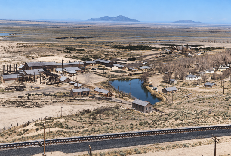
Boston Terrace is a copper and silver mining camp high on the western slope of the Newfoundland Mountains in Box Elder County, Utah. It sits in an austere bowl called Miners Basin, above the salt and mud flats of the Great Salt Lake Desert, about as far from anywhere as a Utah mining camp could be. It was never a real town. It was never incorporated and had no streets or school, and popular accounts put its workforce between 30 and 100 at the busiest. What it has instead is rare: a stone structure, timbered mine openings and rusting metal that the desert has left largely undisturbed.
No historic photographs of the camp turned up in this research, so this page has no images. The ruins and the paper trail of company filings are the main record.
Where Boston Terrace sits
The Newfoundland Mountains are an isolated, north-south desert range about 20 miles long, mostly 3 miles wide and up to about 5 miles wide in the northeast. The high point, Desert Peak, stands at 7,005 feet, roughly 3,000 feet above the playa. During the late Pleistocene the range was an island in ancient Lake Bonneville, and wave-cut shoreline benches from that lake can still be seen along the lower foothills.
The rocks explain why prospectors came. Steeply tilted Paleozoic limestones and dolomites were intruded by a mass of quartz monzonite and granodiorite called the Newfoundland Stock. Hot fluids from the cooling intrusion worked into the surrounding limestone and left copper, silver-bearing lead, bismuth, molybdenum and tungsten. Where the veins weathered at the surface, they stained the hillsides with green malachite and blue azurite, which made the ore easy to spot.
The first rush
Prospecting in the Newfoundlands began in the 1860s. The Box Elder Mining District was organized in 1866 and the separate Newfoundland Mining District in 1872. Sources disagree on when prospectors first arrived; one local history gives 1871, which sits awkwardly with the 1866 organization date. The first settlement of any kind was Knowltonsburg, a small camp near a pass known as The Saddle, close to Miners Basin. It was named for Chris Knowlton, a Grantsville prospector and promoter who staked many of the district’s early claims.
The distance to a railroad and the cost of freighting ore across the mud flats were heavy burdens for the metal prices of the time, and the early rush faded into occasional claim-holding work.
The Boston & Terrace Mining Company
Higher metal prices around the turn of the twentieth century revived the range, and ore was moving by about 1900. The Boston & Terrace Mining Company consolidated claims in Miners Basin and gave the camp its name. Company filings from 1902 and 1904 and Salt Lake Mining Review coverage from 1902 to 1904 document its activity. Popular accounts add eastern financing tied to Boston and field offices at Lucin and Terrace, which fits the company name but which I could not confirm in a primary source.
In 1905 the Copper Handbook listed the property with 11 producing claims, yielding copper, lead, silver, bismuth, tungsten, molybdenum and gold. Housing was whatever could be built or dug: tents, shanties, dugouts in the slopes and a few dry-stacked stone cabins. Boston Terrace was the largest mining area in the range, but it never grew past a camp.
Later revivals
Mining returned in fits. Salt Lake Mining Review articles from 1924 follow new underground work in the range. In the 1950s the prospector and author George A. Thompson worked the Newfoundlands, and he wrote about them in Old West magazine in 1967 and in Some Dreams Die. Wartime and Cold War demand for strategic minerals, tungsten and uranium, drew exploration in the same era, including work at the Sun Uranium prospect. For about 50 years after the early boom the mines produced only trace amounts of precious metals, and commercial mining had ended by the 1970s.
Total production was modest next to Utah’s great districts such as Tintic, Park City or Bingham Canyon. Ore came in pockets rather than continuous veins.
Life without water
Water shaped everything here. The Newfoundland Mountains have no perennial streams, and the few seeps produce little more than salty puddles. Any camp had to haul its water in, and popular accounts describe barrels carried by wagon across the flats from springs or railroad sources at a cost close to that of hauling the ore. I did not find a primary source for the exact distances sometimes given, so I have left them out. Today the only dependable water in the range comes from artificial wildlife catchments built for bighorn sheep.
Transport was nearly as hard. The railroad was the only practical outlet, and the muddy, alkali flats between the range and the tracks could stop a wagon team for much of the year. Today the range is reached only over the Union Pacific causeway and rail-adjacent roads, and the old freight routes are gone.
What remains
The dry climate and sheer remoteness have kept a surprising amount intact. Descriptions from visitors agree on a few things:
A rock structure. A freestanding stone building of undressed rock stands at Boston Terrace. Its roof is gone, and hand-leveled pads, retaining walls and hillside hollows surround it. Whether it is the same place as the “Stone House” mine named in state records is not established.
Mine openings and dumps. Timbered adits, shafts and waste-rock fans stained by copper surround the basin. Old timbers and drill steel can still be found.
Metal and machinery. Compressor parts, boiler plate, stovepipe and abandoned vehicle chassis from later prospecting are reported scattered around the basin and washes. Condition and exact items vary by report, and I could not confirm any single item.
Dells Canyon tramway. A separate site, Dells Canyon, has the remains of an aerial tramway, with an ore trolley still hanging over the canyon. Sources disagree on which side of the range the canyon lies, so check a current map before assuming it is close to Miners Basin.
Legends of the Newfoundlands
The Lost Swedes. Folklore says the early Swedish prospectors found silver so rich it was cut out in sheets with axes, then died of exposure crossing the flats, and the lode was never found again. Versions differ, and the geology supports lead, silver and copper, not a bonanza. It is a classic western lost-mine tale.
Winter isolation. This part is better supported. Thompson and other prospectors described storms that cut the range off for weeks, with snow melted for water and supplies rationed until the flats froze hard enough to drive on.
“Area 52.” The southern end of the range lies inside the Utah Test and Training Range, and desert lore has given the area the nickname “Area 52,” with rumors of hidden complexes and strange lights. The ordinary explanation is the military flights and test activity over the neighboring desert.
Timeline
Historic sites nearby
Further reading
Sources
Expedition Utah — The Mines & Camps of the Newfoundland Mountains (2013) — district dates, Boston Terrace, Knowltonsburg, Dells Canyon and access
Wikipedia — Newfoundland Mountains — range size, Desert Peak elevation and the military range boundary
Utah Geological Survey — Bulletin 115, Geology and Mineral Resources of Box Elder County (1980)
The Trek Planner — Newfoundland Mountains East Mines — eastside mines, hazards and the lack of water
Utah Geological Survey — Picture of the Day, Newfoundland Mountains (2016) — range geology