Old American Falls, Idaho
Most ghost towns are abandoned. Old American Falls was evicted. It wasn’t a mining camp that ran out of ore or a rail stop that lost its line — it was a thriving town of more than fifteen hundred people, a county seat with brick storefronts, banks, hotels, churches, and grain elevators, that the federal government condemned, bought, and physically hauled uphill — building by building, on rollers and steam tractors — so the Snake River could be dammed and a reservoir could drown the ground it stood on. The move took about eighteen months in 1925 and 1926. Then the gates closed, and the old streets went under.
They never entirely stayed under. American Falls Reservoir is an irrigation-storage pool that rises and falls with the farming year, and most late summers the water pulls back far enough to lay the old town bare again — sidewalks, foundations, the outline of a vanished Main Street, and one enormous concrete grain elevator that was simply too solid to take with them. This is the documented history of that town and its move, and the legends worth separating from the record.
A falls, a trail, and a railroad
The place mattered long before there was a town. The falls themselves — a roughly fifty-foot drop over layered basalt — were carved by the catastrophic outburst of Pleistocene Lake Bonneville, and for thousands of years the Shoshone and Bannock peoples fished and camped along this stretch of the Snake. The name comes from an early fur-trade tragedy, in which a party of American trappers was swept over the cataract and lost their supplies — a grim contrast to “Canadian Falls,” today’s Shoshone Falls downstream. Wilson Price Hunt’s overland Astorians camped near the falls in 1811, John C. Frémont noted the cataract in 1843, and the Oregon and California trails funneled thousands of wagons through the river bottoms just north of the later townsite.
A permanent town came much later. The best federal history places sustained settlement around 1880: a ferry was running by 1881, a post office existed by 1882, and the Oregon Short Line — a Union Pacific subsidiary — made American Falls a head-of-rail construction camp as its line pushed across the Snake River country in 1882–83. The settlement was formally platted in 1886, and the railroad reorganized the town’s whole geometry, turning a river-and-trail crossing into a regional shipping and service center.
Grain, power, and a county of its own
By the early twentieth century, two things made American Falls boom: cheap electricity and dryland wheat. Entrepreneurs built low-head hydroelectric diversion plants on the river’s basalt channels in 1901–02, and in 1913 the Idaho legislature carved Power County out of Cassia and Oneida counties — naming it for that electrical infrastructure — and made American Falls the county seat. At the same time, the surrounding sagebrush plains were opened to homesteading, drawing German-Russian, Scandinavian, and Midwestern farm families who turned the arid benches into wheat country.
The railroad corridor filled with the machinery of a grain economy: six industrial grain elevators and a brick flour mill rose beside the tracks, making American Falls a major grain-shipping terminal for southern Idaho. By the 1920 federal census the town had reached 1,547 residents, with a downtown of brick-faced storefronts, banks, modern hotels, civic buildings, and settled neighborhoods.
Why Reclamation decided the town had to go
After the Reclamation Act of 1902, the federal Reclamation Service built the Minidoka Project across the Snake River Plain — Minidoka Dam (1909), Jackson Lake Dam (1916) — but a severe 1919 drought exposed how badly the system needed a big main-stem storage reservoir. In 1918 the Reclamation Service hired MIT geologist W. O. Crosby to evaluate a dozen dam sites; eleven were rejected for porous bedrock or inadequate storage, and American Falls was chosen as the one viable location — a broad, basalt-rimmed basin that could impound about 1.7 million acre-feet. The catch was unavoidable: the best reservoir would flood roughly three-quarters of American Falls and about 640 acres of the townsite. In September 1920 the Secretary of the Interior authorized the American Falls Dam, and twenty-one downstream irrigation districts signed on to help pay for it.
The project nearly died. In September 1921 Interior Secretary Albert B. Fall, alarmed by the cost and the loss of productive farmland, ordered work stopped and the project office closed. Idaho’s political leaders, irrigation interests, and Senator William E. Borah lobbied hard; local farmers and businessmen organized the American Falls Reservoir District, voters approved it in January 1923, and the district ultimately sold about $2.7 million in bonds — shifting much of the burden onto the local irrigators who would benefit. The drowning of American Falls, in other words, wasn’t a simple command from Washington; it was a bargain struck among federal policy, Idaho water politics, and local financing.
Moving a city uphill, 1925–26
Rather than simply abandon the community, Reclamation did something extraordinary: it planned and built a replacement city on about 300 acres of higher ground to the southeast, and moved the old one to it. The Bureau hired New Jersey planner Russell Van Nest Black, who laid out the new town on “Garden City” lines around a civic square — and, controversially, tilted the street grid diagonally to parallel the future reservoir shoreline and maximize sunlight. Citizens grumbled (“How will we teach our children north or south?”), but the plan gave the new city its enduring motto: “The City Where the Sun Shines in Every Window.”
The move itself was a feat of logistics. Reclamation’s records account for 329 properties; professional building-movers came from as far as Ohio and Texas; and a dedicated “Moving Road” was graded in February 1925, running from the old commercial core along a stretch of the historic Oregon Trail, across the dry dam abutment, and up to the new townsite. The first building hauled was the Theil Welding shop on January 22, 1925. Progress was slow at first — about twenty houses by late April — then accelerated through the summer as crews jacked buildings onto steel dollies and wooden rollers and dragged them uphill behind steam traction engines and tractors.
Some episodes became famous. In June 1925 the timber-framed St. John Lutheran Church stalled on its rollers over a weekend, so the congregation set boarding steps against the elevated threshold and held their full Sunday service while the building sat mid-move in the roadway — a scene that drew national press. The three-story Grand Hotel, the largest structure successfully moved, took about two weeks in September 1925. The sprawling Oregon Short Line depot was too wide for the road’s bends, so in July 1926 it was sawn in half, rolled uphill in two pieces, and reassembled. And the 1907 Walter Sparks House was moved to a premier lot by the new town square on October 7, 1925 — reportedly with its ivy intact enough to replant.
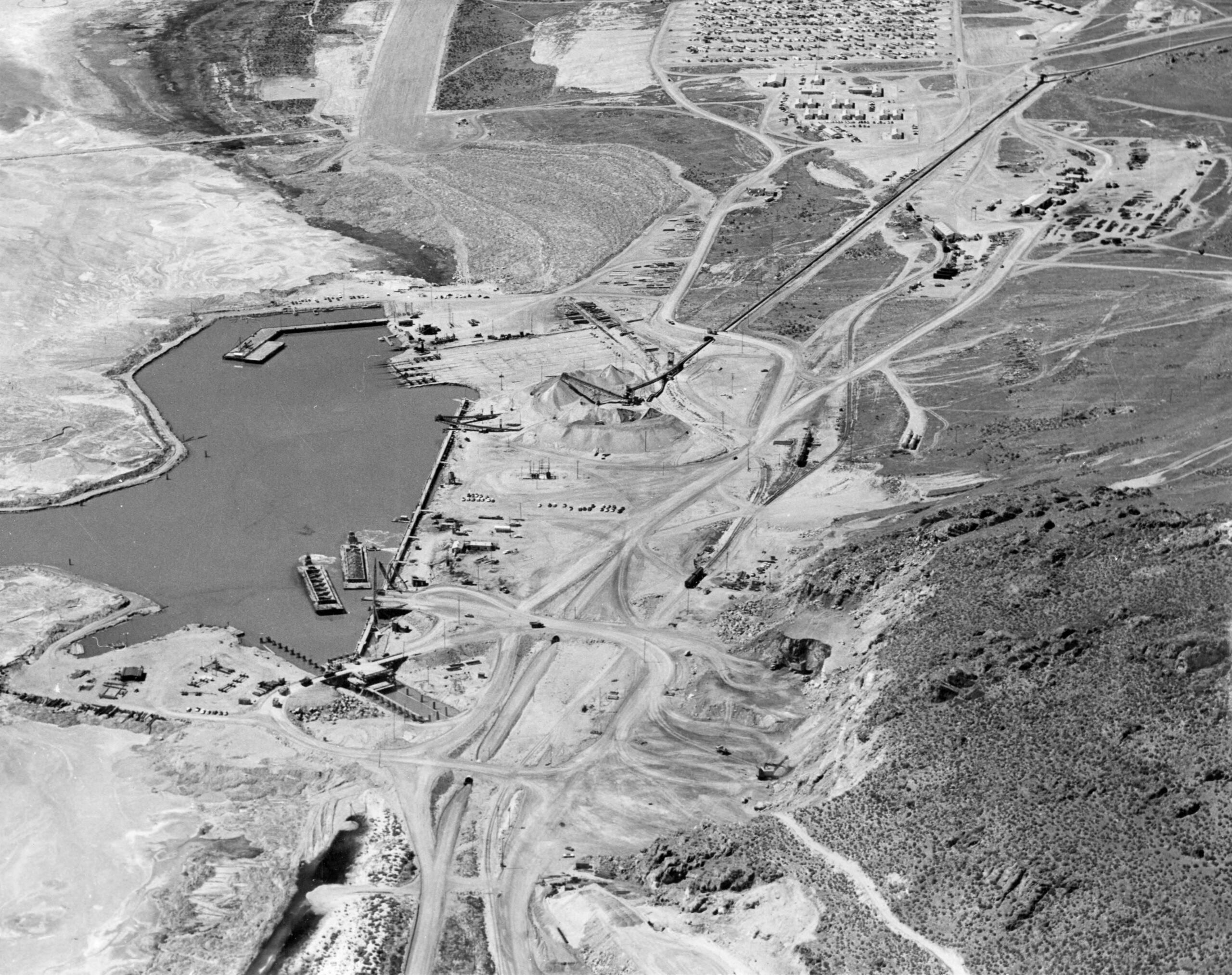
It became a race against the water. Project manager Frank A. Banks set a December 1, 1925 deadline, after which remaining non-grain structures on the reservoir floor would be forfeited for demolition. The dam — an 80-to-94-foot structure stretching 5,277 feet across the Snake — reached the point where its gates could close and storage could begin on April 21, 1926. A modest runoff that year bought the movers a little more time; the Moving Road was finally closed on July 29, 1926, the date the detailed federal history treats as the end of the relocation.
The drowned town today
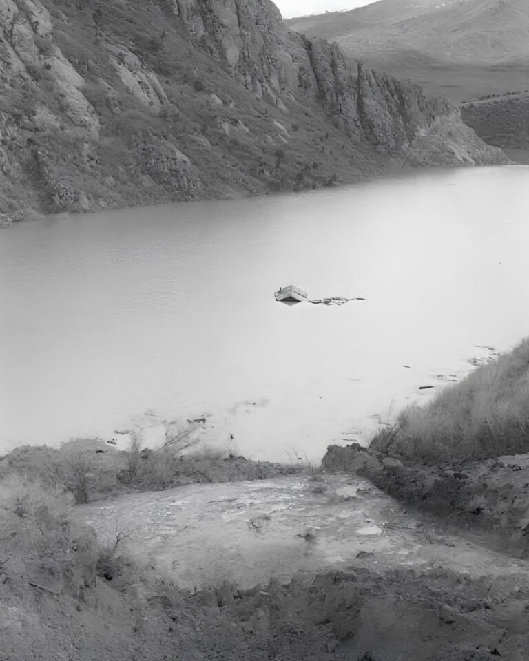
The reservoir did not erase American Falls as completely as a full-pool photograph suggests. Federal archaeology describes a surprisingly extensive submerged landscape — old street and lot patterns, concrete sidewalks, foundations, and building remains spread across the Original Townsite and the Kiers, Riverside, Imes, Union, and Union Acreage additions. The National Register inventory counted 17 business foundations in the old downtown; the Riverside Addition preserves a dense cluster of commercial foundations, church basements, a schoolhouse footing, and a hospital foundation; and the Kiers Addition still holds the three concrete stepped grandstands of the town ballpark. Decades of wave erosion have scoured away silt and topsoil, exposing the civic grid with almost cartographic precision — and the sidewalks still show the linear cracks gouged by the iron-wheeled moving rigs of 1925.
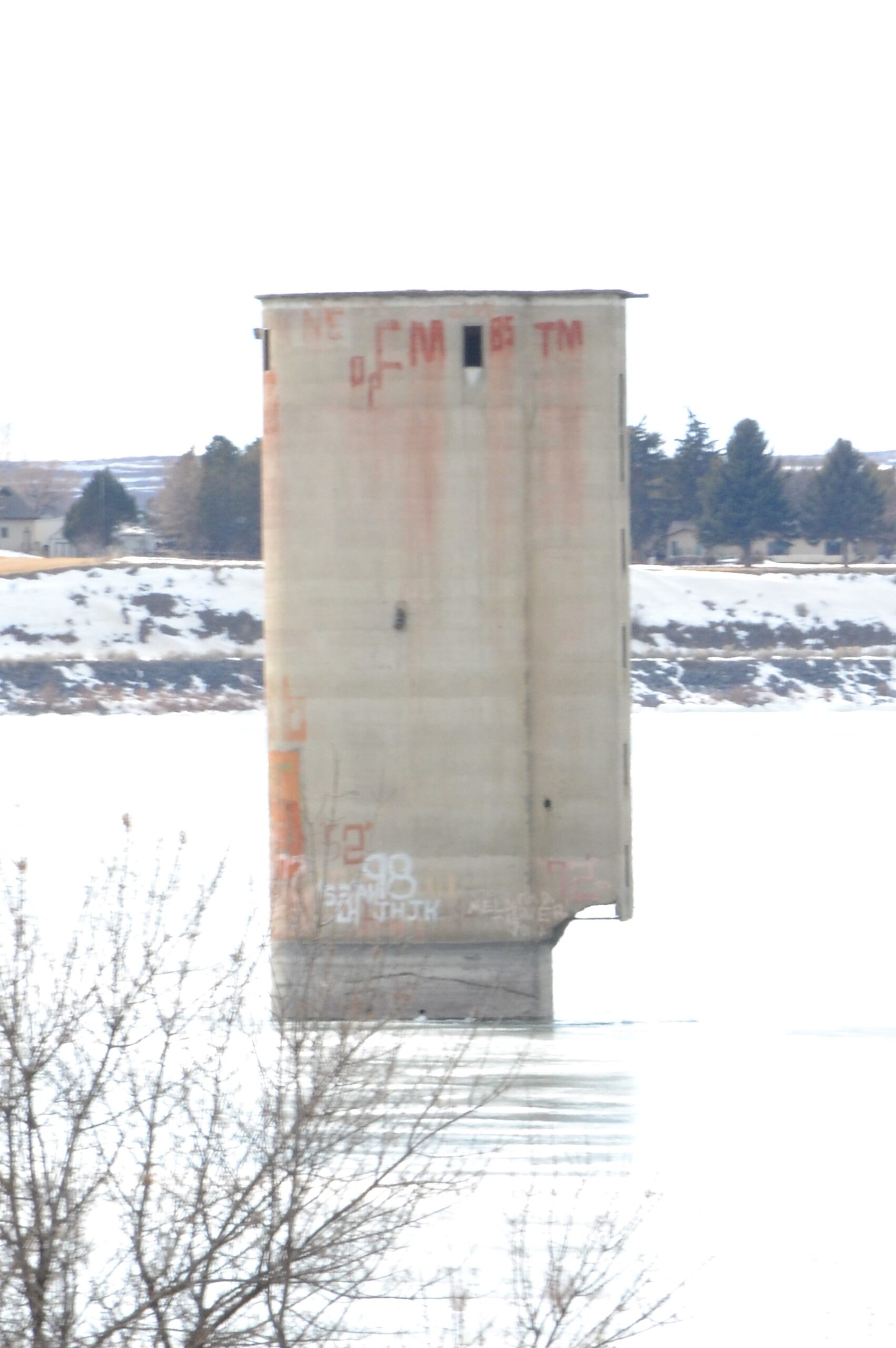
The one structure that went nowhere is the landmark. The Oneida Milling and Elevator Company grain elevator, built in 1912 of continuous-pour reinforced concrete — about 106 feet tall and 36 feet across — was judged uneconomical to move and too solid to safely blast. Reclamation stripped its wooden machinery sheds and loading docks in 1925 and left the bare concrete cylinder standing. It was listed individually on the National Register in 1993 and now rises offshore like a watermarked monument over the sunken town; the larger American Falls Reservoir Flooded Townsite was added to the Register in 2002. One last detail: the dam you see today isn’t the one that drowned the town — Reclamation found serious concrete deterioration in the 1960s and rebuilt the structure in the 1970s.
Timeline
Seeing Old American Falls now
There’s no gate, no fee, and no museum on the site — the town is on the bed of a working irrigation reservoir, so what you can see depends entirely on the water level, which changes year to year and even week to week. Autumn, after the summer irrigation drawdown, is usually the best time; in a low-water year like 2026, the foundations have been conspicuously exposed. Come to look and photograph — not to dig, drive, or climb.
Nearby historic sites & drowned places
Also within reach: the Minidoka National Historic Site (~55 mi W), the WWII Japanese-American incarceration camp tied into the same Snake River irrigation canals. For more ghost towns on the archive, see Bodie, Terrace, and Deadwood.
Further reading
Sources:
“American Falls Reservoir Flooded Townsite,” National Register of Historic Places nomination (listed 2002; NRIS 01001480) & “Oneida Milling and Elevator Company Grain Elevator” (listed 1993; NRIS 93000380) — NPGallery / Idaho SHPO, npgallery.nps.gov.
Eric A. Stene, The Minidoka Project, and American Falls Dam project history — U.S. Bureau of Reclamation, usbr.gov.
Brown v. United States, 263 U.S. 78 (1923) — supreme.justia.com.
Power County, Idaho, “Moving American Falls” & history pages — powercounty.gov; City of American Falls history; 1920 U.S. Census, Idaho.
Idaho State Historical Society / Idaho State Archives (Bureau of Reclamation relocation photographs; American Falls Press; Alfred Jenks oral history); “Oneida Milling and Elevator Company Grain Elevator,” Wikipedia; local reporting on the 2026 low-water exposure.
Photo credits: Hero, Oneida elevator — 25or6to4, CC BY-SA 4.0, via Wikimedia Commons.