Lucin, Utah
Lucin is a railroad town that moved twice. It began in 1869 as an end-of-track camp of the Central Pacific Railroad near Grouse Creek, at the foot of Utah’s Pilot Range. In 1875 the section station moved 1.7 miles east, and that spot became Lucin. When Southern Pacific built its famous Lucin Cutoff straight across the Great Salt Lake in 1902–1904, the name moved again, about a mile south to the new line, where piped mountain water fed ponds for steam engines. The railroad families left in 1936, the old 1869 line was torn up for wartime scrap in 1942, and today Lucin is a desert oasis of ponds and trees managed for wildlife, with one well-known neighbor living in an airplane hangar nearby.
A camp at the end of the track
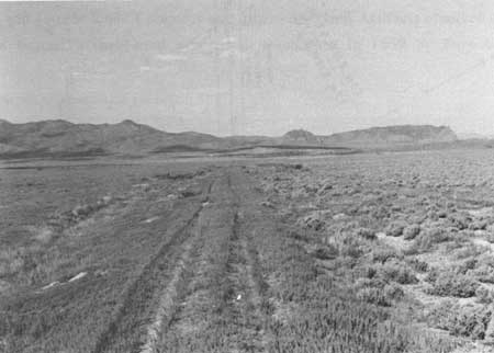
Central Pacific crews building east toward Promontory Summit put up a construction camp beside Grouse Creek in 1869, at milepost 678.8 measured from San Francisco. Railroad records of the time called it Lucin. Bureau of Land Management archaeologists later named the site Umbria, after the nearby switch, and found siding grades, dugout foundations and artifacts left by both Euro-American and Chinese railroad workers.
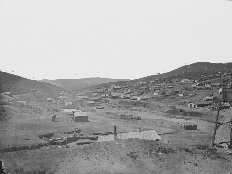
On July 6, 1875, the railroad moved its section facilities 1.7 miles east to milepost 680.5. This is the place now called Historic Lucin, or Old Lucin. According to the BLM, it had a foreman’s house and an old car body north of the tracks, and a section house and a house for Chinese workers south of them. Water for the station and its locomotives was brought in from Thousand Spring Valley near the Nevada line.
Where the name came from
Utah place-name references say Lucin was named for a fossil clam, Lucina subanta, found in the area. Older state sources were less sure and called the origin uncertain, so the fossil story is the usual explanation rather than a proven one.
The Lucin Cutoff
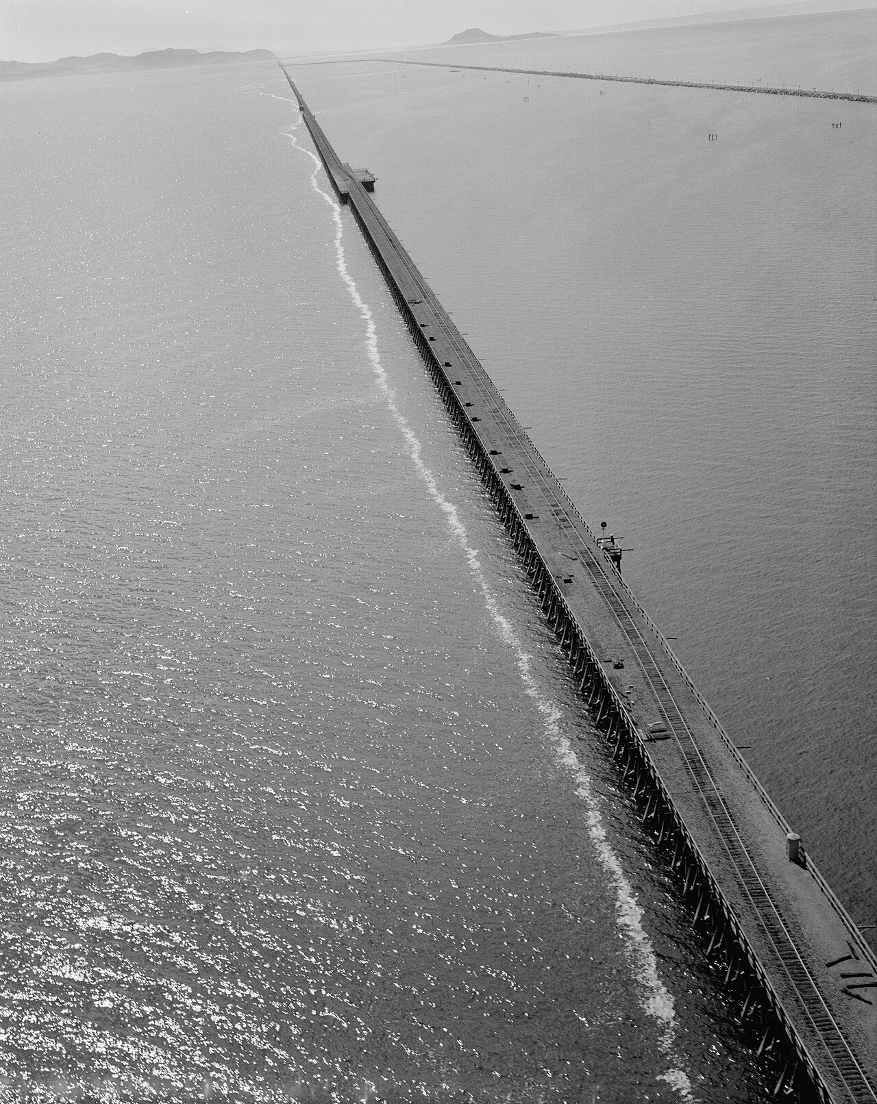
The original 1869 line looped north around the Great Salt Lake and climbed over the Promontory Mountains, with steep grades and sharp curves. After E. H. Harriman took control of Southern Pacific, the company decided to go straight across the lake instead. Planning began in 1899, the Ogden and Lucin Railroad was organized in 1900, and construction started in 1902 under chief engineer William Hood.
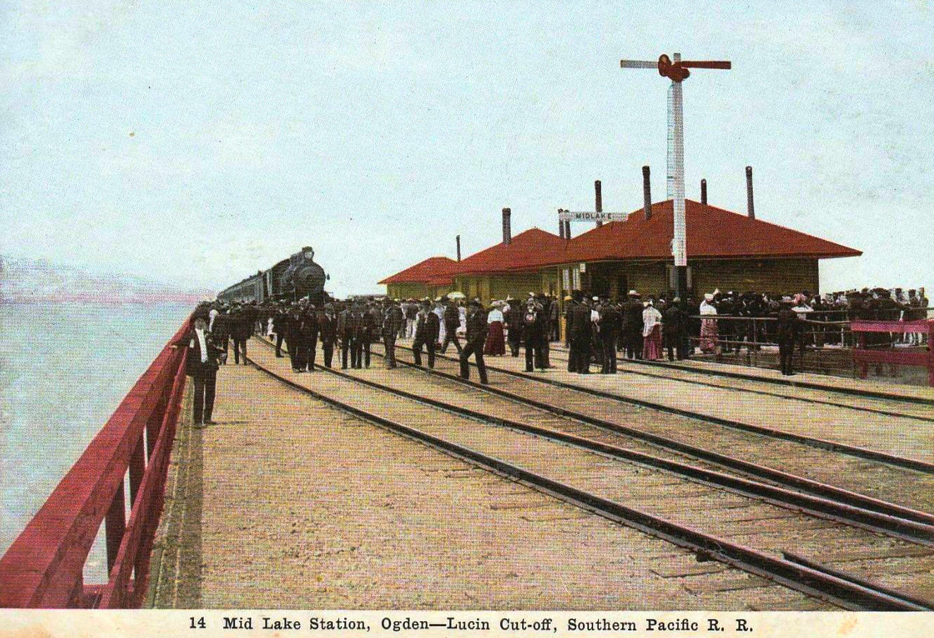
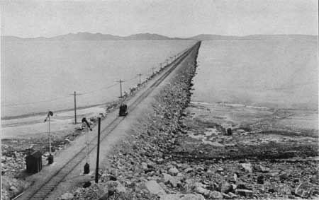
The new line ran about 102 miles from Ogden to Lucin. Most of the lake crossing was rock and earth fill, but the middle was a wooden trestle nearly 12 miles long, with a station called Midlake out on the water. Around 3,000 men worked on the project. The last rail was laid on November 13, 1903, freight trains began using the Cutoff on March 8, 1904, and passenger trains followed on September 18, 1904. The Cutoff made the route about 44 miles shorter and left the hard Promontory grades behind.
Lucin moves south
The Cutoff met the old line at Lucin, and in 1903–1904 Southern Pacific moved the Lucin name and its station about a mile south onto the new tracks. The old station at milepost 680.5 was renamed Grouse and was taken apart by 1907. The switch where the two lines joined was marked Umbria Junction on track maps. It had no buildings of its own.
The new Lucin was a water stop. A small pipeline brought water from the Pilot Range to reservoirs beside the tracks, where steam locomotives refilled before the long run east across the lake. The U.S. Geological Survey’s 1915 guide to the Overland Route described Lucin as a town of about 200 people with a store and a post office, and the starting point of a stage line north to Grouse Creek.
Decline and the end of the old line
With the main line on the Cutoff, the old route over Promontory became a quiet branch. Lucin’s railroad families moved away in 1936. On March 31, 1937, the Utah Public Service Commission let Southern Pacific drop trains on the western end of the branch, and only a few mixed trains ran on parts of it for the next couple of years.
On June 11, 1942, the Interstate Commerce Commission approved abandoning about 120 miles of the old line between Lucin and Corinne. On September 8, 1942, Utah Governor Herbert B. Maw led a ceremony at Promontory where a spike was pulled from the 1869 rails, and the steel went to military depots for the war effort.
Lucin itself did not empty out right away. Four retired railroad workers and their families are said to have lived there from 1937 until 1972. According to the BLM, the last houses were removed in 1990.
The oasis: Lucin Pond
The railroad’s reservoirs outlived the town. Fed by the old Pilot Range pipeline and shaded by tall trees, Lucin Pond is one of the few patches of water and green in this part of the Great Basin. The Utah Division of Wildlife Resources leased the land from Southern Pacific in 1999 and manages it for wildlife. Birders have recorded up to 118 species of songbirds here, many of them migrants stopping to rest. In 1989, 42 least chub, a small native fish, were moved into the pond, according to federal records.
Utahlite and the mineral world’s Lucin
Lucin’s name is also known to rock collectors. In 1909 Frank Edison and Edward Bird staked claims on a hill about three miles north-northwest of town and dug out nodules of green variscite, sold as “utahlite.” In 1916 the USGS mineralogist Waldemar T. Schaller named a Lucin mineral “lucinite,” but in 1925 it was shown to be ordinary variscite. The site is still the type locality for a related mineral, metavariscite.
Lucin’s modern resident
Lucin’s best-known modern story belongs to Ivo Zdarsky. On August 4, 1984, he took off before dawn from a field in Czechoslovakia in a homemade motorized trike with hang-glider wings and an engine from a Trabant car, crossed the Iron Curtain and landed at Vienna’s airport, where he asked for asylum. He moved to the United States and started the propeller company IVOPROP in California in 1986.
Zdarsky later bought land near Lucin and, by published accounts, moved there full time around 2007. He lives and works in an airplane hangar beside a private dirt airstrip listed by the FAA as Lucin Airport (02UT). In 2012 KSL described him as Lucin’s one resident.
What remains
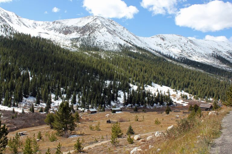
Very little of the railroad towns survives. At the later Lucin, the ponds, the old water line and the grove of large trees are the main sights. Box Elder County lists root cellars, two concrete telephone booths and an old ice box among the scraps left behind, and visitors report bits of concrete foundations. No cemetery is documented at Lucin. At Old Lucin and the 1869 Umbria camp there is only flat ground, old grades and BLM markers, and both sites have been badly damaged by illegal digging.
East of Old Lucin, the raised 1869 Central Pacific grade runs about 90 miles to Golden Spike National Historical Park. The BLM manages it as the Transcontinental Railroad Backcountry Byway, past the sites of Bovine, Terrace and Kelton. About four miles southeast of Lucin stands Nancy Holt’s land-art work Sun Tunnels (1973–1976).
Timeline
Historic sites nearby
Distances are approximate straight-line miles from Lucin. Driving distances are much longer.
Further reading
Sources
Bureau of Land Management — Rails East to Promontory: Umbria and Lucin; Transcontinental Railroad Backcountry Byway map
Historical Marker Database — Historic Lucin; Lucin (Utah DWR); Lucin Cutoff marker
Wikipedia — Lucin, Utah; Lucin Cutoff
Utah Rails — Southern Pacific in Utah; Utah Department of Cultural and Community Engagement — The Lucin Cutoff
Box Elder County — Lucin; USGS — Bulletin 612 (1915); Federal Register — Least chub status review (2010)
Utah Geological Survey — MP 99-6, Utahlite Hill
Smithsonian magazine — The man who pierced the Iron Curtain; KSL — The most interesting Utahn you’ll never meet; AirNav: Lucin Airport (02UT)
Holt/Smithson Foundation — Sun Tunnels; Dia Art Foundation — Visiting Sun Tunnels
Photos: Jack E. Boucher, National Park Service / HAER UT-13, Library of Congress (public domain); Bureau of Land Management (public domain); Dennison News Company postcard, c. 1907, via Wikimedia Commons (public domain in the US); Southern Pacific Company photo in USGS Bulletin 612 (public domain).