Independence, Colorado: The Gold Camp Below Independence Pass
ColoradoGold & Silver MiningLog ruins · Paved highway, summer only·~11 min read
Quick facts
What it is1879 gold camp, now stabilized log cabins and ruins
Gold strikeJuly 4, 1879, by tradition
Peak populationAbout 1,000 to 1,500 in 1882 (some sources say up to 2,000)
Other namesMammoth City, Mount Hope, Chipeta, Farwell, Sparkill
Post officesFarwell 1881–82, Sparkill 1882–87, Chipeta 1899
ElevationAbout 10,900 feet
Coordinates39.1072° N, 106.6059° W
LandWhite River National Forest, interpreted by the Aspen Historical Society
CountyPitkin County
StateColorado
⚠ Reachable only when Independence Pass is open, roughly late May to early November · No services · No dogs · Altitude near 11,000 feet
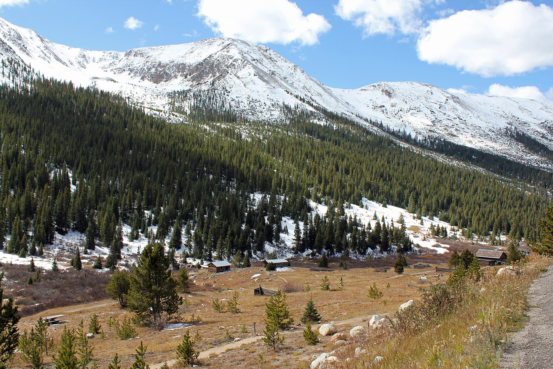
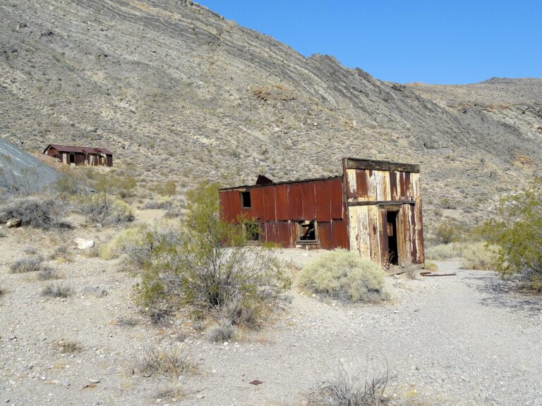
Independence sits in an open meadow on the upper Roaring Fork, below the Continental Divide. Photo: Jeffrey Beall, 2011, CC BY-SA 3.0
Independence was the first mining camp in Colorado’s Roaring Fork Valley, a gold town built at nearly 11,000 feet on the west side of the Continental Divide. Tradition says the strike was made on July 4, 1879, and the camp took its name from the date. By 1882 it held somewhere between 1,000 and 1,500 people, more than 40 businesses and a 30-stamp mill, but the rich ore near the surface gave out within a few years and the silver boom in Aspen drew nearly everyone down the valley. The last holdouts left in the winter of 1899, skiing out to Aspen on homemade skis. Today a scatter of log cabins, some stabilized and re-roofed, stands beside Colorado Highway 82 about 16 miles east of Aspen, cared for by the Aspen Historical Society and the U.S. Forest Service.
A Fourth of July gold strike
In 1879 Leadville was the richest silver camp in the country, and prospectors there were already pushing west over the Sawatch Range. The upper Roaring Fork had long been a Ute summer hunting ground. Within two years of the strike at Independence, after the violence at the White River Agency in the fall of 1879, the Utes were forced out of western Colorado altogether, and the valley was opened to miners and settlers.
The prospectors who crossed the high saddle then called Hunter’s Pass found gold-bearing quartz in the basin just below it. According to the story repeated by the Aspen Historical Society, the lode was found on Independence Day, July 4, 1879, which gave the claim, and then the camp, its name. Within months there were tents, then log cabins, and a mining district to record claims.
On who found the gold: Sources do not agree on the discoverer. Local legend credits a prospector named Billy Belden, while the 1972 National Register nomination lists Belden, Charles Bennett and Dick Irwin as candidates. The July 4 date itself is usually told as tradition rather than a recorded fact.
The boom years, 1880 to 1882
Money came from Leadville. The Farwell Consolidated Mining Company, formed by Leadville investors in 1879, bought the best claims, including the Independence lode, and built a stamp mill to crush the ore on site instead of hauling it over the Divide. The mill started with 15 stamps and was enlarged to 30 in 1881. It produced roughly $100,000 in gold that year, and the Aspen Historical Society puts the camp’s output for 1881 and 1882 at about $190,000.
The town grew around the mill. In 1881 it had four grocery stores, four boarding houses and three saloons, and by 1882 it counted more than 40 businesses, several hotels and a bank. A weekly paper, the Independence Miner, began in October 1881. Daily stagecoaches ran over the pass to Leadville from the summer of 1881.
On the population: Estimates for the 1882 peak range from about 1,000 (Aspen Historical Society) to 1,500 (Colorado Encyclopedia), and the National Register nomination gives 1,000 to 2,000. Mining camp populations were rarely counted carefully, so treat any single figure as a guess.
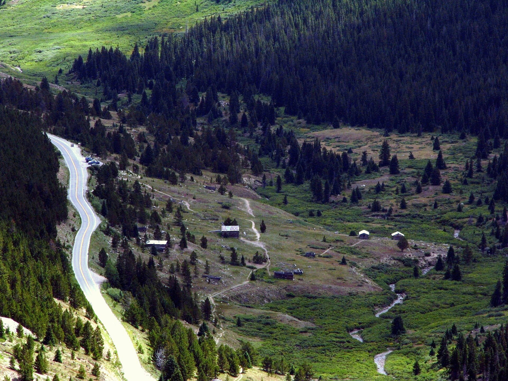
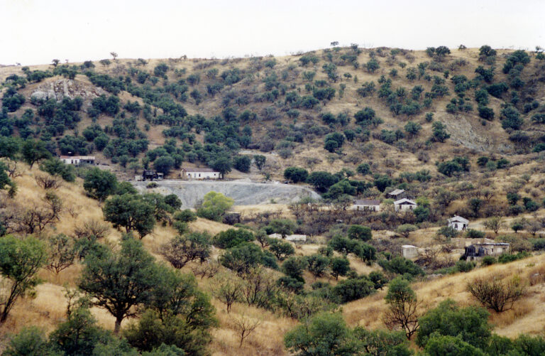
Highway 82 climbs past the townsite toward the pass, with the Roaring Fork and its beaver ponds below the cabins. Photo: U.S. National Archives, 2008, public domain
A town with five names and no Independence post office
The miners always called the camp Independence, but the post office never did. The first post office, opened on July 14, 1881, was named Farwell after the mining company. A second office, Sparkill, opened on February 1, 1882; Farwell closed that July, and Sparkill lasted until October 18, 1887. A last post office, Chipeta, named for the wife of the Ute leader Ouray, operated for only six months in 1899, from April 20 to October 17. Along the way the camp was also known as Mammoth City and Mount Hope.
On the names: Sources disagree about which names were official and when. The post office dates above follow Colorado’s post office records. Some accounts also list “Hunter’s Pass” as a town name, but it was really the old name of the pass itself.
The toll road over Hunter’s Pass
Independence sat on the only direct route between Leadville and the new silver camps lower in the valley, including Aspen. B. Clark Wheeler, the promoter who renamed the camp of Ute City “Aspen” in 1880, organized a toll road over the pass, roughly along today’s Highway 82. According to the Independence Pass Foundation, tolls were 25 cents for a horse and 50 cents for a wagon, and the road carried stages and freight wagons year-round.
The road’s heyday ended when the railroads reached Aspen from the other direction: the Denver & Rio Grande in November 1887 and the Colorado Midland in February 1888. Freight no longer needed to cross the Divide, and traffic over the pass faded.
On the road’s dates: Accounts date the toll road anywhere from 1880 to 1882. The Independence Pass Foundation gives 1880–81, a roadside sign says 1881–82, and the Colorado Department of Transportation says Wheeler’s improvements made it a toll road in 1882.
Why the gold ran out
The gold at Independence was rich but shallow. Once the easy ore near the surface was gone, the mill had little to work, and output fell to about $2,000 in 1883. At the same time, Aspen’s silver mines were booming 16 miles down the valley and nearly 3,000 feet lower, with steadier work and milder winters. Residents followed the jobs, and by 1888, fewer than 100 people were left.
On when the mill closed: The Farwell mill’s closing date varies by source, from January 1882 to January 1883, and the Aspen Historical Society says the mines and mill were shut by August 1882. What is clear is that large-scale mining was over by 1883, though the mill ran on and off for years afterward.
The winter of 1899 and the ski race to Aspen
The handful of people still living at Independence faced the worst winter on record in 1899. Storms in February buried the upper valley and cut off supplies. According to the Aspen Historical Society, the residents built about 75 pairs of skis from long planks and skied the 16 miles down to Aspen, leaving the camp nearly empty. Even so, a new post office named Chipeta opened that April, and closed again in October.
Local tradition: The Aspen Historical Society tells the escape as a race, with an entry fee of one ham sandwich. The homemade skis and the trip to Aspen are well established, but the race and the sandwich are told as local lore, and no contemporary record of them has been found. Some retellings say the skis were cut from cabin walls; the historical society says long planks.
The Mayor of Independence
One man stayed. J.R. “Jack” Williams lived at Independence for more than 20 years and became known as the town hermit, or the “Mayor of Independence,” to travelers crossing the pass in summer. He is usually said to have left in 1912, the last known year-round resident.
The Farwell mill outlived the town but not by much. It was dismantled in stages and torn down by the 1920s, and its foundations and scraps of the mill buildings mark the site about a quarter mile from the townsite.
On the mill’s end: Some accounts say the mill burned in 1912, but the National Register nomination and the Colorado Encyclopedia say it was torn down around 1920, and a detailed Aspen Historical Society history describes it being dismantled from 1912 into the 1920s with no mention of a fire.
Saving the ruins
For decades the cabins were left to snow, rot and souvenir hunters. The last standing boarding house burned in the winter of 1976. On April 11, 1973, “Independence and Independence Mill Site” was listed on the National Register of Historic Places, covering about 40 acres, with a townsite of about 17 acres and a mill site of about 4.3. The 1972 survey counted 19 standing structures in town and 7 at the mill site, plus several collapsed ones.
The Aspen Historical Society took over care of the site under a Forest Service permit, and from 1980 longtime Aspen preservationist Ramona Markalunas led volunteers who stabilized the cabins, added roofs and improved drainage. A State Historical Fund grant in 2007 paid for a preservation plan that was put into effect from 2010.
On the preservation dates: The year the historical society began managing the site differs even among its own materials: its website says 1975, a sign at the site says 1980, and an earlier society history describes a Forest Service permit granted in 1982.
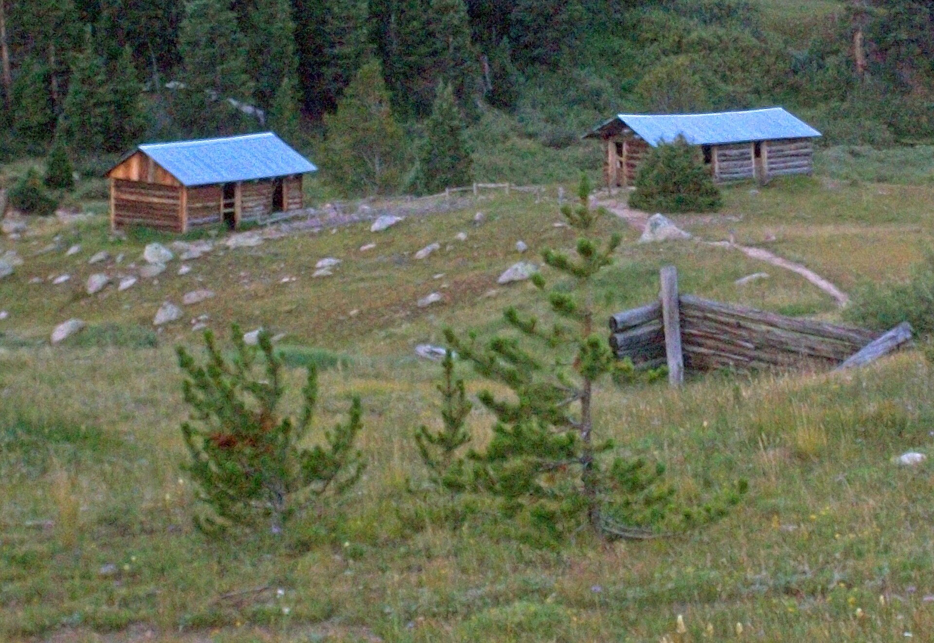
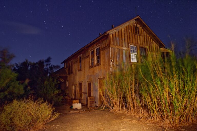
Stabilized cabins and a fallen wall on the main townsite. Photo: Daniel Case, 2010, CC BY-SA 3.0
What remains
Independence is one of the easiest high-country ghost towns in Colorado to see. A short trail from the highway pullout leads into the townsite, where log cabins in different states of repair sit along the old streets. One of the largest is known as the General Store. Interpretive panels from the historical society, the Forest Service and the Independence Pass Foundation explain the gold strike, the Ute people and the geology.
The Farwell mill site lies a short walk from town, with foundations and timber remnants. Above the town, a trail toward Green Mountain passes more cabin ruins and a filled-in mine shaft. Along Highway 82, sections of the 1880s stage road can still be seen beside the pavement.
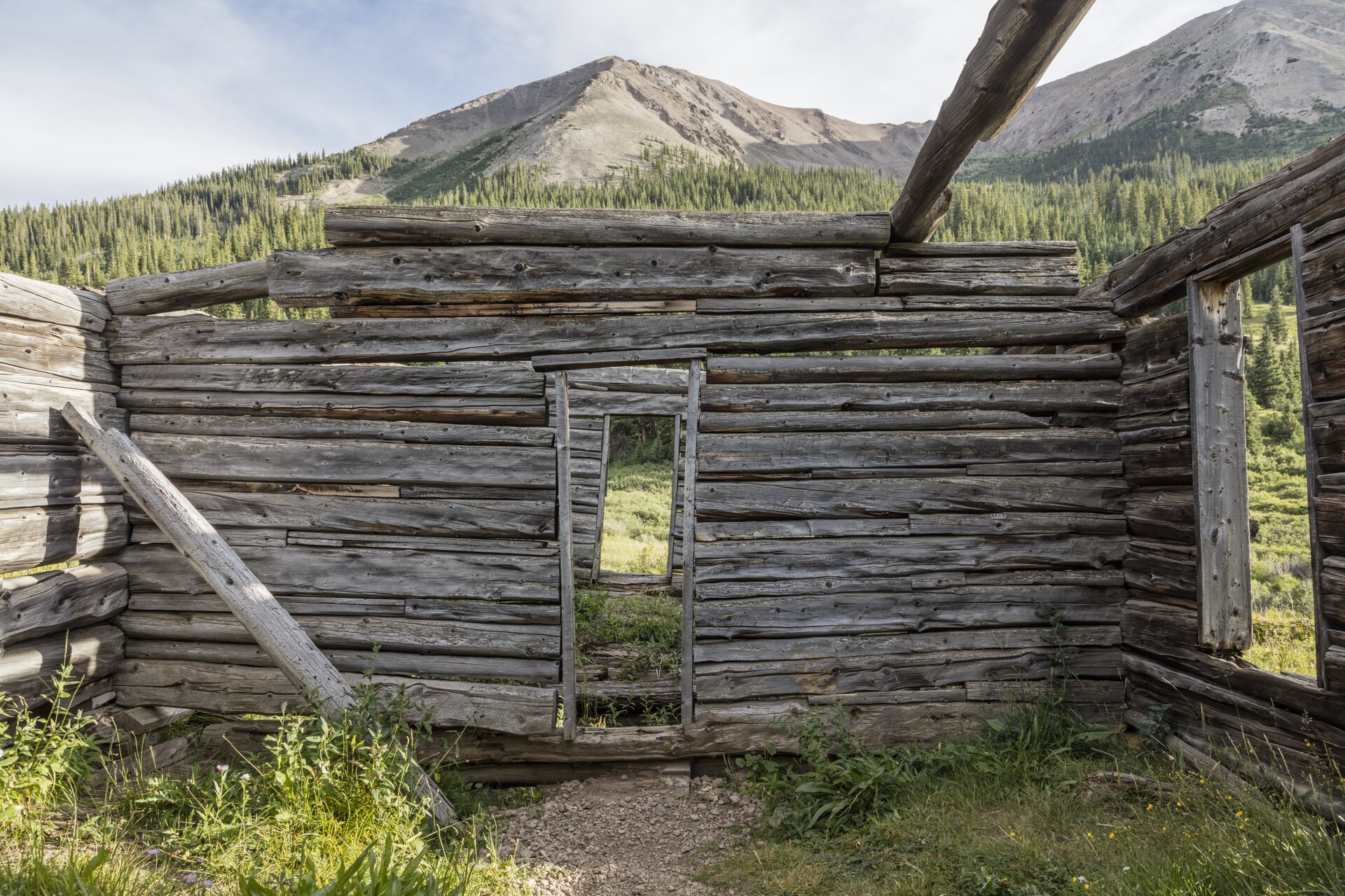
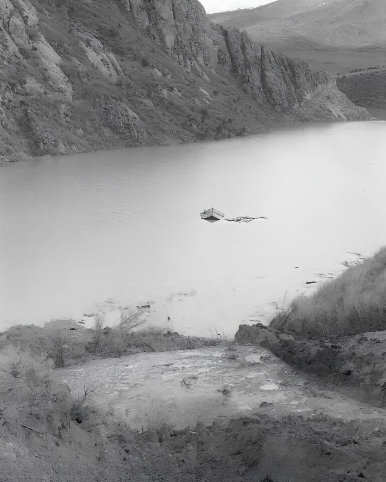
A roofless cabin, its walls still notched together. Photo: Carol M. Highsmith, 2015, Library of Congress, public domain
Timeline
July 1879
Gold lode found below Hunter’s Pass, by tradition on July 4; the camp is named Independence.
1879
Leadville investors form the Farwell Consolidated Mining Company and buy the main claims.
1881
Utes forced out of western Colorado. Farwell post office opens July 14; daily stages run to Leadville; the mill is enlarged to 30 stamps; the Independence Miner begins in October.
1882
Peak year, with more than 40 businesses. Sparkill post office opens February 1; Farwell’s closes in July.
1882–83
The Farwell mines and mill shut down; output falls to about $2,000 in 1883.
1887–88
Railroads reach Aspen; Sparkill post office closes October 18, 1887; fewer than 100 people remain.
1899
February storms cut off the town; the last residents ski to Aspen. Chipeta post office runs April 20 to October 17.
1912
Jack Williams, the “Mayor of Independence,” leaves, by most accounts the last year-round resident.
1920s
What is left of the Farwell mill is torn down.
1973
Listed on the National Register of Historic Places on April 11.
1980s
Aspen Historical Society volunteers, led by Ramona Markalunas, stabilize the cabins.
2010
Work begins under a preservation plan funded by a 2007 State Historical Fund grant.
Visit guide — Independence, Colorado
Can you visit?Yes, whenever Independence Pass is open. The site is self-guided, with an honor box at the trail entrance: a $5 suggested donation for adults, free for ages 18 and under with an adult and for active military. The Aspen Historical Society also runs guided tours on some summer days; check its calendar.
Getting thereAbout 16 miles east of Aspen on Colorado Highway 82, roughly 3 to 4 miles below the summit of Independence Pass. Park at the pullout beside the highway and walk in.
Coordinates39.1072° N, 106.6059° W
Road conditionsPaved but narrow, steep and winding. Vehicles and trailers over 35 feet combined are banned on the pass. The pass closes for winter, usually in early November, and reopens around the week before Memorial Day; in 2026 it closed on October 31.
What to seeLog cabins along the old streets, the General Store, the Farwell mill site, interpretive panels, and more ruins on the trail toward Green Mountain.
ServicesNone. Bring water and warm layers. The nearest gas, food and lodging are in Aspen.
Land statusWhite River National Forest, interpreted by the Aspen Historical Society. Listed on the National Register of Historic Places.
High-altitude hazards: The townsite is at about 10,900 feet. The air is thin, nights are cold even in summer, and afternoon thunderstorms with lightning are common. Snow can fall in any month. Old mine workings and collapsed timbers are dangerous; stay out of them.
Respect the ground: Dogs are not allowed at the site. Stay on the paths, and do not climb on or enter the fragile cabins. Independence is a protected historic site on federal land: no collecting nails, glass, tins or wood, no digging and no metal detecting.
Approximate location of the Independence townsite on Colorado Highway 82, east of Aspen.
Historic sites nearby
Ashcroft, CO
~28 miles by road, via Aspen and Castle Creek Road
The silver camp up Castle Creek, also cared for by the Aspen Historical Society, with standing false-front buildings.
Winfield, CO
~12 miles straight line; about 40 by road over Independence Pass, also on this site
The 1880s silver camp at the head of Clear Creek Canyon, with log cabins and a schoolhouse museum.
Independence Pass summit
~3 to 4 miles east
The old Hunter’s Pass, at 12,095 feet on the Continental Divide. Short paths lead to viewpoints.
Aspen, CO
~16 miles west
The silver boomtown that drew Independence’s people down the valley.
Ruby, CO
~17 miles by road, the last 11 on Lincoln Creek Road
Mining ruins and private cabins from a boom around 1898 to 1911. High clearance required, 4×4 recommended.
Twin Lakes, CO
~24 miles east, over the pass
The old stage stop at the east foot of the pass, with the old Interlaken resort on the south shore, reached by trail.
Leadville, CO
~43 miles by road
The silver city whose investors built the Farwell mill and whose miners founded Independence.
Further reading
Books and records on Independence
Stampede to Timberline: The Ghost Towns and Mining Camps of Colorado
Muriel Sibell Wolle · published by the author, Boulder, 1949; revised edition Swallow Press, 1974
Roaring Fork Valley: An Illustrated Chronicle
Len Shoemaker · Sage Books, Denver, 1958
Mining in Colorado: A History of Discovery, Development, and Production (Professional Paper 138)
Charles W. Henderson · U.S. Geological Survey, 1926
Aspen: The History of a Silver-Mining Town, 1879–1893
Malcolm J. Rohrbough · Oxford University Press, 1986
The History of Independence Gold Mining Camp
Randy Shaffren · Aspen Historical Society
Independence and Independence Mill Site, National Register nomination
National Park Service, National Register of Historic Places, 1972–73
Independence ColoradoColoradocolorado ghost townsghost towngold miningPitkin CountyIndependence PassRoaring Fork ValleyAspenAshcroft