Consumers, Utah: The Gordon Creek Coal Camp That Replaced the Mine Car
Quick facts
Original nameGibson, after Arthur E. Gibson
FoundedWinter of 1921–22 as a wagon-haul mine
Consumers Mutual Coal Co.Incorporated February 1924
Rail shipments beganNovember 1925, per one account; sources vary
Blue Blaze Coal Co.Name adopted autumn 1927
Utah firstUnderground conveyor belts in place of mine cars
ReceivershipJanuary 31, 1938; foreclosure sale July 1938
AbandonedBetween about 1948 and the early 1950s
Deaths reportedNine miners, in individual accidents
LocationAbout 39.69°N, 111.05°W, North Fork of Gordon Creek Canyon
State / CountyUtah / Carbon County
What survivesFoundations, tipple footings, bridge abutments and waste piles
⚠ Patchwork of public and private land · Wildlife area closed to vehicles December 1 to April 15 · Stay out of mine openings
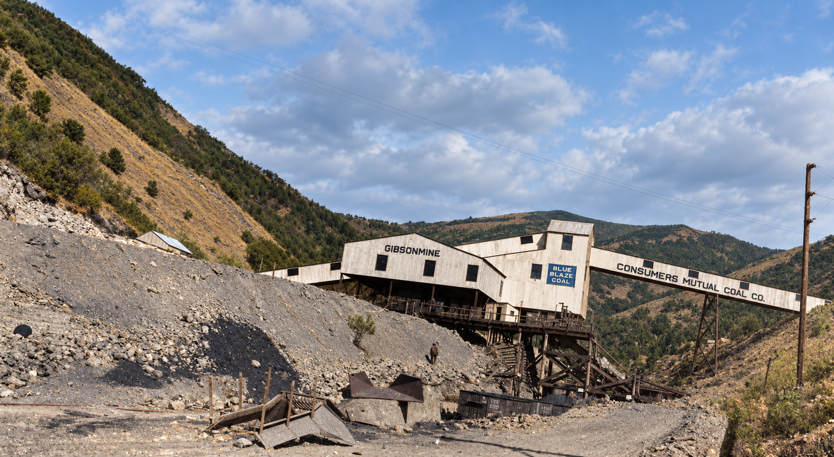
Colorized view of the Gibson mine tipple at Consumers, Utah, with a sign reading Consumers Mutual Coal Co., a steel bridge and a large coal waste slope
The tipple and bridge at the Gibson mine, with a sign reading Consumers Mutual Coal Co., a name the company used from 1924 to 1927. The date is not recorded. Colorized with AI; the colors are an interpretation. Original photo: Utah State Historical Society.

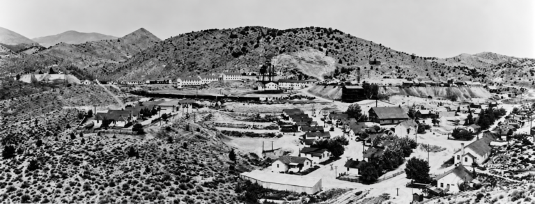
Consumers sat at the end of a narrow road up the North Fork of Gordon Creek Canyon, about 15 miles southwest of Helper. It began in the winter of 1921–22 as a handful of miners driving tunnels into a seven-foot coal seam and hauling the coal out by wagon. Within five years it had a steel tipple, a high canyon bridge and underground conveyor belts that, by the company’s claim and the record that follows it, were the first of their kind in a Utah mine. The camp shared a canyon, a school, a hospital and a hall with two neighbors, National and Sweet, and its Depression-era photographs by Dorothea Lange are among the best-known images of a Utah coal camp.

Arthur Gibson and the camp of Gibson

Coal outcrops in Gordon Creek were noted by prospectors around 1907–08. The man who turned them into a mine was Arthur E. Gibson, a Price telegrapher and longtime mining man who worked at Spring Canyon. Before the federal Mineral Leasing Act of 1920 changed how coal land was acquired, Gibson put together claims on roughly 1,480 to 1,500 acres. In the winter of 1921–22 he opened drifts into a seven-foot seam he had sampled in 1920.

There was no railroad. That first winter his crew took out about 34 carloads of coal, loaded it into horse-drawn wagons and sent it down the canyon grade to the Utah Railway’s Wildcat siding. The rough camp at the tunnel mouths took the name Gibson.

Consumers Mutual and the rail spur

Wagons could not carry a commercial mine. In February 1924 Gibson and two investors, Donald E. Jenkins and J. Tracy Wootton, incorporated the Consumers Mutual Coal Company. Jenkins became president, Gibson vice-president and mine superintendent, and Wootton secretary-treasurer. The camp was renamed Consumers to match a plan to sell coal more directly to the people who burned it. The mining financier Emil J. Raddatz, who also appears in the story of Dividend, later bought a controlling interest.

A railroad was the other half of the plan. The promoters chartered the National Coal Railway and built about five miles of standard-gauge track up Gordon Creek from the Utah Railway main line near Jacobs, next to Wildcat. The Utah Railway later bought the line and called it the National Branch. One account has coal moving by rail in November 1925; another has early shipments still going out by wagon in 1925, and company announcements of the period point to rail service starting in 1925 or 1926. I have kept the date general. Research also contradicts itself on who built the line: some accounts credit the Consumers promoters, while the history of neighboring National says the National Coal Company and George Storrs’s Gordon Creek Coal Company organized it.

On the dates: The record for these years is inconsistent. The incorporation is given as February 16 or February 28, 1924. The change to Blue Blaze is given as September 10, September 21 or October 30, 1927. The tipple was reported finished in 1926, with different months in different passages. Where sources disagree I have used the month and year only.

The mine without cars

In the mid-1920s nearly every coal mine in the Rocky Mountain West still moved coal in mine cars, pulled by mules or electric locomotives and gathered into trips. Derailments, bottlenecks and runaways were routine. In November 1924 Consumers Mutual announced that cars would no longer enter its working rooms. Portable conveyors would carry coal from the face to a main belt in the haulageway, and the belt would carry it out to the portals. Consumers was, by the standard histories of the camp, the first Utah mine to use underground belts in place of cars for its main haulage.

Above ground the company hired the Pittsburg Boiler & Machine Company to build a steel tipple, finished in late 1926. It could grade and load coal across five tracks, and the belts from the tunnels fed it directly. To join the coal entries on both sides of the North Fork, the American Bridge Company put up an 80-foot-high double-track steel bridge that cost about $60,000. It was built to carry heavy Utah Railway locomotives and long trains of loaded cars.
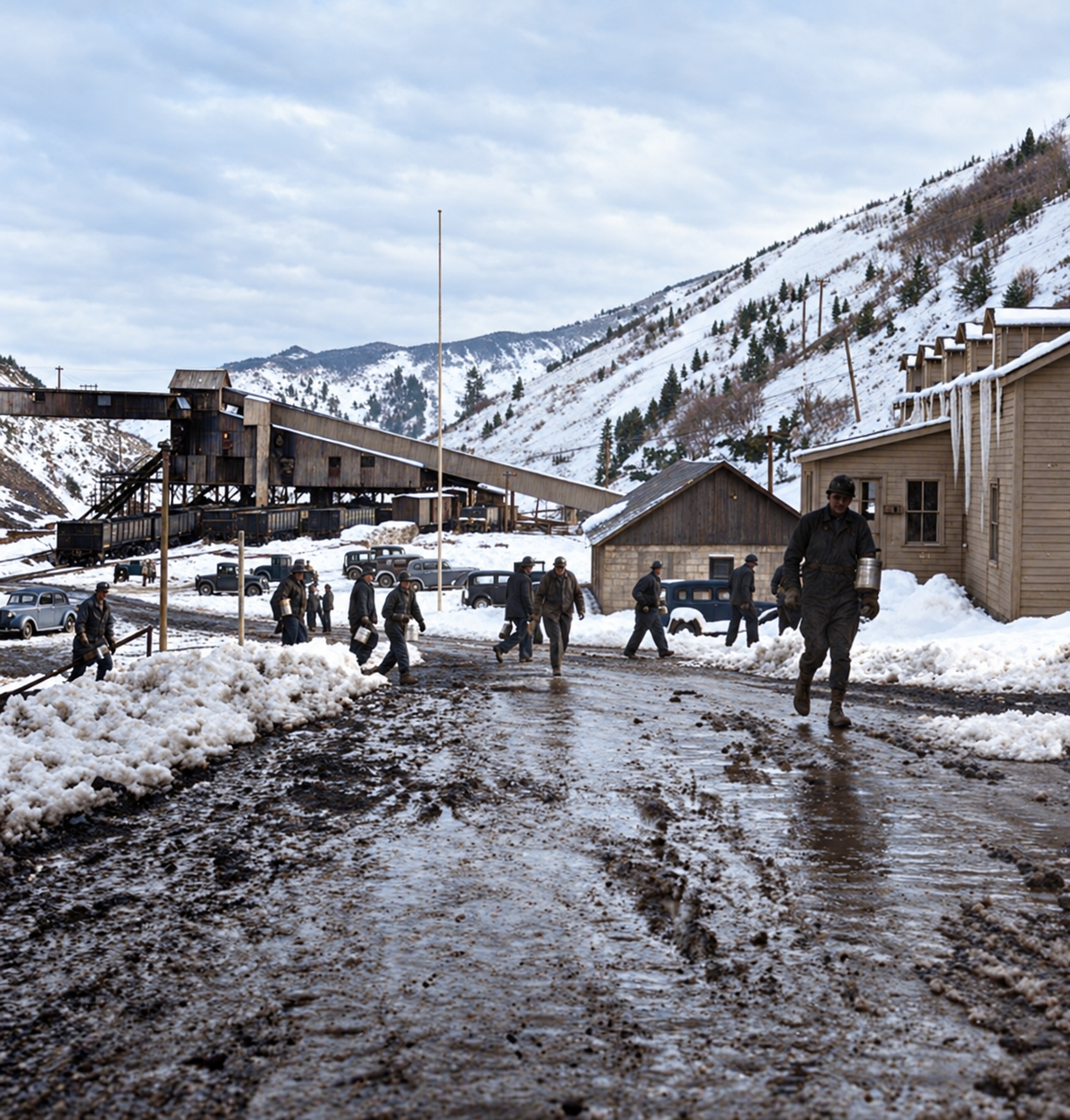
Colorized view of miners and company men walking along a slushy road at Consumers, with the coal tipple on the slope at left and snowy hills behind
Men walking a slushy mine road, with the tipple on the slope at left. Photographed in March 1936. Colorized with AI; the colors are an interpretation.Original photo: Dorothea Lange, March 1936, Library of Congress; this copy from the Utah State Historical Society

Blue Blaze

The company sold its coal under the brand Blue Blaze, promoting it as clean-burning, and in the autumn of 1927 it took the name Blue Blaze Coal Company. The camp’s busiest years came in this period. As the Depression deepened and homes and industry turned to fuel oil and natural gas, the costly plant and the rail line up an isolated canyon wore down the company’s reserves.
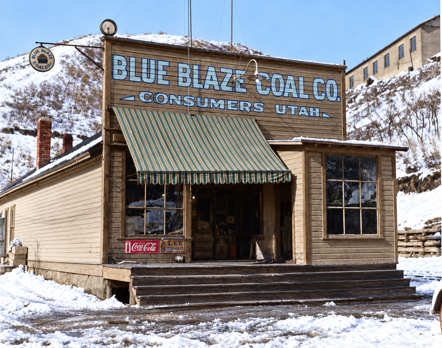
Colorized winter view of a wooden building with a sign reading Blue Blaze Coal Co., Consumers, Utah, a green striped awning, a Coca-Cola sign and snow on the ground
A Blue Blaze Coal Co. building at Consumers in winter, with a Coca-Cola sign by the door; probably the company store. Photographed in March 1936. Colorized with AI; the colors are an interpretation.Original photo: Dorothea Lange, March 1936, Library of Congress; this copy from the Utah State Historical Society

On January 31, 1938, Blue Blaze closed the mine and went into receivership. The whole property was sold at a foreclosure sale in July 1938. Terry McGowan, the former superintendent, stayed more than a year to oversee salvage of the tipple parts and underground equipment. A federal suit over $14,361.40 in unpaid lease royalties ended in February 1939, when the company gave up its federal coal leases and left about four miles of branch track in place.

McGowan Coal Company reopened the mine in October 1939. In January 1949 it was sold to the Hudson Coal Company, which was already working the nearby Sweet mine. By then the old way of running a company town was fading: miners preferred to live in Price or Helper and drive in, and trucks were eating into the economics of canyon rail branches. Hudson closed its Gordon Creek workings, and between about 1948 and 1952 Consumers was abandoned, its houses moved to valley towns or torn down for scrap.

Three camps, one canyon

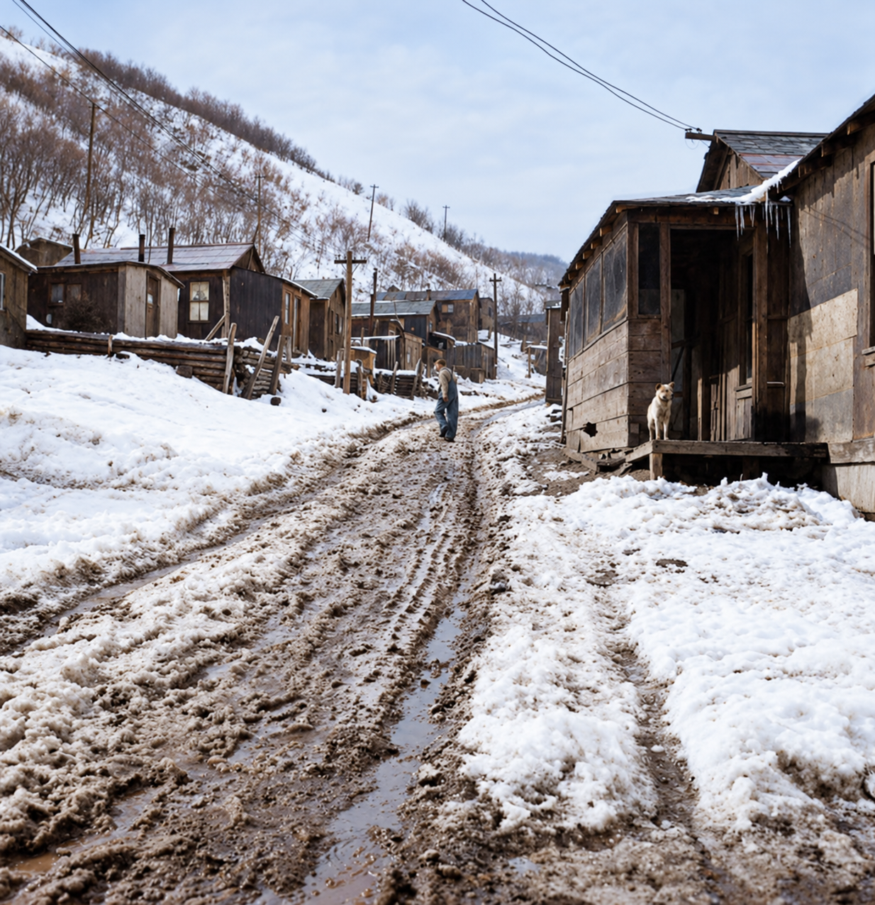
The canyon was too narrow for each mine to build a complete town, so Consumers, National and Sweet shared. National, about a mile east, had the school and the post office. Consumers had the hospital, the doctor’s house, the company store and the Miners’ Amusement Hall, which held films, boxing, dances and union meetings. Sweet, a short distance to the southwest, was a satellite camp where about 200 men lived in tents on wooden platforms and used the services at the other two. Most families lived in company frame houses without plumbing and carried water in cans from standpipes. Lange noted in one of her captions that rent in the camp was $8 a month. In 1930 superintendents and engineers got concrete and sandstone houses with full plumbing on the hillsides above.
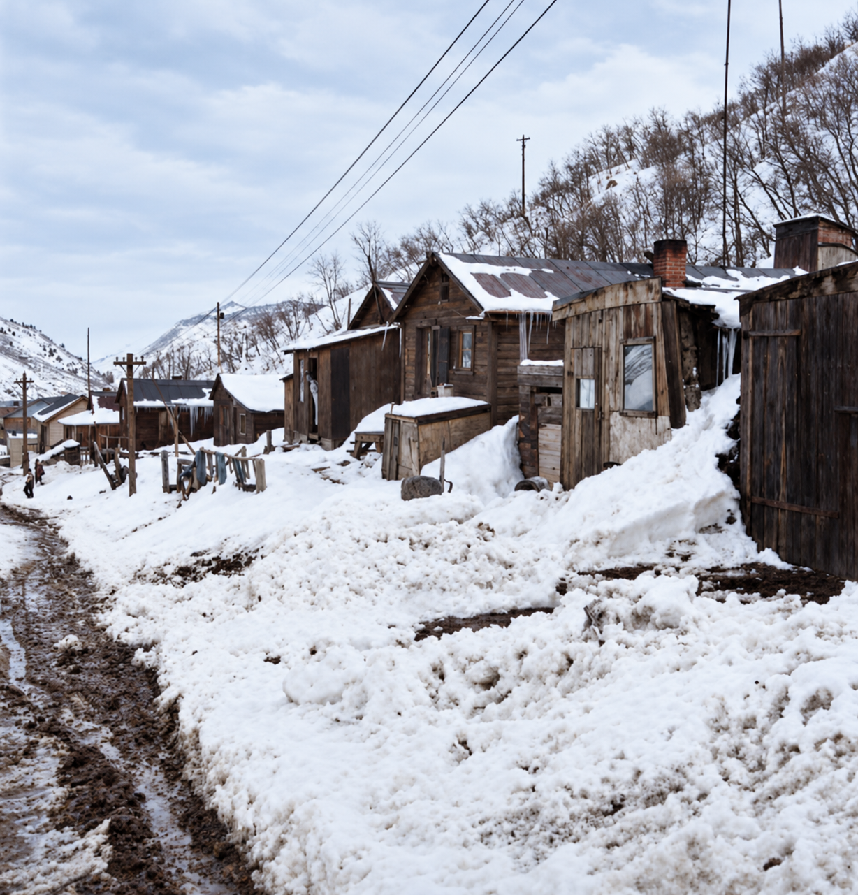
Colorized snowy street of plank company houses at Consumers, Utah, with a muddy track, utility poles and a hillside behind
A snowy street of company houses at Consumers. Photographed in March 1936. Colorized with AI; the colors are an interpretation.Original photo: Dorothea Lange, March 1936, Library of Congress; this copy from the Utah State Historical Society
Colorized muddy, snow-covered street between wooden company houses at Consumers, Utah, with one person walking in the distance
A muddy street between company houses. Photographed in March 1936. Colorized with AI; the colors are an interpretation.Original photo: Dorothea Lange, March 1936, Library of Congress; this copy from the Utah State Historical Society

A small mixed community lived here: Italian, Greek, Austrian, Croatian and Slovene immigrants, alongside Anglo-Americans and Hispanic miners from southern Colorado and northern New Mexico. The Blue Blaze baseball team played weekend doubleheaders in a regional league on gravel diamonds on the benchland.
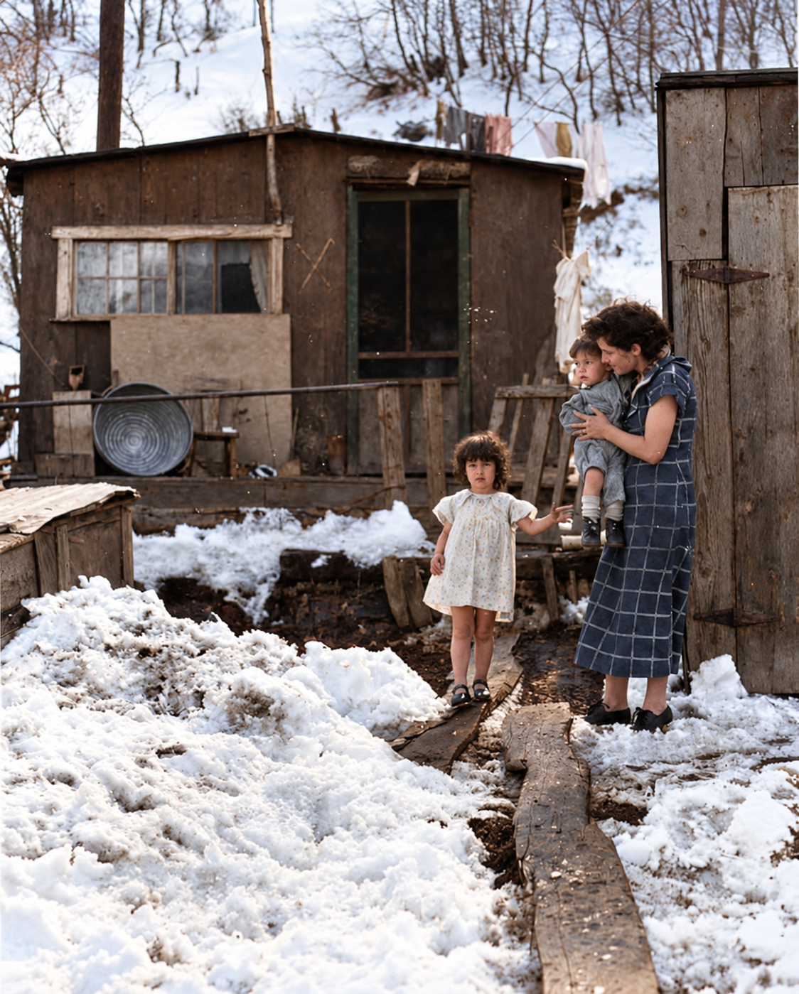
Colorized view of a woman holding a small child beside a young girl in front of a plank house in snow at Consumers, Utah
A woman with two young children outside a company house in the snow. Photographed in March 1936. Colorized with AI; the colors are an interpretation.Original photo: Dorothea Lange, March 1936, Library of Congress; this copy from the Utah State Historical Society
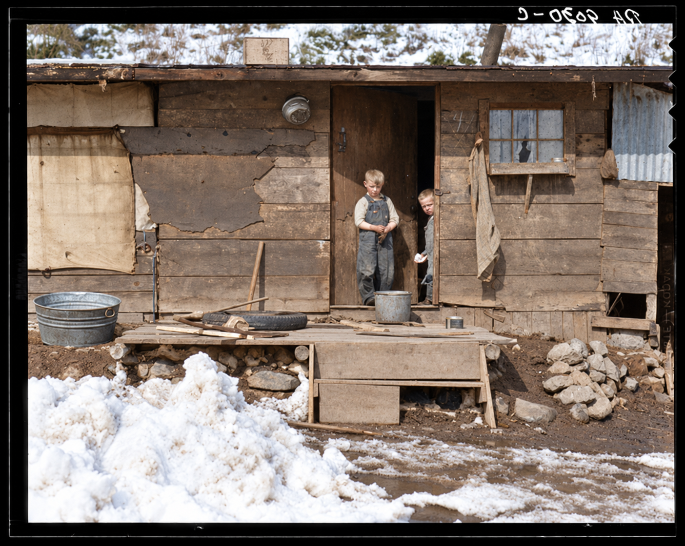
Colorized view of two boys in the doorway of a weathered plank house with stone footings, a washtub and snow in the foreground, Consumers, Utah
Two boys at the door of a weathered plank house. Photographed in March 1936. Colorized with AI; the colors are an interpretation.Original photo: Dorothea Lange, March 1936, Library of Congress; this copy from the Utah State Historical Society
On the population: One source says the three camps together approached 3,000 people at their peak. Another says Consumers alone held several hundred, living in company houses. I did not find a census count for the camp, and 3,000 looks high for three camps in a narrow canyon, so I have not given a firm figure. The camp’s own size is better described as a few hundred.

Dorothea Lange at the Blue Blaze mine

In March 1936 the photographer Dorothea Lange visited Consumers on assignment for the federal Resettlement Administration, later the Farm Security Administration, and made more than twenty photographs. They show miners coming off shift with coal-blackened faces, women on wooden boardwalks above muddy ground and children playing near the mine waste. Her caption for one image describes the settlement around the Blue Blazes coal mine as sometimes called the “dumping ground of the West.” The Library of Congress holds the photographs, and the six camp scenes on this page are hers, colorized with AI.

On “dumping ground of the West”: The phrase is Lange’s record of what people called the place. Some retellings turn it into a story that Consumers was a penal colony or a destination for blacklisted miners. The record shows an ordinary commercial mine. The better reading is that a late-developed, financially pressed mine took on laid-off and transient workers from larger mines.

The camp doctor

Dr. J. Eldon Dorman arrived on January 3, 1937, to be the company doctor for Consumers, National and Sweet, and he ran the hospital until the camp began to break up around 1940. His memoir, Confessions of a Coal Camp Doctor and Other Stories, published in 1995, describes crushed limbs and burns alongside childbirth and sickness from bad well water, and the gap between the managers’ houses and the miners’ rows.

The 1933 strike

The Gordon Creek camps were centers of support for the communist-led National Miners Union in the 1933 strike that shut down much of Carbon County. One source describes an August 27, 1933 clash at Consumers and National, in which Sheriff S. Marion Bliss and deputized men used tear gas on pickets and arrested 68 miners. Another says the strike did not bring violence to Consumers specifically.

On the August 27 clash: I could not confirm the date, the tear-gassing or the number of arrests from a source I could read. The best-documented violence of the strike was a march on the Price courthouse on September 11, 1933, where National Guardsmen used tear gas; Ephraim Towne, the union leader at National, was among its leaders. I have left the Gordon Creek clash as a reported event rather than a firm one, and Consumers’ part in the strike deserves a primary-source check.

Danger underground

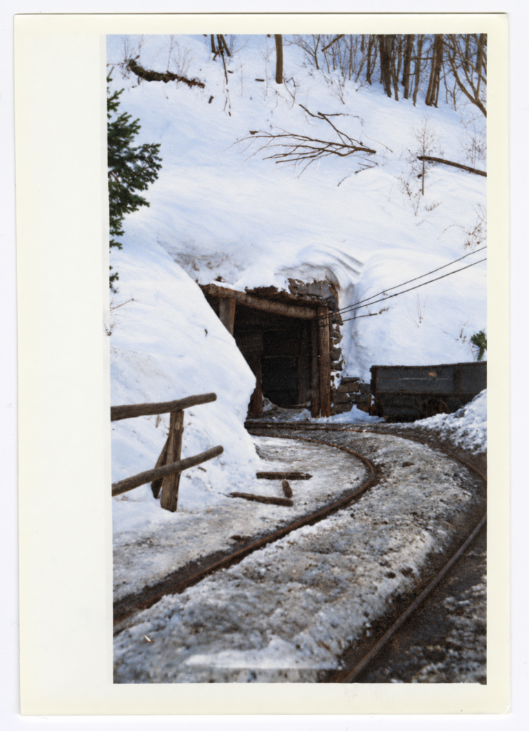
The mine cut into the Blackhawk Formation of the Wasatch Plateau, where heavy rock above the coal can cause “bumps,” violent failures of coal pillars. Nine miners are reported to have died at Consumers over the years. They were killed in separate accidents, such as roof falls and equipment, not in a single disaster like Scofield in 1900 or Castle Gate in 1924.

What is left

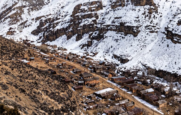
Most of the wooden buildings are gone. Visitor and survey accounts describe sandstone foundations and concrete basement walls from the company store and offices, concrete footings that held the tipple, reinforced-concrete abutments on opposite sides of the canyon from the steel bridge, graded house terraces with retaining walls and steps, and dark piles of coal waste along the old rail line. A ghost-town visitor describes one partial stone building on fenced property and a more recent shack, with little else beyond foundations.

Later coal operators worked the Gordon Creek field in the 1970s and 1980s and used parts of the old townsite for staging and loading. State reclamation under the Surface Mining Control and Reclamation Act has since collapsed, sealed or covered many of the old tunnel mouths and regraded the portal benches.

On what survives: The ruin lists above come from published accounts and visitor reports, not a survey I could check, and they disagree on detail. One says a ruined company store and post office stand; another says only a few foundations remain. Reclamation and active mining nearby have changed the site, so treat the list as a guide to what to look for, not a promise.

Legends and what the record says

The buried payroll. A story says a gold payroll was buried near Consumers during the strikes or the receivership. No record supports it. Blue Blaze was in debt, behind on taxes and federal royalties, and paid in checks and company-store scrip. The company failed for lack of cash.

A lawless camp. Some guidebooks describe daily gunfights. Court records from Price and Helper show the usual small-town offenses of the period: petty theft, bootlegging and brawls. The nine deaths at the mine were industrial accidents.

Timeline

1907–1908
Prospectors note coal outcrops in Gordon Creek.
1921–1922
Arthur Gibson opens drifts on a seven-foot seam; 34 carloads go out by wagon.
February 1924
Consumers Mutual Coal Company is incorporated; the camp becomes Consumers.
November 1924
The company announces underground conveyors in place of mine cars.
1925
Shipments begin; the National Coal Railway spur is built from Jacobs.
1926
The steel tipple and the 80-foot bridge are built.
Autumn 1927
The company becomes the Blue Blaze Coal Company.
1930
Concrete and sandstone houses with plumbing are built for managers.
1933
The National Miners Union strike shuts down much of Carbon County.
March 1936
Dorothea Lange photographs the camp.
January 1937
Dr. J. Eldon Dorman arrives as company doctor.
January 31, 1938
Blue Blaze closes the mine and enters receivership.
July 1938
The property is sold at foreclosure.
October 1939
McGowan Coal Company reopens the mine.
January 1949
McGowan sells to Hudson Coal Company.
About 1948–1952
The camp is abandoned and its buildings moved or razed.
Visit guide — Consumers, Utah
Can you visit?You can reach the area by public county road, but land around it is a mix of state wildlife land, BLM land and private patented mining ground. Respect posted private property, reclaimed pads and fenced areas.
Getting thereFrom US-6 and US-191 near Helper and Spring Glen, turn west onto SR-139 and Consumers Road (Gordon Creek Road, Carbon County Road 290). One source gives about 9 miles of paved and then gravel road to the canyon mouth, then a mile or two past the ruins of Coal City and National, then a right fork up the North Fork for about half a mile. Distances vary between sources, so use a current map.
CoordinatesAbout 39.69°N, 111.05°W. This is approximate, from a coordinate listing; it is not a survey.
Road conditionsPassable for ordinary cars in dry weather as far as National. The last stretch up the right fork is rough, with washboard, ledges and steep wash crossings; high clearance is advised. Wet clay turns the road to slick mud, and washes can flood.
Seasonal closureThe Gordon Creek Wildlife Management Area is closed to motor vehicles from December 1 to April 15 to protect wintering elk and deer. Check with the Division of Wildlife Resources before you go.
Land statusState wildlife management area, BLM upland, and private patented claims, some owned by energy companies. Active coal operations continue nearby.
FacilitiesNone. Helper and Price have services.
Best seasonLate spring through fall, in dry weather.
Serious hazards: Do not enter any mine opening. Reports mention open adits and vertical shafts in the area, and ground above old workings can subside. Stone-lined cellar pits, loose masonry and steep slopes of coal waste are easy to fall on. Flash floods and slick clay are real risks in storms.
Respect the ground: Do not pass gates or No Trespassing signs, and do not take artifacts or building stone. Mine waste can be unstable and dusty; keep children and pets out of it.
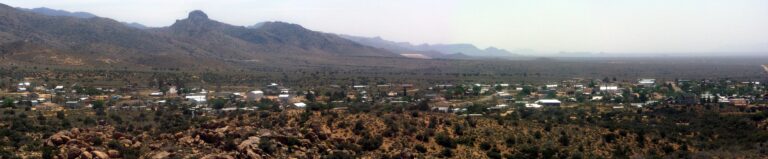
Approximate location of Consumers in the North Fork of Gordon Creek Canyon, Carbon County. The exact site is not marked.

Historic sites nearby

National, UT
Under a mile down the canyon, also on this site
Brick-and-concrete camp · National Coal Railway
Sweet, UT
~1 mile southwest
Tent camp for about 200 miners · Concrete pad and waste heaps
Coal City, UT
~3 miles east
Independent “open town” · Chimneys and foundations
Standardville, UT
~9 miles north
Spring Canyon planned camp · Concrete foundations
Castle Gate, UT
~14 miles northeast, also on this site
1924 mine disaster · Butch Cassidy payroll robbery
Kenilworth, UT
~16 miles northeast
Independent Coal & Coke camp · Largely preserved

Further reading

Books, studies and records about Consumers and Carbon County
A History of Carbon County
Ronald G. Watt · Utah Centennial County History Series, 1997 — The fullest county history, including the Consumers companies.
Centennial Echoes from Carbon County
1948 — Includes Arthur E. Gibson’s own account of the Gordon Creek coal district.
The Next Time We Strike: Labor in Utah’s Coal Fields, 1900–1933
Allan Kent Powell, 1992 — The standard study of the 1933 strike and its background.
Confessions of a Coal Camp Doctor and Other Stories
J. Eldon Dorman, 1995 — A physician’s memoir of Consumers in the late 1930s.
Dorothea Lange’s Portrait of Utah’s Great Depression
James R. Swensen · Utah Historical Quarterly, 2002 — Context for Lange’s 1936 photographs.
Energy, Mineral, and Ground-Water Resources of Carbon and Emery Counties, Utah
Utah Geological Survey Bulletin 132 — The geology of the Gordon Creek coal field.
ConsumersUtahGhost TownUtah Ghost TownsCarbon CountyGordon CreekBlue Blaze Coal CompanyCoal MiningCompany Town

Sources

UtahRails.net — Gordon Creek Coal Mines — company history, conveyors, tipple, bridge and receivership

Legends of America — Consumers, Utah Ghost Town — the site and road

Library of Congress — Dorothea Lange, Consumers, Utah, March 1936

Utah Division of Arts & Museums — Life in a Utah Coal Camp — Lange’s photographs

Carbon County genealogy site — 1933 strike — the September 11 Price march

Utah Geological Survey — Bulletin 132 — Gordon Creek coal geology
Similar Posts

Leave a Reply

Your email address will not be published. Required fields are marked *