Ironton, Colorado: The Red Mountain Supply Town on the Million Dollar Highway
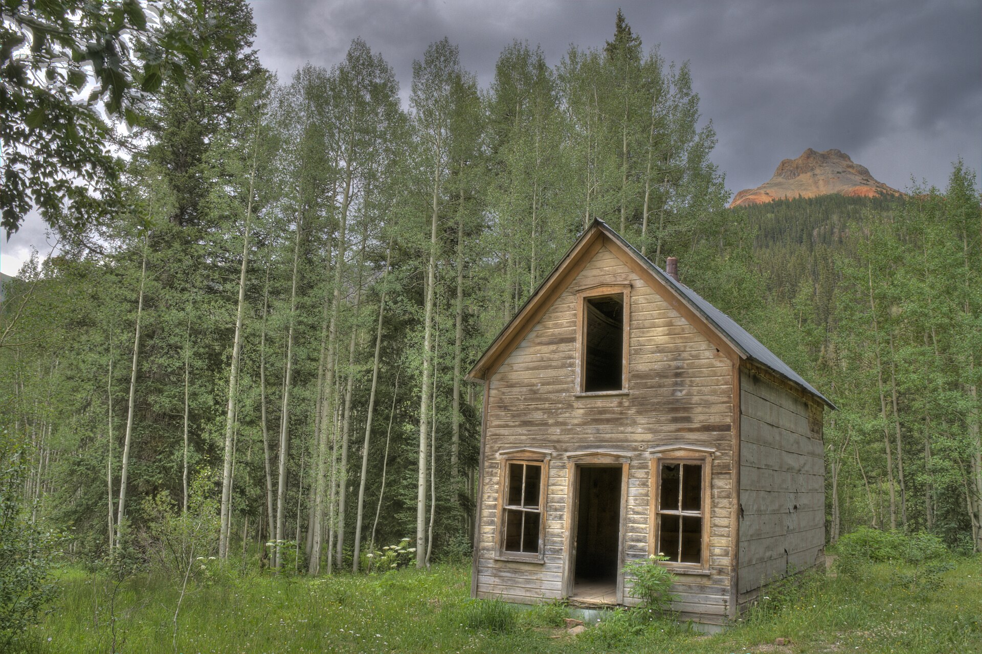
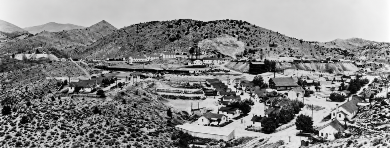
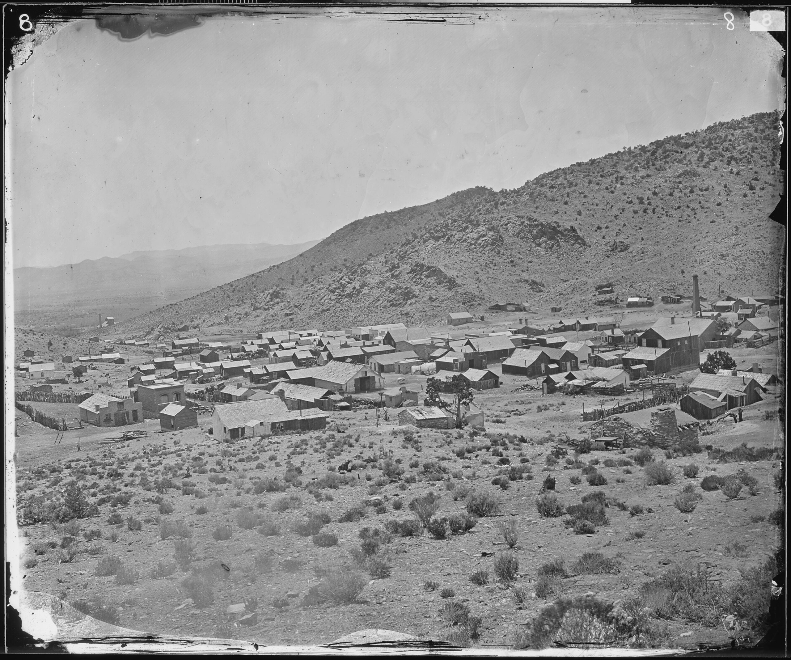
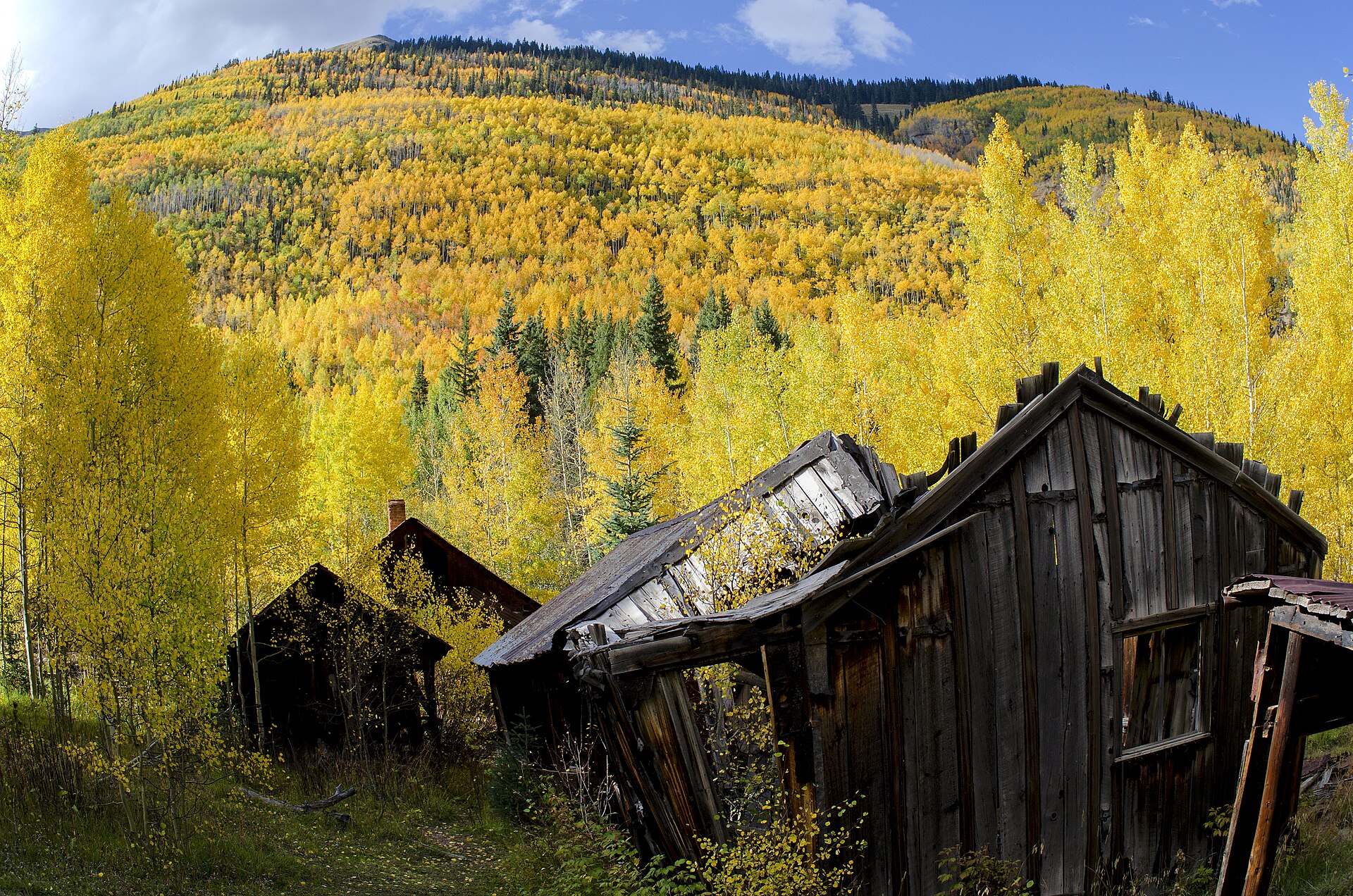
Ironton is a ghost town in a quiet meadow called Ironton Park, about 8 miles south of Ouray on the Million Dollar Highway. It sprang up in 1883 as the supply town for the rich silver mines on Red Mountain Pass, where pack trains from Ouray traded their loads for sacks of ore. In 1888 Otto Mears’s Silverton Railroad climbed over the pass and down to Ironton, and for a few years the town had hotels, saloons, a school and, by some accounts, more than 1,000 people in summer. The silver crash of 1893 emptied it, small gold and mining revivals kept a few people on, and the last resident, Milton Larson, died in 1964. Today a handful of wooden houses and cabins stand among the aspens, a short walk from the highway, and the meadow is a Nordic ski area in winter.
Silver on Red Mountain
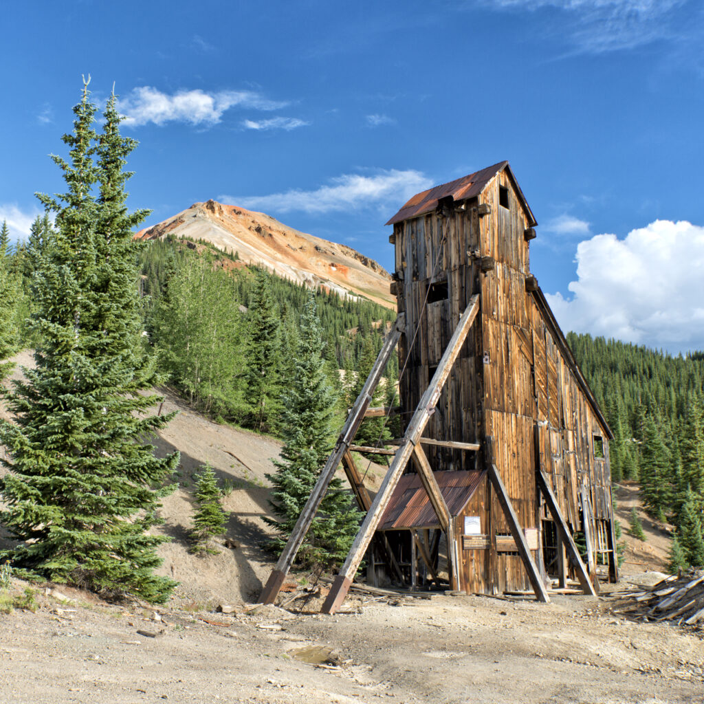
The Red Mountains, three iron-stained peaks at the head of Red Mountain Creek, held some of the strangest ore bodies in Colorado. Instead of long veins, the silver sat in chimney-like pipes and caves in the rock, rich near the surface and hard to follow at depth. John Robinson and his partners found the first ore at the Guston claim in the summer of 1881, and Robinson found the Yankee Girl in August 1882. It was resold about a month later for $125,000. The Genesee and the National Belle, whose miners broke into natural caverns lined with ore, were also found in 1882.
Within a few years the Red Mountain district was one of the richest silver camps in the state. Some accounts rank it second only to Leadville in its heyday. The U.S. Geological Survey’s 1901 report on the district put the output of the Yankee Girl and Guston together at $6 million to $7 million.
The mines sat high on steep, avalanche-swept slopes, and the camps beside them, Guston and Red Mountain Town, had little flat ground. The broad, level floor of Ironton Park, a few miles down the creek, was the natural place for a supply town.
A town in three weeks
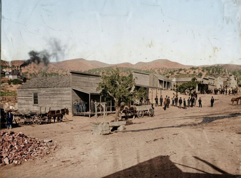
Ironton was laid out early in 1883 and was first called Copper Glen. By April the name Ironton, for the iron-stained rock all around, had taken over. Lots went fast. In March 1883 the Delta Chief newspaper reported that “168 lots” had been surveyed and that nearly all were taken. Merchants from Ouray and Silverton opened branch stores, and saloons and restaurants went up almost overnight.
The post office opened on May 2, 1883. That year Otto Mears finished his toll road from Ouray up through the Uncompahgre Gorge to Ironton and Red Mountain, and in 1884 he pushed it on over the pass to Silverton. Stagecoaches ran through Ironton, and long strings of burros and mules carried lumber, machinery and food up to the mines and brought ore back down. The townsite was platted and incorporated in 1884.
The Silverton Railroad
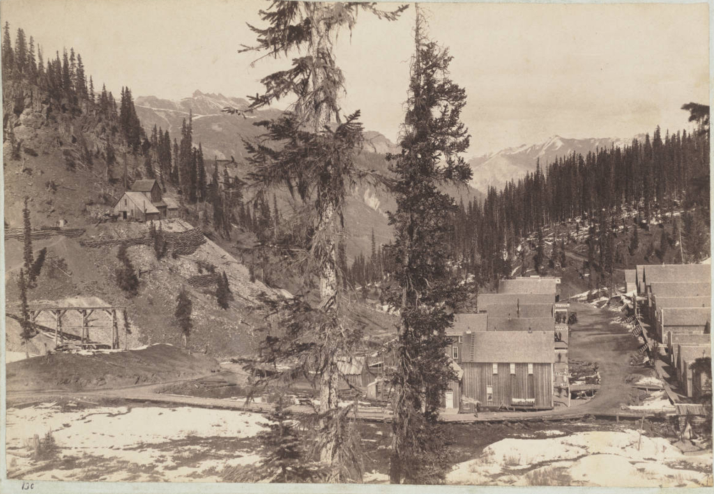
Ironton’s best years came with the railroad. Otto Mears built the narrow-gauge Silverton Railroad north from Silverton over Red Mountain Pass, and its first train reached Red Mountain Town on September 17, 1888. Track reached Ironton that November, and full service to Ironton began in June 1889. A short spur ran on to Albany, the mill site at the Saratoga smelter just beyond town. Ironton and Albany were the end of the line. The cliffs of the Uncompahgre Gorge were too steep for rails, so passengers and freight bound for Ouray switched to stagecoaches and wagons here.
Building the line took some daring engineering. Grades ran to 5 percent, and curves were as sharp as 30 degrees. At Corkscrew Gulch, where there was no room for a loop, the railroad put a turntable right on the main line at a switchback, so engines could be turned to climb on. Its engineer, Charles W. Gibbs, said in 1890 that he had never heard of a turntable used on a switchback in that way. He called the road “the steepest, the crookedest and the best paying road in Colorado.”
The railroad made cheaper ore worth shipping, and Ironton grew into a real town. Its waterworks and a church came about 1891, and it had a school, hotels, stores, saloons and lodge halls. The 1890 census counted 323 people.
Fire, crime and hard winters
Fire was a constant danger in a town built of wood. In February 1888 a fire destroyed the post office, the Masonic Opera House, the Odd Fellows lodge and other buildings. The town rebuilt. Red Mountain Town, up the pass, burned almost entirely in 1892.
Ironton also had its share of violence. In 1888 a man named George Witherell left Ironton for Silverton with two Swedish miners, who were never seen again. He was suspected of killing them, but their bodies were never found. Witherell was later arrested for the murder of another man, Charles McCain, and on December 4, 1888, a mob took him from the jail at Cañon City and hanged him from a pole.
Winter shaped everything. Snowslides came off the mountains all along the road between Ouray and Ironton, and deep snow could close the toll road and the railroad for weeks. The avalanche paths along this stretch of US-550, such as the East Riverside, are still among the most dangerous on any highway in Colorado.
The silver crash
Ironton depended on silver, and silver collapsed in 1893. In June, India stopped coining silver and the price in New York fell from about 83 cents to 62 cents an ounce in four days. That fall Congress repealed the Sherman Silver Purchase Act, which had propped up the price, and President Cleveland signed the repeal on November 1, 1893. Mines across Red Mountain shut down. Ironton’s post office closed that September and did not reopen until 1894.
The big mines had their own troubles. Deep shafts filled with acid water that ate pumps and pipes, and the Yankee Girl and Guston worked only until about 1896 to 1898. By 1897 the railroad had pulled its trains back from Ironton to Red Mountain Town.
Gold, tunnels and a long fade
Ironton never quite died. Gold was found in the district in 1898, and new work followed. Around 1904 miners began the Joker Tunnel, which ran almost a mile into the mountain by 1907 to drain and reach the old mines from below. It closed in 1914. The Barstow Mine produced about $750,000 before it closed in 1917. Still, the town kept shrinking, to 48 people in 1910.
The Silverton Railroad ended regular service in 1921, was abandoned the next year and had its rails pulled up in 1926. The Ironton post office closed for good on August 2, 1920.
In the late 1930s two Ouray businessmen tried something new. Using brick and timber salvaged from an old smelter at the north end of the park, they built a ski lodge with an 1,800-foot run and dammed the streams to make a lake. The lodge held an opening ceremony in 1940 but, by most accounts, never opened to the public. It later belonged to the Saint Germain Foundation and burned in 1952.
Big mining came back to Red Mountain in the 1940s. Newmont began buying old claims in 1939 and formed the Idarado Mining Company, which worked a huge network of tunnels between Red Mountain and Telluride from 1945 until it closed on September 30, 1978.
The Larson brothers, last residents
Ironton’s last chapter belongs to one family. In 1933 Charles L. Larson bought the Ida L. and Dauntless mines, beside the highway at Ironton, for $200. After he died in 1936, his sons Harry and Milton kept working them, building a small mill, a bunkhouse and a blacksmith shop. Harry died in 1959. Milton stayed on alone as Ironton’s only resident, and in 1963 he appeared on the television game show I’ve Got a Secret, where his secret was that he was the entire population of Ironton, Colorado. He died there in 1964.
Saving Red Mountain
By the 1990s the old mines and towns of Red Mountain were falling down, and much of the land was for sale. Local people formed the Red Mountain Task Force, and in June 2000 the National Trust for Historic Preservation named the Red Mountain district one of America’s 11 Most Endangered Historic Places. With the Trust for Public Land, the task force helped move about 7,800 acres of old mining land, in several purchases from 2001 on, into public hands under the Forest Service.
Ouray County owns the Ironton townsite, and a land trust, the Trust for Land Restoration, holds conservation easements on it. In 2024 the trust put up an information kiosk and shored up a leaning house by the creek, and the Forest Service took down hazard trees around the old buildings. The county also owns the Larson brothers’ mine, bought in 2005 with help from Great Outdoors Colorado, and the site of the Corkscrew Gulch turntable.
What remains
Ironton is one of the easier ghost towns in the San Juans to see. What you’ll find in the meadow and nearby:
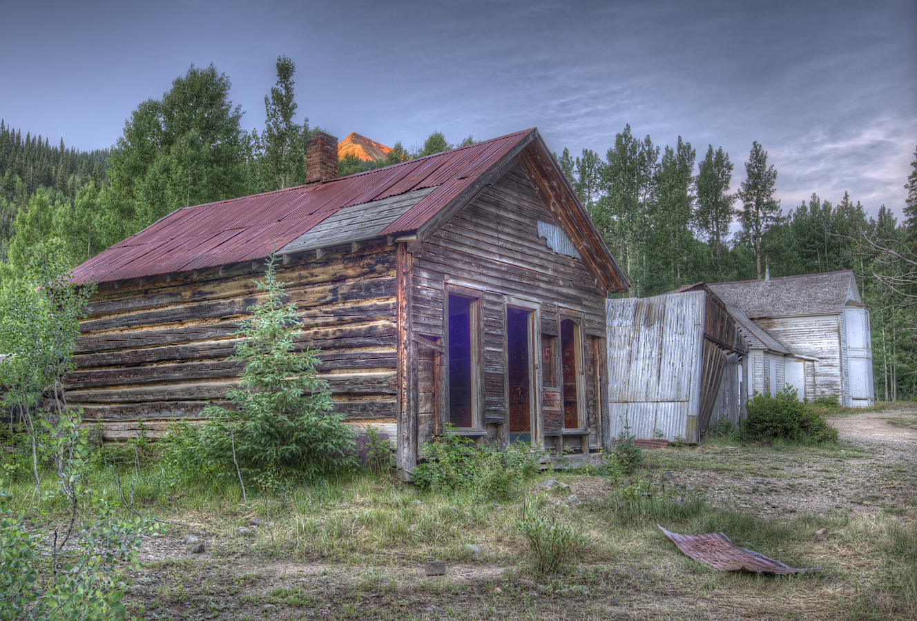
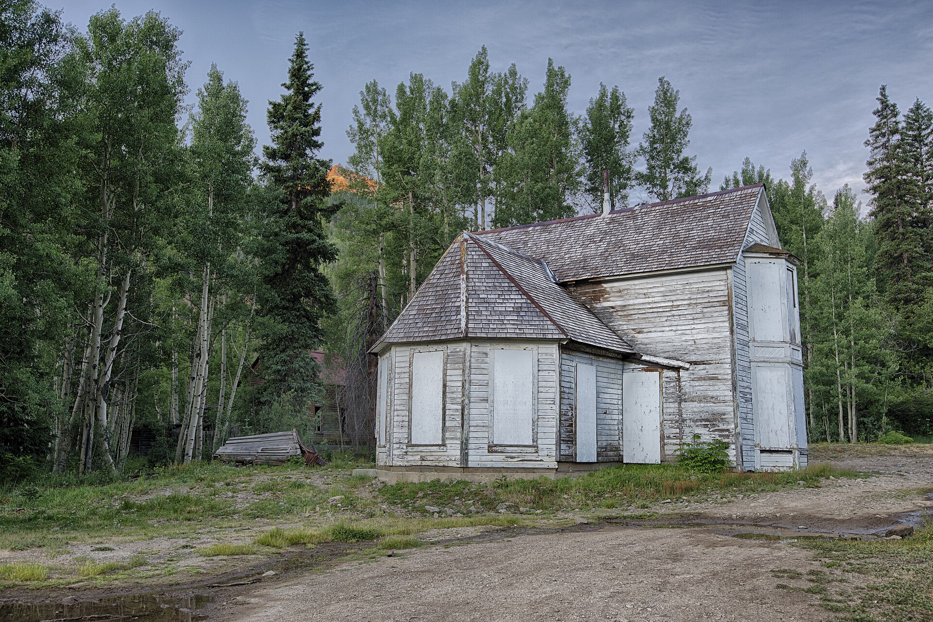
The houses. Three or four wooden houses still stand among the aspens, including a large painted house locally called the White House, believed to date from about 1891.
Cabins and outbuildings. A log house, small cabins and sheds, some collapsing, sit around the old townsite.
The Colorado Boy hoist house. A restored mine building near the townsite.
The Larson brothers’ mine. The mine building and a historical society plaque stand beside US-550 near the townsite.
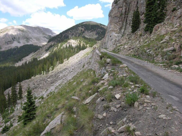
The railroad grade. Stretches of Mears’s old grade survive in the park and up toward Corkscrew Gulch.
Timeline
Historic sites nearby
Further reading
Sources
Western Mining History — Ironton; Legends of America — Ironton and Guston; HistoryNet — Ghost Town: Ironton, Colorado
Josie Moore Crum — Three Little Lines; U.S. Geological Survey — Bulletin 182 and Red Mountain Creek water study
Historical Marker Database — Boom Towns and Larson Brothers Mine; Fort Lewis College — Red Mountain Project; High Country News — Red Mountain tries to hang on to history
Ouray County Plaindealer — Trust for Land Restoration at Ironton and Forest Service to close abandoned mines; Ouray County Nordic Council — Ironton
Durango Telegraph — Not just any old garage; Wikipedia — Ironton, Colorado, Silverton Railroad and Lynching of George Witherell; 4x4explore — Corkscrew Gulch
Photos: John Fowler, painted house, log house, cabins in fall and Yankee Girl Mine; Sandy Horvath-Dori, two-story house; all CC BY 2.0; W. J. Carpenter, Red Mountain Town about 1890, public domain; via Wikimedia Commons